Ambergris Caye Belize Resort Development - Department of ...
Ambergris Caye Belize Resort Development - Department of ...
Ambergris Caye Belize Resort Development - Department of ...

You also want an ePaper? Increase the reach of your titles
YUMPU automatically turns print PDFs into web optimized ePapers that Google loves.
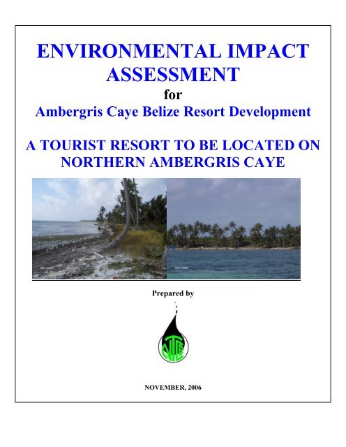
ENVIRONMENTAL IMPACT<br />
ASSESSMENT<br />
for<br />
<strong>Ambergris</strong> <strong>Caye</strong> <strong>Belize</strong> <strong>Resort</strong> <strong>Development</strong><br />
A TOURIST RESORT TO BE LOCATED ON<br />
NORTHERN AMBERGRIS CAYE<br />
Prepared by<br />
NOVEMBER, 2006
Table <strong>of</strong> Contents<br />
Pg.<br />
1.0 Project Description 1-1<br />
1.1 Project Location 1-1<br />
1.2 Physical Plan 1-4<br />
1.2.1 Existing <strong>Development</strong> 1-4<br />
1.2.3 Planned <strong>Development</strong> 1-4<br />
1.2.3.1 Construction Phase 1-19<br />
1.2.3.2 Utility Zone Construction and Installation <strong>of</strong> Associated<br />
Infrastructure 1-19<br />
1.2.3.3 Energy Generation Facilities 1-21<br />
1.2.3.4 Potable Water Supply Infrastructure 1-21<br />
1.2.3.5 Sewage Treatment Facilities 1-21<br />
1.2.3.6 Solid Waste Infrastructure 1-22<br />
1.3 Operational Phase 1-22<br />
1.4 Staffing 1-23<br />
2.0 Bio-Physical Description <strong>of</strong> Proposed <strong>Development</strong> Site 2-1<br />
2.1 Meteorology 2-4<br />
2.2 Oceanography 2-5<br />
2.2.1 Bathymetry 2-5<br />
2.2.2 Winds and Waves 2-7<br />
2.2.3 Tides 2-7<br />
2.2.4 Currents 2-7<br />
2.2.5 Water Temperature 2-7<br />
2.2.6 Salinity 2-8<br />
2.2.7 Turbidity 2-8<br />
2.2.8 Total Coliform and E. coli 2-9<br />
2.3 Biological Oceanography 2-9<br />
2.3.1 Flora and Fauna 2-9<br />
2.3.1.1 Flora 2-10<br />
2.3.1.2 Fauna 2-34<br />
2.3.1.2.1 Invertebrates 2-35<br />
2.3.1.2.2 Vertebrates 2-45<br />
2.3.1.2.2.1 Fish 2-45<br />
2.3.1.2.2.2 Reptiles and Amphibians 2-55<br />
2.3.1.2.2.3 Mammals 2-58<br />
2.3.1.2.2.4 Avi-fauna or Birds 2-61<br />
2.4 Conservation Issues 2-69<br />
2.4.1 Endangered Species <strong>of</strong> Special Significance 2-69<br />
2.4.2 Conservation 2-71<br />
2.5 Geology 2-73<br />
ii
2.5.1 Regional Geology 2-73<br />
2.5.2 Structural Geology 2-73<br />
2.5.3 Geomorphology 2-74<br />
2.5.3 Local Area Geology 2-74<br />
3.0 Policy Review 3-1<br />
3.1 Introduction 3-1<br />
3.1.1 The Environmental Protection Act<br />
SI 22/1992 and 328/2003 3-1<br />
3.1.2 Environmental Impact Assessment Regulations SI 107/1995 3-2<br />
3.1.3 Coastal Zone Management Strategy Chap. 329 2000<br />
Revised Edition 3-3<br />
3.1.4 Effluent Limitation Regulations SI 94/1995 3-3<br />
3.1.5 Pollution Regulations SI 56/1996 3-3<br />
3.1.6 Solid Waste Management Authority Act SI 224 <strong>of</strong> 2000 3-3<br />
3.1.7 Ancient Monuments and Antiquities Act SI 330/2000 3-4<br />
3.1.8 <strong>Belize</strong> Water Industry Act No. 1 <strong>of</strong> 2001 3-4<br />
3.1.9 <strong>Belize</strong> Port Authority Act SI 233 <strong>of</strong> 2000/2003 3-4<br />
3.1.10 <strong>Belize</strong> Public Health Act Revised Edition SI 40/2000 3-5<br />
3.1.11 National Lands Act (No. 6 <strong>of</strong> 1992) and SI 191 <strong>of</strong> 2000 3-5<br />
3.1.12 Crown Land Rules SI 60 <strong>of</strong> 1939 3-5<br />
3.1.13 Mines and Minerals Act Chap. 226 <strong>of</strong> 2000 3-5<br />
3.1.14 Bacalar Chico Marine Reserve SI 88/1996 3-5<br />
3.1.15 Bacalar Chico Marine Reserve Regulations Chap 210/2003<br />
(& 68/2001) 3-6<br />
3.1.15.1 Rules for the General Use Zone Part II (4) 1 – 9 3-6<br />
3.1.15.2 Rules for the Conservation I Zone Part II (5) 3-7<br />
3.1.15.3 Rules for the Conservation II Zone Part II (6) a – d 3-7<br />
3.1.15.4 Special Rules for Conservation Zones I and II 3-7<br />
Part II (7) 1 –3 3-7<br />
3.1.15.5 Rules for the Preservation Zone Part II 8 (1 and 2) 3-8<br />
3.1.16 National Park System Act SI 215/2000 3-8<br />
3.1.17 Bacalar Chico National Park SI 89 <strong>of</strong> 1996 3-9<br />
3.1.18 Forests (Mangrove Protection) Regulations, SI No. 52 <strong>of</strong> 1989 3-9<br />
3.1.19 The Forest Act SI 213/2000 3-10<br />
3.1.20 Fisheries Act SI 210/2000 3-10<br />
3.1.21 The Wildlife Protection Act SI 220/2000 3-11<br />
3.1.22 The Ministry <strong>of</strong> Housing and the Central Housing<br />
Planning Committee 3-11<br />
3.1.23 Housing and Town Planning Act SI 182/2000 3-11<br />
3.1.24 Wildlife Sanctuary Declaration (Corozal Bay) (Manatee)<br />
Order Chapter 215 /2003 3-12<br />
3.1.25 Hotels and Tourist Accommodation Act 285/2000 3-12<br />
3.1.26 Protected Areas Conservation Trust Act (PACT) Chap. 218/2000 3-12<br />
3.1.27 <strong>Belize</strong> Tourist Board Act 3-12<br />
iii
3.1.28 International Conventions and Agreements 3-13<br />
4.0 Water Resources 4-1<br />
4.1 Occupancy 4-1<br />
4.2 Water Source 4-1<br />
4.3 Potable Water Demand 4-2<br />
4.4 Selection <strong>of</strong> the preferred source 4-3<br />
4.5 Source Supply Description 4-4<br />
4.5.1 Main Source Supply Description 4-5<br />
4.5.1.1 Average Rainfall 4-5<br />
4.5.1.2 Water Source Treatment 4-7<br />
4.5.2 Secondary Source Description 4-8<br />
4.5.3 Tertiary Source Description 4-12<br />
4.5.4 Water Conservation 4-13<br />
4.6 Surface and Ground Water Analysis 4-14<br />
4.7 Water Quality Monitoring Program 4-14<br />
5.0 Wastewater Disposal 5-1<br />
5.1 Nature <strong>of</strong> Wastewater 5-1<br />
5.2 Wastewater Characteristics 5-1<br />
5.3 Waste Water Production 5-2<br />
5.4 Environmental Wastewater Load 5-3<br />
5.5 National Environmental Effluent Standards 5-3<br />
5.6 Wastewater Treatment Options 5-4<br />
5.7 Typical BESST Plant Treatment Effluent and Loading Parameters 5-5<br />
5.8 Wastewater Recycling 5-6<br />
6.0 Energy Generation 6-1<br />
6.1 Energy Demand 6-1<br />
6.2 Energy Supply Source 6-2<br />
6.2.1 Alternate Energy Source 6-2<br />
6.3 Power Transmission Lines 6-3<br />
6.4 Fuel Management, Health and Safety 6-3<br />
6.4.1 Cooking Fuel 6-4<br />
6.4.2 Fuel Storage and Transportation 6-4<br />
6.5 Impacts and Mitigative Measures 6-5<br />
7.0 Solid Waste 7-1<br />
7.1 Solid Waste Categories 7-1<br />
7.2 Projected Solid Waste Production and Waste Category Pr<strong>of</strong>ile 7-1<br />
7.3 Types <strong>of</strong> Waste 7-3<br />
7.4 Waste Category I – Construction and Field Waste 7-4<br />
7.5 Waste Category II – Domestic Waste 7-5<br />
7.5.1 Domestic Waste disposal 7-5<br />
7.5.2 Selection <strong>of</strong> the preferred option 7-5<br />
iv
7.6 Waste Category III and IV - Industrial and Toxic Waste 7-7<br />
7.7 Waste Minimization Strategies 7-7<br />
7.7.1 Waste Minimization Volumes 7-8<br />
7.8 Garbage Collection 7-8<br />
7.8.1 Educational Program 7-9<br />
7.8.2 Collection Schedule 7-9<br />
7.8.3 Reporting Requirements and Compliance Monitoring. 7-9<br />
8.0 Disaster Management 8-1<br />
8.1 Introduction 8-1<br />
8.1.1 Management Structure 8-1<br />
8.2 3 NEMO Storm Categories 8-3<br />
8.2.4 NEMO Summary <strong>of</strong> Hurricane Warning Flags 8-3<br />
8.2.5 Pre-Season Preparation 8-3<br />
8.2.6 Implementation Plan during Threats 8-4<br />
8.2.7 Safety Precautions 8-6<br />
8.3 Fire Prevention and Response Plan 8-6<br />
8.3.1 Purpose <strong>of</strong> Plan 8-7<br />
8.3.2 Fire Prevention 8-7<br />
8.3.3 Fire Protection Equipment/Systems 8-8<br />
8.3.4. Fire Response 8-8<br />
8.4 Spill Contingency Plan 8-9<br />
8.4.1 Purpose <strong>of</strong> Plan 8-9<br />
8.4.2 Mechanism 8-9<br />
8.4.3 Response Policy 8-9<br />
8.4.4 Fuel Management 8-10<br />
8.4.5 Waste Oil Management 8-11<br />
8.4.6 Contingency Equipment 8-11<br />
8.4.7 Safety and Response Priorities 8-11<br />
9.0 Integrated Social Assessment Review 9-1<br />
9.1 Background 9-1<br />
9.1.1 Introduction 9-3<br />
9.1.2 Core Concerns <strong>of</strong> the Social Assessment 9-3<br />
9.2 Demographics 9-3<br />
9.2.1 Population and Housing 9-4<br />
9.2.2 Employment 9-4<br />
9.2.3 Social Infrastructure 9-5<br />
9.2.4 Communication and Services 9-5<br />
9.2.5 Cultural 9-6<br />
9.2.6 Traditional Activities 9-6<br />
9.3 Land Tenure 9-7<br />
9.4 Transportation/Access 9-7<br />
9.4.1 Sea Access 9-7<br />
9.4.2 Road Access 9-11<br />
v
9.5 Air Access 9-13<br />
9.6 Tourism Activities 9-13<br />
9.7 Regional Planning 9-16<br />
9.7.1 The <strong>Ambergris</strong> <strong>Caye</strong> Planning Authority 9-16<br />
9.7.2 The <strong>Ambergris</strong> <strong>Caye</strong> Master Plan 9-16<br />
9.7.3 Bacalar Chico Advisory Committee 9-16<br />
9.7.4 The San Pedro Town Council 9-17<br />
9.8 <strong>Belize</strong> Tourism Policy 2005 9-17<br />
9.8.1 Tourism Master Plan 9-17<br />
9.8.2 <strong>Belize</strong> Tourism Board 9-18<br />
9.8.3 <strong>Belize</strong> Tourism Industry Association 9-18<br />
9.8.4 The National Protected Areas Policy and System Plan 9-18<br />
9.9 The <strong>Belize</strong> Port Authority 9-18<br />
9.10 <strong>Caye</strong>s <strong>Development</strong> Policy and the Coastal Zone Management Strategy 9-19<br />
9.11 Mooring Buoy Program 9-19<br />
9.12 Pier Guidelines and Seawall <strong>Development</strong> 9-19<br />
9.13 Local Non Pr<strong>of</strong>it Organizations 9-19<br />
9.14 Protected Areas in the Region 9-20<br />
9.14.1 Bacalar Chico National Park and Marine Reserve (BCNP/MR) 9-21<br />
9.14.1.1 Marine Component 9-24<br />
9.14.1.2 The Terrestrial Component 9-25<br />
9.14.2 Hol Chan Marine Reserve 9-25<br />
9.14.3 Rocky Point 9-27<br />
9.14.4 Mexico Rocks 9-27<br />
9.14.5 Little Guana & Los Salones <strong>Caye</strong> Bird Sanctuaries 9-27<br />
9.14.6 UNESCO World Heritage Site 9-27<br />
9.14.7 The Corozal Bay Wildlife Sanctuary 9-29<br />
9.15 NGO and Public Consultations 9-29<br />
10.0 Environmental Impacts <strong>of</strong> Proposed <strong>Development</strong> 10-1<br />
10.1 General Principles Underpinning Environmental Impacts 10-1<br />
10.2 Overview <strong>of</strong> Environmental Impacts 10-2<br />
10.3 Details <strong>of</strong> the Ecological Impacts 10-3<br />
10.3.1 Dredging Impacts 10-3<br />
10.3.2 Domestic Effluent Impacts 10-5<br />
10.3.3 Potable Water Impacts 10-6<br />
10.3.4 Solid Waste Impacts 10-7<br />
10.3.5 Boating and Dockside Impacts 10-8<br />
10.3.6 Impacts from Energy Generation 10-8<br />
10.4 Details <strong>of</strong> the Social Impacts 10-9<br />
10.4.1 Core Issues <strong>of</strong> the Social Impact Assessment 10-9<br />
10.4.2 The Impact Review 10-10<br />
10.4.3 Sources <strong>of</strong> Impacts 10-11<br />
10.4.4 The Social Impact 10-11<br />
10.4.4.1 Existing and Proposed Activities 10-11<br />
10.4.4.2 Marine Traffic 10-12<br />
vi
10.4.4.3 Road Access 10-12<br />
10.4.4.5 Disturbances (noise, air quality) 10-13<br />
10.4.4.6 Population/Housing 10-14<br />
10.4.4.7 Socio - Cultural 10-14<br />
10.4.4.8 Education/Health Services 10-15<br />
10.4.4.9 Employment/Safety 10-15<br />
10.4.4.10 Emergency Services 10-15<br />
10.4.4.11 Tourism Activities 10-16<br />
10.4.4.12 Economic Impact 10-16<br />
11.0 Impact Mitigation 11-1<br />
11.1 General Principles Underpinning Environmental Impact Mitigation 11-1<br />
11.2 Specific Mitigation Measures 11-1<br />
11.2.1 Mitigation Measures In Relation To Dredging and Land Reclamation<br />
Activities 11-1<br />
11.2.2 Mitigation Measures In Relation To Human Wastes and Domestic<br />
Effluents 11-5<br />
11.2.3 Mitigation Measures In Relation To Solid Wastes 11-8<br />
11.2.5 Mitigation Measures In Relation To Socio-Economic Concerns 11-10<br />
12.0 Monitoring Plans 12-1<br />
12.1 Principles Underpinning Environmental Monitoring 12-2<br />
12.2 Specific Monitoring Issues 12-3<br />
13.0 Alternatives to <strong>Development</strong> 13-1<br />
13.1 Principles Underpinning Alternatives to <strong>Development</strong> 13-1<br />
14.0 Archaeology Report 14-1<br />
Introduction 14 - 2<br />
Review <strong>of</strong> Literature on Coastal Sites in <strong>Belize</strong> 14 - 2.<br />
<strong>Ambergris</strong> <strong>Caye</strong> in Archaeological Context 14 - 4<br />
Prehistoric Salt Production on <strong>Ambergris</strong> <strong>Caye</strong> 14 - 8<br />
Survey and Research Methodology 14 - 8<br />
Description <strong>of</strong> ABR Property 14 - 8<br />
Survey Methodology 14 -11<br />
Excavations and Shovel Tests 14 -11<br />
Test Pit 1 14 -11<br />
Test Pit 2 14 -11<br />
Test Pit 3 (shovel test) 14 -14<br />
Results <strong>of</strong> the Investigations 14 -14<br />
Site Descriptions 14 -15<br />
Ek Luum 14 -15<br />
Valencia 14 -16<br />
Franco 14 -17<br />
Conclusions and Recommendations 14 -17<br />
References Cited 14 -19<br />
vii
Appendix A<br />
List <strong>of</strong> Tables<br />
List <strong>of</strong> Figures<br />
Photos <strong>of</strong> ABR property and research activities….. 14 -22<br />
Table 1: Transect Data for ABR <strong>Development</strong>. 14 -10<br />
Fig. 1: Map <strong>of</strong> <strong>Belize</strong> showing location <strong>of</strong> <strong>Ambergris</strong> <strong>Caye</strong> 14 -5<br />
Fig. 2: Map <strong>of</strong> <strong>Ambergris</strong> <strong>Caye</strong> with inset showing north<br />
<strong>Ambergris</strong> and archaeological sites recorded in the<br />
area. 14 -5<br />
Fig. 3: Map <strong>of</strong> <strong>Ambergris</strong> <strong>Caye</strong> showing location <strong>of</strong> previously<br />
Recorded archaeological sites. 14 -7<br />
Fig. 4: Map <strong>of</strong> <strong>Ambergris</strong> <strong>Caye</strong> showing location <strong>of</strong> ABR<br />
Property 14 -9<br />
Fig. 5: Map <strong>of</strong> ABR property showing location <strong>of</strong> transects. 14 -9<br />
Fig. 6: Section plans <strong>of</strong> Test Pits 1 and 2. 14 -12<br />
Fig. 7: Section Plan <strong>of</strong> posthole test. 14 -13<br />
Fig. 8: Photo <strong>of</strong> potsherds discovered on Transect C. 14 -13<br />
Fig. 9: Map showing location <strong>of</strong> Ek Luum, Valencia and<br />
Franco archaeological sites in reference to ABR<br />
property. 14 -16<br />
ANNEXES<br />
Annex I - TOR<br />
Annex II – EIA Preparers<br />
Annex III – ABR Project Summary<br />
Annex IV – BESST Plant Specifications<br />
Annex V – Water Sample Tests<br />
Annex VI – Earth Tub Composting Technology<br />
Annex VII – Legal Documents<br />
viii
List <strong>of</strong> Figures<br />
No. Title Sec./Pg.<br />
Fig. 1.1: Project Location 1-2<br />
Fig. 1.2: Conceptual <strong>Development</strong> Plan 1-5<br />
Fig. 1.2a: Elevation Contours in relation to Placement <strong>of</strong> Buildings 1-8<br />
Fig. 1.2b: Elevation Contours in relation to Placement <strong>of</strong> Buildings (Cont’d) 1-9<br />
Fig. 1.2c: Elevation Contours in relation to Placement <strong>of</strong> Buildings (Cont’d) 1-10<br />
Fig. 1.3a: Phase I <strong>of</strong> <strong>Development</strong> 1-11<br />
Fig. 1.3b: Phase 2 <strong>of</strong> <strong>Development</strong> 1-12<br />
Fig. 1.4: <strong>Development</strong> Components at Nova Pier. 1-13<br />
Fig. 1.5a: Roads and Paths from Nova Pier to Proposed Project Site. 1-14<br />
Fig. 1.5b: On-Site Project Roads and Pathways 1-15<br />
Fig. 1.6: Project Contour Map 1-16<br />
Fig. 1.7a: Over-water Buildings, Piers and Boardwalk Plan 1-17<br />
Fig. 1.7b: Typical Over-water Cabana and Pier End View 1-18<br />
Fig. 2.1: Ecosystems Map <strong>of</strong> Proposed Project Area 2-2<br />
Fig. 2.2: Soundings or Depth Pr<strong>of</strong>ile in Nearshore Areas <strong>of</strong> Project Site 2-3<br />
Fig. 2.3A: Vegetation Classification <strong>of</strong> Greater BCNP/MR 2-12<br />
Fig. 2.3B: Vegetation Map <strong>of</strong> Project Site 2-13<br />
Fig. 2.4: BCNP/MR Zoning Scheme 2-75<br />
Fig. 2.5: Sediment Pr<strong>of</strong>ile and Groundwater Availability at Project Site 2-78<br />
Figure 4.1 Rainfall Isopleths <strong>of</strong> <strong>Belize</strong> 4-6<br />
Fig. 4.2 Water Harvesting Layout for the Proposed Project. 4-9<br />
Fig. 4.3 Typical R.O. well Section 4-10<br />
Fig. 4.4 Typical Brine Injection Well 4-11<br />
Fig. 4.5 Recycled wastewater treatment plan 4-13<br />
Fig. 4.6 Water Sampling sites for the ABR Project 4-16<br />
Fig. 5.1 Proposed Project Sewer Treatment Zones 1 5-7<br />
Fig. 5.2 Proposed Sewer Treatment Zones (2 &3) 5-8<br />
Fig. 6.1 Above Ground Storage Tank that will be used for ABR 6-5<br />
Fig. 9.1 Rural Communities & Urban Centers near the Project site 9-2<br />
Fig. 9.2 Reef Cuts In the Region <strong>of</strong> the Proposed <strong>Development</strong> Site 9-9<br />
Fig. 9.3 Laguna Cantena facing north showing a portion <strong>of</strong> Rocky Point on the<br />
bottom left and a portion <strong>of</strong> the proposed development site facing east. 9-10<br />
Fig. 9.4 Proposed Road to Project <strong>Development</strong> Site 9-12<br />
Fig. 9.5 Dive Sites at <strong>Ambergris</strong> <strong>Caye</strong> and the Region <strong>of</strong> the Proposed<br />
<strong>Development</strong> 9-15<br />
Fig. 9.6 Bacalar Chico National Park and Marine Reserve (BCNP/MR) 9-23<br />
Fig. 9.7 Management Zones within the BCNP/MR <strong>Ambergris</strong> <strong>Caye</strong> 9-26<br />
Fig. 9.8 Protected Areas in the Region <strong>of</strong> the Proposed <strong>Development</strong> 9-28<br />
Fig. 10.1: Environmental Impact Cycle 10-1<br />
ix
List <strong>of</strong> Tables<br />
No. Title Pg.<br />
Table 1.1: ABR <strong>Development</strong> Summary 1-6<br />
Table 1.2: Construction Schedule 1-20<br />
Table 1.3: Maximum Daily Occupancy 1-22<br />
Table 2.1: Water Quality Tests Results 2-6<br />
Table 2.2A: Terrestrial and Inter-tidal Plants <strong>of</strong> the Project Area 2-14<br />
Table 2.2B: Sub-tidal plants <strong>of</strong> the project area 2-27<br />
Table 2.3: Invertebrates including corals found in and around the project site. 2-36<br />
Table 2.4: Fish Species Found in Project Area 2-48<br />
Table 2.5 Reptiles and Amphibians 2-58<br />
Table 2.6: Mammals 2-61<br />
Table 2.7: Birds Found in and Around the Project Area 2-64<br />
Table 3.1 Licenses and Permits required by the <strong>Development</strong> 3-14<br />
Table 4.1 Maximum Daily Occupancy 4-1<br />
Table 4.2 Projected potable water demand for ABR 4-2<br />
Table 4.3 Projected ABR Water demand according to zones 4-2<br />
Table 4.4 Selection <strong>of</strong> the preferred water source for ABR 4-3<br />
Table 4.5 Rainfall Volume collected for the buildings at ABR 4-7<br />
Table 4.6 Volume <strong>of</strong> recycled Wastewater required for flushing 4-12<br />
Table 4.7 Projected Water Demand at different occupational rates for ABR 4-13<br />
Table 4.8 ABR Surface water and well water Analysis results 4-17<br />
Table 4.9 ABR Second Surface Water Analysis Results 4-18<br />
Table 5.1 Typical Composition <strong>of</strong> untreated domestic sewage 5-1<br />
Table 5.2 Projected Wastewater Production according to Facilities 5-2<br />
Table 5.3 Project Domestic Wastewater Pr<strong>of</strong>ile 5-3<br />
Table 5.4 Effluent Limitation Standard for Commercial Activities 5-3<br />
Table 5.5 Wastewater Treatment Options 5-4<br />
Table 5.6 Projected Performance <strong>of</strong> BESST Treatment Plant. 5-6<br />
Table 5.7 Wastewater Alternative Uses. 5-6<br />
Table 6.1 Project Energy Demand 6-1<br />
Table 6.2 Comparison <strong>of</strong> alternate energy sources for ABR 6-3<br />
Table 6.3 Matrix <strong>of</strong> potential impacts within the project area 6-6<br />
Table 7.1 Projected Domestic Waste Production at ABR<br />
during Operational Phase 7-2<br />
Table 7.2: Estimated Solid Waste Generation for <strong>Belize</strong> Municipalities 7-3<br />
Table 7.3 ABR Solid Waste Disposal Options 7-6<br />
Table 7.4 Waste Reduction Yield for ABR after WMS 7-8<br />
Table 7.4b Waste Reduction Yield for ABR according to Occupancy 7-9<br />
Table 8.1 Disaster Preparedness Plans for ABR Limited 8-1<br />
Table 8.2 Marine Spills Levels 8-10<br />
Table 8.3 Inland Spill Levels 8-10<br />
Table 9.1 Tourism Statistics 9-14<br />
x
Table 10.1 ABR EIA Matrix 10-3<br />
Table 10.2 ABR Social Impact Summary 10-17<br />
Table 11.1: Mitigation Responses in relation to Dredging Impacts 11-1<br />
Table 11.2: Summary <strong>of</strong> impacts associated with human wastes and domestic<br />
effluents 11-2<br />
Table 11.3: Mitigation Matrix in Relation to Solid Wastes 11-9<br />
Table 11.4: Mitigations In Relation to Socio-Economic Concerns 11-11<br />
Table 12.1: Proposed Monitoring Plan for ABR 12-2<br />
Table 13.1: Options for <strong>Development</strong> 13-1<br />
xi
Glossary <strong>of</strong> Terms<br />
Algae: one celled or many celled plants that have no root, stem, or leaf system.<br />
Bathymetry: depth pr<strong>of</strong>ile <strong>of</strong> the ocean bottom or seafloor.<br />
Beach: sediment seaward <strong>of</strong> the coastline through the surf zone that is in transport along<br />
the shore and within the surf zone.<br />
Benthic: pertaining to the ocean bottom or seafloor.<br />
Benthos: the forms <strong>of</strong> marine life that live on the ocean bottom or seafloor.<br />
Biogenic Sediments: sediments containing materials produced by plants or animals such<br />
as corals, shell fragments and tests housing diatoms and radiolarians.<br />
Biomass: total weight <strong>of</strong> the organisms in a particular habitat, species, or group <strong>of</strong><br />
species.<br />
Biota: the total plants and animals <strong>of</strong> a given area.<br />
Coast: a strip <strong>of</strong> land that extends inland from the coastline as far as marine influence is<br />
evidenced in the landforms.<br />
Coastline: landward limit <strong>of</strong> the highest storm waves’ effect on the shore.<br />
Coliform: Type <strong>of</strong> bacterial found in feaces.<br />
Construction: excavation, movement <strong>of</strong> earth, erection <strong>of</strong> forms or structures, or similar<br />
activities at a development or project site.<br />
Disposal: the discharge, deposit, injection, dumping, spilling, leaking, or placing <strong>of</strong> any<br />
waste into or on any land, water so that it may enter the wider environment, including<br />
ground water sources.<br />
Effluent: water discharged from a development into receiving water body or the<br />
environment otherwise.<br />
Euryhaline: pertaining to the ability <strong>of</strong> a marine organism to tolerate a wide range <strong>of</strong><br />
salinity.<br />
Eutrophication: elevation <strong>of</strong> nutrient content <strong>of</strong> water through input <strong>of</strong> fertilizers, fecal<br />
materials and domestic effluents<br />
Fauna: animals.<br />
xii
Fecal: <strong>of</strong> or related to feces.<br />
Flora: plants.<br />
Finfish: collective terns for aquatic vertebrates with scales which uses fins for propulsion.<br />
Groundwater: water below the land surface in a zone <strong>of</strong> saturation.<br />
Habitat: a place where a particular plant or animal lives: Generally refers to a smaller<br />
area than environment.<br />
Intertidal Zone: lies between the high and low tide extremes and can be divided into a<br />
high tide zone which is mostly dry and covered by the highest high tide but not the lowest<br />
high tide, the middle tide zone exposed and covered equally by all high tides and exposed<br />
during all low tides, and the low tide zone which is mostly wet and covered during the<br />
highest low tides and exposed during the lowest low tides.<br />
Lagoon: a body <strong>of</strong> water separated from the sea by a bank or coral reef: Also the region<br />
between a shore and a barrier reef or inside a ring <strong>of</strong> islands composing an atoll.<br />
Littoral Zone: also known as the foreshore or intertidal zone, lies between the high and<br />
low tide extremes.<br />
Lagoonal: <strong>of</strong> or pertaining to lagoon.<br />
Macroalgae: algae that project more than 1 cm above the substrate, such as Dictyota spp.,<br />
and Halimeda spp.<br />
Mangal: a swamp dominated by mangroves.<br />
Mangroves: collective term used for range <strong>of</strong> salt-tolerated inter-tidal plants found<br />
throughout the tropics and within latitude <strong>of</strong> 20 <br />
Neap Tide: tide <strong>of</strong> minimal range occurring when the moon in quadrature, or its 1st<br />
Quarter and 3rd Quarter Phases.<br />
Nearshore Zone: the seaward zone from the shoreline to the line <strong>of</strong> breakers.<br />
Pelagic Environment: the open ocean environment which is divided into a neretic<br />
province with water depths 0 to 200 m and the oceanic province with depths greater than<br />
200 m.<br />
Pelagic Organism: free-swimming or floating biota that live exclusively in the water<br />
column, not on the sea floor or ocean bottom.<br />
xiii
Permitting Agency: a Government Agency responsible for issuing permits to allow<br />
various aspects <strong>of</strong> a development to proceed within the context <strong>of</strong> the Laws <strong>of</strong> <strong>Belize</strong>.<br />
Permit: authorization, license, or equivalent control document issued by an Agency <strong>of</strong> the<br />
Government <strong>of</strong> <strong>Belize</strong> to implement various aspects <strong>of</strong> a development.<br />
Pollutant: any dredged spoil, solid waste, incinerator residue, sewage, garbage, chemical<br />
waste, heat, industrial, domestic, municipal or agriculture waste discharged into the<br />
environment.<br />
Primary Productivity: the amount <strong>of</strong> organic matter organisms synthesize from inorganic<br />
substances within a given volume <strong>of</strong> water or habitat in a unit <strong>of</strong> time.<br />
Project Proponent: developer proposing a particular project.<br />
Red List: Catalogue <strong>of</strong> Threatened Species compiled by IUCN.<br />
Salinity: a measure <strong>of</strong> the quantity <strong>of</strong> dissolved solids in ocean water: it is expressed in<br />
part per thousand by weight after all carbonates have been converted to oxide, the<br />
bromide and iodide to chloride, and all the organic matter oxidized.<br />
Sessile: attached to the bottom or to rocks, pilings, etc. and unable to move.<br />
Sewage: any human body waste and the waste from toilets and other receptacles intended<br />
to receive or retain body wastes that are discharged into the environment.<br />
Sand: particle size ranging from 1/16 to 2 mm: It pertains to particles that lie between silt<br />
and granules on the Wentworth Scale <strong>of</strong> grain size.<br />
Sanitary Landfill Site: a facility at which municipal, industrial wastes and hazardous<br />
wastes are applied onto or incorporated into the soil surface.<br />
Shore: the section <strong>of</strong> land seaward <strong>of</strong> the coast: This extends from the highest level <strong>of</strong><br />
wave action during storms to the low water line.<br />
Shoreline: the line marking the intersection <strong>of</strong> the water surface with the shore: It<br />
migrates up and down as the tide rises and falls.<br />
Silt: a particle size ranging from 1/128 to 1/16 mm: It is intermediate between sand and<br />
clay.<br />
Spring Tide: tide <strong>of</strong> maximum range occurring every fortnight and coincides with when<br />
the moon is new and full respectively.<br />
Sublittoral: seabed below the low tide mark.<br />
xiv
Tide: periodic rise and fall <strong>of</strong> the ocean surface and connected bodies <strong>of</strong> water resulting<br />
from the unequal gravitational attraction <strong>of</strong> the moon and sun on different parts <strong>of</strong> the<br />
earth.<br />
Tidal Range or Amplitude: the difference in height between consecutive high and low<br />
water: The comparison may also be a day, month or year.<br />
Topography: the physical shape <strong>of</strong> the land surface.<br />
Transect: a line or narrow belt used to survey the distribution <strong>of</strong> organisms or substrate<br />
across a given area.<br />
Vertebrates: animals belonging to the Subphylum Chordata, also known as the Chordates<br />
that include those animals with a well-developed brain and a skeleton <strong>of</strong> bone or<br />
cartilage: Includes fishes, amphibians, reptiles, birds and mammals.<br />
Wave: a disturbance that moves over or through a medium with a speed determined by<br />
the properties <strong>of</strong> the medium.<br />
Wave Height: vertical distance between a crest and the preceding trough.<br />
Wave Length: horizontal distance between two corresponding points on successive waves<br />
such as from crest to crest.<br />
xv
Glossary <strong>of</strong> Acronyms<br />
ABR: <strong>Ambergris</strong> <strong>Caye</strong> <strong>Belize</strong> <strong>Resort</strong> <strong>Development</strong><br />
BCNP/MR: Bacalar Chico National Park and Marine Reserve<br />
CITES: Convention on the International Trade in Endangered Species <strong>of</strong> wild flora and<br />
fauna.<br />
CZMAI: Coastal Zone Management Authority and Institute.<br />
EIA: Environmental Impact Assessment.<br />
DOE: <strong>Department</strong> <strong>of</strong> the Environment.<br />
GOB: Government <strong>of</strong> <strong>Belize</strong>.<br />
IUCN: International Union for the Conservation <strong>of</strong> Nature.<br />
NGO: Non-Government Organization.<br />
TOR: Terms <strong>of</strong> Reference.<br />
xvi
ORIENTATION NOTES<br />
The current EIA submission consists <strong>of</strong> two (2) major components, viz: a project brief or<br />
executive summary and an expansive narrative. The latter consists <strong>of</strong> the immediate<br />
project concerns as stipulated by the TOR for the initiative, supplemented by a number <strong>of</strong><br />
annexes which in principle provides further details to issues covered in the main part <strong>of</strong><br />
the narrative.<br />
The main narrative is broken down into a number <strong>of</strong> components which are to some<br />
extent segregated into chapters. The narrative begins with the physical description <strong>of</strong> the<br />
project which is captured in chapter 1. This includes among other issues an introductory<br />
overview <strong>of</strong> how the utilities for the project are to be addressed – these issues are further<br />
expanded and dealt with in details in chapters 4, 5, 6 & 7 <strong>of</strong> the document. A description<br />
<strong>of</strong> the physical and biological environment is the focus <strong>of</strong> chapter 2 <strong>of</strong> the narrative. This<br />
includes a description <strong>of</strong> the flora and fauna <strong>of</strong> the area, as well as issues such as water<br />
quality, bathymetry and water quality.<br />
The orientation <strong>of</strong> the document changes in Chapter 9, which is focused on disaster<br />
preparedness and response.<br />
Arguably, the most substantive part <strong>of</strong> the document deals with the magnitude and<br />
orientation <strong>of</strong> the impacts arising as a consequence <strong>of</strong> the implementation <strong>of</strong> the project:<br />
This is captured in chapter 10 <strong>of</strong> the document. The assessment <strong>of</strong> the impacts <strong>of</strong> the<br />
project is divided into two (2) main areas, viz: the ecological impacts and the social<br />
impacts. The mitigation to ameliorate or circumvent the negative environmental impacts<br />
are dealt with in chapter 11 <strong>of</strong> the document.<br />
The issue <strong>of</strong> environmental monitoring was dealt with in chapter 12 <strong>of</strong> the document. The<br />
final chapter <strong>of</strong> the document (Chapter 13) deals with ‘alternatives to development’. This<br />
section entails some detailed analysis and response: This was both in relation to the broad<br />
concepts <strong>of</strong> the project, as well as specific components. Great care was taken to avoiding<br />
generic and elementary responses to issues that would require some studied introspection.<br />
The overall document was prepared not only with a view <strong>of</strong> responding to the<br />
prescriptions <strong>of</strong> the TOR, but also with the view <strong>of</strong> understanding that documents <strong>of</strong> this<br />
nature are an resource material for researchers, administrators, natural resource managers,<br />
students, faculty and the public at large. In this regard great care was taken in undertaking<br />
the necessary field based surveys and assessments, as well as in providing information<br />
with the requisite level <strong>of</strong> academic integrity.<br />
xvii
Project Location<br />
Executive Summary<br />
The proposed project: <strong>Ambergris</strong> <strong>Caye</strong> <strong>Belize</strong> <strong>Resort</strong> <strong>Development</strong>, or ‘ABR’, is to be<br />
located on northern <strong>Ambergris</strong> <strong>Caye</strong>. The project site is located approximately 23 miles<br />
north <strong>of</strong> San Pedro, or 59 miles north-east <strong>of</strong> <strong>Belize</strong> City.<br />
The project site is on the windward or eastern side <strong>of</strong> <strong>Ambergris</strong> <strong>Caye</strong>. The project site<br />
has both an ocean side, and a lagoonal side: The Caribbean Sea washes the shores <strong>of</strong> the<br />
property on the eastern side, and the Laguna de Cantena delimits the boundary on the<br />
western side <strong>of</strong> the property.<br />
The property is 185 acres and entails a well developed sandy beach, as well as a fairly<br />
extensive tropical littoral forest, and lowland mangroves.<br />
The property is a part <strong>of</strong> the larger area <strong>of</strong> <strong>Ambergris</strong> <strong>Caye</strong> known as Bacalar Chico. The<br />
larger Bacalar Chico area runs to the northern border with Mexico and comprises 28,169<br />
acres land and coastal waters.<br />
The larger Bacalar Chico area is a National Park and Marine Reserve: This protected area<br />
is the Bacalar Chico National Park and Marine Reserve [BCNP/MR].<br />
There is no development on the property: Neither is there a history <strong>of</strong> any development(s)<br />
that may have been pre-existing.<br />
The project site is not serviced by any roads or airport. The only immediate access to the<br />
site is by boat. The nearest airstrip to the area is the Nova Airstrip, which is 4.5 miles by<br />
the shortest navigable overland route.<br />
Project Pr<strong>of</strong>ile<br />
The proposed project is <strong>of</strong> a recreational tourism orientation, complimented by an upscale<br />
residential development. The hotel resort development entails rooming accommodations,<br />
meeting/conferencing facilities, restaurants and bars, pool facilities and recreational<br />
facilities for children: This aspect <strong>of</strong> the development is to cover 126,986 sq. ft. <strong>of</strong> the<br />
property.<br />
The time-share condominium component <strong>of</strong> the development entails beachfront villas,<br />
cottages and bungalows: This aspect <strong>of</strong> the proposed development is to take up 128,700<br />
sq. ft.<br />
The overall development, including lawns, gardens, hedgerows and recreational open<br />
spaces is to take up 27 acres <strong>of</strong> property. This represents approximately 30% <strong>of</strong> the land<br />
area, and 15% <strong>of</strong> the overall property, including the lagoonal portion.<br />
xviii
The resort facilities include:<br />
(i) Eighteen 56 units hotel rooms;<br />
(ii) Eight pool cabanas;<br />
(iii) Thirteen beach palapas;<br />
(iv) Six spa cabanas;<br />
(v) Twelve over-water cabanas;<br />
(vi) A specialty restaurant;<br />
(vii) A business centre.<br />
The residential facilities are to include:<br />
(i) Fourteen beach-front villas;<br />
(ii) Twenty-five beach cottages;<br />
(iii) Eleven bungalows;<br />
(iv) A centralized owner’s club.<br />
Supporting infrastructure and amenities are to include:<br />
(i) An employee dorm;<br />
(ii) An extensive boardwalk;<br />
(iii) A utility zone;<br />
(iv) A swimming pool;<br />
(v) A children’s play park;<br />
(vi) Three piers that are to be coincident with the overwater cabanas and dive center;<br />
(vii) 4.5 miles <strong>of</strong> road leading from Nova Pier to<br />
The project is to be developed over a two (2) years time-frame: it is to be subdivided into<br />
two phases with a concentration on the resort and infrastructure facilities in phase I [See<br />
Table 1].<br />
The ABR facilities have been designed to accommodate 967 persons: Apart from tourists<br />
and home owners, this includes 289 workers [See Table 2]. Almost all <strong>of</strong> these workers<br />
are to be <strong>Belize</strong>ans.<br />
The Utility Zone is to house energy generation facilities, potable water storage and<br />
harvesting infrastructure, sewage treatment technologies and solid waste sorting, storage<br />
and disposal facilities.<br />
The primary source <strong>of</strong> energy is to be from diesel generators, supplement by solar panels<br />
and wind turbines. The latter two (2) sources <strong>of</strong> electricity are to be integrated with banks<br />
<strong>of</strong> batteries for energy storage purposes.<br />
The primary source <strong>of</strong> potable water is to be ferried from Reverse Osmosis: This is to be<br />
complimented by rainwater harvesting. Both <strong>of</strong> these sources <strong>of</strong> potable water are to be<br />
integrated with cisterns installed in the Utility Zone.<br />
xix
Table 1.2: Construction Schedule<br />
Project<br />
Concept<br />
Hotel/<br />
<strong>Resort</strong><br />
Project Components<br />
Time Frame<br />
Yr. 1 Yr. 2<br />
Qt. Qt. Qt. Qt. Qt. Qt. Qt.<br />
1 2 3 4 1 2 3<br />
Main Hotel, Hotel<br />
Cananas and Kitchen<br />
<br />
Conference Facilities <br />
3-Meal Restaurant and<br />
Pool Bar<br />
<br />
Spa and Spa Cabanas <br />
Overwater Cabanas <br />
Specialty Restaurant <br />
Pier Construction and<br />
Dredging<br />
<br />
Swimming Pools <br />
Pool Bar and Ocean<br />
Pool Bar<br />
<br />
Beach Cottages and<br />
Palapas<br />
<br />
Beach and Nearshore<br />
Swimming Area<br />
<br />
Utilities Zone <br />
Boardwalk and<br />
Lagoonal Restaurant<br />
<br />
Children Play Park <br />
Road Construction <br />
Infrastructure at Nova<br />
Pier<br />
<br />
Residential Housing Quarters for<br />
Workers<br />
<br />
Owner’s Club <br />
Beach Front Villas <br />
Beach Cottages <br />
xx<br />
Qt.<br />
4
Table 2: <strong>Caye</strong> Occupancy<br />
Type Description Units Occupancy<br />
A Hotel 56 rooms 112<br />
B Hotel Suites Type A 8 suite buildings 24<br />
C Hotel Suites Type B 12 suite buildings<br />
12 Cabana<br />
36<br />
D Water Cabanas buildings 36<br />
E Beach Front Villas 14 villa buildings<br />
12 cottage<br />
126<br />
F Beach Cottages buildings 72<br />
G Apartments 22 Units 88<br />
H Future <strong>Development</strong>s 13 Units 78<br />
I Owner's Club House 1 unit 6<br />
J Employee Housing 1 unit 289<br />
K Transient Visitors persons 100<br />
Totals 967 Persons<br />
Sewage derived from human waste and domestic effluents is to be treated through the<br />
deployment <strong>of</strong> secondary treatment technology. A ‘package plant’ known by<br />
its trade name “BESST” is to be employed in the treatment <strong>of</strong> all wastewater generated<br />
by the resort facilities. This technology, which the acronym stands for Biologically<br />
Engineered Single Sludge Treatment - reduces major pollutants such as the macronutrients<br />
nitrates and phosphates, and ammonia, as well as Total Suspended Solids (TSS),<br />
BOD substances and microbes to levels where they do not pose a threat to the integrity <strong>of</strong><br />
environment, or human health. The post-treated effluents from the BESST Treatment<br />
Plant, is to be chlorinated, stored and used for the flushing <strong>of</strong> toilets, as well as the<br />
irrigation <strong>of</strong> lawns and hedgerows, and fire-fighting purposes.<br />
Solid waste management entails the separation <strong>of</strong> the garbage generated by the facilities<br />
into its organic and inorganic components. The organic or biodegradable component is to<br />
be composted on-site through the application <strong>of</strong> ‘earth tub’ technology. The waste in the<br />
form <strong>of</strong> a semi-dry mulch is to be used as an organic fertilizer for the hedge rows and<br />
lawns. The inorganic components are to be further separated into combustible and noncombustible<br />
components: These are to be bagged in color coded impervious plastic bags<br />
and transported to the San Pedro Sanitary Land-fill for disposal.<br />
State <strong>of</strong> the Environment<br />
The project site can be segregated into two (2) distinct terrestrial ecosystems, viz: a beach<br />
vegetation herbaceous and shrubbery component and littoral forest on the beach berm and<br />
xxi
higher ground on the windward or eastern 2/3rd <strong>of</strong> the property, and a mangrove forest on<br />
the leeward or lower end <strong>of</strong> the property. Both the littoral forest and mangrove lowlands<br />
were in a robust and hardy state <strong>of</strong> health.<br />
The sub-tidal flora in the sea <strong>of</strong>f the eastern side <strong>of</strong> the property was dominated by<br />
seagrass beds in the nearshore areas, and by coral reef in the more distal areas. The<br />
dominant species <strong>of</strong> seagrass was the Turtle Grass (Thalassia testudinium). A number <strong>of</strong><br />
macro-algae were found growing in intermittent tufts with the seagrass, these included:<br />
the Clump Halimeda (Halimeda opuntia), the Shaving Bush Algae (Penicillus spp.), the<br />
Feather Algae (Caulerpa prolifera), and the Smooth Leather -fan Algae (Udotea<br />
flabellum).<br />
Coral species in the <strong>of</strong>fshore areas included: the Staghorn Coral (Acropora cervicornis),<br />
the Elkhorn Coral (Acropora palmata), the Lettuce Coral (Agaricia agaricites) and the<br />
Grooved Brain Coral (Diplora labyrinthiformes).<br />
Apart from corals, the nearshore and <strong>of</strong>fshore waters <strong>of</strong>f the eastern side <strong>of</strong> the property<br />
were inhabited by a number <strong>of</strong> invertebrate and vertebrate species. The invertebrate<br />
species such as Spiny Lobster (Panulirus argus), the Queen Conch or ‘conch’ (Strombus<br />
gigas)the Bleeding Tooth (Nertia peloronta), the Mantis Shrimps (Squilla sp.) and the<br />
Long Spined Black Urchin (Diadema antillarum.)<br />
The vertebrate fauna included a number <strong>of</strong> fish species such as the Rockfish Grouper<br />
(Mycteroperca bonaci), the Honeycomb Cowfish (Lactophrys polygonia), the Long jaw<br />
Squirrelfish (Holocentrus ascensionis), and the Spotted Moray (Gymnothorax moringa).<br />
The vertebrate fauna were also represented by a number <strong>of</strong> reptile species. These<br />
included: the Smooth-Scaled Gecko (Sphaerodactylus glaucus), the Wish-Willy or Spinytail<br />
Iguana (Ctenosaura similis), and the Green Vine Snake (Oxybelis fulgidus).<br />
The Amphibians were the least represented class <strong>of</strong> vertebrates, both in relation to<br />
abudance and species diversity, which is typical in mangrove and littoral forest areas.<br />
The vertebrate fauna in the area also included aquatic mammals such as the West Indian<br />
Manatee (Trichechus manatus) and the Bottlenose Dolphin (Tursiops truncatus). The<br />
most prominent terrestrial mammals were the Four-Eyed Opossum (Philander opossum).<br />
The birds were the most abundant and diverse non-aquatic vertebrate fauna. These<br />
included the Brown Pelican (Pelicanus occidentalis), the Herring Gull (Larus argentatus),<br />
the Golden-fronted Woodpecker (Melanerpes aurifrons), and the Tropica l Kingbird<br />
(Tyrannus melancholicus).<br />
Environmental Impacts<br />
The environmental impacts arising from the project were both ecological and social in<br />
orientation. The project activities that are likely to give rise to some environmental<br />
xxii
impacts <strong>of</strong> note are the dredging and reclamation operations, the generation <strong>of</strong> domestic<br />
effluents and solid wastes, as well as energy generation.<br />
The primary turbidity and sedimentation impacts arising as a consequence <strong>of</strong> the<br />
dredging activities scheduled to be undertaken in conjunction with the currently proposed<br />
project are moderate in scope. The secondary impacts have been assessed as ‘minor’ at<br />
their most severe: This is related to the limited dredging volumes, the modest sensitivity<br />
<strong>of</strong> the area, and the dredging methods and associated protocols to be applied. In relation<br />
to the latter, a cutter-head dredge will be applied: This is to be accompanied by sediment<br />
curtains. Additional mitigative measures will also be applied such as dredging in calm<br />
sea-states only, and suctioning the barrow pits <strong>of</strong> mobile sediments on a daily basis to<br />
curtail re-suspension and the re-broadcasting <strong>of</strong> sediments.<br />
The primary impacts in relation to human and domestic wastes were evaluated as major<br />
given the scope <strong>of</strong> the development. These relate to nutrient enrichment or<br />
eutrophication, increase in BOD compounds and the elevation <strong>of</strong> fecal pathogens in the<br />
water column. Much <strong>of</strong> the secondary nutrient effluent impacts were positive, given the<br />
very limited liberation <strong>of</strong> nutrients into the environment and its positive influence on<br />
primary production and fisheries productivity. The secondary impacts in regard to BOD<br />
and fecal coliform were evaluated in the minor deleterious category at their most severe.<br />
Apart from the limited dispersal <strong>of</strong> effluents into the environment, the sewage treatment<br />
methodology applied was also responsible for the minor deleterious categorization <strong>of</strong> the<br />
secondary impacts. The adoption <strong>of</strong> the BESST Sewage Treatment System in the design<br />
<strong>of</strong> the proposed project will reduce macro-nutrients, BOD substances and fecal pathogens<br />
to levels that are well within national standards. The storage and chlorination <strong>of</strong> effluents<br />
that are to be reused for flushing toilets and the watering <strong>of</strong> lawns and hedgerows should<br />
denature any pathogens that would remain after treatment by the BESST Plant.<br />
The most severe primary impacts in regard to solid waste, has been evaluated as major.<br />
The secondary ecosystems level impacts have been evaluated as minor deleterious. This<br />
is attributable to the solid waste management strategies to be applied. The composting <strong>of</strong><br />
organic wastes, and the collection and <strong>of</strong>f-site disposal <strong>of</strong> the inorganic components<br />
should greatly reduce its impacts on feral animals such as the raccoon (Procyon lotor),<br />
the Wish-Willy (Cteno saura similis) and the Great Tailed Grackle (Quiscalus<br />
mexicanus).<br />
The more relevant social impacts <strong>of</strong> the proposed project include continued access to the<br />
resources and geographic space <strong>of</strong> the areas, as well as the potential human health risks <strong>of</strong><br />
exposure to pathogenic microbes. Other impacts <strong>of</strong> relevance are the threat <strong>of</strong> trauma and<br />
injury and trauma and exposure to aesthetic pollution. These have all be classified as<br />
‘level 3’ or ‘tertiary level’ impacts.<br />
The issue <strong>of</strong> ‘access to resource’ relates to the need to ensure uninterrupted access to the<br />
fishery resources <strong>of</strong> the area by sports fishers and commercial fishermen, as well as need<br />
to ensure continued access to the area by dive guides and tour operators. The need <strong>of</strong><br />
xxiii
guaranteeing access <strong>of</strong> the BCNP/MR Staff is also <strong>of</strong> relevance. The pathogenic disease<br />
issues relates to the risk <strong>of</strong> augmenting or creating additional habitats for malaria bearing<br />
mosquitoes and other insect pests. The threat <strong>of</strong> injury and trauma relates to potential<br />
encounter with guests <strong>of</strong> the facilities with wildlife attracted to the area such as raccoons,<br />
as well as road-traffic accidents and mishaps, and collision-at-sea events. These tertiary<br />
level impacts have all been assesses as insignificant or ‘minor deleterious’ in scope.<br />
xxiv
1.0 Project Description<br />
1.1 Project Location<br />
Chapter 1<br />
ABR is a resort and time share condominium development. The project is to be located<br />
on the upper north-eastern portion <strong>of</strong> <strong>Ambergris</strong> <strong>Caye</strong> [See Fig. 1.1]. This places the<br />
project site approximately 23 miles north <strong>of</strong> San Pedro Town [See Fig. 1.1]. This places<br />
the project location 59 miles north-east <strong>of</strong> <strong>Belize</strong> City [See Fig. 1.1].<br />
Rocky Point, which is a popularly know area to mariners and the local towns people, lies<br />
just to the south <strong>of</strong> the property. Rocky Point is the only known area in <strong>Belize</strong> where the<br />
reef crest merges with the shore, to produce a situation <strong>of</strong> relatively deep and turbulent<br />
water right next to shore [See PL 1.1]<br />
The project location is a moderately thick strip <strong>of</strong> land with the Caribbean sea on the<br />
windward or eastern side, and a saline lagoon, the Laguna de Cantena, on the leeward<br />
side <strong>of</strong> the property [See Fig. 1.1, and PL 1.1 & PL 1.2].<br />
The windward side <strong>of</strong> the property is relatively shallow, with maximum depths within 20<br />
ft. [See PL 1.2]. This shallow area proceeds from the beaches <strong>of</strong> the property, to the reef<br />
crest <strong>of</strong> the <strong>Belize</strong> Barrier Reef [See light blue contour in Fig. 1.2].<br />
The Laguna de Cantena is an expansive semi-isolated body <strong>of</strong> water measuring over<br />
2,300 acres [See PL 1.1].<br />
The property is 185 acres and entails a well developed beach and berm, as well as<br />
relatively high ridge colonized by a tropical littoral forest, and lowland mangroves. The<br />
nearshore portions <strong>of</strong> the Laguna de Cantena on the leeward side <strong>of</strong> the property, is a part<br />
<strong>of</strong> the legal description <strong>of</strong> the property [See PL 1.1].<br />
The littoral forest and beach environment comprises 48 acres <strong>of</strong> the property, while the<br />
lowland mangroves comprise 43 acres, and the lagoon 93 acres <strong>of</strong> the property.<br />
The property is a part <strong>of</strong> a larger area <strong>of</strong> <strong>Ambergris</strong> <strong>Caye</strong> known as Bacalar Chico. The<br />
larger Bacalar Chico area runs to the northern border with Mexico. The area comprises<br />
28,169 acres land and coastal waters.<br />
The larger Bacalar Chico area is a National Park and Marine Reserve. The protected area<br />
is dubbed the Bacalar Chico National Park and Marine Reserve [BCNP/MR].<br />
The project site is not serviced by any roads or airport. The only immediate access to the<br />
site is by boat. The nearest airstrip to the area is the Nova Airstrip: This area is 4.5 miles<br />
overland. Although no road runs to the property, a road reserve has been delineated.<br />
1 - 1
Fig. 1.1: Project Location<br />
1 - 2
PL 1.1<br />
PL 1.1: North/South view <strong>of</strong> proposed project area: Water body to the left proceeding<br />
from 9 o’clock <strong>of</strong> frame is Laguna de Cantena – Strip <strong>of</strong> land at right proceeding from the<br />
3 o/clock latitude to the distal end <strong>of</strong> the frame is proposed project site…<br />
PL 1.2<br />
PL 1.2: East/West view <strong>of</strong> project site: Bloches in lower to mid-portion <strong>of</strong> frame are<br />
coral formations, dark arcuate swath leading up to beach are seagrass beds – Note Laguna<br />
de Cantena just beyond strip <strong>of</strong> land in mid-ground describing proposed project site.<br />
1 - 3
1.2 Physical Plan<br />
1.2.1 Existing <strong>Development</strong><br />
There is no development on the property: Neither is there a history <strong>of</strong> any development(s)<br />
that may have been pre-existing. There is a private residence just north <strong>of</strong> the property.<br />
The nearest developments in the area are two (2) unfinished or abandoned houses just<br />
north <strong>of</strong> the Nova pier, which lies 4.5 miles to the south <strong>of</strong> the property.<br />
The only other development <strong>of</strong> note is the Ranger Station for the staff <strong>of</strong> the Bacalar<br />
Chico Marine Reserve. This facility lies 4.6 miles, as the crow flies, west <strong>of</strong> the proposed<br />
project site<br />
Ninety percent (90%) <strong>of</strong> the project area is comprised <strong>of</strong> a well developed and fairly<br />
dense littoral forest on the higher grounds <strong>of</strong> the property, and low-land mangroves in the<br />
swampy or inter-tidal portions <strong>of</strong> the property.<br />
1.2.3 Planned <strong>Development</strong><br />
The proposed project is conceptually a hotel resort development complimented by a timeshare<br />
residential condominium component. The hotel resort development is to cover<br />
130,066 sq. ft. <strong>of</strong> the property [See Table 1.1]. This part <strong>of</strong> the development is to entail<br />
rooming accommodations, meeting/conferencing facilities, restaurants and bars, pool<br />
facilities and recreational facilities for children [See Table 1.1].<br />
The time-share or residential component <strong>of</strong> the development is to occupy 160,100 sq. ft.<br />
[See Table 1.1]. This consists <strong>of</strong> cottages, villas and bungalows.<br />
The overall development, including lawns, gardens, hedgerows and recreational open<br />
spaces is to take up 36.8 acres <strong>of</strong> property. This represents approximately 30% <strong>of</strong> the land<br />
area, and 15% <strong>of</strong> the overall property, including he lagoonal portion. The development<br />
entails the placement <strong>of</strong> buildings and associated infrastructure on the seaward, midlatitude<br />
and lagoonal berms, as well as the nearshore environment on the seaward side <strong>of</strong><br />
the property [See Fig. 1.2].<br />
1 - 4
Fig. 1.2: Conceptual <strong>Development</strong> Plan<br />
1 - 5
Table 1.1: ABR <strong>Development</strong> Summary<br />
Components No. <strong>of</strong><br />
Units/<br />
Lots<br />
HOTEL<br />
Lobby, Front Desk, Admin.,<br />
Accounts, Bar<br />
No.<br />
<strong>of</strong><br />
Keys<br />
1 - 6<br />
Unit<br />
Area<br />
S.F.<br />
A/C<br />
Unit<br />
Area<br />
S.F.<br />
Terr.<br />
Per<br />
Rm<br />
T/Area<br />
S.F.<br />
Total Area<br />
S.F.<br />
4,800<br />
Banquet & Meeting 2,400<br />
Kids Play Room 1,800<br />
Business Center, Adults<br />
Games Room<br />
2,600<br />
3-Meal Restaurant 7,000<br />
Specialty Restaurant 1,800<br />
Kitchen 3,000<br />
Pool Bar 1,100<br />
Lakeside Bar & Grill 3,000<br />
Ocean Pool Bar 930<br />
Diving Center 910<br />
B.O.H & Service 16,700<br />
Employee Housing 7,100<br />
Pool Cabanas 8 200 200 1,600<br />
Beach Palapas 13 50 50 650<br />
Spa 6,600<br />
Spa Cabanas 6 500 180 680 4,080<br />
Hotel Suites (Type A) 6 6 680 180 860 5,160<br />
Hotel Suites (Type B) 12 12 596 167 763 9,156<br />
Hotel Rooms 56 56 650 130 780 43,680<br />
Over-water Cabanas 6 6 650 350 1,000 6,000<br />
SUB-TOTAL 80 80 130,066
Components No. <strong>of</strong><br />
Units/<br />
Lots<br />
No.<br />
<strong>of</strong><br />
Keys<br />
1 - 7<br />
Unit<br />
Area<br />
S.F.<br />
A/C<br />
Unit<br />
Area<br />
S.F.<br />
Terr.<br />
Per<br />
Rm<br />
T/Area<br />
S.F.<br />
Total Area<br />
S.F.<br />
Residential<br />
Owner’s Club 2,800<br />
Beach Front Villas 14 42 100’ x<br />
70’<br />
3,000 42,000<br />
Beach Cottages 12 24 100’ x<br />
50’<br />
2,500 30,000<br />
Bungalows 22 44 100 x<br />
50’<br />
2,400 52,800<br />
Future <strong>Development</strong><br />
(Beach Cottages)<br />
13 26 2,500 32,500<br />
SUB-TOTAL 50 114 160,100<br />
TOTAL 130 194 290,166
Fig. 1.2a: Elevation Contours in relation to Placement <strong>of</strong> Buildings<br />
1 - 8
Fig. 1.2b: Elevation Contours in relation to Placement <strong>of</strong> Buildings (Cont’d)<br />
1 - 9
Fig. 1.2c: Elevation Contours in relation to Placement <strong>of</strong> Buildings (Cont’d)<br />
1 - 10
Fig. 1.3a: Phase I <strong>of</strong> <strong>Development</strong><br />
1 - 11
Fig. 1.3b: Phase 2 <strong>of</strong> <strong>Development</strong><br />
1 - 12
Fig. 1.4: <strong>Development</strong> Components at Nova Pier.<br />
1 - 13
Fig. 1.5a: Roads and Paths from Nova Pier to Proposed Project Site.<br />
1 - 14
Fig. 1.5b: On-Site Project Roads and Pathways<br />
1 - 15
Fig. 1.6: Project Contour Map<br />
1 - 16
Fig. 1.7a: Over-water Buildings, Piers and Boardwalk Plan<br />
1 - 17
Fig. 1.7b: Typical Over-water Cabana and Pier End View<br />
1 - 18
1.2.3.1 Construction Phase<br />
Most <strong>of</strong> the land-based resort facilities, time-share condominiums and other associated infrastructure<br />
are to be constructed on the higher grounds, currently occupied by the littoral forest [See Figs. 1.2a,<br />
1.2b, 1.2c & 1.6]. The construction work is to be completed in two (2) main phases [See Figs. 1.3a &<br />
1.3b], over a two (2) years timeframe [See Table 1.2]. The development is to be sub-divided in two (2)<br />
more or less equal parts with the southern portion <strong>of</strong> the development being constructed in phase 1,<br />
and the northern portion in phase 2.<br />
Construction supplies are to be brought in by barge from <strong>Belize</strong> City and landed at the Nova pier<br />
where it is to be unloaded and taken overland by vehicles. A pre-existing road reserve is to be build<br />
into an all weather road [See Fig. 1.5a]. The volume <strong>of</strong> quarry material is 84,458 m³. This material is<br />
to be obtained from the Nova Quarry [See Fig. 1.4]. A network <strong>of</strong> on-site pathways is also to be<br />
constructed as a corollary to the all weather road [See Fig. 1.5b].<br />
The area <strong>of</strong> the Nova pier is to be dredged to accommodate the berthing <strong>of</strong> the barges bringing<br />
construction supplies and equipment [See Fig. 1.4]. The volume <strong>of</strong> material to be dredged is to be<br />
1,963 cu yds. [See Fig. 1.4]. The excavated material will be placed on the leeward side <strong>of</strong> the caye in<br />
the low-lying mangroves [See Fig. 1.4].<br />
The shoreline near the Nova pier is also to be reclaimed and bulk-headed to facilitate the loading and<br />
unloading operations associated with the construction phase <strong>of</strong> the operation: This facility should also<br />
serve the bulk freighting needs <strong>of</strong> the project during the operational or post-construction phase <strong>of</strong> the<br />
proposed development [See Fig. 1.4].<br />
Two (2) swimming areas are to be developed in the nearshore areas <strong>of</strong> the project site [See Fig. 1.6].<br />
No dredging is to take place to develop these areas. The areas will be developed by the placement <strong>of</strong> a<br />
geo-textile matting on the seafloor which will be loaded with shore-based sand to be excavated from<br />
the higher portions <strong>of</strong> the caye [See Fig. 11.6]. The weight <strong>of</strong> the sand on the geo-textile matting will<br />
have the effect <strong>of</strong> compressing the unconsolidated material on the seafloor to the appropriate depth to<br />
accommodate swimming and wading. The volume <strong>of</strong> shore-based material to be placed on the geotextile<br />
mats is 6,453 cu yds.<br />
Apart from the land-based buildings, there are also to be 14 over-water cabanas [See Figs. 1.2a, 1.2b<br />
& 1.7a]. Three (3) piers are also to be constructed in the nearshore areas to allow the docking <strong>of</strong> the<br />
vessels owned <strong>of</strong> the facilities [See Fig. 1.7a & 1.7b].<br />
The dredging to be associated with the nearshore areas <strong>of</strong> the project site is to provide the appropriate<br />
depth for the berthing <strong>of</strong> boats at the head <strong>of</strong> the pier/dive shop area [See ‘2’ Fig.1.6]: The volume <strong>of</strong><br />
material to be dredged is 7,000 cu yds.<br />
1.2.3.2 Utility Zone Construction and Installation <strong>of</strong> Associated Infrastructure<br />
All <strong>of</strong> the utilities are to be located in a centralized utility zone [See ‘5’ Fig. 1.3b]. This is to make for<br />
the efficient use <strong>of</strong> space. It also cuts down on visual or aesthetic pollution.<br />
1 - 19
Table 1.2: Construction Schedule<br />
Project Project Components<br />
Time Frame<br />
Concept<br />
Yr. 1 Yr. 2<br />
Qt. Qt. Qt. Qt. Qt. Qt. Qt.<br />
1 2 3 4 1 2 3<br />
Hotel/ Main Hotel, Hotel <br />
<strong>Resort</strong> Cananas and Kitchen<br />
Conference Facilities <br />
3-Meal Restaurant and<br />
Pool Bar<br />
<br />
Spa and Spa Cabanas <br />
Overwater Cabanas <br />
Specialty Restaurant <br />
Pier Construction and<br />
Dredging<br />
<br />
Swimming Pools <br />
Pool Bar and Ocean Pool<br />
Bar<br />
<br />
Beach Cottages and<br />
Palapas<br />
<br />
Beach and Nearshore<br />
Swimming Area<br />
<br />
Utilities Zone <br />
Boardwalk and Lagoonal<br />
Restaurant<br />
<br />
Children Play Park <br />
Road Construction <br />
Infrastructure at Nova<br />
Pier<br />
<br />
Residential Housing Quarters for<br />
Workers<br />
<br />
Owner’s Club <br />
Beach Front Villas <br />
Beach Cottages <br />
1 - 20<br />
Qt.<br />
4
The utilities to be located in the utility zone includes: electrical generation facilities, waste water<br />
treatment installation, potable water sourcing equipment and solid waste sorting and storage facilities.<br />
1.2.3.3 Energy Generation Facilities<br />
The primary electrical generation facilities are to be from diesel generators supplemented solar sources<br />
and wind generators.<br />
The primary source <strong>of</strong> energy is to be from two 15 KV Generators with and additional one being held<br />
in a stand-by mode. The source <strong>of</strong> energy from solar generators is to be from solar panels in sequence<br />
with banks <strong>of</strong> batteries for storage purpose. This is to be used mainly for heating water, and at night<br />
for night lights along footpaths and in landscaped hedgerows.<br />
The source <strong>of</strong> wind energy is to be from wind mills or wind generators that are to be deployed in<br />
sequence with banks <strong>of</strong> batteries for storage purposes.<br />
It has been estimated that the total energy consumption for the year has been estimated at 2.93 MW or<br />
8,000KWH/Dy.<br />
The issue <strong>of</strong> energy generation has been comprehensively dealt with in Chapter 6.<br />
1.2.3.4 Potable Water Supply Infrastructure<br />
The primary source <strong>of</strong> water is to be from reverse osmosis or ‘R.O.’. This is to be supplemented by<br />
rainwater catchment, assisted by waste water recycling. The post-treated waste water associated with<br />
the waste water treatment facilities if to be reintegrated into the system. This is to be used mainly for<br />
the flushing <strong>of</strong> toilets, the washing <strong>of</strong> equipments, and the irrigation <strong>of</strong> lawns and hedgerows.<br />
The sourcing <strong>of</strong> potable has been comprehensively dealt with in Chapter 5.<br />
1.2.3.5 Sewage Treatment Facilities<br />
The sewage and waste water associated with the proposed development is to be treated to secondary<br />
levels using a ‘Package Plant’. The particular Package Plant to be deployed is known by its trade<br />
name “BESST”. This technology, <strong>of</strong> which the acronym stands for Biologically Engineered Single<br />
Sludge Treatment, reduces major pollutants such as the macro-nutrients nitrates and phosphates, and<br />
ammonia, as well as Total Suspended Solids (TSS), BOD substances and microbes to levels where<br />
they do not pose a threat to the integrity <strong>of</strong> environment, or human health. The post-treated effluents<br />
from the BESST Treatment Plant, is to be stored and used for the flushing <strong>of</strong> toilets, as well as for<br />
irrigation and fire-fighting.<br />
The management <strong>of</strong> waste water has been comprehensively dealt with in Chapter 5.<br />
1 - 21
1.2.3.6 Solid Waste Infrastructure<br />
The solid waste management strategy is to entail a sequence <strong>of</strong> activities. This is to begin with the<br />
initial separation <strong>of</strong> the waste into its organic and inorganic components. The organic component is<br />
then to be composted using an ‘earth tub’. The mulch from the earth tub is to then be redeployed as a<br />
fertilizer in gardening operations to fertilize lawns and hedgerows.<br />
After the initial separation, the inorganic component is to be further separated into combustible and<br />
non-combustible components. The combustible component is to be incinerated on-site: The noncombustible<br />
is to be tagged, bagged and stored and transported intermittently to the San Pedro Landfill<br />
Site.<br />
The management <strong>of</strong> solid waste has been dealt with comprehensively in Chapter 7.<br />
1.3 Operational Phase<br />
The facilities are to be commissioned upon the completion <strong>of</strong> the construction phase <strong>of</strong> the<br />
development. The total clientele for the facility at full development is expected to be 967 persons [See<br />
Table 1.3].<br />
The water-based activities <strong>of</strong> the area are to include swimming, snorkeling, scuba diving and parasailing.<br />
The shore-based activities are to include a range <strong>of</strong> recreational activities and everyday living<br />
activities. These include sunbathing, walking, swimming, light motor vehicle use.<br />
Table 1.3: Maximum Daily Occupancy<br />
Type Description Units Occupancy<br />
A Hotel 56 rooms 112<br />
B Hotel Suites Type A 8 suite buildings 24<br />
C Hotel Suites Type B 12 suite buildings 36<br />
D Water Cabanas 12 Cabana buildings 36<br />
E Beach Front Villas 14 villa buildings 126<br />
F Beach Cottages 12 cottage buildings 72<br />
G Apartments 22 Units 88<br />
H Future <strong>Development</strong>s 13 Units 78<br />
I Owner's Club House 1 unit 6<br />
J Employee Housing 1 unit 289<br />
K Transient Visitors persons 100<br />
Totals 967 Persons<br />
1 - 22
1.4 Staffing<br />
The total staffing for the facilities at full development is 289 persons. These include managers,<br />
administrative staff, chamber maids, bar tenders, chefs, waitresses, grounds keepers, security<br />
personnel, boat handlers and tour guides.<br />
1 - 23
Chapter 2<br />
2.0 Bio-Physical Description <strong>of</strong> Proposed <strong>Development</strong> Site<br />
The proposed development site in northeastern <strong>Ambergris</strong> <strong>Caye</strong> is invested with three (3)<br />
major ecosystem types. These include the sea <strong>of</strong>f the eastern end <strong>of</strong> the property, a supratidal<br />
and intertidal ecosystem components which describes the legal and functional<br />
boundaries <strong>of</strong> the property, and an expansive semi-isolated lagoonal ecosystem referred<br />
to as the Laguna de Cantena [See Fig. 2.1].<br />
The sea area can be ecologically divided into two (2) components, viz the continental<br />
shelf and continental slope which is defined by longitude from ‘H’ to ‘C’, and the ‘open<br />
sea’ or ‘deep sea’ which is characterized by great depths and in effect an expansive<br />
pelagic zone or ‘water column’ and a seafloor that is far beyond the influence <strong>of</strong> sunlight<br />
and in general photosynthetic-driven primary production processes. This deep sea<br />
environment referred to as ‘the blue’ in local parlance is characterized by relatively large<br />
waves and rough or turbulent sea states for the most part, except in sustained calm and<br />
windless conditions which are for the most part a function <strong>of</strong> the ‘doldrums’ which<br />
affects <strong>Belize</strong> in August and September [Pers. comm.., G. Myvett]. The doldrums<br />
describes the situation where the sun is in symmetrical alignment with <strong>Belize</strong> in regards<br />
to the tidal bulge, as qualified by the Dynamic Tidal Theory [Pers. comm.., G. Myvett].<br />
This a functional part <strong>of</strong> the annual cycles which drives the season and which is in effect<br />
marks the ‘migration’ <strong>of</strong> the sun from the northern to the southern hemisphere and vice<br />
versa [Pers. comm.., G. Myvett].<br />
The ‘deep sea’ zone is described by ‘I’ in Fig. 2.1.<br />
The shallower portion <strong>of</strong> the sea in front <strong>of</strong> the proposed project site can be sub-divided<br />
into the continental slope and the continental slope. The continental slope runs from the<br />
seaward side <strong>of</strong> the reef crest at its shallower and landward limit, down to great depths<br />
before it merges into the continental rise [Pers. comm.., G. Myvett]. Much <strong>of</strong> the upper<br />
portion <strong>of</strong> the continental slope is colonized by coral reef. This coral reef zone is<br />
ecologically divided into a shallower fore-reef slope which runs from the reef crest to a<br />
depth <strong>of</strong> 40 – 50 ft., and a deeper fore reef slope which extends to a depth <strong>of</strong> 250 – 280 ft.<br />
in the vicinity <strong>of</strong> the project site [Pers. comm.., G. Myvett].<br />
The shallow and deep fore-reef zones are defined by H in Fig. 2.1. The continental shelf<br />
described by DEFG in Fig. 2.1 is about 0.75 mile in geographic extent. It is characterized<br />
by a coral reef environment [See F & G, Fig. 2.1], a relatively deep area running parallel<br />
to the beach that is largely devoid <strong>of</strong> colonization <strong>of</strong> any biota that describes the midreaches<br />
<strong>of</strong> the ‘barrier lagoon’ that has been labeled ‘E’ in Fig. 2.1, and a prolific shallow<br />
sea grass beds defined as ‘D’ in Fig. 2.1. The ‘barrier lagoon’ is an ecological<br />
component <strong>of</strong> the barrier reef system: It is a relatively deep and uninterrupted body <strong>of</strong><br />
water that runs from the back reef environment to the beach - this area is described by D<br />
and E in Fig. 2.1. The reef crest in the coral reef zone [See G, fig. 2.1] is characterized<br />
by breaking<br />
2-1
Fig. 2.1: Ecosystems Map <strong>of</strong> Proposed Project Area<br />
2-2
Fig. 2.2: Soundings or Depth Pr<strong>of</strong>ile in Nearshore Areas <strong>of</strong> Project Site<br />
2-3
waves, which forms an extensive zone <strong>of</strong> surf especially under heavy sea state, runs parallel to<br />
the shoreline <strong>of</strong> the property and indeed the caye, is punctuated by tidal channels or ‘cuts’ which<br />
runs perpendicular to it, and which in the wider and deeper examples are used as access channels<br />
to go from the ‘blue’ to the calmer and shallower barrier lagoon, and vice versa [Pers. comm..,<br />
G. Myvett].<br />
The land ‘proper’ which is functionally above the high tide line, runs from what is referred to as<br />
the ‘supra-tidal’ zone, on the eastern side <strong>of</strong> the property, to the Laguna de Cantena on the<br />
western side <strong>of</strong> the property [See Fig. 2.1]. The denuded part <strong>of</strong> the beach above the high tide<br />
line comprises the ‘supra-littoral’ zone. The sandy shoulder <strong>of</strong> the beach that is vegetated or<br />
colonized by a range <strong>of</strong> herbaceous bush and shrubs, and in part coconut trees, is referred to as<br />
the beach berm. The beach, which runs along the eastern margins <strong>of</strong> the property, is shown as<br />
‘C’in Fig. 2.1<br />
The land beyond the beach is characterized by a series <strong>of</strong> promontories running parallel to the<br />
shoreline: These promontories are in effect relic or ancient beach bermsthat have been left<br />
behind as a function <strong>of</strong> the retreating seas over geologic time frames [Pers. comm.., G. Myvett].<br />
The relic ridges and the intervening troughs or depressions were heavily colonized by a range <strong>of</strong><br />
trees, shrubs and herbaceous vegetation. The approaches to the Laguna de Cantena were<br />
colonized by a belt <strong>of</strong> mangroves <strong>of</strong> varying thickness [See B, Fig. 2.1].<br />
The portion <strong>of</strong> the Laguna de Cantena that abuts or delimits the western side <strong>of</strong> the property has<br />
been defined as the southern portion <strong>of</strong> the Lagoon [See Fig. 2.1]. The Lagoon is a relatively<br />
expansive, saline body <strong>of</strong> water.<br />
There are conflicting reports in relation to the biota associated with the lagoon. Gibson (1991)<br />
stated that the Lagoon was once an important fishing area for species groups such as snappers,<br />
grunts, sharks, bone fish and snooks. The <strong>Belize</strong> Center for Environmental Studies [BCES]<br />
reported to the contrary (1993) that the Lagoon was devoid <strong>of</strong> fish life. This latter observation<br />
was the experience <strong>of</strong> the Tunich Nah Survey Team in April/May 2006.<br />
2.1 Meteorology<br />
Air temperatures for the project area have been cited to range from 22.8 to 26.1 oC in the cooler<br />
months which generally runs from October to February [Grimshaw and Paz, 2004]. During these<br />
times the coast <strong>of</strong> <strong>Belize</strong> and by extension the project area are impacted by ‘Northerns’ or ‘Cold<br />
Fronts’ which last for 3 to 4 days at a spell and which are accompanied by northerly winds<br />
blowing at 15 to 20 knots with gusts to 25 to 30 knots on the open sea [Stoddart, 1962].<br />
Air temperatures during the warmer months in San Pedro range from 27.8 to 31.1 oC [Grimshaw<br />
and Paz, 2004]. During the early dry season, prevailing winds in the area are from the south-east<br />
and may reach<br />
Rainfall in the San Pedro area, which is the nearest weather station for which there is reliable<br />
historical data, ranges from 143 cm in 1952 to 200 cm in 2002 [Grimshaw and Paz, 2004].<br />
2-4
2.2 Oceanography<br />
T he oceanography in the area refers to tw o (2) m ain bodies <strong>of</strong> w ater: the sea <strong>of</strong>f the eastern shores <strong>of</strong><br />
the property, and the L agu na de C antena on the leew ard or w estern shores <strong>of</strong> th e property.<br />
2.2.1 Bathymetry<br />
There has been no published or anecdotal data or information on the depth pr<strong>of</strong>ile or bathymetry<br />
<strong>of</strong> the proposed project area. The bathymetric charts that have been published for <strong>Belize</strong> are not<br />
<strong>of</strong> a scale or geographic focus to be relevant to the project site [Pers. comm.., G. Myvett].<br />
The Tunich Nah Survey Team in its April/May site specific survey effort has done some limited<br />
work in this area [See Fig. 2.2]. This survey was undertaken mainly to provide information to<br />
guide informed judgment in regard to the placement and dimension <strong>of</strong> the access piers that are to<br />
be constructed, that are an integral part <strong>of</strong> the proposed development.<br />
The water depth 250 to 300 ft. from the beach is generally less than 0.5 m [See A-A’ & B-B’,<br />
Fig. 2.2]. The depth pr<strong>of</strong>ile as one proceeds in an eastward direction from the beach varies from<br />
‘0’ at the low tide line, to approximately 0.3 to 0.4 m 20 to 30 ft. from the beach – the depth then<br />
gets progressively shallower up to a distance <strong>of</strong> 200 to 250 ft. from the beach [See Fig. 2.2].<br />
Beyond the 250 to 300 ft. mark, the water depth then again gets progressively deeper, where it<br />
proceeds to 15 – 20 ft in the mid-reaches <strong>of</strong> the barrier lagoon. Seaward <strong>of</strong> the mid-reaches <strong>of</strong> the<br />
barrier lagoon the water depth begins to get progressively shallower until a depth <strong>of</strong> 4 – 5 ft. is<br />
attained at the landward or western limits <strong>of</strong> the back reef area. Water depths in the area <strong>of</strong> the<br />
reef flat and pavement area varies from 1.5 ft. landward <strong>of</strong> the reef crest, to 4.0 ft at the landward<br />
limit <strong>of</strong> the zone.<br />
The shallow fore-reef zone varies from 15 – 20 ft in depth. The water depth proceeds to 350 –<br />
400 ft. 150 m seaward <strong>of</strong> the reef crest. The deeper areas <strong>of</strong> the open ocean, referred to locally as<br />
‘the blue’, is readily apparent 400 – 500 m seaward <strong>of</strong> the reef crest [Pers. comm.., G. Myvett].<br />
2-5
Table 2.1: Water Quality Tests Results<br />
2-6
2.2.2 Winds and Waves<br />
There are no scientifically determined wind data for the project site. Anecdotal information<br />
however is to the effect that wind speeds associated with the south-easterlies in the earlier part <strong>of</strong><br />
the year, and the northerlies during the cooler months <strong>of</strong> the year may approach 25 knots during<br />
stormier conditions [Grimshaw and Paz, 2004].<br />
There are also no site-specific scientifically based wave data for the proposed project area. It has<br />
been observed however that heavy sea states are associated with the outside <strong>of</strong> the reef, to the<br />
extent that navigation for smaller crafts becomes difficult if not impossible during high wind<br />
conditions and consequently heavy sea states [Pers. comm.., P. Marin]. The relatively reduced<br />
degree <strong>of</strong> exposure and in general calmer sea states, allows for the navigations <strong>of</strong> small crafts<br />
under most conditions, except for catastrophic storms [Pers. comm.., P. Marin].<br />
2.2.3 Tides<br />
Tides in the area are semi-diurnal in nature with two (2) high tides and two (2) low tides over the<br />
24 hours daily cycle [Pers. comm.., G. Myvett]. The tidal amplitude ranged from 37 to 45 cms on<br />
the seaward or eastern shores <strong>of</strong> the property, and from 0 to 15 cms on the lagoonal shores <strong>of</strong> the<br />
Laguna de Cantena [Grimshaw and Paz, 2004].<br />
The tidal height can reach 55 cm on the eastern shores <strong>of</strong> the project area during high tide<br />
[Grimshaw and Paz, 2004]. During the period <strong>of</strong> the sun tides which generally impacts <strong>Belize</strong> in<br />
late September through October, and late February through March which increases tidal height<br />
by 15 to 20 percent [Pers. comm.., G. Myvett]: This is particularly apparent during the highest<br />
phases <strong>of</strong> the Spring Tides which are referred to as Higher High Water Spring Tides (HHWS)<br />
which occurs during the New Moon and Full Moon Phases <strong>of</strong> the lunar cycle [Pers. comm.., G.<br />
Myvett].<br />
Extreme low tides and the greatest variation in tidal amplitudes are experienced in the area<br />
during the northerlies: At these times fairly extensive portions <strong>of</strong> the near shore sea grass beds on<br />
the seaward side <strong>of</strong> the property are exposed [Pers. comm.., G. Myvett].<br />
2.2.4 Currents<br />
The current measurements recorded in the area were relevant to waters <strong>of</strong>f the eastern side <strong>of</strong> the<br />
property. There was no discernible current in the southern portions <strong>of</strong> the Laguna de Cantena <strong>of</strong>f<br />
the western shores <strong>of</strong> the project site during the time <strong>of</strong> the Tunich Nah Survey in April and May<br />
<strong>of</strong> 2006. The currents measured in the barrier lagoon <strong>of</strong>f the eastern shores <strong>of</strong> the property<br />
ranged from 1 to 3 knots [Grimshaw and Paz, 2004]. Currents <strong>of</strong> up to 7 knots have been<br />
recorded in the barrier lagoon during low tide [Grimshaw and Paz, 2004].<br />
2.2.5 Water Temperature<br />
The in situ water temperature recorded by the Tunic Nah Survey Team ranged from 29.3 to 31.7<br />
oC. Ishmael in 1984 stated that water temperatures go as high 30 oC [Grimshaw and Paz, 2004].<br />
2-7
2.2.6 Salinity<br />
The proposed project site is abutted on the eastern side by the open sea, and a lagoonal system<br />
referred to as the Laguna de Cantena on the western or leeward side [See PL 1.1 and Fig. 2.1].<br />
The seaward side <strong>of</strong> the property was characterized by oceanic quality water which ranged from<br />
29 ppt to 36 ppt, at the time <strong>of</strong> the Tunich Nah Survey, which took place between mid-April and<br />
mid-May 2006, [See Table 2.1]. The salinity <strong>of</strong> the waters <strong>of</strong>f the eastern shores <strong>of</strong> the property<br />
are expected to approximate oceanic quality throughout the year, with some slight elevations in<br />
value during the drier portions <strong>of</strong> the year [Pers. comm.., G. Myvett]: This is particularly relevant<br />
to the reef environment and the <strong>of</strong>fshore areas <strong>of</strong> the project site [See Sample Sites #’s 3, 4 & 5],<br />
given the proximity and contiguous articulation <strong>of</strong> the area with the pelagic deep ocean<br />
environment [See ‘I’ Fig. 2.1]. The average salinity in the area <strong>of</strong> the reef lagoon <strong>of</strong>f the eastern<br />
shores <strong>of</strong> the property has been stated as 37.2 ppt [BCES, 1993].<br />
The Laguna de Cantena is a fairly hyper saline body <strong>of</strong> water with limited connection with the<br />
moderating influences <strong>of</strong> the open sea environment, through various mangrove channels<br />
rereffred to as ‘Bogues’ [Pers. comm.., G. Myvett]. Salinity in the Lagoon ranged from 42 to 45<br />
ppt [See Sample Sites #’s 1 & 2 Table 2.1]. The stated average for salinity in the Laguna de<br />
Cantena was 40.9 ppt [BCES]. The hypersaline condition <strong>of</strong> the lagoon in the vicinity <strong>of</strong> the<br />
project site is understandable given the limited inflows <strong>of</strong> water from the wider marine<br />
environment [Pers. comm., G. Myvett].<br />
Apart from the open sea and the relatively expansive Laguna de Cantena, there are isolated<br />
hypersaline ponds and inundated depressions throughout the greater Bacalar Chico area with<br />
salinities as high as 123.8 ppt [Grimshaw and Paz, 2004]. None <strong>of</strong> these hypersaline ponds or<br />
inundated depressions was seen on the property during the Tunich Nah survey in April and May<br />
2006.<br />
Salinity is arguably among the most important physico-chemical parameters influencing the<br />
evolutionary history <strong>of</strong> the flora and fauna in the area: These biota are adapted to live in fairly<br />
high saline conditions and are not physiologically equipped to deal with any appreciable<br />
variation in salinities. The fauna adapted to live in these conditions have been characterized as<br />
being ‘stenohaline’ in character.<br />
2.2.7 Turbidity<br />
Visibility in the water column was approximately 250 ft. in the reef environment and 150 to 170<br />
ft. in the nearshore sea grass beds [Pers. comm., G. Myvett]. This was consistent with the<br />
Turbidity Values recorded in the area by the Tunich Survey Team: These values ranged from 2<br />
to 3 ppm on the 11 th May 2006, and from 1 to 2 ppm on the 16 th May 2006.<br />
The turbidity in the area varies with wave energy and currents: It generally increases with heavy<br />
sea states and strong tidal currents. Heavy sea states, in terms <strong>of</strong> annual cycles, are associated<br />
with the strong and sustained southeasterly winds in April and May, and the northerlies which<br />
affect the area from October to February [Pers. comm.., G. Myvett]. The stronger tidal currents<br />
2-8
are associated with the rising and falling tides in the area: These currents are functionally nonexistent<br />
and at their weakest during ‘slack’ tide when the tides are changing from low tide to<br />
high tides and vice versa, and during the times immediately approaching ‘slack tide’ as well as in<br />
the aftermath <strong>of</strong> same [Pers. comm.., G. Myvett].<br />
2.2.8 Total Coliform and E. coli<br />
Total coliform as documented by the Tunich Nah Survey team ranged from 72/100 ml to<br />
142/100 ml. [See Table 2.1]. The E. coli counts for the samples taken were 0/100 ml [See Table<br />
2.1]. The latter means that the sea in front <strong>of</strong> the property has no discernible levels <strong>of</strong> pollution<br />
from human waste and the water is safe for swimming, snorkeling, scuba diving and other seabased<br />
recreational activities.<br />
The total coliform count recorded for the area would in effect be derived from warm blooded<br />
creatures such as marine mammals, vis-à-vis dolphins and manatees, as well as sea birds such as<br />
gulls and cormorants [Pers. comm.., G. Myvett].<br />
2.3 Biological Oceanography<br />
The location <strong>of</strong> the proposed project site in north-eastern <strong>Ambergris</strong> <strong>Caye</strong> is reflective <strong>of</strong> a<br />
diverse aggregation <strong>of</strong> species and ecosystems. Both the flora and faunal forms entails supratidal<br />
terrestrial forms, as well as sub-tidal components. The flora and faunal forms also varies in<br />
terms <strong>of</strong> the complexity <strong>of</strong> biological organization as well as in relation to their evolutionary<br />
history, abundance and distribution.<br />
2.3.1 Flora and Fauna<br />
The sub-tidal floral forms documented in the area varied from simpler macro-algal forms such as<br />
the Feather Algae (Caulerpa spp.) and the Shaving Bush Algae (Penicillus capitatus), to<br />
flowering forms such as the Turtle Grass (Thallasia testudinium) and Halodule (Halodule<br />
beaudettel) [See Table 2.2 B].<br />
The supratidal dune and terrestrial vegetation have been collectively classified as a ‘littoral<br />
forest’ [Meerman and Sabido, 2000]. This is one <strong>of</strong> seven (7) forest types identified by<br />
Grimshaw and Paz [2004] for the larger Bacalar Chico area. Tree species on the property were a<br />
reflection <strong>of</strong> the diversity <strong>of</strong> soil chemistry and landform, and ranged from typical beach<br />
inhibants like the coconut (Cocos nocifera) and the Australian Pine (Casuarina equisetifolia), to<br />
salt tolerant species such as the Red Mangrove (Rhiziphora mangle) and the Black Mangrove<br />
(Avicennia germinans), as well as ubiquitous coastal species such as Gumbo Limbo (Bursera<br />
simaruba), the Buttonwood (Conocarpus erectus) and the Sea Grape (Coccolaba uvifera) [See<br />
Table 2.2A].<br />
The faunal forms <strong>of</strong> the proposed project area cover all <strong>of</strong> the five (5) phylogenetic classes <strong>of</strong><br />
vertebrates, as well as an even more diverse assemblage <strong>of</strong> invertebrates. The most diverse and<br />
abundant classes <strong>of</strong> vertebrates were the fishes and the birds [See Tables 2.4 and 2.7], and the<br />
2-9
least diverse and numerically limited faunal assemblage were the amphibians and the mammals<br />
[See Table 2.5 and 2.6]. The abundance and diversity among the various vertebrate classes at the<br />
project site is reflective <strong>of</strong> the situation encountered in other parts <strong>of</strong> coastal <strong>Belize</strong> by the Tunich<br />
Nah Survey Team [Pers. comm.., G. Myvett].<br />
2.3.1.1 Flora<br />
The greater Bacalar Chico National Park and Marine Reserve [BCNP/MR] is characterized by a<br />
range <strong>of</strong> landforms and plant species that have been grouped into seven (7) forest types, viz:<br />
Tropical Littoral Forest and Beach Communities<br />
Mixed Mangrove Scrub<br />
Coastal Fringe Rhizophora mangle-Dominated Forest<br />
Basin Mangrove Forest<br />
Marine Salt Marsh With Many Succulent Species<br />
Tropical Semi-Deciduous Broadleaf Lowland Forest<br />
Tropical Drought-Deciduous Microphyllous Lowland Forest.<br />
These forest types have been identified by Meerman and Sabido [2000]. The forest type <strong>of</strong> the<br />
proposed project site has been ascribed by Myvett [Pers. comm.] to two (2) categories, viz:<br />
Tropical Littoral Forest and Beach Communities<br />
Mixed Mangrove Scrub<br />
This classification for the proposed project area is shown in Fig. 2.3A. The littoral forest<br />
component proceed landward from the beach for a distance <strong>of</strong> about 2/3 rd the width <strong>of</strong> the<br />
property, while the mangrove scrub runs from this area to the shores <strong>of</strong> the Laguna de Cantena<br />
[See Figs. 2.3A & 2.3B].<br />
Grimshaw and Paz [2004] have cited the existence <strong>of</strong> 206 intertidal and terrestrial plant species<br />
in the larger BCNP/MR area [See Table 2.2A]. The Tunich Nah Survey Team has identified 37<br />
intertidal and terrestrial plant species at the propose project site [See Table 2.2A]. Some <strong>of</strong> the<br />
herbaceous bracts and shrubs includes: the Spider Lily (Hymenocallis littoralis), the Verdolaga<br />
de playa (Sesuvium portulacastrum), the Yama Bush or Rat Bean (Senna occidentalis) and the<br />
Espino de playa or Burr-burr (Cenchrus echinatus) [See Table 2.2A].<br />
Some <strong>of</strong> the Tree species found in the Littoral Forest included: the Chechem Negro or Black<br />
Poisonwood (Metopium brownei), the Anona or Wild Custard Apple (Annona reticulata), and<br />
the Ziricote (Cordia curassavica) [See Table 2.2A].<br />
The canopy coverage <strong>of</strong> the littoral forest was 80-90%. The position <strong>of</strong> the various tree species<br />
have been defined relative to the series <strong>of</strong> ridges running parallel to the beach [See Table 2.2A].<br />
The ridges proceeding from the beach to leeward side <strong>of</strong> the property have been defined as: the<br />
Beach Berm [BB], the Littoral Forest Seaward Consolidated Berm [LFSCB], the Littoral Forest<br />
Mid-Lattitude Berm [LFMLB], and the Littoral Forest Lagunal Berm [LFLB] (See Table 2.2A).<br />
2-10
Most <strong>of</strong> the grasses and weeds, and vines, and herbaceous bracts and shrubs were confined to the<br />
Beach Berm [See PL 2.17], and the seaward 1/4 th <strong>of</strong> the Littoral Forest Seaward Consolidated<br />
Berm. The succeeding berms or ridges were heavily forested. Except for a small area at the midlatitude<br />
<strong>of</strong> the property immediately landward <strong>of</strong> the beach berm, as well as the survey trails [See<br />
PLs’ 2.18 and 2.27 respectively], there were no signs <strong>of</strong> previous land-clearing [Pers. comm.., G.<br />
Myvett]. The forest was surmised to be <strong>of</strong> primary growth form [See PL’s 2.19 & 2.20].<br />
The Mangrove Scrub component <strong>of</strong> the forest included two (2) components, viz: an area<br />
characterized by littoral forest species interspersed by mangroves species, and a zone dominated<br />
90-100% by mangroves. The mixed mangrove shrub component was located mainly in the area<br />
titled ‘Littoral Forest Lagunal Berm’. The mangrove species found in this area were the Black<br />
Mangrove (Avicennia germinans) and the White Mangrove (Laguncularia racemosa) [See Table<br />
2.2A]. The more frequently encountered species was the Black Mangrove (Avicennia<br />
germinans).<br />
The monospecific mangrove zone has been defined as the Laguna de Cantena Low-lands<br />
[LdCLL] in Table 2.2A. Although all three (3) species <strong>of</strong> mangroves present in <strong>Belize</strong> were<br />
found in the area, the most dominant species was the Red Mangrove (Rhizophora mangle) [See<br />
PL’s 2.7 & 2.8], followed by the Black Mangrove (Avicennia germinans).<br />
Apart from the land-based trees, shrubs and grasses, the site was also richly invested with subtidal<br />
or sea-based plant life. The dominant species was the Turtle Grass (Thalassia testudinium)<br />
which formed extensive meadows or ‘bed’ [See PL’s 2.2 & 2.3], which proceeded from the<br />
nearshore areas, to the medial shallows about 400-500 m from the shoreline [See D Fig. 2.1].<br />
Apart from the Turtle Grass (Thalassia testudinium) [See PL 2.12], the two (2) other seagrass<br />
species found in the area included the Manatee Grass (Syringodium filiforme) [See PL 2.13] and<br />
Halodule (Halodule beaudettel) [See Table 2.2A].<br />
The macro-algae figured prominently in regards to the sub-tidal species found in the area. The<br />
Shag Carpet Algae (Dasycladus vermicularis) was found in great pr<strong>of</strong>usion in the Laguna de<br />
Cantena. The Disc Tree Halimeda (Halimeda copiosa) [See PL 2.11] was found in the midreaches<br />
<strong>of</strong> the barrier lagoon in the seas <strong>of</strong>f the front or eastern side <strong>of</strong> the property. The floating<br />
seaweed or sargassum (Sargassum polycerathum) was also found <strong>of</strong>f the front <strong>of</strong> the property in<br />
the barrier lagoon, as well as on the beach [See PL’s 2.6, 2.17 & 2.22]. Other macro-algal<br />
species <strong>of</strong> note found in the area include: the Dichotomously Branched Algae (Dictyota spp.),<br />
Valonia (Valonia ventricosa), the Feather Algae (Caulerpa prolifera) and the Cactus Branchlets<br />
(Caulerpa cupressoides) [See Table 2.2B].<br />
Much <strong>of</strong> the macor-algae were found in the primary reef zone, including the pavement area and<br />
backreef zone [See F, Fig. 2.1].<br />
Grimshaw and Paz [2004] cited the existence <strong>of</strong> 37 species seagrasses and macro-algae in the<br />
greater Bacalar Chico National Park and Marine Reserve [BCNP/MR]. The Tunich Nah Survey<br />
Team documented 19 species, <strong>of</strong> which 3 were not previously cited by Grimsha and Paz [2004].<br />
2-11
These included the seagrass Halodule (Halodule beaudettel), and the macro-algae Shag Carpet<br />
Algae (Dasycladus vermicularis) and Valonia (Valonia ventricosa) [See Table 2.2B].<br />
.<br />
Fig. 2.3A: Vegetation Classification <strong>of</strong> Greater BCNP/MR.<br />
2-12
Fig. 2.3B: Vegetation Map <strong>of</strong> Project Site<br />
2-13
Table 2.2A: Terrestrial and Inter-tidal Plants <strong>of</strong> the Project Area<br />
Common Name and/or<br />
Local Name<br />
POLYPODIACEAE<br />
Helecho de manglar,<br />
Mangrove Fern<br />
Scientific Name Obs.<br />
Tunich<br />
Nah<br />
Team<br />
2-14<br />
BCMP<br />
Survey<br />
Acrostichum<br />
danaeifolium<br />
☺ ☺ LdCLL<br />
--- Adiantum princeps ☺<br />
Culantrillo Adiantum tricholepis ☺<br />
H-hesajo Cheilanthes<br />
microphylla<br />
☺<br />
Tsos’ak Microgramma nitida ☺<br />
Helecho Phlebodium ☺<br />
SCHIZACEAE<br />
--- Anemia adiantifolia ☺<br />
ACANTHACEAE<br />
Hulub Bravaisia tubiflora ☺<br />
AGAVACEAE<br />
--- Agave angustifolia ☺ ☺ LFMLB<br />
AIZOACEAE<br />
Verdolaga de playa Sesuvium<br />
portulacastrum<br />
☺ ☺ BB<br />
AMARANTHACEAE<br />
--- Amaranthus spinosus ☺<br />
--- Celosia argentea ☺<br />
--- Iresine diffusa ☺<br />
AMARYLLIDACEAE<br />
Lirio, Spider lily Hymenocallis<br />
littoralis<br />
ANACARDIACEAE<br />
Mango Mangifera indica ☺<br />
Chechem Negro, Black<br />
Poisonwood<br />
Environment<br />
☺ ☺ BB, LFSCB<br />
Metopium brownei ☺ ☺ LFMLB
Common Name<br />
and/or<br />
Local Name<br />
Scientific Name Obs.<br />
Tunich<br />
Nah<br />
Team<br />
2-15<br />
BCMP<br />
Survey<br />
ANNONACEAE<br />
Palo de corcho Annona glabra ☺<br />
Guanábana, Soursop Annona muricata ☺<br />
--- Annona primigenia ☺<br />
Environment<br />
Anona, Wild Custard<br />
apple<br />
Annona reticulata ☺ ☺ LFMLB, LFLB<br />
Saramuyo, Sugar apple Annona squamosa ☺<br />
APOCYNACEAE<br />
Chechem blanco, White<br />
Poisonwood<br />
Cameraria latifolia ☺ ☺ LFMLB, LFLB<br />
Vicaria blanca Lochnera rosea ☺<br />
Chakleón Mandevilla<br />
subsagittata<br />
☺<br />
Oleander Nerium oleander ☺<br />
Flor de mayo, Fransipansi Plumeria obtusa ☺<br />
Akitz Thevetia gaumeri ☺<br />
--- Thevetia peruviana ☺<br />
ASCLEPIADACEAE<br />
Cancerillo, Cochinita,<br />
Cuchillo, Blood flower<br />
Asclepias<br />
curassavica<br />
BATACEAE<br />
--- Batis maritima ☺ ☺ BB, LFSCB<br />
BORAGINACEAE<br />
Siricote, Ziricote Cordia curassavica ☺ ☺ LFSCB<br />
Siricote de Playa, Ziricote Cordia sevestena ☺<br />
X-coi Tournefortia<br />
gnaphalodes<br />
☺<br />
☺ ☺ BB, LFSCB
Common Name<br />
and/or<br />
Local Name<br />
Scientific Name Obs.<br />
Tunich<br />
Nah<br />
Team<br />
2-16<br />
BCMP<br />
Survey<br />
---<br />
BROMELIACEAE<br />
Tournefortia<br />
volubilis<br />
X-chu Aechmea bracteata ☺<br />
☺ ☺ BB<br />
Piñuela, Wild Pineapple Bromelia alsodes ☺ ☺ LFMLB<br />
Environment<br />
X-ch’u<br />
BURSERACEAE<br />
Tillandsia<br />
dasyrilifolia<br />
☺<br />
Chacah, Gumbo Limbo,<br />
Indio desnudo<br />
Bursera simaruba ☺ ☺ LFMLB, LFLB<br />
LAURACEAE ☺<br />
Kankubal Cassytha filiformis ☺<br />
Aguacate, Avocado Persea americana ☺<br />
LEGUMINOSAE<br />
Katzim Acacia gentle ☺<br />
--- Canavalia<br />
brasiliensis<br />
☺<br />
Frijol de playa Canavalia rosea ☺<br />
--- Caesalpinia<br />
pulcherrima<br />
☺<br />
--- Crotalaria pumila ☺<br />
Ahmuk Dalbergia glabra ☺<br />
Pakum pak Desmodium incanum ☺<br />
--- Desmodium<br />
tortuosum<br />
☺<br />
Ruda de monte Diphysa<br />
carthagenensis<br />
☺<br />
--- Galactia striata ☺<br />
Palo de tinta Haematoxylan<br />
campechianum<br />
☺
Common Name<br />
and/or<br />
Local Name<br />
Scientific Name Obs.<br />
Tunich<br />
Nah<br />
Team<br />
2-17<br />
BCMP<br />
Survey<br />
Huaxim, Waxim Leucaena<br />
leucocephala<br />
☺<br />
Kanasin Lonchocarpus<br />
rugosus<br />
☺<br />
Tsalam, Dzalam Lysiloma latisiliqua ☺<br />
Katsim blanco Minosa bahamensis ☺ ☺ BB<br />
Dormilona Minosa pudica ☺<br />
Habín Piscidia piscipula ☺<br />
Chucum blanco Pithecellobium dulce ☺<br />
Xyaxk’aax Pithecellobium<br />
keyense<br />
☺<br />
Verde lucero,<br />
Pithecellobium<br />
☺<br />
Chakchucum<br />
mangense<br />
Frijolillo, Yama bush, Rat<br />
bean<br />
Senna occidentalis ☺ ☺ LFSCB<br />
Frijolillo Sophora tomentosa ☺<br />
LILIACEAE<br />
Despeinada, Corcho Beaucarnea ameliae ☺<br />
LORANTHACEAE<br />
Matapalo Struthanthus<br />
cassythoides<br />
LYTHRACEAE<br />
Crepe Myrtle Lagerstroemia indica ☺<br />
MALPIGHIACEAE<br />
Nance agrio Byrsonima<br />
bucidaefolia<br />
Nance Byrsonima<br />
crassifolia<br />
MALVACEAE<br />
Sakwis Albutilon permolle ☺<br />
Majahua Hampea trilobata ☺<br />
☺<br />
☺<br />
☺<br />
Environment
Common Name<br />
and/or<br />
Local Name<br />
Scientific Name Obs.<br />
Tunich<br />
Nah<br />
Team<br />
2-18<br />
BCMP<br />
Survey<br />
Tulipán Hibiscus rosasinensis<br />
☺ ☺ LFMLB<br />
--- Gossypium hirsutum ☺<br />
Environment<br />
Tulipán de monte Malvaviscus<br />
arboreus<br />
☺<br />
Chichibe Sida rhombifolia ☺ ☺ BB, LFSCB<br />
--- Thespesia sp. ☺<br />
MORACEAE ☺<br />
--- Artocarpus<br />
communis<br />
☺<br />
Guarumo, Trompeta,<br />
Trumpet tree<br />
Cecropia peltata ☺<br />
--- Ficus elastica ☺<br />
Higuero, Amate, Fig tree Ficus maxima ☺<br />
MUSACEAE<br />
MYRTACEAE<br />
Granada cimarrona Eugenia axillaris ☺<br />
Guayaba, Guava Psidium guajava ☺ ☺ LFMLB, LFLB<br />
CATCEAE<br />
__ Acanthocereus<br />
pentagonus<br />
☺<br />
__ Selenicereus<br />
donkelaarii<br />
☺<br />
A de tortuga Selenicereus testudo ☺<br />
--- Stenocereus griseus ☺<br />
NACEAE<br />
Lengua de dragón Canna edulis ☺<br />
PARIDACEAE<br />
--- Capparis incana ☺
Common Name<br />
and/or<br />
Local Name<br />
RICACEAE<br />
SUARINACEAE<br />
De mar, Australian Pine Casuarina<br />
Scientific Name Obs.<br />
Tunich<br />
Nah<br />
Team<br />
2-19<br />
BCMP<br />
Survey<br />
Carica papaya ☺<br />
equisetifolia<br />
☺ ☺ LFSCB<br />
STRACEAE<br />
---- Rhacoma gaumeri ☺<br />
ACEAE<br />
--- Salicornia bigelovii ☺<br />
--- Suaeda linearis ☺<br />
Environment<br />
LANACEAE<br />
Icaco, Jicaco, Cocoplum Chrysobalanus icaco ☺ ☺ LFMLB, LFLB<br />
BRETACEAE<br />
espinoso, Una de gato Bucida spinosa ☺<br />
Botoncillo, Buttonwood Conocarpus erectus<br />
var typica<br />
☺ ☺ LFLB, LdCLL<br />
Botoncillo, Buttonwood Conocarpus erectus<br />
var sericeus<br />
☺ LFLB<br />
Blanco, Sacocum, White Laguncularia<br />
☺ ☺ LFLB, LdCLL<br />
Mangrove<br />
racemorsa<br />
--- Terminalia cattapa ☺<br />
POSITAE<br />
Awayche Ageratum littorale ☺<br />
De mar, Bay tansy Ambrosia hispida ☺<br />
--- Aster subularis ☺<br />
--- Bidens pilosa ☺<br />
De playa Borrichia<br />
arborescens<br />
☺<br />
--- Calea peckii ☺
Common Name<br />
and/or<br />
Local Name<br />
Scientific Name Obs.<br />
Tunich<br />
Nah<br />
Team<br />
2-20<br />
BCMP<br />
Survey<br />
--- Eupatorium albicaule ☺<br />
--- Eupatorium<br />
odoratum<br />
☺<br />
Iu Flaveria linearis ☺ Aaaaaa<br />
De plata Melanthera nivea ☺<br />
--- Parthenium<br />
hysterophorus<br />
☺<br />
Pechuk’il Porophyllum<br />
punctatum<br />
☺<br />
Santa Maria Pluchea odorata ☺<br />
CEAE<br />
--- Ipomoea alba ☺ ☺ LFSCB<br />
--- Ipomoea indica ☺<br />
Margarita, Morning Glory Ipomoea pes caprae ☺<br />
--- Ipomoea tuxtlensis ☺<br />
CEAE<br />
Cortadera Cyperus ligularis ☺<br />
--- Dichromena ciliaris ☺<br />
--- Fimbristylis spadicea ☺<br />
--- Fimbristylis<br />
spathacea<br />
☺<br />
--- Scleria bracteata ☺<br />
CEAE<br />
NYCTAGINACEAE<br />
Diospyros veraecrucis<br />
Guapira<br />
linearibracteata<br />
☺<br />
☺<br />
Environment
Common Name<br />
and/or<br />
Local Name<br />
ORCHIDACEAE<br />
X-k’ubemba Schomburgkia<br />
Scientific Name Obs.<br />
Tunich<br />
Nah<br />
Team<br />
tibicinis<br />
2-21<br />
BCMP<br />
Survey<br />
PALMAE<br />
Tasiste Acoelorrhaphe<br />
wrightii<br />
☺<br />
--- Chamaedrea sp ☺<br />
☺<br />
Environment<br />
Coco, Coconut Cocos nucifera ☺ ☺ BB, LFSCB<br />
Kuka Pseudophoenix<br />
sargentii<br />
☺<br />
Guana Sabal yapa ☺<br />
Chit Thrinax radiata ☺ ☺ LFSCB<br />
PASSIFLORACEAE<br />
Love-in-a-Mist Passiflora foetida ☺<br />
Pap bush Passiflora suberosa ☺<br />
POLYPODIACEAE<br />
Mangrove Fern Acrostichum aureum ☺ ☺ LdCLL<br />
POLYGONACEAE<br />
Sea Grape Coccolaba<br />
diversifolia<br />
☺<br />
Uva de mar, Sea Grape Coccolaba uvifera ☺ ☺ LFLL<br />
Gymnopodium<br />
☺<br />
floribundum<br />
PORTULACACEAE<br />
Verdolaga de mar, Pussley ☺<br />
Purslane Portulaca oleracea ☺<br />
RHAMNACEAE<br />
--- Colubrine asiatica ☺<br />
--- Zizypus mauritiana ☺
Common Name Scientific Name Obs.<br />
Tunich<br />
Nah<br />
2-22<br />
Team<br />
BCMP<br />
Survey<br />
Environment<br />
RHIZOPHORACEAE<br />
Mangle rojo, Tapche, Red<br />
Mangrove<br />
Rhizophora mangle ☺ ☺ LdCLL, LFLB<br />
RUBIACEAE ☺<br />
Ibchu-ichhu, ich-hu Asemnanthe<br />
pubescens<br />
☺<br />
--- Bourreria verticillata ☺<br />
Skunk root, Rat root,<br />
Zorillo<br />
Chiococca alba ☺<br />
--- Clerodendron ☺<br />
--- speciosissimum ☺ A<br />
--- Erithalis fruticosa ☺<br />
Guayabillo Ernodea littoralis ☺<br />
Xhanan, Tres hojitas, Red<br />
head,<br />
☺<br />
Sanalo-todo Hamelia patens ☺<br />
Noni Molinda panamensis ☺<br />
Pinita Morinda royoc ☺<br />
K’anal, Planta macho Psychotria nervosa ☺<br />
Cruceta Randia aculeate ☺<br />
Yaaxkanche Randia longiloba ☺<br />
-- Strumpfia maritima ☺ ☺ BB<br />
RUTACEAE<br />
Limón agrio Citrus limon ☺<br />
SAPINDACEAE<br />
Xakanke Cupania dentata ☺
Common Name Scientific Name Obs.<br />
Tunich<br />
Nah<br />
Team<br />
2-23<br />
BCMP<br />
Survey<br />
Huaya, Guaya Talisis olivaeformis ☺<br />
Environment<br />
SAPOTACEAE<br />
--- Bumelia americana ☺ ☺ BB, LFSCB<br />
Chicozapote Manilkara zapota ☺<br />
Kaniste<br />
ERYTHROXYLACEAE<br />
Pouteria<br />
campechiana<br />
☺<br />
---<br />
EUPHORBIACEAE<br />
Erythroxylum<br />
confusum<br />
☺<br />
--- Chamaesyce<br />
buxifolia<br />
☺<br />
Chaya mansa Cnidoscolus<br />
chayamansa<br />
☺<br />
--- Euphobia<br />
heterophylla<br />
☺ ☺ BB, LLSCB<br />
Flor de pascua del monte, Euphorbia<br />
☺<br />
Wild poinsettia<br />
pulcherrima<br />
--- Phyllantus niruri ☺<br />
--- Ricinus communis ☺<br />
FLACOURTIACEAE<br />
Cafetillo de monte Casearia nitida ☺<br />
GENTIANACEAE<br />
--- Eustoma exaltatum ☺<br />
GRAMINEAE<br />
--- Andropogon bicornis ☺<br />
-- . Bambusa sp ☺<br />
Espino de playa, Burrburr,<br />
Burr<br />
Cenchrus echinatus ☺ ☺ BB, LFSCB<br />
--- Cenchrus incertus ☺ ☺ BB, LFSCB
Common Name Scientific Name Obs.<br />
Tunich<br />
Nah<br />
Team<br />
--- Dactyloctenium<br />
aegyptium<br />
2-24<br />
BCMP<br />
Survey<br />
--- Distichlis spicata ☺<br />
--- Laciasis divaricata ☺<br />
-- Paspalum sp. ☺<br />
--- Sacharum <strong>of</strong>ficinalis ☺<br />
☺<br />
Environment<br />
--- Sporobolus<br />
virginicus<br />
☺ ☺ BB, LFSCB<br />
Maíz Zea mays ☺<br />
GOODENIACEAE<br />
--- Scaevola plumier ☺<br />
SCROPHULARIACEAE<br />
Claudiosa, Apote de<br />
monte, Tan chi<br />
Capraria biflora ☺<br />
--- Stemodia maritima ☺<br />
SIMAROUBACHEAE<br />
Pantsil Suriana maritima ☺ ☺ BB, LFSCB<br />
SOLANACEAE<br />
Chile habanero Capsicus sp ☺<br />
Chile max, Chile de monte Capsicus frutescens ☺<br />
Hierba mora Solanum americanum ☺<br />
--- Solanum erianthum ☺<br />
---<br />
STERCULIACEAE<br />
Solanum<br />
schlechtendalianum<br />
☺<br />
Trompillo, Tzutup Helicteres baruensis ☺<br />
Malva de monte Waltheria americana ☺
Common Name Scientific Name Obs.<br />
Tunich<br />
Nah<br />
2-25<br />
Team<br />
BCMP<br />
Survey<br />
THEOPHRASTACEAE<br />
Palo de animas Jacquinia aurantiaca ☺<br />
TURNERACEAE<br />
--- Turnera ulmifolia ☺<br />
ULMACEAE<br />
--- Trema micrantha ☺<br />
Environment<br />
VERBENACEAE<br />
Mangle Negro, Tapche,<br />
Black Mangrove<br />
Avicennia germinans ☺ ☺ LFLB, LdCLL<br />
Pukim Callicarpa<br />
acuminata<br />
☺<br />
Corona de sol, Wild Sage Lantana camara ☺<br />
Sikilhaxiw, Oregano de<br />
monte<br />
Lantana involucrata ☺<br />
--- Phyla nodiflora<br />
Mosate, Sticky burr burr,<br />
pega ropa<br />
Priva luppulacea ☺ ☺ LFSCB<br />
Ibin xiw, Verbena, Stachytarpheta<br />
☺<br />
Verveine<br />
VITACEAE<br />
jamaicensis<br />
Xtakanil Cissus sicyoides ☺<br />
Key:<br />
BB = Beach Berm<br />
LdCLL = Laguna de Cantena Low-lands<br />
LFLB = Littoral Forest Lagunal Berm<br />
LFSCB = Littoral Forest Seaward Consolidated Berm<br />
LFMLB = Littoral Forest Mid-Lattitude Berm
Table 2.2B: Sub-tidal plants <strong>of</strong> the project area<br />
Common Name Scientific Name Obs.<br />
Tunich<br />
Nah<br />
2-26<br />
Team<br />
BCMP<br />
Survey<br />
Sea Grasses<br />
Turtle Grass Thallasia<br />
testudinium<br />
☺ ☺<br />
Manatee Grass Syringodium<br />
filiforme<br />
☺ ☺<br />
Halodule Halodule beaudettel ☺<br />
Macro-Algae<br />
Green Algae or<br />
Chlorophyta<br />
Firm Lettuce Algae Ulva spp. ☺ ☺<br />
Mermaid’s Wine Glass Acetabularia spp ☺ ☺<br />
Feather Algae Caulerpa spp ☺<br />
Palm Tree Algae Caulerpa paspaloides ☺<br />
Cactus Branchlets Caulerpa cupressoides ☺ ☺<br />
Feather Algae Caulerpa prolifera ☺ ☺<br />
Calcareous Tree Algae Rhapocephalus phoenix ☺<br />
Shaving Bush Algae, Cap<br />
Pencilus<br />
Penicillus capitatus ☺<br />
SmoothLeather Fan Algae Udotea flabellum ☺ ☺<br />
Udotea Udotea wilsonii ☺<br />
Firm Ruffled Fan Algae Udotea occidentalis ☺<br />
Cup-like Udotea Udotea cyathiformis ☺ ☺<br />
Plate Halimeda, Disc Tree<br />
Algae<br />
Tree Halimeda, Disc Tree<br />
Algae<br />
Clump Halimeda, Disc<br />
Tree Halimeda, Water<br />
Crest Algae<br />
-<br />
☺<br />
Cladocephalus<br />
lute<strong>of</strong>uscus<br />
Halimeda incrassata ☺ ☺<br />
Halimeda monile ☺<br />
Halimeda opuntia ☺ ☺<br />
Environment
Common Name Scientific Name Obs.<br />
Tunich<br />
Nah<br />
Single Strand Chain<br />
Halimeda, Small-leaf<br />
Hanging Vine<br />
Green Chain Algae, Disc<br />
Tree Algae, Large-leaf<br />
Hanging Vine<br />
Oatmeal Disc Algae,<br />
Stalked Lettuce Leaf<br />
Algae<br />
Variable Disc Algae,<br />
Large Leaf Water Crest<br />
Algae<br />
2-27<br />
Team<br />
BCMP<br />
Survey<br />
Halimeda goreaui ☺<br />
Halimeda copiosa ☺<br />
Halimeda tuna ☺<br />
Halimeda discoidea ☺ ☺<br />
- Cladophora prolifera ☺<br />
Sea Grape Algae Ventricaria ventricosa ☺<br />
- Enteromorpha flexuosa ☺<br />
Shag Carpet Algae Dasycladus vermicularis ☺<br />
Valonia Valonia ventricosa ☺<br />
Red Algae or Rhodophyta<br />
Clumped Calcareous<br />
Algae<br />
Amphiroa spp. ☺ ☺<br />
Purple-red Turf Algae Wrangelia argus ☺<br />
Brown Algae or<br />
Phaeophyta<br />
Dichotomously Branched<br />
Algae<br />
- Liagora spp. ☺ ☺<br />
- Halymenia floresia ☺<br />
- Kallymenia limminghei ☺<br />
Dictyota spp ☺ ☺<br />
Brown Ruffle Algae Lobophora variegata ☺<br />
Environment<br />
Sargassum Sargassum spp ☺ ☺ BRSGB,<br />
NSSGB
Common Name Scientific Name Obs.<br />
Tunich<br />
Nah<br />
Team<br />
Key:<br />
2-28<br />
BCMP<br />
Survey<br />
Rooted Sargassum Sargassum hystrix ☺<br />
Trumpet Brown Algae Turbinaria turbinara ☺<br />
Ruffled Algae Padina gymnospora ☺ ☺<br />
Ruffled Algae Padina stypopodium ☺<br />
MLBL = Mid-latitude Barrier Lagoon<br />
NSSGB = Near-shore Seagrass Beds<br />
RF = Reef Flat<br />
BR = Back Reef<br />
SFR = Shallow Fore-reef<br />
TC = Tidal Channel<br />
BRSGB = Back Reef Seagrass Beds<br />
MLSG = Mid-latitude Seagrass Bed<br />
Environment
PL 2.1 PL 2.2<br />
PL 2.1: Gray Snapper (Lutjanus griseus) in seagrass habitat in nearshore seagrass habitat <strong>of</strong><br />
project site…<br />
PL 2.2: Juvenile Barracuda (Sphyraena barracuda) at right mid-latitude <strong>of</strong> frame and Gray<br />
Snapper (Lutjanus grisues) at lower left…<br />
PL 2.3 PL 2.4<br />
PL 2.3: Seagrass bed dominated by Turtle Grass (Thalassia testudinium) found in the<br />
nearshore areas <strong>of</strong> the project site…<br />
PL 2.4: Close-up <strong>of</strong> seagrass meadow showing undescribed encrusting sponge as yellow<br />
digitating form at 6 o’clock in frame.<br />
2-29
PL 2.5 PL 2.6<br />
PL 2.5: Eastern approaches <strong>of</strong> project site – Note isolated clumps <strong>of</strong> mangroves in nearshore<br />
waters and continuous line <strong>of</strong> beach behind this…<br />
PL 2.6: Nearshore and beach environment <strong>of</strong> project site looking west – Note detritus as dark<br />
contours on seafloor and accumulation <strong>of</strong> organic debris mainly in the form <strong>of</strong> seagrass blades<br />
along beach…<br />
PL 2.7 PL 2.8<br />
PL 2.7: Nearshore environment <strong>of</strong> project site at low tide - Note semi-exposed seagrass and<br />
macro-algae in mid-latitude <strong>of</strong> frame and isolated Red Mangrove (Rhizophora mangle) stand at<br />
left...<br />
PL 2.8: Nearshore environment <strong>of</strong> southwestern reaches <strong>of</strong> the ‘Laguna de Cantena’ Lagoon,<br />
looking west.<br />
2-30
PL 2.9 PL 2.10<br />
PL 2.9: Nearshore environment <strong>of</strong> ‘Laguna de Cantena’ Lagoon: Note calcerous white sand in<br />
beach environment and contiguous mangrove zone…<br />
PL 2.10: Littoral forest landward <strong>of</strong> mangrove zone from Laguna de Cantena: Note<br />
Buttonwood (Conocarpus erectus), an ubiquitous mangrove associate in foreground…<br />
PL 2.11 PL 2.12<br />
PL 2.11: Disc Tree Halimeda (Halimeda copiosa) collected from nearshore areas <strong>of</strong> Laguna de<br />
Cantena…<br />
PL 2.12: Turtle Grass (Thalassia testudinium) collected from nearshore seas bordering eastern<br />
side <strong>of</strong> project site.<br />
2-31
PL 2.13 PL 2.14<br />
PL 2.13: Manatee Grass (Syringodium filiforme) found in nearshore environment immediately<br />
<strong>of</strong>f eastern beaches <strong>of</strong> project site…<br />
PL 2.14: Sea Fan (Gorgonia vetalina) found stranded on eastern beaches <strong>of</strong> property…<br />
PL 2.15 PL 2.16<br />
PL 2.15: Bushy Sargassum (Sargassum polycerathum) found in nearshore waters immediately<br />
<strong>of</strong>f eastern beaches <strong>of</strong> project site…<br />
PL 2.16: Shag Carpet Algae (Dasycladus vermicularis) found growing in dense pr<strong>of</strong>usion on a<br />
piece <strong>of</strong> Red Mangrove (Rhizophora mangle) root in the nearshore environment <strong>of</strong> the<br />
southwestern reaches <strong>of</strong> the Laguna de Cantena <strong>of</strong>f the northern borders <strong>of</strong> the property.<br />
2-32
PL 2.17 PL 2.18<br />
PL 2.17: Mid-latitude beach environment on eastern side <strong>of</strong> property – Note degree <strong>of</strong> dry and<br />
decomposing seagrass litter on beach berm…<br />
PL 2.18: Area described as the ‘Littoral Forest Seaward Consolidated Berm’ in the narrative –<br />
Note secondary growth in foreground and coconut dominated littoral forest in background…<br />
PL 2.19 PL 2.20<br />
PL 2.19: Area described as ‘Littoral Forest Mid-Latitude Berm’ – Note Sea Grape (Coccolaba<br />
uvifera)…<br />
PL 2.20: Area described as ‘Littoral Forest Lagunal Berm’ in narrative – Note thick pr<strong>of</strong>usion<br />
<strong>of</strong> mangroves in background <strong>of</strong> frame.<br />
2-33
PL 2.21 PL 2.22<br />
PL 2.21: Stakes or ‘brush sticks’ harvested from area <strong>of</strong> Mid-latitude Berm…<br />
PL 2.22: Northern portion <strong>of</strong> beach at low tide on eastern side <strong>of</strong> property – Note ‘Wrack<br />
Line’ <strong>of</strong> bio-debris deposited from the receding tide, note also exposed seagrass in the middle<br />
ground <strong>of</strong> the frame.<br />
2.3.1.2 Fauna<br />
The invertebrate phyla and the vertebrate classes found in the area have been listed in Tables<br />
2.3 – 2.7. The faunal assemblage listed by both Brimshaw and Paz, as well as the Tunich Nah<br />
Survey Team are in no way an exhaustive audit <strong>of</strong> the species found in the area, but simply<br />
represent an output <strong>of</strong> the work done thus far. The Tunich Nah effort was based on a Rapid<br />
Ecological Assessment <strong>of</strong> the area, and is thus inherently limited in the discovery that would be<br />
made.<br />
The Tunich Nah effort was has been convened to yield a representative portfolio <strong>of</strong> the nature<br />
<strong>of</strong> the habitat and the range <strong>of</strong> species present, with the evaluating how these systems and<br />
species would be impacted by the currently proposed development, and vice versa.<br />
The cataloguing <strong>of</strong> the faunal assemblages by Grimshaw and Paz [2004] relates to the greater<br />
Bacalar Chico National park and Marine Reserve [BCNP/MR] which covers an area <strong>of</strong> 28,169<br />
acres, 12,640 acres <strong>of</strong> which are wetlands, terrestrial areas and lagoons, and 15,520 acres <strong>of</strong><br />
which are coastal waters or the sea ‘proper’ [Grimshaw and Paz, 2004].<br />
The total area <strong>of</strong> the titled property for the proposed development is 185 acres: This includes<br />
the ‘highlands’ or truly terrestrial portion, the mangrove wetlands and a portion <strong>of</strong> the Laguna<br />
de Cantena. The area <strong>of</strong> the littoral forest and beach environment is 48 acrea or 26%, while that<br />
<strong>of</strong> the intertidal mangroves is 43 acres or 23%, and that <strong>of</strong> the lagoonal portion <strong>of</strong> the property<br />
is 94 acres or 51% <strong>of</strong> the total quantum <strong>of</strong> the title.<br />
2-34
The area <strong>of</strong> the coastal waters as defined by the latitude <strong>of</strong> the northern and southern<br />
boundaries <strong>of</strong> the property and running from the shoreline to the reef crest is 405 acres.<br />
The ratio <strong>of</strong> the area <strong>of</strong> the terrestrial habitats, and wetlands and lagoons <strong>of</strong> the property to<br />
these habitats in the greater BCNP/MR is approximately 1.5%. The ratio <strong>of</strong> the coastal seas <strong>of</strong><br />
the immediate project area to the waters <strong>of</strong> the greater BCNP/MR is approximately 2.6%. The<br />
ratio <strong>of</strong> property boundaries and coastal seas to the greater BCNP/MR is approximately 2.1%.<br />
2.3.1.2.1 Invertebrates<br />
The invertebrates found in the area have been listed in Table 2.3. Grimshaw and Paz [2004]<br />
have cited the existence <strong>of</strong> 145 species in the overall BCNP/MR whereas the Tunich Nah<br />
Survey Team has documented 60 species [See Table 2.3]. Grimshaw and Paz [2004] have cited<br />
the existence 44 species <strong>of</strong> hard corals and 24 species <strong>of</strong> s<strong>of</strong>t corals [SeeTable 2.3]. The Tunich<br />
Nah Survey Team has documented 16 species <strong>of</strong> Hard Corals and 7 Species <strong>of</strong> S<strong>of</strong>t Corals [See<br />
Table 2.3]. Two (2) <strong>of</strong> the species <strong>of</strong> s<strong>of</strong>t corals documented by the Tunich Nah Survey were<br />
not previously recorded by Grimshaw and Paz [2004] (See Table 2.3).<br />
The Tunich Nah Survey Team documented representatives from six (6) invertebrate phyla.<br />
These included: the Cnidarians or Jellyfishes and corals, the Poriferans or sponges, the<br />
Molluscans which includes the conch, as well as the Crustaceans which includes the crabs and<br />
lobsters, the Ehinodermatans which includes the star-fishes, and the Annelidans or earthworm<br />
group.<br />
In terms <strong>of</strong> the molluscs, the Horse Conch (Pleuroplanca gigantean) was found in the<br />
nearshore seagrass beds in front <strong>of</strong> the property [See PL’s 2.23 & 2.24]. The Periwinkle<br />
(Littorina angulifera) was found in some abundance in the nearshore waters <strong>of</strong> the Laguna de<br />
Cantena [See PL 2.27]. A scientifically undescribed bivalve mollusc was also collected from<br />
the Laguna de Cantena [See PL 2.28].<br />
One <strong>of</strong> the most frequently encountered crustacean on land was the Soldier Crabs (Calcinus<br />
tibicen) which was found throughout the littoral forest floor [See PL 2.25].<br />
In terms <strong>of</strong> the crustacean assemblage, the Sally Lightfoot Crab (Graspus sp.) and the familiar<br />
Large Land Crab (Cardisoma guanhumi) were also encountered in the littoral forest and the<br />
beach environment [See Table 2.3].<br />
The most abundant invertebrates encountered were the corals. The large reef-building forms or<br />
Hard Corals such as the Boulder Star Coral (Montastrea annulari), the Pillar Coral (Dendrogyra<br />
cylindricus) and the Mustard Hill Coral (Porites astreoides) were prominent in the shallow<br />
fore-reef and back-reef areas [See Tabole 2.3]<br />
2-35
Table 2.3: Invertebrates including corals found in and around the project site.<br />
Common Scientific Name Obs. BCMP Environment<br />
Name or Local<br />
Tunich Nah Survey<br />
Name<br />
Jellyfishes and<br />
Fire Corals<br />
Team<br />
Moon Jellyfish Aurelia sp. ☺ ☺ MLBL<br />
Sea Wasp Carybdea sp. ☺<br />
Sea Wasp Chiropsalmus sp. ☺<br />
Upside-Down Cassiopeia<br />
☺ ☺ NSSGB<br />
Jellyfish xamachana<br />
Portuguese<br />
Man-<strong>of</strong> War<br />
Physalia physalia ☺ ☺ NSSGB, BH<br />
Colonial<br />
Anemone<br />
Palythoa ☺<br />
Sun Anemone Stoichactus<br />
helianthus<br />
☺ ☺ NSSGB<br />
Giant<br />
Caribbean<br />
Anemone<br />
Ringed<br />
Anemone<br />
Flat Topped<br />
Fire Coral<br />
Encrusting Fire<br />
Coral<br />
Crenelated Fire<br />
Coral<br />
Condyiaclis wantea ☺ ☺ NSSGB<br />
Bartholomea<br />
annulata<br />
☺<br />
Millepora complanta ☺ ☺ RF, BR<br />
Millepora squarrosa ☺<br />
Millepora alcicornis ☺ ☺ BR<br />
Sponges or<br />
Poriferans<br />
Black Chimney<br />
Sponge<br />
Pellina carbonaria ☺ ☺ SFR, TC, BR<br />
Loggerhead Spheciospong<br />
☺<br />
Sponge vesparium:<br />
Branching Vase Callyspongia<br />
☺ ☺ SFR, TC<br />
Sponge vaginalis<br />
Fire Sponge Tedania ignis ☺ ☺ NSSGB<br />
Brown Tube<br />
Sponge<br />
Branching Tube<br />
Sponge<br />
Aplysina fistularis ☺ ☺ SFR<br />
Pseudoceratina<br />
crassa<br />
2-36<br />
☺ ☺ SFR, TC
Common<br />
Name or Local<br />
Name<br />
Netted Barrel<br />
Sponge<br />
Molluscs<br />
Queen Conch,<br />
Pink Roller<br />
Scientific Name Obs.<br />
Tunich Nah<br />
Team<br />
2-37<br />
BCMP<br />
Survey<br />
Verongula gigantean ☺ ☺ SFR<br />
Environment<br />
Strombus gigas ☺ ☺ BRSGB, MLSG<br />
NSSGB<br />
Milk Conch Strombus costatus ☺ ☺ BRSGS<br />
Rooster-tail<br />
Conch<br />
Strombus gallus ☺<br />
Hawkswing<br />
Conch<br />
Strombus raninus ☺<br />
West-Indian<br />
Fighting Conch<br />
Strombus pugilis ☺ ☺ NSSGB<br />
Atlantic Carrier Xenophora<br />
☺<br />
Shell<br />
canchyliophora<br />
West Indian<br />
Turban Shell<br />
Cittarium pica ☺<br />
Tulip Shell Fasciolaria tulipa ☺ ☺ MLSG, NSSGB<br />
Horse Conch Pleuroploca<br />
gigantean<br />
☺ ☺ NSSGB<br />
Emperor Cassis<br />
☺ ☺ BRSGB<br />
Helmet madagascariensis<br />
Royal Triton Charonia variegate ☺<br />
Scotch Bonnet Phalium granulatum ☺<br />
Atlantic<br />
Partridge Tun<br />
Tonna maculosa ☺<br />
Long-spined<br />
Star-shell<br />
Astraea phoebia ☺<br />
Moon Snail Polinices sp ☺<br />
Common<br />
Atlantic Bubble<br />
Bulla striata ☺ ☺ BR, RF<br />
Flamingo<br />
Tongue<br />
Cyphoma gibbosum ☺ ☺ RF<br />
Caribbean Vase Vasum muricatum ☺<br />
West Indian<br />
Crown Conch<br />
Melongena<br />
melongena<br />
☺
Common<br />
Name or Local<br />
Name<br />
Scientific Name Obs.<br />
Tunich Nah<br />
Team<br />
2-38<br />
BCMP<br />
Survey<br />
Nerites Nerita sp. ☺ ☺ BR<br />
Tessellate<br />
Nerite<br />
Nerita tessellata ☺<br />
Four-toothed<br />
Nerite<br />
Nerita versicolor ☺<br />
Bleeding Tooth Nertia peloronta ☺ ☺ RF, BR<br />
<strong>Caye</strong>nne<br />
Keyhole Limpet<br />
Diodora cayensis ☺<br />
Spotted Sea<br />
Hare<br />
Aplysia dactylomela ☺<br />
Cross-barred<br />
Venus<br />
Chione cancellata ☺<br />
Flat Tree Oyster Isognomon alatus ☺<br />
Crustaceans<br />
Spiny Lobster Panulirus argus ☺ ☺ RF, TC<br />
Slipper Lobster Scyllarides species ☺<br />
Spotted Spiney<br />
Lobster<br />
Panulirus guttatus ☺<br />
American Pink<br />
Shrimp<br />
Panaeus duorarum ☺<br />
White Shrimp Panaeus sp. ☺<br />
Mantis Shrimps Squilla sp. ☺ ☺ NSSGB<br />
Common Watchman<br />
Shrimp<br />
Snapping<br />
Shrimps<br />
Sponge<br />
Shrimps<br />
Patonia mexicana ☺<br />
Alpheus sp. ☺<br />
Synalpheus sp. ☺<br />
Environment<br />
Common<br />
Cleaner Shrimp<br />
Stenopus hispidus ☺ ☺ TC<br />
Blue Crab Callinectes sp. ☺ ☺ NSSGB
Common<br />
Name or Local<br />
Name<br />
Scientific Name Obs.<br />
Tunich Nah<br />
Team<br />
2-39<br />
BCMP<br />
Survey<br />
Coral Crab Carpilius corallinus ☺<br />
Stone Crab Menippe mercenaria ☺<br />
Environment<br />
Large Reef<br />
Spider Crab<br />
Mithrax sp. ☺ ☺ TC, SFR<br />
Shamefaced or<br />
Box Crab<br />
Calappa sp. ☺<br />
Spotted<br />
Porcelain Crab<br />
Porcellana sayana ☺<br />
Arrow Crab Stenorhynchus<br />
seticornis<br />
☺ ☺ RF, BR<br />
Giant Decorator Stenocionopus<br />
☺<br />
Crab<br />
turcata<br />
Sally Lightfoot<br />
Crab<br />
Graspus sp ☺ ☺ BH<br />
Red Hermit<br />
Crab<br />
Petrochirus Diogenes ☺ ☺ LF<br />
Large Land<br />
Crab<br />
Cardisoma guanhumi ☺ ☺ LF<br />
Goose Barnacle Lepas anatifera ☺<br />
Echinoderms<br />
Reticulated Sea<br />
Star<br />
Oreaster reticulatus ☺ ☺ NSSGB<br />
Beaded Sea Star Astropecten<br />
articulates<br />
☺<br />
Sea Egg Tripneustes<br />
ventricosus<br />
☺<br />
Green Sea<br />
Urchin<br />
Lytechinus variegatus ☺ ☺ NSSGB<br />
Long Spined<br />
Black Urchin<br />
Diadema antillarum ☺ ☺ RC, RF<br />
Sea Pussy Meomaventricosa ☺<br />
Donkey Dung<br />
Sea Cucumber<br />
Burrowing Sea<br />
Cucumber<br />
Holothuria mexicana ☺ ☺ TC, MLSG<br />
Holothuria arenicola ☺
Common<br />
Name or Local<br />
Name<br />
Beaded Sea<br />
Cucumber<br />
Annelids<br />
Christmas Tree<br />
Worm<br />
Scientific Name Obs.<br />
Tunich Nah<br />
Team<br />
2-40<br />
BCMP<br />
Survey<br />
Euapta lappa ☺<br />
Spirobranchus<br />
giganteus<br />
Environment<br />
☺ ☺ RF, BR, TC<br />
Reef-building<br />
or Hard Corals<br />
S tagh o rn Co ral Acropora cervicornis ☺ ☺ RF, BR<br />
E lk h o rn Co ral Acropora palmata ☺ ☺ RC, RF, SFR<br />
F u sed S tag h o rn Acropora prolifera ☺<br />
L ettu ce Co ral Agaricia agaricites ☺ ☺ SFR, BR, TC<br />
F rag ile S au cer<br />
C o ral<br />
Agaricia fragilis ☺<br />
L o w R elief Agaricia humilis ☺<br />
L ettu ce C o ral<br />
L am arck 's S h eet<br />
Co ral<br />
Agaricia lamarcki ☺<br />
T h in L eaf<br />
L ettu ce Co ral<br />
Agaricia tenuifolia ☺<br />
L ettu ce Co ral Agaricia purpurea ☺ ☺ BR<br />
S cro ll C o ral Agaricia undata ☺<br />
S cro ll C o ral Agaricia undata ☺<br />
S u n ray L ettu ce<br />
C o ra<br />
B lu sh in g S tar<br />
C o ral<br />
S m o o th F lo w er<br />
C o ral<br />
K n o b b y B rain<br />
Co ral<br />
G ro o v ed B rain<br />
Co ral<br />
S y m m etrical<br />
B rain C o ral<br />
Leptoseris cucullata ☺<br />
Stephanocoenia<br />
michelinii<br />
☺<br />
Eusmilia fastigiata ☺ ☺ BR<br />
Diplora clivosa ☺ ☺ RF, BR, SFR<br />
Diplora<br />
labyrinthiformes<br />
☺ ☺ SFR, RF<br />
Diplora strigosa ☺ ☺ BR
Common<br />
Name or Local<br />
Name<br />
B o u ld er S tar<br />
Co ral<br />
Scientific Name Obs.<br />
Tunich Nah<br />
Team<br />
2-41<br />
BCMP<br />
Survey<br />
Environment<br />
Montastrea annularis ☺ ☺ RF, BR, TC<br />
G reat S tar C o ral Montastrea cavernosa ☺<br />
R o se C o ral Manicina areolata ☺<br />
G o lfb all C o ral Favia fragum ☺ ☺ BR, NSSGB<br />
S m o o th S tar<br />
C o ral<br />
Solenastrea bournoni ☺<br />
K n o b b y S tar<br />
C o ral<br />
Solenastrea hyades ☺ ☺ BR<br />
P illar Co ral Dendrogyra cylindrus ☺ ☺ BR, SFR<br />
E llip tical S tar<br />
C o ral<br />
Dichocoenia stokesii ☺<br />
M aze C o ral Meandrina<br />
meandrites<br />
☺<br />
R o u g h S tar<br />
C o ral<br />
Isophyllastrea rigida ☺<br />
S in u o u s C actu s<br />
Co ral<br />
Isophyllia sinuosa ☺<br />
K n o b b y C actu s<br />
C o ral<br />
Mycetophyllia aliciae ☺<br />
R o u g h C actu s<br />
C o ral<br />
Mycetophyllia ferox ☺<br />
L o w rid g e Mycetophyllia<br />
☺<br />
C actu s Co ral danaana<br />
R id g ed C actu s Mycetophyllia<br />
☺<br />
C o ral<br />
lamamarckiana<br />
S p in y F lo w er<br />
C o ral<br />
Mussa angulosa ☺<br />
A tlantic<br />
M u sh ro o m<br />
C o ral<br />
Scolymia lacera ☺<br />
L esser S tarlet Siderastrea radians ☺<br />
C o ral L esser S tarlet C o ral<br />
M assiv e S tarlet<br />
Co ral<br />
Siderastrea siderea ☺ ☺ SFR, RF, BR<br />
F in g er Co ral Porites porites ☺ ☺ RF, BR
Common<br />
Name or Local<br />
Name<br />
M u stard H ill<br />
co ral<br />
Scientific Name Obs.<br />
Tunich Nah<br />
Team<br />
2-42<br />
BCMP<br />
Survey<br />
Porites astreoides ☺ ☺ RF, BR<br />
--- Porites furcata ☺<br />
H o n eyco m b<br />
P late C o ral<br />
Porites colonensis ☺<br />
--- Porites divaricata ☺ ☺ BR<br />
T en -R ay S tar<br />
C o ral<br />
Madracis decactis ☺<br />
Y ello w P en cil<br />
Co ral<br />
Madracis mirabillis ☺<br />
S tar C o ral Madracis pharensis ☺<br />
S<strong>of</strong>t Corals<br />
E n cru stin g<br />
G o rg o n ian<br />
Caribaeorum ☺<br />
D eep w ater S ea<br />
F an<br />
Schrammi ☺<br />
C o rk y S ea<br />
F in g er<br />
Asbestinum ☺ ☺ BR, TC<br />
W arty S ea R o d Calyculata ☺<br />
D o u g h n u t S ea<br />
R o d<br />
Fusca ☺<br />
S w o llen -K n o b<br />
S ea R o d<br />
Mammosa ☺ ☺ BR<br />
S h elf-K n o b S ea<br />
R o d<br />
Succinea ☺<br />
--- Tourneforti ☺<br />
--- ucicea atlantica ☺<br />
O rang e S p in y<br />
S ea R o d<br />
ucicea elongata ☺<br />
D elicate S p in y<br />
S ea R o d<br />
ucicea laxa ☺<br />
S p in y S ea R o d Ucicea muricata ☺<br />
R o u g h S ea<br />
P lu m e<br />
uriceopsis flavida ☺<br />
Environment
Common<br />
Name or Local<br />
Name<br />
Scientific Name Obs.<br />
Tunich Nah<br />
Team<br />
2-43<br />
BCMP<br />
Survey<br />
B en t S ea R o d Flexuosa ☺<br />
B lack S ea R o d Homomalla ☺<br />
S ilt-P o re S ea<br />
R o d<br />
G ian t S lit-P o re<br />
S ea R o d<br />
Grandiflora ☺<br />
Nutans ☺<br />
P o ro u s S ea R o d Porosa ☺<br />
Environment<br />
V enu s S ea F an flavellum ☺ ☺ RF, BR, TC<br />
W id e-M esh S ea<br />
F an<br />
Mariae ☺<br />
C o m m o n S ea<br />
F an<br />
Ventalina ☺ ☺ RF, TC<br />
S ea P lu m es Sp ☺ ☺ BR, TC<br />
B ip in n ate S ea<br />
P lu m e<br />
bipinnat ☺<br />
A n g u lar S ea<br />
W h ip<br />
Anceps ☺<br />
Corky Sea<br />
Finger<br />
Briareum asbestinum ☺ BR, TC, MLSG<br />
S<strong>of</strong>t Coral Plexaura flexuosa ☺ SFR, RF, BR<br />
Key:<br />
MLBL = Mid-latitude Barrier Lagoon<br />
NSSGB = Near-shore Seagrass Beds<br />
BH = Beach<br />
RF = Reef Flat<br />
BR = Back Reef<br />
SFR = Shallow Fore-reef<br />
TC = Tidal Channel<br />
BRSGB = Back Reef Seagrass Beds<br />
MLSG = Mid-latitude Seagrass Bed<br />
RC = Reef Crest
PL 2.23 PL 2.24<br />
PL 2.23: Horse Conch (Pleuroplanca gigantean) found in sea-grass beds <strong>of</strong>f eastern beaches<br />
<strong>of</strong> project site…<br />
PL 2.24: Dorsal view <strong>of</strong> Horse Conch (Pleuroplanca gigantean)…<br />
PL 2.25 PL 2.26<br />
PL 2.25: Soldier Crabs (Calcinus tibicen) found in Littoral Forest <strong>of</strong> project site…<br />
PL 2.26: Tellin (Tellina sp.) found intertwined in Shag Carpet Algae (Dasycladus<br />
vermicularis) in nearhore areas <strong>of</strong> south-eastern extreme <strong>of</strong> the ‘Laguna de Cantena’ Lagoon.<br />
2-44
PL 2.27 PL 2.28<br />
PL 2.27: Periwinkle (Littorina angulifera) collected in the nearshore areas <strong>of</strong> the Laguna de<br />
Cantena where it borders the proposed project site…<br />
PL 2.28: Undescribed mussel found in the nearshore areas <strong>of</strong> the Laguna de Cantena where it<br />
borders the proposed project site.<br />
2.3.1.2.2 Vertebrates<br />
The documentation <strong>of</strong> vertebrate species by the Tunich Nah Survey Team entails both aquatic<br />
and terrestrial forms. This approach is consistent with the strategy adopted for the<br />
invertebrates.<br />
2.3.1.2.2.1 Fish<br />
Grimshaw and Paz [2004] cited the existence <strong>of</strong> 144 species <strong>of</strong> vertebrate fish for the larger<br />
BCNP/MR [See Table 2.4]. The Tunich Nah Survey Team has documented the existence <strong>of</strong> 44<br />
species in the immediate project area 25 <strong>of</strong> which were not previously documented by<br />
Grimshaw and Paz in their 2004 endeavour [See Table 2.4].<br />
The documentation <strong>of</strong> species by the Tunich Nah Team that were not listed by Grimshaw and<br />
Paz [2004] are a likely function <strong>of</strong> the scope for further work on species identification in the<br />
area. The situation is also a likely reflection <strong>of</strong> the species richness and in general robust health<br />
status <strong>of</strong> the ecosystems in the area.<br />
The Tunich Nah Survey Team did not detect any vertebrate fish species in the south-eastern<br />
portion <strong>of</strong> the Laguna de Cantena, which is in some measure a legal part <strong>of</strong> the<br />
2-45
Table 2.4: Fish Species Found in Project Area<br />
Common Name Scientific Name Obs.<br />
Tunich<br />
Nah<br />
Team<br />
Sergeant Major Abudefduf<br />
saxatilis<br />
Doctorfish Acanthurus<br />
chirurgus<br />
2-46<br />
BCMP<br />
Survey<br />
Environment<br />
☺ ☺ RF, BR<br />
☺ RF, SFR<br />
Reef Squirrelfish Adioryx coruscus ☺ ☺ TC, SFR<br />
Bonefish Albula vulpes ☺<br />
Hawkfish Amblycirritus<br />
pinos<br />
☺<br />
Flamefish Apogon<br />
maculatus<br />
☺<br />
Bronze Cardinalfish Astropagon<br />
alutus<br />
☺<br />
Silverside Athermomorus<br />
stipes<br />
☺<br />
Queen Trigger Balistes vetula ☺ ☺ NSSGB, TC<br />
Peacock Flounder Bothus lunatus ☺ ☺ RF<br />
Orangespotted Cantherhinus ☺ ☺ TC, SFR,<br />
Filefish<br />
pullus<br />
MLBL<br />
Blue Runner Caranx crysos ☺ ☺ BR, BRSGB<br />
Horse-eye Jack Caranx latus ☺<br />
Bull Shark Carcharhinus<br />
leucas<br />
Nurse Shark Ginglymostoma<br />
cirratum<br />
Spadefish Chaetodipterus<br />
faber<br />
Spotfin Butterflyfish Chaetodon<br />
ocellatus<br />
Striped Burrfish Chilomycterus<br />
schoepfi<br />
Dolphinfish Coryphaena<br />
hippurus<br />
Masked Goby Coryphopterus<br />
personatus<br />
☺ ☺ RF, BRSGB<br />
☺<br />
☺ RF<br />
☺ SFR, RF<br />
☺<br />
☺ SFR
Common Name Scientific Name Obs.<br />
Tunich<br />
Nah<br />
Atlantic Flyingfish Cypselurus<br />
heterurus<br />
Southern Stingray Dasyatis<br />
americana<br />
Team<br />
2-47<br />
BCMP<br />
Survey<br />
Environment<br />
☺ ☺ NSSGB,<br />
BRSGB<br />
Porcupinefish Diodon hystrix ☺ ☺ RF<br />
Rock Hind Epinephalus<br />
adscensionis<br />
☺ ☺ SFR<br />
Red Hind Grouper Epinephalus<br />
gattatus<br />
☺ TC, SFR<br />
Jewfish Epinephalus<br />
itajara<br />
☺<br />
Nassau Grouper Epinephalus<br />
striatus<br />
☺ RF<br />
Mojarra Eucinostomas sp. ☺ NSSGB<br />
Longspine<br />
falmmeo<br />
☺ SFR<br />
Squirrelfish marianus<br />
Yellowfin mojarra Gerres cinereus ☺<br />
Fairy Basslet Gramma loreto ☺ SFR, RF<br />
Spotted Moray<br />
Gymnothorax<br />
moringa<br />
☺ RF<br />
Margate Haemulon album ☺ SFR, RF<br />
Small Mouth Grunt Haemulon<br />
☺ NSSGB,<br />
chrysargyreum<br />
BRSGB<br />
Cottonwick Haemulon<br />
melanurum<br />
☺ RF<br />
Blue-Striped Grunt Haemulon sciurus ☺ BRSGB<br />
Yellowhead Wrasse<br />
Rainbow Wrasse<br />
Scaled Sardine<br />
Seahorse<br />
Halichoeres<br />
garnotti<br />
Halichoeres<br />
pictus<br />
Harengula<br />
jaguana<br />
Hippocampus sp.<br />
☺ RF, RC<br />
☺ RF<br />
☺<br />
☺ TC
Common Name Scientific Name Obs.<br />
Tunich<br />
Nah<br />
Long jaw<br />
Squirrelfish<br />
Queen Angelfish<br />
Hamlet<br />
Holocentrus<br />
ascensionis<br />
Holacanthus<br />
ciliaris<br />
Hypoplectus sp.<br />
Dwarf Herring Jenkensia<br />
(Sprat)<br />
lamprotaenia<br />
Bermuda Chub<br />
Kyphosus<br />
sectatrix<br />
Honeycomb Cowfish Lactophrys<br />
polygonia<br />
Trunkfish<br />
Lactophrys<br />
trigonus<br />
Candy Bass<br />
Liopropoma<br />
carmabi<br />
Crested Goby<br />
Lophogobius<br />
eyprinoides<br />
Schoolmaster<br />
Snapper<br />
Lutjanus apodus<br />
Grey Snapper<br />
Lutjanus griseus<br />
Rock Hind<br />
Red Hind Grouper<br />
Jewfish<br />
Nassau Grouper<br />
Mahogany Snapper<br />
Sand Tilefish<br />
Tarpon<br />
Yellowtail<br />
damselfish<br />
Yellow Goatfish<br />
Epinephalus<br />
adscensionis<br />
Epinephalus<br />
gattatus<br />
Epinephalus<br />
itajara<br />
Epinephalus<br />
striatus<br />
Lutjanus<br />
mahogoni<br />
Malacanthus<br />
plumieri<br />
Megalops<br />
atlanticus<br />
Microspathodon<br />
chrysurus<br />
Mulloidichthys<br />
martinicus<br />
Team<br />
☺ SFR<br />
2-48<br />
BCMP<br />
Survey<br />
Environment<br />
☺ RF, SFR<br />
☺ SFR<br />
☺ NSSGB<br />
☺ RF<br />
☺ BR, BRSGB<br />
☺<br />
☺<br />
☺<br />
☺ RF, BR,<br />
BRSGB<br />
☺ NSSGB<br />
☺<br />
☺<br />
☺<br />
☺ ☺ RF, SFR<br />
☺<br />
☺<br />
☺<br />
☺<br />
☺ ☺ BR
Common Name Scientific Name Obs.<br />
Tunich<br />
Nah<br />
Team<br />
Rockfish Grouper<br />
Mycteroperca<br />
bonaci<br />
Yellowfin Grouper<br />
Mycteroperca<br />
venenosa<br />
Yellowtail Snapper<br />
Ocyurus<br />
chrysurus<br />
Yellowhead Jawfish Opistognathus<br />
Glassy Sweeper<br />
Sailfin Molly<br />
French Angelfish<br />
Beaugregory<br />
Three Spot<br />
Damselfish<br />
Spotted Goatfish<br />
Soapfish<br />
Blue Parrotfish<br />
Rainbow Parrotfish<br />
Queen Parrotfish<br />
Reef Scorpionfish<br />
Look Down<br />
Harlequin Bass<br />
aurifrons<br />
Pempheris<br />
schomburgki<br />
Poecilia latipinna<br />
Pomacanthus<br />
paru<br />
Pomacentrus<br />
leucostictus<br />
Pomacentrus<br />
planifrons<br />
Pseudopeneus<br />
maculatus<br />
Rypticus sp.<br />
Scarus coeruleus<br />
Scarus<br />
guacamaia<br />
Scarus vetula<br />
Scorpaena<br />
caribbaeus<br />
Selene vomer<br />
Serranus tigrinus<br />
Red-tailed Parrotfish<br />
Sparisoma<br />
chrysopterum<br />
Redfin Parrotfish<br />
Sparisoma<br />
rubripinne<br />
Southern Puffer Sphoeroides<br />
nephelus<br />
2-49<br />
BCMP<br />
Survey<br />
☺<br />
☺<br />
Environment<br />
☺ ☺ BR, BRSGB<br />
☺<br />
☺<br />
☺<br />
☺ ☺ SFR<br />
☺ ☺ RF<br />
☺<br />
☺<br />
☺<br />
☺ ☺ RF, SFR<br />
☺<br />
☺<br />
☺<br />
☺<br />
☺ ☺ SFR<br />
☺<br />
☺<br />
☺
Common Name Scientific Name Obs.<br />
Tunich<br />
Nah<br />
Team<br />
Checkered Puffer<br />
Sphoeroides<br />
Great Hammerhead<br />
Shark<br />
Pipefish<br />
Red Lizardfish<br />
testudineus<br />
Sphyrna<br />
mokarran<br />
Syngnathus sp.<br />
Synodus synodus<br />
2-50<br />
BCMP<br />
Survey<br />
☺<br />
☺<br />
☺<br />
☺<br />
Environment<br />
Permit<br />
Trachinotus<br />
falcatus<br />
☺<br />
Yellow Stingray<br />
Urolophus<br />
jamaicensis<br />
☺ ☺ NSSGB<br />
Ocean Surgeonfish Acanthuirus<br />
bahianus<br />
☺ ☺ RF, SFR<br />
Blue Tang Acanthurus<br />
coeruleus<br />
☺ ☺ RF<br />
Spotted Eagle Ray Aetoboatus<br />
narinari<br />
☺<br />
Scrawled Filefish Aluterus scriptus ☺ ☺ TC<br />
Black Margate Anisotremus<br />
surinamensis<br />
☺ ☺ SFR, RF<br />
Bridled Cardinalfish Apogon<br />
aurolineatus<br />
☺<br />
Sea Bream Archosargus<br />
rhomboidals<br />
☺<br />
Conchfish Astrapogon<br />
stellatus<br />
☺<br />
Spanish Hogfish Bodianus rufus ☺<br />
Saucereye Porgy Calamus calamus ☺<br />
Sharpnose Puffer Canthigaster<br />
rostrata<br />
☺ ☺ TC<br />
Crevalle Jack Caranx hippos ☺ ☺ BRSGB<br />
Bar Jack Caranx ruber ☺ ☺ BR, BRSGB<br />
Black Tip Shark Carcharhinus<br />
limbatus<br />
☺
Common Name Scientific Name Obs.<br />
Tunich<br />
Nah<br />
Team<br />
Snook Centropomus<br />
undecimalis<br />
Four-eye<br />
Chaetodoncapistr<br />
Butterflyfish atu<br />
Banded Butterflyfish Chaetodon<br />
striatus<br />
2-51<br />
BCMP<br />
Survey<br />
☺<br />
☺<br />
Environment<br />
☺ ☺ RF<br />
Blue Chromis Chromis cyaneus ☺ ☺ RF, RC<br />
Bridled Goby Coryphopterus<br />
glauc<strong>of</strong>raenum<br />
Sheepshead Minnow Cyprinodon<br />
variegatus<br />
Flying Grunard Dactylopterus<br />
volitans<br />
Balloonfish Diodon<br />
holocanthus<br />
Shark Sucker Echeneis<br />
naucrates<br />
Graysby Epinephalus<br />
cruentatus<br />
Coney Epinephalus<br />
fulvus<br />
Red Grouper Epinephalus<br />
mario<br />
Jackknife Fish Equetus<br />
lanceolatus<br />
Cornetfish Fistularia<br />
tabacaria<br />
Tiger Shark Galeocerdo<br />
cuvieri<br />
Neon Goby Gobiosoma<br />
oceanops<br />
Green Moray Gymnothorax<br />
funebris<br />
Purple Mouth Moray Gymnothorax<br />
vicinus<br />
Tomate Haemulon<br />
aurolineatum<br />
French Grunt<br />
Haemulon<br />
flavolineatum<br />
☺<br />
☺<br />
☺<br />
☺ ☺ TC, RF<br />
☺<br />
☺<br />
☺<br />
☺<br />
☺<br />
☺<br />
☺<br />
☺ ☺ RF, BR<br />
☺ ☺ RF<br />
☺<br />
☺<br />
☺ ☺
Common Name Scientific Name Obs.<br />
Tunich<br />
Nah<br />
Team<br />
White Grunt Haemulon<br />
plumieri<br />
Slippery Dick<br />
Halichoeres<br />
bivittatus<br />
Clown Wrasse<br />
Halichoeres<br />
maculipinna<br />
Puddingwife<br />
Halichoeres<br />
Ballyhoo<br />
Squirrelfish<br />
Longspine<br />
Squirrelfish<br />
Rock Beauty<br />
Indego Hamlet<br />
Chub<br />
Hogfish<br />
Scrawled Cowfish<br />
Perpermint Bass<br />
Triple-tail<br />
Mutton Snapper<br />
Cubera Snapper<br />
Dog Snapper<br />
Graysby<br />
Coney<br />
Red Grouper<br />
radiatus<br />
Hemiramphus<br />
brasiliensis<br />
Holocentrus sp.<br />
Holocentrus rufus<br />
Holacanthus<br />
tricolor<br />
Hypoplectus<br />
indego<br />
Kyphosus sp.<br />
Lachnolaimus<br />
maximus<br />
Lactophrys<br />
quadricornis<br />
Liopropoma<br />
rubre<br />
Loliotes<br />
surinamensis<br />
Lutjanus analis<br />
Lutjanus<br />
cyanopterus<br />
Lutjanus jocu<br />
Epinephalus<br />
cruentatus<br />
Epinephalus<br />
fulvus<br />
Epinephalus<br />
mario<br />
2-52<br />
BCMP<br />
Survey<br />
☺ ☺<br />
☺<br />
☺<br />
Environment<br />
☺ ☺ RF<br />
☺<br />
☺ ☺ TC<br />
☺ TC, SFR<br />
☺ ☺ SFR<br />
☺ ☺ RC<br />
☺ ☺ BR, RF<br />
☺ ☺ BRSGB<br />
☺ ☺ BR<br />
☺<br />
☺<br />
☺<br />
☺<br />
☺ ☺<br />
☺<br />
SFR, BR,<br />
BRSGB<br />
☺ ☺ SFR<br />
☺
Common Name Scientific Name Obs.<br />
Tunich<br />
Nah<br />
Jackknife Fish<br />
Lane Snapper<br />
Atlantic Manta<br />
Black Durgon<br />
White Mullet<br />
Goldentail Moray<br />
Tiger Grouper<br />
Lemon Shark<br />
Shortnose Batfish<br />
Creole Fish<br />
Freckled<br />
Cardinalfish<br />
Gray Angelfish<br />
Dusky Damselfish<br />
Bicolor Damselfish<br />
Cocoa Damselfish<br />
Southern Guitarfish<br />
Midnight Parrotfish<br />
Striped Parrotfish<br />
Princess Parrotfish<br />
Cero<br />
Equetus<br />
lanceolatus<br />
Lutjanus synagris<br />
Manta birostris<br />
Melichthys niger<br />
Mugil curema<br />
Muraena miliaris<br />
Mycteroperca<br />
tigris<br />
Negaprion<br />
brevirostris<br />
Ogcocephalus<br />
nasutus<br />
Paranthias fucifer<br />
Phaeoptyx<br />
conklini<br />
Pomacanthus<br />
arcuatus<br />
Pomacentrus<br />
fuscus<br />
Pomascentrus<br />
partitus<br />
Pomacentrus<br />
variabilis<br />
Rhinoboutos<br />
percellens<br />
Scarus<br />
coelestinus<br />
Scarus croicensis<br />
Scarus<br />
taeniopterus<br />
Scomberomorus<br />
regalis<br />
Team<br />
2-53<br />
BCMP<br />
Survey<br />
☺<br />
☺<br />
☺<br />
☺<br />
☺<br />
☺<br />
☺<br />
Environment<br />
☺ ☺ BR, BRSGB<br />
☺<br />
☺ ☺ SFR<br />
☺<br />
☺<br />
☺<br />
☺ ☺ SFR<br />
☺<br />
☺<br />
☺<br />
☺ ☺ RC, RF<br />
☺<br />
☺
Common Name Scientific Name Obs.<br />
Tunich<br />
Nah<br />
Plumed Scorpionfish<br />
Greater Amberjack<br />
Redband Parrotfish<br />
Bucktooth Parrotfish<br />
Stoplight Parrotfish<br />
Bandtail Puffer<br />
Great Barracuda<br />
Redfin Needlefish<br />
Lizardfish<br />
Bluehead Wrasse<br />
Houndfish<br />
Key:<br />
Scorpaena<br />
grandicornis<br />
Seriola dumerili<br />
Sparisoma<br />
aur<strong>of</strong>renatum<br />
Sparisoma<br />
radians<br />
Sparisoma viride<br />
Sphoeroides<br />
spengleri<br />
Sphyraena<br />
barracuda<br />
Strongylura<br />
notata<br />
Synodus sp.<br />
Thalassoma<br />
bifasciatum<br />
Tylosurus<br />
crocodilus<br />
MLBL = Mid-latitude Barrier Lagoon<br />
NSSGB = Near-shore Seagrass Beds<br />
BH = Beach<br />
RF = Reef Flat<br />
BR = Back Reef<br />
SFR = Shallow Fore-reef<br />
TC = Tidal Channel<br />
BRSGB = Back Reef Seagrass Beds<br />
MLSG = Mid-latitude Seagrass Bed<br />
RC = Reef Crest<br />
Team<br />
2-54<br />
BCMP<br />
Survey<br />
☺<br />
☺<br />
☺<br />
☺<br />
☺<br />
☺<br />
Environment<br />
☺ ☺<br />
☺<br />
SFR, BR,<br />
BRSGB<br />
☺<br />
☺ ☺ RF<br />
☺
description <strong>of</strong> the property. The situation <strong>of</strong> the lack <strong>of</strong> fishlife in the lagoon has also been<br />
cited by Grimshaw and Paz [2004] as the experience <strong>of</strong> other authors. It would be very unlikely<br />
that there would be no fishlife in the lagoon, since although it is understandable that ecological<br />
functions <strong>of</strong> the lagoon would change over annual cycles and longer time frames, it is unlikely<br />
that the changes encountererd, including that <strong>of</strong> fishing pressures, would be <strong>of</strong> a magnitude or<br />
orientation to completely wiped out the fish stocks from the area [Pers. comm.., G. Myvett].<br />
Much <strong>of</strong> the species encountered are stenohaline stocks that are incapable <strong>of</strong> withstanding<br />
freshwater influences and in general large shifts in salinity. The species encountererd by the<br />
Tunich Nah Survey Team, as well as those cited by Grimshaw and Paz [2004], typically<br />
includes reef species such as the Blue Tang (Acanthurus coeruleus), the Dog Snapper<br />
(Lutjanus jocu), and the Hogfish (Lachnolaimus maximus), as well as oceanic stocks such as<br />
the Greater Amberjack (Seriola dumerili), the Dolphinfish (Coryphaena hippurus) and the<br />
Houndfish (Tylosurus crocodilus) [See Table 2.4].<br />
Much <strong>of</strong> the euryhaline species, which can adjust to low salinity circumstances, and which can<br />
tolerate relatively wide variations in salinity, that were listed by Grimshaw and Paz [2004]<br />
were not seen or reported anectdotally by the Tunich Nah Survey Team for the proposed<br />
project area. These include species such as the Tarpon (Megalops atlanticus), the Snook<br />
(Centropomus undecimalis) and the White Mullet (Mugil curema) [See Table 2.4].<br />
The presence <strong>of</strong> euryhaline stocks in the Grimshaw and Paz endeavour [2004] relates to the<br />
fact that it is unlikely that these species were recorded in the immediate project area: Given the<br />
diversity <strong>of</strong> habitats and the expansive extent <strong>of</strong> the wider Bacalar Chico National Park and<br />
Marine Reserve [BCNP/MR], it is likely that the euryhaline stocks were documented or<br />
reported for some locale other than the current project site that would be characterized by low<br />
salinities and consequently significant freshwater inputs.<br />
2.3.1.2.2.2 Reptiles and Amphibians<br />
Grimshaw and Paz [2004] cited the existence <strong>of</strong> 33 reptiles in the larger BCNP/MR: These<br />
included 15 species <strong>of</strong> snakes and 1 crocodilian [See Table 2.5]. The Tunich Nah Survey Team<br />
documented 5 species <strong>of</strong> reptiles, with 2 species <strong>of</strong> snakes and no crocodilian [See Table 2.5].<br />
The limited number <strong>of</strong> reptilian species documented on the project site is a function <strong>of</strong> the size<br />
<strong>of</strong> the property, geography and ecological characterization. The property is a relatively thin<br />
strip <strong>of</strong> land with the sea on one side and a lagoon on the other. It’s geographic placement and<br />
size does not allow for the diversity and geographic extent <strong>of</strong> habitats that would allow for a<br />
wide array <strong>of</strong> species.<br />
The most abundant species documented by the Tunich Nah Team was the Wish-Willy, Spinytail<br />
Iguana (Ctenosaura similis), followed by the Smooth-Scaled Gecko<br />
2-55
Table 2.5 Reptiles and Amphibians<br />
Common Name Scientific Name Obs. Tunich<br />
LIZZARDS<br />
Mangrove Gecko Phylodactylus<br />
tuberculosus<br />
Smooth-Scaled Sphaerodactylus<br />
Gecko<br />
glaucus<br />
Lemurs Anole Norops (Anolis)<br />
lemurinus<br />
Yellow Fan Anole Norops (Anolis)<br />
limifrons<br />
Brown Anole, Bark Norops (Anolis)<br />
Anole<br />
sagrei<br />
Jesus Christ Lizard, Basiliscus<br />
Stripped Basilisk vittatus<br />
Wish-Willy, Spiny- Ctenosaura<br />
tail Iguana similis<br />
Yucatan Spiny Sceloporus<br />
Lizard<br />
chrysostictus<br />
Nah Team<br />
Skink Eumeces sp.<br />
(probably)<br />
schwartzei<br />
☺<br />
Rainbow Ameiva Ameiva undulata ☺<br />
Black-bellied<br />
Racerunner<br />
Cnemidophorus<br />
sp. (probably)<br />
gularis<br />
2-56<br />
BCMP Survey Environment<br />
☺<br />
☺ ☺<br />
☺<br />
LFLB, LFSCB,<br />
LFMLB<br />
☺<br />
☺<br />
☺ ☺ LFMLB,<br />
LFSCB<br />
☺ ☺<br />
☺<br />
LdCLL, LFLB,<br />
LFMLB<br />
Weatherman<br />
SNAKES<br />
Aristelliger<br />
georgeensis<br />
☺<br />
Blind Snake Leptotyphlops<br />
goudoti<br />
☺<br />
Boa, Wowla Boa constrictor ☺ ☺ LFMLB<br />
Black Tailed Indigo Drymarchan<br />
☺<br />
snake<br />
corasis<br />
Speckled Racer Drymobius<br />
margaritiferus<br />
☺<br />
Mexican Tree Leptophis<br />
☺<br />
Snake<br />
mexicanus<br />
Gray Vine Snake Oxybelis aeneus ☺<br />
☺
Common Name Scientific Name Obs. Tunich<br />
Nah Team<br />
BCMP Survey Environment<br />
Green Vine Snake Oxybelis<br />
☺ ☺ LFMLB,<br />
fulgidus<br />
LFSCB<br />
Black-Headed<br />
Snake<br />
Tantilla canula ☺<br />
Cat-eyed Snake Leptodeira<br />
frenata<br />
☺<br />
Central American Leptodeira<br />
☺<br />
Cat-eyed Snake septentrionalis<br />
Thunder and<br />
Lightning Snake,<br />
Cribo<br />
Spilotes pullatus ☺<br />
Black-headed Tantilla<br />
☺<br />
Snake<br />
schistosa<br />
Central American Thamnophis<br />
☺<br />
Ribbon Snake proximus<br />
Coral Snake Micrurus<br />
diastema<br />
☺<br />
Coral Snake<br />
CROCODILIDANS<br />
Micrurus<br />
nigrocinctus<br />
☺<br />
Crocodile<br />
TURTLES<br />
Crocodylus<br />
acutus<br />
☺<br />
Mud Turtle Kinosternon<br />
scorpioides<br />
☺<br />
White-faced Mud Kinostermon<br />
☺<br />
Turtle<br />
leucostomum<br />
Black Belly Turtle Rhinoclemys<br />
areolata<br />
☺<br />
Loggerhead Sea<br />
Turtle<br />
Caretta caretta ☺<br />
Hawksbill Sea Eretmochelys<br />
☺<br />
Turtle<br />
AMPHIBIANS<br />
imbricata<br />
Marine Toad Bufo marinus ☺ ☺ LFLB<br />
Gulf Coast Toad Bufo valliceps ☺<br />
Key: BB = Beach Berm<br />
LdCLL = Laguna de Cantena Low-lands<br />
LFLB = Littoral Forest Lagunal Berm<br />
LFSCB = Littoral Forest Seaward Consolidated Berm<br />
LFMLB = Littoral Forest Mid-Lattitude Berm<br />
2-57
(Sphaerodactylus glaucus) [See Table 2.5]. The Green Vine Snake (Oxybelis fulgidus) was<br />
also fairly frequently encountered [See Table 2.5].<br />
Grimshaw and Paz [2004] cited the existence <strong>of</strong> two (2) species <strong>of</strong> amphibians for the larger<br />
BCNP/MR area [See Table 2.5]. Only one (1) species <strong>of</strong> Amphibian was documented by the<br />
Tunich Nah Survey Team: This was the Marine Toad (Bufo marinus) [See Table 2.5]. The<br />
paucity <strong>of</strong> amphibian species in a coastal/marine environment is typical, it is unlikely however<br />
that the two (2) species cited by Grimshaw and Paz [2004] is the full extent <strong>of</strong> the species<br />
portfolio in the area given the overall size <strong>of</strong> the BCNP/MR and the diversity <strong>of</strong> habitats, some<br />
<strong>of</strong> which are know to be suitable for colonization by amphibians [Pers. comm.., G. Myvett].<br />
2.3.1.2.2.3 Mammals<br />
Grimshaw and Paz [2004] have documented the existence <strong>of</strong> 31 mammalian species, including<br />
marine mammals, for the larger BCNP/MR [See Table 2.6]. The Tunich Nah Survey Team<br />
documented 3 species <strong>of</strong> mammals for the proposed project site [See Table 2.6]. Although the<br />
Bottlenose Dolphin (Tursiops truncatus) would be a likely inhabitant <strong>of</strong> the project area, none<br />
was observed by the Tunich Nah Team [Pers. comm.., G. Myvett].<br />
The mammalian species most frequently encountered species by the Tunich Nah Team was the<br />
Raccoon (Procyon lotor) [See Table 2.6]. This was probably a function <strong>of</strong> the availability <strong>of</strong><br />
food in the form <strong>of</strong> the Large Land Crab (Cardisoma guanhumi) [Pers. comm., G. Myvett].<br />
2-58
Table 2.6: Mammals<br />
Common Name Scientific Name Obs. Tunich<br />
Four-Eyed<br />
Opossum<br />
Philander<br />
(Metachirops)<br />
opossum<br />
Tamandua<br />
mexicana<br />
BCMP Survey Environment<br />
Nah Team<br />
☺ ☺ LFLB, LFMLB<br />
Ant Bear,<br />
Tamandua<br />
☺<br />
Gibnut Agouti paca ☺<br />
Spiny Pocket<br />
Mouse<br />
Hispid Cotton<br />
Rat<br />
Mexican<br />
Porcupine<br />
Heteromys<br />
gaumeri<br />
Sigmodon<br />
hispidus<br />
Sphiggurus<br />
(Coendou)<br />
mexicannus<br />
☺ ☺ LFMLB<br />
Yucatan Squirrel Sciurus<br />
sp.(probably)<br />
deppei<br />
☺<br />
Black-eared<br />
Rice Rat<br />
Oryzomys couesi ☺<br />
Slender Harvest Reithrodontomys<br />
☺<br />
Mouse<br />
gracilis<br />
Grey Fox Urocyon<br />
cinereoargenteus<br />
☺<br />
Raccoon Procyon lotor ☺ ☺ LdCLL, LFSCB,<br />
LFMLB<br />
Ocelot Leopardis<br />
(Felis) pardalis<br />
☺<br />
Jaguar Panthera (Felis)<br />
onca<br />
☺<br />
Puma, Mountain Puma (Felis)<br />
☺<br />
Lion<br />
concolor<br />
Bush dog, Grayheaded<br />
Tayra<br />
Eira barbara ☺<br />
Cocomistle or Bassariscus<br />
☺<br />
Ring-tail Cat<br />
Martucha,<br />
Kinkajou,<br />
Nightwalker<br />
2-59<br />
☺<br />
☺<br />
sumichrasti<br />
Patos flavus ☺
Common Name Scientific Name Obs. Tunich<br />
Nah Team<br />
BCMP Survey Environment<br />
Quash,<br />
Coatimundi,<br />
White-nosed<br />
Coati<br />
Nasua nasua ☺<br />
Jaguarundi, Herpailurus<br />
☺<br />
Halar<br />
(Felis)<br />
yagouaroundi<br />
Margay Leopardis<br />
(Felis) wiedii<br />
☺<br />
Greater Grison,<br />
Grisón<br />
Galictis vittata ☺<br />
White-Lipped<br />
Peccary, Warrie<br />
Tayassu pecari ☺<br />
Collared Peccary Tayassu tajacu ☺<br />
Savanna Deer,<br />
White-Tail Deer<br />
Jamaican Fruiteating<br />
Bat<br />
Brazilian Largeeared<br />
Bat<br />
Pygmy Fruiteating<br />
Bat<br />
Common Tentmaking<br />
Bat<br />
Central<br />
American<br />
Yellow Bat<br />
Bottlenose<br />
Dolphin<br />
Odocoileus<br />
virginianus<br />
Artibeus<br />
jamaicensis<br />
Micronycteris<br />
mealotis<br />
Dermanura<br />
(Artibeus)<br />
phoeotis<br />
Uroderma<br />
bilobatum<br />
Rhogeessa<br />
tumida<br />
Tursiops<br />
truncatus<br />
Manatee Trichechus<br />
manatus<br />
Key:<br />
BB = Beach Berm<br />
LdCLL = Laguna de Cantena Low-lands<br />
LFLB = Littoral Forest Lagunal Berm<br />
LFSCB = Littoral Forest Seaward Consolidated Berm<br />
LFMLB = Littoral Forest Mid-Latitude Berm<br />
2-60<br />
☺<br />
☺<br />
☺<br />
☺<br />
☺<br />
☺<br />
☺<br />
☺
2.3.1.2.2.4 Avi-fauna or Birds<br />
The project site was richly invested with bird species. Grimshaw and Paz cited the existence <strong>of</strong><br />
182 species <strong>of</strong> birds for the larger BCNP/MR [See Table 2.7]. The Tunich Nah Survey Team<br />
documented 52 species <strong>of</strong> birds for the project site: Seven (7) <strong>of</strong> these species have not been<br />
previously documented by Grimshaw and Paz [2004].<br />
In 1995 Martin Meadows identified 186 species <strong>of</strong> birds in the Laguna de Cantena area <strong>of</strong><br />
Bacalar Chico National Park. The survey by the Tunich Nah Team revealed that tropical<br />
Littoral forest supports three times (3x) the level <strong>of</strong> species as compared to the more central<br />
scrub forest. The Laguna de Cantena area is important for several Yucatan endemics such as<br />
the Red Vented Woodpecker (Malenerpes pymaeus), Yucatan Vireo (Vireo magister), and<br />
the Black Catbird (Melanoptila glarirostris). The lagoon is an important feeding area for<br />
wetland species such as Reddish Egret (Egretta rufescens), Roseate Spoonbill Heron (Ajaia<br />
ajaja) and Wood Storks. Some mangrove cayes in the lagoon are roosting areas for over ten<br />
species (Meadows 1995).<br />
Fifteen (15) North American migrants were identified on the site, these observations all<br />
occurred at the end <strong>of</strong> bird migration period (Mar-May). The birds use the property and<br />
adjacent areas as feeding and roosting grounds. Olive Throated Parakeets (Aratinga nana) are<br />
reported by local fishers to nest in coconut palms. The key bird habitat observed on this site is<br />
the Beach/Littoral forest located along the shoreline that supports the Black Catbird<br />
(Melanoptila glabrirostris), which is endemic to <strong>Belize</strong>.<br />
2-61
Table 2.7: Birds Found in and Around the Project Area<br />
Common Name Scientific Name Obs.<br />
Tunich Nah<br />
Team<br />
L east G reb e Tachybaptus<br />
dominicus<br />
P ied -b illed G reb e Podilymbus<br />
podiceps<br />
B ro w n P elican Pelecanus<br />
occidentalis<br />
D o u b le crested Phalacrocorax<br />
C o rm o ran t<br />
auritus<br />
Neotropic Cormorant Phalacrocorax<br />
brasilianus<br />
2-62<br />
BCMP<br />
Survey<br />
☺<br />
☺ ☺<br />
Environment<br />
☺ ☺ v-V<br />
☺<br />
☺ v-P<br />
A n h in g a Anhinga anhinga ☺<br />
M ag n ificen t<br />
Fregata<br />
☺ ☺ v-V<br />
F rig atebird<br />
magnificens<br />
B are-th ro ated T ig er- Tigrisoma<br />
☺<br />
H ero n<br />
mexicanum<br />
B o at-b illed H ero n Cochlearius<br />
cochlearius<br />
☺<br />
C attle E g ret Bubulcus ibis ☺<br />
G reen H ero n Butorides Butorides striatus<br />
virescens<br />
☺ ☺ c-P<br />
L ittle B lu e H ero n Egretta caerulea ☺ ☺ v-W<br />
G reat B lu e H ero n Ardea herodias ☺ c-V<br />
T rico lo red H ero n Egretta tricolor ☺<br />
R ed d ish E g ret Egretta<br />
rufescens<br />
☺<br />
G reat E g ret Ardea albus ☺ ☺ v-P<br />
W h ite Ib is Eudocimus albus ☺<br />
R o seate S p o o n b ill Platalea ajaja ☺<br />
W o o d S to rk Mycteria<br />
americana<br />
☺<br />
T u rk ey V u ltu re Cathartes aura ☺
Common Name Scientific Name Obs.<br />
Tunich Nah<br />
Team<br />
L esser Y ello w -h ead ed Cathartes<br />
V u ltu re<br />
burrovianus<br />
2-63<br />
BCMP<br />
Survey<br />
☺<br />
Environment<br />
B lack V u ltu re Coragyps atratus ☺ ☺ v-P<br />
A m erican W ig eo n Anas americana<br />
☺<br />
B lu e-w in g ed T eal<br />
Anas americana<br />
Anas discors ☺<br />
L esser S cau p Aythya affinis ☺<br />
O sp rey Pandion<br />
haliaetus<br />
☺<br />
H o o k -b illed K ite C h o n d ro h ierax<br />
u n cin atu s<br />
☺<br />
B lack -S h o u ld ered<br />
K ite<br />
Elanus caeruleus ☺<br />
C ran e H aw k Geranospiza<br />
caerulescens<br />
☺<br />
C o m m o n B lack - Buteogallus<br />
☺ ☺ u-P<br />
H aw k<br />
anthracinus<br />
R o adsid e H aw k Buteo<br />
magnirostris<br />
☺<br />
C o m m o n N ig h th aw k Chordeiles<br />
minor<br />
☺<br />
L esser N ig h th aw k Chordeiles<br />
acutipennis<br />
☺<br />
C o m m o n P au raq u e Nyctidromus<br />
albicollis<br />
☺<br />
T aw n y -C o llared Caprimulgus<br />
☺<br />
N ig h tjar<br />
salvini<br />
C h im n ey S w ift Chaetura<br />
pelagica<br />
☺<br />
V aux's S w ift Chaetura vauxi ☺<br />
F o rk -T ailed E m erald Chlorostilbon<br />
canivetii<br />
C in n am o n<br />
H u m m in g b ird<br />
☺<br />
Amazilia rutila ☺
Common Name Scientific Name Obs.<br />
Tunich Nah<br />
Team<br />
R u b y-th ro ated Archilochus<br />
H u m m in g b ird colubris<br />
Rufous<br />
Hummingbird<br />
Tailed<br />
B lack -h ead ed T ro g o n Trogon<br />
melanocephalus<br />
2-64<br />
BCMP<br />
Survey<br />
☺<br />
Environment<br />
Amazilia tzacatl ☺ v-P<br />
B elted K in g fish er Ceryle alcyon ☺<br />
G reen K in g fish er Chloroceryle<br />
americana<br />
☺<br />
G o ld en -fro n ted Melanerpes<br />
☺ ☺ c-P<br />
W o o d p eck er<br />
aurifrons<br />
R ed -v en ted<br />
Melanerpes<br />
☺<br />
W o o d p eck er<br />
pgymaeus<br />
Y ello w -b ellied Sphyrapicus<br />
☺<br />
S ap su ck er<br />
varius<br />
L in eated W o o d p eck er Dryocopus<br />
lineatus<br />
☺ ☺ c-P<br />
C arib b ean E laenia Elaenia<br />
martinica<br />
☺<br />
Y ello w -b ellied Elaenia<br />
☺<br />
E laen ia<br />
flavogaster<br />
C o m m o n T o d y - Todirostrum<br />
☺<br />
fly catch er<br />
cinereum<br />
L east fly catch er Empidonax<br />
minimus<br />
☺<br />
Y u can tan F ly catch er Myiarchus<br />
yucatanensis<br />
☺<br />
D u sk y -capp ed Myiarchus<br />
☺ ☺ c-p<br />
F ly catch er<br />
tuberculifer<br />
B ro w n C rested Myiarchus<br />
☺<br />
F ly catch er<br />
tyrannulus<br />
G reat K isd ad ee Pitangus<br />
sulphuratus<br />
☺ ☺ v-P<br />
S o cial F ly catcher Mylozetates<br />
similis<br />
☺ ☺ v-P<br />
T ro p ical K in g b ird Tyrannus<br />
melancholicus<br />
☺ ☺ v-P<br />
E astern K in g b ird Tyrannus<br />
☺<br />
M erlin<br />
P ereg rin e F alcon<br />
tyrannus<br />
Falco<br />
columbarius<br />
Falco peregrinus<br />
☺<br />
☺<br />
☺
Common Name Scientific Name Obs.<br />
Tunich Nah<br />
Team<br />
2-65<br />
BCMP<br />
Survey<br />
Environment<br />
P lain C h ach alaca Ortalis vetula ☺<br />
Gray Necked Wood<br />
Rail<br />
R u fo u s-n ecked<br />
W o o d -R ail<br />
Aramides<br />
cajanea<br />
Aramides<br />
axillaris<br />
☺ ☺<br />
☺<br />
f-P<br />
S o ra Porzana carolina ☺<br />
C o m m o n M o o rh en ,<br />
T ap -n a-ch ick<br />
Gallinula<br />
chloropus<br />
C lapp er R ail<br />
A m erican C o o t<br />
L im p k in<br />
Rallus<br />
longirostris<br />
Fulica<br />
americana<br />
amus guarauna<br />
☺<br />
☺<br />
☺<br />
A m erican G o ld en -<br />
P lo v er<br />
B lack -b ellied P lo v er<br />
S em ip alm ated P lo v er<br />
W ilso n 's P lo v er<br />
K illd eer<br />
B lack -n eck ed S tilt<br />
Black-necked Stilt<br />
W h im b rel<br />
L o n g -b illed C u rlew<br />
U p land S and p ip er<br />
G reater Y ello w legs<br />
L esser Y ello w leg s<br />
Pluvialis<br />
dominica<br />
Pluvialis<br />
squatarola<br />
Charadrius<br />
semipalmatus<br />
Charadrius<br />
wilsonia<br />
Charadrius<br />
vociferus<br />
Himantopus<br />
mexicanus<br />
Himantopus<br />
mexicanus<br />
Numenius<br />
phaeopus<br />
Numenius<br />
americanus<br />
Bartramia<br />
longicauda<br />
Tringa<br />
melanoleuca<br />
Tinga flavipes<br />
☺<br />
☺<br />
☺<br />
☺<br />
☺<br />
☺<br />
☺<br />
☺<br />
☺<br />
☺<br />
☺<br />
☺<br />
☺<br />
☺<br />
☺<br />
☺<br />
f-W<br />
f-W<br />
l-P<br />
l-P<br />
f-W<br />
S o litary S and p ip er Tinga solitaria ☺ ☺ f-W<br />
W illet<br />
S p o tted S and p ip er<br />
Catoptrophorus<br />
semipalmatus<br />
Actitis macularia<br />
☺<br />
☺<br />
☺<br />
☺<br />
u-W<br />
c-W<br />
R u d d y T u rn sto n e<br />
C o m m o n S n ip e<br />
S h o rt-b illed<br />
D o w itch er<br />
S an d erlin g<br />
Arenaria<br />
interpres<br />
Gallinago<br />
gallinago<br />
Limnodromus<br />
griseus<br />
Calidris alba<br />
☺<br />
☺<br />
☺<br />
☺<br />
☺<br />
f-W<br />
S em ip alm ated<br />
S an d p ip er<br />
L east S and p ip er<br />
W estern S and p ip er<br />
Calidris pusilla<br />
Calidris<br />
minutilla<br />
Calidris mauri<br />
☺ ☺<br />
☺<br />
☺<br />
u –T<br />
P arasitic Jaeg er<br />
L aug h in g G u ll<br />
Stercorarius<br />
parasiticus<br />
Larus atricilla ☺<br />
☺<br />
☺ v-V<br />
G u ll-b illed T ern Sterna nilotica ☺<br />
☺
Common Name Scientific Name Obs.<br />
Tunich Nah<br />
Team<br />
2-66<br />
BCMP<br />
Survey<br />
Environment<br />
C asp ian T ern Sterna caspia ☺ ☺ F<br />
L east T ern Sterna antillarum ☺<br />
R o y al T ern Sterna maxima ☺ ☺ C,V<br />
S an d w ich T ern Sterna<br />
sandvicensis ☺ ☺ V,V<br />
B lu e-w in g ed W arb ler Vermivora pinus ☺<br />
T enn essee W arb ler Vermivora<br />
peregrinaeop ygia<br />
☺<br />
N o rth ern P aru la Parula<br />
americana<br />
☺<br />
Y ello w /M an g ro v e Dendroica<br />
W arb ler<br />
petchia<br />
☺<br />
M ag n o lia W arb ler Dendroica<br />
magnolia ☺ ☺ c-W<br />
C ap e M ay W arb ler Dendroica<br />
tigrina<br />
☺<br />
B lack -th ro ated B lu e Dendroica<br />
W arb ler<br />
caerulescens<br />
☺<br />
Y ello w -ru m p ed Dendroica<br />
W arb ler<br />
coronata<br />
☺<br />
B lack -th ro ated G reen Dendroica vinens<br />
W arb ler<br />
☺<br />
B lackb u rn ian W arb ler Dendroica fusca ☺<br />
Y ello w -th ro ated Dendroica<br />
W arb ler<br />
dominica<br />
☺<br />
P rairie W arb ler Dendroica<br />
discolor<br />
☺<br />
P alm W arb ler Dendroica<br />
palmarum<br />
☺<br />
B lack -p o ll W arb ler Dendroica<br />
striata<br />
☺<br />
B lack an d W h ite Mniotilta varia<br />
W arb ler<br />
☺ ☺ c-W<br />
A m erican R ed start Setophaga<br />
ruticilla<br />
☺<br />
P ro th o n o tary W arb ler Protonotaria<br />
eitrea<br />
☺<br />
W o rm -eatin g W arb ler Helmitheros<br />
vermivorus<br />
☺<br />
S w ain so n ’s W arb ler Limnothlyps<br />
swainsonii<br />
☺<br />
O v en B ird Seiurus<br />
aurocapillus<br />
☺<br />
N o rth ern W aterth ru sh Seiurus<br />
noveboracensis ☺ ☺<br />
L o u isian a<br />
Seiurus motacilla<br />
W aterth ru sh<br />
☺<br />
K entu ck y W arb ler Oporornis<br />
formosus<br />
☺<br />
M o u rn in g W arb ler Oporornis<br />
philadelphia<br />
☺<br />
C o m m o n<br />
Geothylpis<br />
Y ello w th ro at<br />
trichas ☺ ☺ c-W<br />
G ray-cro w n ed Geothylpis<br />
Y ello w th ro u at poliocephala<br />
☺<br />
H o o d ed W arb ler Wilsonia citrina ☺ ☺ c-W<br />
Y ello w -b reasted C h at Icteria virens ☺<br />
P u rp le M artin Progne subis ☺<br />
G ray-b reasted M artin Progne chalybea ☺
Common Name Scientific Name Obs.<br />
Tunich Nah<br />
T ree S w allo w<br />
M an g ro v e S w allo w<br />
N o rth R o u ch w in g<br />
S w allo w<br />
Tachycineta<br />
bicolor<br />
Tachycineta<br />
albilinea<br />
Stelgidopteryx<br />
serripennis<br />
Team<br />
2-67<br />
BCMP<br />
Survey<br />
B an k S w allo w Riparia riparia ☺<br />
☺<br />
☺<br />
☺<br />
Environment<br />
C liff S w allo w<br />
B arn S w allo w<br />
Hirundo<br />
pyrrhonota<br />
Hirundo rustica<br />
☺<br />
☺<br />
P u rp le M artin Progne subis ☺<br />
G ray-b reasted M artin<br />
T ree S w allo w<br />
M an g ro v e S w allo w<br />
N o rth R o u ch w in g<br />
S w allo w<br />
B an k S w allo w<br />
Progne chalybea<br />
Tachycineta<br />
bicolor<br />
Tachycineta<br />
albilinea<br />
Stelgidopteryx<br />
serripennis<br />
Riparia riparia<br />
☺<br />
☺<br />
☺<br />
☺<br />
☺<br />
☺<br />
☺<br />
c-P<br />
c-W<br />
C liff S w allo w<br />
B arn S w allo w<br />
Hirundo<br />
pyrrhonota<br />
Hirundo rustica<br />
☺<br />
☺<br />
Lesser Swallow<br />
Tailed- Swift<br />
Y u catan Jay<br />
B lu e-g ray G n atcatch er<br />
V eery<br />
G ray-ch eeked T h ru sh<br />
S w ain so n ’s T h ru sh<br />
W o o d T h ru sh<br />
G ray C atb ird<br />
B lack C atb ird<br />
T ro p ical M o ckin g b ird<br />
W h ite-eyed V ireo<br />
Panyptila<br />
cayennensis<br />
Cyanocorax<br />
yucatanicus<br />
Polioptila<br />
caerulea<br />
Catharus<br />
fuscescens<br />
Catharus<br />
minimus<br />
Catharus<br />
ustulatus<br />
Hylocichla<br />
mustelina<br />
Dumetella<br />
cardolinensis<br />
Melanoptila<br />
glabrirostris<br />
Mimus gilvus<br />
Vireo griseus<br />
☺<br />
☺<br />
☺<br />
☺<br />
☺<br />
☺<br />
☺<br />
☺<br />
☺<br />
☺<br />
☺<br />
☺<br />
☺<br />
l-P<br />
c-P<br />
M an g ro v e V ireo Vireo pallens ☺ ☺ c-P<br />
Y ello w -th ro ated V ireo<br />
R ed -eyed V ireo<br />
Vireo flavifrons<br />
Vireo olivaceus<br />
☺<br />
☺<br />
Y u catan V ireo<br />
R u fo u s-b ro w n ed<br />
P ep p ersh rik e<br />
W h ite-cro w n ed<br />
P ig eo n<br />
P ale V e n ted P ig eo n<br />
W h ite-w in g ed D o v e<br />
Vireosylva<br />
magister<br />
Cyclarhis<br />
gujanensis<br />
Columba<br />
leucocephala<br />
Columba<br />
cayennensis<br />
Zenaida asiatica<br />
☺<br />
☺<br />
☺<br />
☺<br />
☺<br />
☺<br />
☺<br />
v-P<br />
u-P<br />
v-P<br />
C o m m o n G ro u n d -<br />
D o v e<br />
Columbina<br />
passerine<br />
☺
Common Name Scientific Name Obs.<br />
Tunich Nah<br />
C arib b ean D o v e<br />
O liv e-th ro ated<br />
P arak eet<br />
Y ello w -b illed C u ck o o<br />
L epto tila<br />
jam aicensis<br />
Coccyzus<br />
americanus<br />
Team<br />
2-68<br />
BCMP<br />
Survey<br />
Environment<br />
Aratinga nana ☺<br />
☺<br />
☺ c-P<br />
M an g ro v e C u ck o o Coccyzus minor<br />
☺<br />
☺<br />
S q u irrel C u cko o Piaya cayana ☺<br />
G ro o v e-b illed A n i<br />
S m o o th -b illed A n i<br />
G reat H o rn ed O w l<br />
M o ttled O w l<br />
B an an a Q u it<br />
S u m m er T an ag er<br />
Crotophaga<br />
sulcirostris<br />
Crotophaga<br />
ani<br />
Bubo<br />
virginianus<br />
Ciccaba<br />
virgata<br />
Coereba<br />
flaveola<br />
Piranga rubra<br />
☺<br />
☺<br />
☺<br />
☺<br />
☺<br />
☺<br />
S carlet T an ag er<br />
Blue Gray Tanager<br />
B lack -h ead ed S altato r<br />
R o se-b reasted<br />
G ro sb eak<br />
B lu e G ro sb eak<br />
In d ig o B u n tin g<br />
W h ite-collared<br />
S eed eater<br />
L in coln ’s S p arro w<br />
M elo d iu s B lack b ird<br />
Piranga<br />
olivacea<br />
Thraupis<br />
episcopus<br />
Saltator<br />
atriceps<br />
Pheucticus<br />
ludovicianus<br />
Guiraca<br />
caerulea<br />
Passerina<br />
cyanea<br />
Sporophila<br />
torqueola<br />
Melospiza<br />
lincolnii<br />
Dives dives<br />
☺<br />
☺<br />
☺<br />
☺<br />
☺<br />
☺<br />
☺<br />
☺<br />
☺<br />
v-P<br />
G reat-tailed G rack le<br />
O ach ard O rio le<br />
H o o d ed O rio le<br />
Y ello w -b ack ed O rio le<br />
N o rth ern O rio le<br />
Quiscalus<br />
mexicanus<br />
Icterus<br />
spurious<br />
Icterus<br />
cucullatus<br />
Icterus<br />
chrysater<br />
Icterus galbula<br />
☺<br />
☺<br />
☺<br />
☺<br />
☺<br />
☺<br />
☺<br />
v-P<br />
f-P<br />
Altamira Oriole Icterus gularis ☺ c-W<br />
Y ello w -b illed C aciq u e Amblycercus<br />
holosericeus ☺ ☺ c-P<br />
Key:<br />
Abundance<br />
v = very common c = common f = fairly common u = uncommon<br />
r = rare o = occasional l = uncommon locally but absent in other districts<br />
Seasonality<br />
P = permanent resident S = seasonal resident V = visitor T = Transient<br />
W = winter resident X = Known from only two records.
2.4 Conservation Issues<br />
The conservation issues in regards to the proposed undertaking relates to both conservation<br />
areas and species <strong>of</strong> special interest. The Bacalar Chico area is a National Park and Marine<br />
Reserve: Thus the title Bacalar Chico National Park and Marine Reserve [BCNP/MR].<br />
Relatedly, in terms <strong>of</strong> the issue <strong>of</strong> ‘conservation area’ status, some <strong>of</strong> the neighbouring beaches<br />
have been identified as important nesting sites for sea turtles.<br />
In terms <strong>of</strong> species <strong>of</strong> special interest: There are ten (10) species existing in the larger<br />
BCNP/MR that have been classified as ‘threatened’ or ‘endangered’ [Grimshaw and Paz,<br />
2004].<br />
2.4.1 Endangered Species <strong>of</strong> Special Significance<br />
There are a number <strong>of</strong> threatened and endangered species. These includes: sea turtles,<br />
crocodiles, marine mammals and birds.<br />
The sea turtles <strong>of</strong> relevance are the Green Turtle (Chelonia mydas), the Hawksbill Turtle<br />
(Eretmochelys imbricata), and the Loggerhead (Caretta caretta). The beaches south <strong>of</strong> the<br />
proposed project area running from Robles to Rocky Point are an important nesting site for<br />
these species: This is especially relevant to the Green Turtle (Chelonia mydas) and the<br />
Loggerhead (Caretta caretta) [Grimshaw and Paz [2004]. It has been reported that the<br />
Hawksbill Turtle (Eretmochelys imbricata) is only an occasional visitor to the beaches<br />
[Grimshaw and Paz, 2004]. The development activities, both during the construction and<br />
operational phases <strong>of</strong> the undertaking, should in no way interfere with the nesting activities on<br />
these beaches.<br />
There have been no reports <strong>of</strong> any use <strong>of</strong> the beaches <strong>of</strong> the project site for nesting activities<br />
for sea turtles.<br />
The Hawks Bill Turtle (Eretmochelys imbricata) is listed in Appendix I <strong>of</strong> the CITES<br />
Regulations which means that the species is threatened with extinction and is or would be<br />
affected by trade. Trade in the Hawks Bill (Eretmochelys imbricata) in compliance with the<br />
goals <strong>of</strong> the convention, must be accompanied by the strictest <strong>of</strong> regulations to ensure that the<br />
species is not further imperiled, and should only be authorized under exceptional circumstances<br />
[Pers. comm. G. Myvett]. The Fisheries Regulations were strengthened in 2003 in regards to<br />
the Hawks Bill (Eretmochelys imbricata) and sea turtles in general: SI 66 <strong>of</strong> 2002, Reg. 2<br />
prohibits the harvesting <strong>of</strong> sea turtles. Prior to this amendment in the Fisheries Act, harvest was<br />
regulated by size limits and closed season [Pers. comm. G. Myvett].<br />
In addition to the issue <strong>of</strong> the harvesting and trade, the nesting sites the Hawks Bill Turtle<br />
(Eretmochelys imbricata) are also protected. SI 66 <strong>of</strong> 2002 Reg. 3 prohibits the taking <strong>of</strong> turtle<br />
egg or the interference with any nesting site(s).<br />
2-69
The CITES listing <strong>of</strong> the Hawks Bill (Eretmochelys imbricata) and the follow-on national<br />
legislations derives from a recognition <strong>of</strong> the reduced number <strong>of</strong> individuals in the wild and the<br />
inferred or projected continuation in the decline <strong>of</strong> the population [Pers. comm. G. Myvett].<br />
The perceived decline and degradation <strong>of</strong> the habitat <strong>of</strong> Turtle was also a valid consideration in<br />
relation to the subscription to principles <strong>of</strong> CITES and the consequent strengthening national<br />
legislations [Pers. comm. G. Myvett]. The proposed project is not designed in any way to<br />
impact, or erode the integrity <strong>of</strong> the nesting sites or aquatic habitat <strong>of</strong> the Hawks Bill<br />
(Eretmochelys imbricata), or indeed to in any way contribute to any perceived or real decline<br />
in the abundance or distribution <strong>of</strong> the species.<br />
Apart from the CITES Designation and national legislation, the Hawks Bill Turtle<br />
(Eretmochelys imbricata) is listed as “Critically Endangered” by IUCN.<br />
The Green Turtle (Chelonia mydas) is also listed in Appendix I <strong>of</strong> CITES. All <strong>of</strong> the provisions<br />
relating to the Hawks Bill Turtle (Eretmochelys imbricata) in regard to CITES as well as<br />
national legislations also apply to the species. Allowances are made however for the utilization<br />
<strong>of</strong> the Green Turtle for cultural reasons: SI 66 <strong>of</strong> 2002 Reg. #5 stipulates that permission can<br />
be obtained form the Fisheries Administrator for those parties that would qualify [Pers. comm.<br />
G.Myvett].<br />
The Green Turtle (Chelonia mydas) is not known to nest in the Manatee Area or indeed the<br />
project area. It has been reported to be taken occasionally by fishermen in <strong>of</strong>fshore areas.<br />
Apart form the CITES Designation and national legislation, the Green Turtle (Chelonia mydas)<br />
is listed as “Endangered” by IUCN.<br />
Although the American Crocodile (Crocodylus acutus) has not been seen at the project site<br />
during the survey efforts by the Tunich Nah Team, the ecological range certainly embraces the<br />
area. The American Crocodile (Crocodylus acutus) has in fact been reported to range from<br />
Northern <strong>Ambergris</strong> <strong>Caye</strong> up to Bacalar Chico [Perkins, 1983; Smith 1995], as well as the<br />
Laguna de Cayo Frances [J. Garcia, pers, comm.] which lies to the south <strong>of</strong> the project site.<br />
The American Crocodile (Crocodylus acutus) has been listed in Appendix I <strong>of</strong> the CITES<br />
Regulations. The Forest Act also prohibits the hunting or exploitation <strong>of</strong> this species otherwise<br />
[Pers. comm. G. Myvett].<br />
The American Crocodile (Crocodylus acutus) has been listed as “Vulnerable” by IUCN.<br />
The proposed development is in no way designed to destroy, erode or to otherwise negatively<br />
impact the populations <strong>of</strong> crocodiles that may be found in the area.<br />
Although Manatees (Trichechus manatus) have been reported generally in the back reef areas<br />
or barrier lagoon <strong>of</strong> <strong>Ambergris</strong> <strong>Caye</strong>, the Tunich Nah Survey Team did not document any in<br />
the project area during the April/May 2006 site-specific survey. The 1995 and 1999 aerial<br />
surveys by the CZMA/I also did not identify the barrier lagoon in front <strong>of</strong> the site as a habitat<br />
for manatees.<br />
2-70
The absence <strong>of</strong> manatees (Trichechus manatus) from the project area may be as a result <strong>of</strong> the<br />
fact that the area is not prime habitat for the species [Pers. comm. G. Myvett].<br />
The Manatee (Trichechus manatus) has been listed in Appendix I <strong>of</strong> the CITES Regulations.<br />
The Manatee (Trichechus manatus) has been listed as “Vulnerable” in the IUCN Registry <strong>of</strong><br />
species.<br />
In the zoological report for the “National Protected Areas Systems Plan for <strong>Belize</strong>” [Miller and<br />
Miller, 1995], mention was made <strong>of</strong> the vulnerability <strong>of</strong> the Black Catbird (Melanoptila<br />
glabrirostris). This bird is a regional endemic species with a narrow range that is limited to the<br />
east coast <strong>of</strong> the Yucatan and northeastern <strong>Belize</strong> [Phillips, 1986]. The latter is consistent with<br />
the citing <strong>of</strong> the species in the wider BCNP/MR area by Grimshaw and Paz [2004].<br />
2.4.2 Conservation Areas<br />
The land, sea and lagoon <strong>of</strong> the project area fall within three (3) different zone within the<br />
BCNP/MR. The sea in front <strong>of</strong> the property falls within the Bacalar Chico Marine Reserve<br />
General Use Zone I [BCMR:GZ I] (See Fig. 2.4). The activities slated for this zone in regards<br />
to the proposed hotel and resort development, are all non-extractive in nature. This includes<br />
swimming, snorkeling, scuba diving, wind surfing and para-sailing. These should in no way<br />
conflict with the rules and regulations <strong>of</strong> the reserve.<br />
The land portion <strong>of</strong> the property falls within the boundaries <strong>of</strong> the National Park component <strong>of</strong><br />
the ‘Protected Area’. The construction <strong>of</strong> the hotel and resort infrastructure and the associated<br />
activities associated with the commissioning <strong>of</strong> operations should not pose any conflicts with<br />
National Park designation since provisions are made for private land holding within the Park.<br />
This was in recognition <strong>of</strong> the fact that many <strong>of</strong> the private parcels predated the designation <strong>of</strong><br />
the Park.<br />
2-71
Fig. 2.4: BCNP/MR Zoning Scheme<br />
2-72
2.5 Geology<br />
2.5.1 Regional Geology<br />
<strong>Belize</strong> straddles two (2) <strong>of</strong> the major morphometric units <strong>of</strong> Central America: These are the<br />
‘Sierras’ <strong>of</strong> northern Central America which runs into <strong>Belize</strong> as the Maya Mountains in the<br />
south, and the Yucatan Platform in the north. The Maya Mountains are a rugged area<br />
comprising <strong>of</strong> unmetamorphosed to slightly metamorphosed late Palaeozoic Sedimentary<br />
Rocks and granitic intrusions [James and Ginsburg 1979]. The Yucatan Platform in the north<br />
<strong>of</strong> <strong>Belize</strong> is underlain by low and flat-lying carbonate <strong>of</strong> Cenozoic age [James and Ginsburg<br />
1979]. This cenezoic limestone is overlained by a yoke <strong>of</strong> coastal plain sediments that includes<br />
Tertiary deposits in the east and some portions <strong>of</strong> the north [James and Ginsburg 1979].<br />
2.5.2 Structural Geology<br />
There is no evidence <strong>of</strong> faulting at the proposed project site. The nearest fault line which is<br />
aligned in a north-north-east direction lies just east <strong>of</strong> the reef crest [Pers. comm.., G. Myvett].<br />
This fault is not active [Purdy 2003] and is thus not expected to have any immediate impacts<br />
on the depositional or erosional processes <strong>of</strong> the project site [Pers. comm.., G. Myvett].<br />
<strong>Ambergris</strong> <strong>Caye</strong> and in effect the proposed project site is a part <strong>of</strong> the Yucatan Platform. The<br />
area is formed from Pleistocene limestone bedrock, eroded over the years by rainfall and<br />
dissolution to form sinkholes and cenotes. A relict ridge forms the backbone <strong>of</strong><br />
<strong>Ambergris</strong> <strong>Caye</strong>, and a raised beach ridge, 3 meters thick and 40-90 meters wide, runs along<br />
the east coast. This is covered by calcareous sand, except at Rocky Point, just south <strong>of</strong> the<br />
project site, where the bedrock is exposed. Robles Point is probably the highest natural<br />
elevation on the caye, where coral boulders have been piled into a 5 meter-high barrier<br />
by heavy wave action and storms. Elevations in the remainder <strong>of</strong> the area vary from 1-3 m<br />
[Smith 1995, Tebbutt 1975, and Ebanks 1975].<br />
During the Pleistocene era, when sea levels were higher, much <strong>of</strong> what is now land on<br />
Northern <strong>Ambergris</strong> <strong>Caye</strong> was reef. Outcrops <strong>of</strong> fossilized reefs and associated communities<br />
can therefore be found throughout the area, especially in the central and western portions,<br />
along Rocky Point and in the inland lagoons.<br />
Although <strong>Ambergris</strong> <strong>Caye</strong> has been the focus <strong>of</strong> much <strong>of</strong> the geological efforts from the<br />
scientific and academic communities, Rocky Point is <strong>of</strong> particular interest as the reef crest and<br />
back reef facies are exposed [Tebbutt 1975; BCES 1993].<br />
Modern sediments include mainly white coralline sand on the beach: The barrier lagoon<br />
bottom is comprised <strong>of</strong> fragments <strong>of</strong> reef animals and calcareous algae.<br />
Sandy sedim ent on the w est coast in C orozal/C hetum al B ay area is co m posed <strong>of</strong> peneroplid<br />
foram iniferans.<br />
2-73
2.5.3 Geomorphology<br />
The beaches <strong>of</strong> the project site are linear with no discernible embayments. This configuration is<br />
consistent with the orientation <strong>of</strong> the crest <strong>of</strong> the barrier reef which lies 0.8 miles from the<br />
beach.<br />
The sand grains are angular and moderate in size. The sand is biogeneic in origin and are<br />
derived from the bio-erosional processes <strong>of</strong> corals shells, calcareous algae, and other<br />
calcareous materials.<br />
The beach is approximately 1 m in elevation and is gently sloping with a vegetated berm that is<br />
about 1.5m in height, as measured from the low tide line. The property is defined by a number<br />
<strong>of</strong> ridges running parallel with the beach and which begins about 100 m from the beach: These<br />
are in effect relic beach berms that are a function <strong>of</strong> the rise and fall <strong>of</strong> sea level over geologic<br />
time-frames.<br />
The leeward side <strong>of</strong> the property is characterized by lowland mangrove which merges with the<br />
Laguna de Cantena.<br />
2.5.3 Local Area Geology<br />
The depositional processes <strong>of</strong> the area are wholly influenced by marine processes. The net<br />
long-shore drift along the beach is from north to south, which is co-incident with the net<br />
current flow in the area.<br />
The major beach sediments were Halimeda sand.<br />
The topography <strong>of</strong> the development site is generally flat, punctuated intermittently by the relic<br />
beach berms cited earlier. The caye slopes gently upwards to about 3/5 th the distance from the<br />
sea to the lagoon [See Figs. 2.5A & 2.5B]. After the highest point <strong>of</strong> the project site is reached,<br />
the elevation then gently falls until it reaches the low-land mangroves [See Fig. 2.5A & 2.5B].<br />
The surficial sediments consists <strong>of</strong> a thin layers <strong>of</strong> humus interspersed with sand followed by a<br />
pure layer <strong>of</strong> sand. The layer <strong>of</strong> humus is especially apparent in the midreaches <strong>of</strong> the littoral<br />
forest and on the leeward side <strong>of</strong> the caye leading to the approaches <strong>of</strong> the lowland mangroves.<br />
The mid 2/5 th portion <strong>of</strong> the caye is characterized by a fair amount <strong>of</strong> small to medium sized<br />
rocks, which are probably intermittently deposited by catastrophic storm events [Pers. comm..,<br />
G. Myvett].<br />
The major component <strong>of</strong> unconsolidated sediments is fairly fine-grained calcareous sand. The<br />
depth <strong>of</strong> unconsolidated sediments, relative to the bedrock layer, varies from 3 to 7 meters [See<br />
Fig. 2.5]. The thickest layers occur at the highest elevation, with the thinnest layers being at the<br />
beach on the windward side, and at the shores <strong>of</strong> the lagoon on the leeward side [See Fig. 2.5].<br />
The bedrock was consolidated limestone [See Fig. 2.5].<br />
The Water Table varied from 0.5 to 4.5 meters [See Figs. 2.5]<br />
2-74
Fig. 2.5: Sediment Pr<strong>of</strong>ile and Groundwater Availability at Project Site<br />
2-75
3.0 Policy Review<br />
3.1 INTRODUCTION<br />
Chapter 3<br />
Current national environmental policies are based on the need to take an integrated approach to<br />
environmental management and the need to work towards the goal <strong>of</strong> sustainable development.<br />
The Government <strong>of</strong> <strong>Belize</strong> through the <strong>Department</strong> <strong>of</strong> Environment, Coastal Zone Management<br />
Authority and Institute, the <strong>Department</strong> <strong>of</strong> Fisheries, and the other government institutions are<br />
the regulatory bodies <strong>of</strong> the various instruments.<br />
Of importance to the proposed development is the need to identify those regulations and<br />
legislations which will need compliance for development activities in respect to the area and<br />
region <strong>of</strong> the proposed development. In light <strong>of</strong> the fact that the area and region <strong>of</strong> the proposed<br />
development is within an area <strong>of</strong> significant importance in terms <strong>of</strong> its ecological and biological<br />
importance and proposed planning regime, it is also <strong>of</strong> important that development activities<br />
strike a balance development and the environment.<br />
This section is aimed at reviewing relevant environmental resource and planning legislations and<br />
regulations to ensure that “development projects” meets policy and legislative criteria, and that<br />
relevant requirements are built into project design and implementation. The policy review also<br />
outlines specific procedures and measures to be carried out before, during and after project<br />
development. It is noted that the proposed development site is located within two protected<br />
areas. Specific conservation zones been established for all user activities within marine reserve.<br />
The Environmental Protection Act SI 22/1992 and 328/2003<br />
THE ENVIRONMENTAL PROTECTION ACT established the <strong>Department</strong> <strong>of</strong> the Environment. Under<br />
section 3 (3) the <strong>Department</strong> has the responsibility to monitor the implementation <strong>of</strong> the Act and<br />
Regulations, and to take necessary actions to enforce the provisions <strong>of</strong> the Act and Regulations.<br />
This enabling legislation provides the Government and the <strong>Department</strong> with comprehensive<br />
environmental protection authority it needs in order to address modern environmental pollution<br />
problems. The ACT also grants the <strong>Department</strong> <strong>of</strong> Environment broad regulatory and<br />
enforcement authority for the prevention and control <strong>of</strong> environmental pollution, conservation<br />
and management <strong>of</strong> natural resources, and environmental impact assessment (EIA).<br />
The Environmental Protection Act entrusted the <strong>Department</strong> <strong>of</strong> the Environment and Ministry <strong>of</strong><br />
Tourism with broad range <strong>of</strong> functions relating but not limited to the assessment <strong>of</strong> water<br />
pollution, the coordination <strong>of</strong> activities relating to the discharge <strong>of</strong> wastes, the licensing <strong>of</strong><br />
activities that may cause water pollution, the registration <strong>of</strong> sources <strong>of</strong> pollution and the carrying<br />
out <strong>of</strong> research and investigations as to the causes, nature and extent <strong>of</strong> water pollution, and the<br />
necessary prevention and control measures (section 4). The <strong>Department</strong> is also empowered to<br />
approve EIAs.<br />
3-1
Under the revised edition 2000 Part III 7 (1) (d) specifying the standards in excess <strong>of</strong> which<br />
pollutants discharged into the environment shall not be discharged or emitted; (e) formulating<br />
environmental codes <strong>of</strong> practices specifying procedures, practices or releases limits for<br />
environmental control relating to works, undertakings and activities during any phase <strong>of</strong> the<br />
development and operation, including the location, design, construction, start-up, closure,<br />
dismantling and clean-up phases and any subsequent monitoring activities and (f) environmental<br />
quality guidelines specifying recommendations in quantitative or qualitative terms to support and<br />
maintain particular uses <strong>of</strong> the environment and (j) the control <strong>of</strong> noise.<br />
Under the Act, no person, installation, factory or plant shall, unless specifically permitted by the<br />
<strong>Department</strong>, emit, deposit or discharge or cause emission <strong>of</strong> any pollutant or contaminant into<br />
the atmosphere or environment in contravention <strong>of</strong> the permitted levels: Every person,<br />
installation, factory or plant emitting air pollutants is required to maintain and submit to the<br />
<strong>Department</strong>, records <strong>of</strong> the type, composition and quantity <strong>of</strong> pollutants emitted.<br />
No person shall cause or permit the extracting, crushing, screening, handling or conveyance <strong>of</strong><br />
materials or other operations likely to give rise to airborne dust without taking reasonable<br />
precautions, by means <strong>of</strong> spray bars or wetting agents, to prevent particulate matter form<br />
becoming airborne.<br />
Furthermore any person or undertaking exploiting the land, water resources, seas or other natural<br />
resources shall ensure the protection <strong>of</strong> the environment against unnecessary damage or from<br />
pollution by harmful substances; and no person shall emit, import, discharge, deposit, dispose <strong>of</strong><br />
or dump any waste that might directly or indirectly pollute water resources or damage or destroy<br />
marine life.<br />
3.1.2 Environmental Impact Assessment Regulations SI 107/1995<br />
The Environmental Impact Assessment (1995) regulations describe in detail the processes<br />
involved in the preparation and evaluation <strong>of</strong> environmental impact assessments. The<br />
regulations divide projects or activities into three categories. The first category consists <strong>of</strong> those<br />
projects that automatically require an environmental assessment based on the sensitivity <strong>of</strong> the<br />
surroundings or the nature <strong>of</strong> the undertaking. The second category comprises those projects that<br />
may require an assessment to be carried out, but with some modifications based on the location<br />
and size <strong>of</strong> a project. The third category encompasses activities or programs that do not require<br />
an assessment to be conducted which may not have significant impacts on the environment.<br />
The Environmental Impact Assessment Part V - 20 (4) states that every project, programme or<br />
activity shall be assessed with a view to the need to protect and improve human health and living<br />
conditions and the need to preserve the reproductive capacity <strong>of</strong> ecosystems as well as the<br />
diversity <strong>of</strong> species; under 20 (5) when making an environmental impact assessment, a proposed<br />
developer shall consult with public and other interested bodies or organizations and under 20 (7)<br />
a decision by the DOE to approve an environmental impact assessment may be subjected to<br />
conditions which are reasonably required for environmental purposes<br />
3-2
3.1.3 Coastal Zone Management Strategy Chap. 329 2000 Revised Edition<br />
The Coastal Zone Management was legally established in 1998 with the passage <strong>of</strong> the Coastal<br />
Zone Management Authority Act (Act # 5 <strong>of</strong> 1998). Under section 5 (1), the main functions <strong>of</strong><br />
the Authority include (i) to advise Government on matters related to development and use <strong>of</strong><br />
resources in the coastal zone in an orderly and sustainable manner; (ii) formulation <strong>of</strong> policies on<br />
coastal zone management; (iii) development <strong>of</strong> a coastal zone management plan and revise it as<br />
needed; (iv) commission monitoring and research <strong>of</strong> coastal areas and; (v) pro mote public<br />
awareness; (vi) prepare guidelines for developers.<br />
The Coastal Zone Management Strategy seeks to facilitate improved management <strong>of</strong> coastal<br />
resources, to ensure economic growth is balanced with sound environmental management<br />
practices. The Strategy seeks to review and ‘enhance existing laws, regulations, ‘policies’ and<br />
guidelines relating to conservation, resource management and development controls in the<br />
coastal zone are.’ These support a coastal area management framework that addresses the need<br />
for management approaches in location between, as well as within, Coastal and marine Protected<br />
Areas, and special requirements for management development and conservation in the barrier<br />
reef region, particularly the cayes.<br />
3.1.4 Effluent Limitation Regulations SI 94/1995<br />
THE ENVIRONMENTAL PROTECTION EFFLUENT LIMITATION REGULATIONS came into force in<br />
1996, at which time the <strong>Department</strong> <strong>of</strong> the Environment commenced enforcing the Regulations.<br />
The Regulations are intended to control and monitor discharges <strong>of</strong> effluent into any inland waters<br />
or the marine environment <strong>of</strong> <strong>Belize</strong>.<br />
3.1.5 Pollution Regulations SI 56/1996<br />
The Pollution Regulations <strong>of</strong> 1996 addresses issues <strong>of</strong> air, water and soil pollution, including<br />
noise pollution. Part III – 6 (1) deals generally with the emission <strong>of</strong> contaminants into the air<br />
where no person shall cause, allow or permit contaminants to be emitted or discharged either<br />
directly or indirectly into the air from any source.<br />
Part X 31 (c & d) deals with pollution <strong>of</strong> land generally that could be harmful, or potentially<br />
harmful to animals, birds, wildlife, plants or vegetation. The <strong>Department</strong> <strong>of</strong> Environment is<br />
responsible for the enforcement <strong>of</strong> the Regulations made Act.<br />
3.1.6 Solid Waste Management Authority Act SI 224 <strong>of</strong> 2000<br />
Under the Act, the Authority shall devise ways and means for the efficient collection and<br />
disposal <strong>of</strong> solid waste employing modern methods and techniques and exploring the possibility<br />
<strong>of</strong> recycling waste materials. Under the Act “construction waste material” includes building<br />
materials from construction, alteration and remodeling building or structure <strong>of</strong> any kind, such as<br />
3-3
lumber, concrete, steel ro<strong>of</strong>ing, etc. SI 13/1991 established the Solid Waste Management<br />
Authority and gave it broad powers for the collection and disposal <strong>of</strong> solid waste.<br />
3.1.7 Ancient Monuments and Antiquities Act SI 330/2000<br />
Under section (4) <strong>of</strong> the Ancient Monuments and Antiquities Act, all ancient monuments and<br />
antiquities however situate, whether upon any land or in any river, stream or watercourse, or<br />
under territorial waters <strong>of</strong> the country, and whether or not before the date <strong>of</strong> the commencement<br />
<strong>of</strong> this Act in private ownership, possession, custody or control, shall absolutely vest in the<br />
Government<br />
Under section (12), if any person finds any ancient monument or antiquity he shall within<br />
fourteen days <strong>of</strong> such findings report the details <strong>of</strong> the findings to the Minister.<br />
3.1.8 <strong>Belize</strong> Water Industry Act No. 1 <strong>of</strong> 2001<br />
The Water Industry Act repeals the Water and Sewerage Act, Chapter 185 <strong>of</strong> 1971 Laws <strong>of</strong><br />
<strong>Belize</strong>. Chapter one <strong>of</strong> the Act deals with controlling disposal <strong>of</strong> wastes generated from sewer<br />
treatment. The Act makes new provisions with respect to the supply and control <strong>of</strong> water and<br />
sewerage services in <strong>Belize</strong>.<br />
The Water Industry Act also establishes the responsibility <strong>of</strong> private entities to provide facilities<br />
for the final disposal <strong>of</strong> sewerage taking into consideration 36 <strong>of</strong> the Environmental Protection<br />
Act 1 <strong>of</strong> 2001.<br />
3.1.9 <strong>Belize</strong> Port Authority Act SI 233 <strong>of</strong> 2000/2003<br />
Under Part III Sec. 23 (1) the Minister may, after consultation with the Authority, grant in<br />
writing a license to any person, corporation or other body to construct and operate a private port<br />
subject to such terms, conditions and restrictions and on the payment <strong>of</strong> such fees as the Minister<br />
may consider appropriate (Private ports 15 <strong>of</strong> 1989).<br />
Under part III 19 –(3) and in particular and without prejudice to the generality <strong>of</strong> the provisions<br />
<strong>of</strong> subsections (1) and (2), it is the duty <strong>of</strong> the Authority- (a) to operate the ports as appears to it<br />
best calculated to serve the public interest; (b) to regulate and control navigation within the limits<br />
<strong>of</strong> ports and their approaches; (c) to maintain, improve and regulate the use <strong>of</strong> such ports and<br />
services and facilities therein as it considers necessary or desirable; (d) to provide for such ports<br />
and the approaches thereto such pilotage services, beacons, buoys and other navigational services<br />
and aids as it considers necessary or desirable; (e) to exercise the duties and functions relating to<br />
shipping and navigation exercisable under the provisions <strong>of</strong> any other law.<br />
3-4
3.1.10 <strong>Belize</strong> Public Health Act Revised Edition SI 40/2000<br />
Under Part VIII <strong>of</strong> Offensive Trades 128 (1) b the Minister can make re gulations relating to<br />
nuisances for the prevention, control or reduction <strong>of</strong> pollution or contamination <strong>of</strong> air, soil or<br />
water caused by any activity or condition resulting in the emission <strong>of</strong> a pollutant or contaminant<br />
into the environment. The Act also specifies restrictions and regulations for nuisances from<br />
factories or other industrial developments, and incidental provisions relating to <strong>of</strong>fensive<br />
businesses.<br />
3.1.11 National Lands Act (No. 6 <strong>of</strong> 1992) and SI 191 <strong>of</strong> 2000<br />
The Act is designed to establish a framework for the management <strong>of</strong> national lands. The Act<br />
applies to all lands (other than Reserved Forest) not already "located" or granted, including any<br />
lands acquired by or ceded to the Crown. They are classified as town, suburban, rural, mineral<br />
lands and beach lands.<br />
In section 28 where the sea, or any sound bay or creek is described as forming part <strong>of</strong> the<br />
boundary <strong>of</strong> any national land to be granted or disposed <strong>of</strong>, then the high water mark shall be<br />
considered to be the property boundary. Under the Act, the seabed defined as the land extending<br />
seawards from the high water mark <strong>of</strong> ordinary tides is National Land owned by the Government<br />
<strong>of</strong> <strong>Belize</strong> under the authority <strong>of</strong> the National Lands Act.<br />
3.1.12 Crown Land Rules SI 60 <strong>of</strong> 1939<br />
Under Crown Land Rules (Statutory Rules and Orders 66 <strong>of</strong> 1939), a 66 ft wide strip <strong>of</strong> land<br />
along all water frontages, measured from high water mark, is designated as public easement, but<br />
lands titles prior to 1930 included the land to the high water mark and in some cases, below the<br />
high water mark.<br />
3.1.13 Mines and Minerals Act Chap. 226 <strong>of</strong> 2000<br />
The Mines and Minerals (General) Regulations provide a general framework for the<br />
implementation <strong>of</strong> the Mines and Minerals Act. These Regulations cover a range <strong>of</strong> topics such<br />
as application, duties, terms and conditions and failure to comply with the conditions <strong>of</strong> a mining<br />
license. Under the Act “land” includes land beneath water. The Act also addresses dredging<br />
and sand mining, which is essential in avoiding destruction to coastal habitats such as seagrass<br />
beds and the coral reef.<br />
3.1.14 Bacalar Chico Marine Reserve SI 88/1996<br />
Statutory Instrument 88 <strong>of</strong> 1996 created the Bacalar Chico Marine Reserve (BCMR) under the<br />
Fisheries Act <strong>of</strong> 2000. The marine reserve encompasses 15,529.33 acres <strong>of</strong> coral reefs, sea grass<br />
beds and mangrove habitats. The boundaries <strong>of</strong> the eastern Marine Reserve run from the<br />
3-5
northeast corner <strong>of</strong> the National Park at the <strong>Belize</strong>/Mexico Boarder eastward to 600 meters<br />
fathom outside the barrier reef, then southwest to the 600 meters fathom just south <strong>of</strong> Basil<br />
Jones, then to the northwest until intersection with the coastline, and thereafter along the<br />
coastline to the north eastern corner <strong>of</strong> the National Park.<br />
The boundaries <strong>of</strong> the western Marine Reserve run from Santa Rita westward across the<br />
Chetumal Bay to the south eastern corner <strong>of</strong> the Corozal Bay Manatee Wildlife Sanctuary, then<br />
northward to the <strong>Belize</strong>/Mexico Boarder, then eastward along the <strong>Belize</strong>/Mexico Boarder to the<br />
north western corner <strong>of</strong> the National Park, and thereafter southward along the coastline to Santa<br />
Rita. Signs at key locations inform users as to the boundaries <strong>of</strong> the National Park and Marine<br />
Reserve. The marine reserve spans coastal waters, which include the northernmost portion <strong>of</strong> the<br />
<strong>Belize</strong> Barrier Reef and the northernmost portion <strong>of</strong> the Barrier Reef Lagoon on the east, and a<br />
portion <strong>of</strong> Corozal - Chetumal Bay on the west.<br />
Statutory Instruments 68 established the zones and regulations for the Bacalar Chico Marine<br />
Reserve. The legislative basis for conservation <strong>of</strong> marine resources within the Bacalar Chico<br />
Marine Reserve is defined by Statutory Instrument 136 <strong>of</strong> 2001.<br />
3.1.15 Bacalar Chico Marine Reserve Regulations Chap 210/2003 (& 68/2001)<br />
Under the Fisheries (Bacalar Chico Marine Reserve) Regulations, Part II established zones and<br />
rules for the four zones within the marine reserve. These include, the General Use Zone, the<br />
Conservation Zones I and II and the Preservation Zone for Rules for the General Use. The<br />
following includes rules for the various zones and activities permitted or not permitted within the<br />
marine reserve.<br />
3.1.15.1 Rules for the General Use Zone Part II (4) 1 – 9<br />
(1) The General Use Zone shall be restricted for fishing only by fishermen who currently use this<br />
zone and such fishermen shall apply for a license in accordance with the regulations;<br />
(2) Only residents <strong>of</strong> the Bacalar Chico who have special license shall be allowed to fish solely<br />
for subsistence purposes and such fishing shall be determined by the terms and conditions <strong>of</strong><br />
each resident’s license;<br />
(3) No person shall be permitted to use long lines, spear guns, or gill nets in the BCMR;<br />
(4) No person shall be permitted to use or erect beach traps other than beach traps that have been<br />
there before 1996;<br />
(5) No traps shall be constructed with seine, cast nets, gill nets, trammel nets or tangle nets;<br />
(6) Nets may only be used to round up the fish within the beach trap;<br />
3-6
(7) Each traps shall be monitored each day by the caretakers and birds, manatees, rays, turtles,<br />
crocodiles, nurse sharks, and dolphins caught in or by the nets shall be released;<br />
(8) No beach traps shall be allowed to catch fish beyond its capacity where such fish maim and<br />
kill each other. Persons removing fish from traps shall do so at least every three days. Juvenile<br />
fish shall be released and;<br />
(9) No person shall within the General Use Zone cast or drag any anchor in any manner which<br />
may damage coral<br />
3.1.15.2 Rules for the Conservation I Zone Part II (5)<br />
There shall be only non – extractive recreational activities in the Conservation I Zone<br />
3.1.15.3 Rules for the Conservation II Zone Part II (6) a – d<br />
(a) Sport fishing shall only be carried out under a license in accordance with this Regulations and<br />
such fishing shall only be carried out on a catch and release basis;<br />
(b) Spear fishing shall not be permitted;<br />
(c) Only trolling shall be allowed in the months <strong>of</strong> December to February each year and<br />
(d) Catch and release fishing tours may only remove fish for subsistence purposes during the<br />
tour.<br />
3.1.15.4 Special Rules for Conservation Zones I and II Part II (7) 1 –3<br />
7 (1) No person shall secure a boat to the seabed <strong>of</strong> the Conservation Zones I and II except by<br />
means <strong>of</strong> a mooring that is <strong>of</strong>ficially designated for this purpose (save in the case <strong>of</strong> an<br />
emergency where life and property are endangered), or with the prior written permission <strong>of</strong> the<br />
Reserve Manager.<br />
7 (2) states that all divers in Conservation Zone I and II shall adhere to the following rules:<br />
a) Divers shall register with the reserve manager prior to entering any <strong>of</strong> the conservation zones;<br />
b) charter divers shall first obtain a license in accordance with the Regulations before operating<br />
in any <strong>of</strong> the Conservation Zones, and all dive boats shall “divers down flag” when they have<br />
divers in the water;<br />
c) Only certified scuba divers undergoing a training course conducted by a recognize instructor<br />
shall be allowed to use scuba equipment in the whole <strong>of</strong> the reserve;<br />
3-7
d) Dive guides shall be required to explain the rules <strong>of</strong> the reserve to a diver within the reserve;<br />
e) All boats which need to operate in any <strong>of</strong> the zones shall first obtain registration from the<br />
Fisheries Administrator<br />
3) For the purpose <strong>of</strong> the regulation, “Divers Flag Down” means a flag with a white<br />
diagonal stripe upon a red or blue background.<br />
3.1.15.5 Rules for the Preservation Zone Part II 8 (1 and 2)<br />
(1) Subject to sub regulation (2) below, no fishing, sport fishing, diving, or any other water<br />
activity shall be permitted within the Preservation Zone and;<br />
(2) No motorized boat shall be permitted within the Preservation Zone except in case <strong>of</strong><br />
emergency or where written permission has first been obtained from the Fisheries Administrator.<br />
Part III <strong>of</strong> the Act sets out the licenses and requirements for various activities such as<br />
commercial fishing, research, sport fishing, licenses and registration <strong>of</strong> dive boats.<br />
3.1.16 National Park System Act SI 215/2000<br />
The National Parks Systems Act - This Act establishes four types or categories <strong>of</strong> protected<br />
areas: Natural Monuments, National Parks, Nature Reserves and Wildlife Sanctuaries. Several<br />
reports have suggested the usefulness <strong>of</strong> a revision <strong>of</strong> this Act to address the mandatory<br />
requirement <strong>of</strong> management plans for protected areas, assessment <strong>of</strong> the success <strong>of</strong> protected<br />
areas, and the periodic review <strong>of</strong> existing Management Plans for Protected Areas.<br />
Under part II <strong>of</strong> the act the Minister may declare any specified area <strong>of</strong> land to be designated a<br />
national park, a nature reserve, a wildlife sanctuary or a natural monument. Essential features<br />
include but are not limited to the following:<br />
a) No person shall be entitled to enter any national park except for the purpose <strong>of</strong> observing the<br />
fauna and flora therein and for the purpose <strong>of</strong> education, recreation and scientific research;<br />
(b) No person shall be entitled to enter any nature reserve or in any way disturb the fauna and<br />
flora therein;<br />
(c) No animal shall be hunted, killed or taken and no plant shall be damaged, collected or<br />
destroyed in a national park or nature reserve;<br />
(d) No person shall hunt, shoot, kill or take any wild animal, or take or destroy any egg <strong>of</strong> any<br />
bird or reptile or any nest <strong>of</strong> any bird, in any wildlife sanctuary and;<br />
3-8
(e) No person shall disturb the natural features <strong>of</strong> a natural monument, but may use the unit for<br />
interpretation, education, appreciation and research.<br />
A special permit can be obtained to carry out various activities in the protected area; however,<br />
specific rules are also enforced for various activities. Section III sets out the general rules and<br />
regulations pertaining to the Act.<br />
3.1.17 Bacalar Chico National Park SI 89 <strong>of</strong> 1996<br />
Statutory Instrument 89 <strong>of</strong> 1996 created the Bacalar Chico National Park ( BCNP) under the<br />
National Park Systems Act. The national park encompasses 12,640 acres <strong>of</strong> land and includes the<br />
Laguna de Cantena, which is one <strong>of</strong> the largest lagoons in Northern <strong>Ambergris</strong> <strong>Caye</strong>. Private<br />
lands within the National Park boundary acquired prior to designation are regulated by the Lands<br />
<strong>Department</strong> under the Ministry <strong>of</strong> Natural Resources, Environment and Industry.<br />
The boundaries <strong>of</strong> the National Park run from the <strong>Belize</strong>/Mexico Border southward along the<br />
eastern coastline to a point just south <strong>of</strong> Robles Point, then northwest to a point near the middle<br />
<strong>of</strong> <strong>Ambergris</strong> <strong>Caye</strong>, then southwest to a point east <strong>of</strong> Santa Rita, then northward along the<br />
western coastline to the <strong>Belize</strong>/Mexico Boarder. The National Park has a maximum width <strong>of</strong> 7.5<br />
km between Rocky Point on the east coast and San Juan on the west, and encompasses terrestrial<br />
habitats, wetlands and inland lagoons.<br />
Ministerial responsibility for the Bacalar Chico National Park and Marine Reserve is shared<br />
between the Ministry <strong>of</strong> Natural Resources, Environment and Industry (responsible for National<br />
Parks, Natural Monuments, Wildlife Sanctuaries and Reserves) and the Ministry <strong>of</strong> Agriculture<br />
and Fisheries (responsible for marine reserves).<br />
3.1.18 Forests (Mangrove Protection) Regulations, SI No. 52 <strong>of</strong> 1989<br />
The Forests (Protection <strong>of</strong> Mangrove) Regulations, 1989, prohibit any "alteration” (which<br />
includes cutting and defoliating, but does not include "selective trimming") <strong>of</strong> mangroves on any<br />
land except with a permit (reg. 4). Alterations which involve dredging or filling can be<br />
authorized only in "exceptional circumstances."<br />
Factors considered for issuing or denying permits include the proximity <strong>of</strong> the proposed project<br />
to coastal and reef areas known to be <strong>of</strong> outstandingly high ecological value (reg. 5(2) (i)), and<br />
the existing or proposed plans such as the barrier reef regional management and development<br />
plan. The Mangrove Regulations were amended in 1992 to increase the level <strong>of</strong> fines and<br />
sanctions.<br />
3-9
3.1.19 The Forest Act SI 213/2000<br />
The protection <strong>of</strong> all mangroves fall under this Act via the Forest (Protection <strong>of</strong> Mangrove)<br />
Regulations. Mangrove clearance may be permitted under this Act. In most cases a permit to<br />
clear mangroves is issued after a multi-agency assessment is conducted. This Act includes the<br />
establishment <strong>of</strong> Forest Reserves which may include mangroves, littoral forests and water<br />
bodies. However, no specific regulations exist under this Act that address littoral forests. The<br />
Forest Act is currently being revised.<br />
The legislative basis for conservation <strong>of</strong> national lands within BCNP is defined by the Forest and<br />
Wildlife Conservation Acts. The Forest Act provides for the protection and conservation <strong>of</strong> all<br />
mangrove forests on both private and national lands, any alterations to which require evaluation<br />
and permit by the Forestry <strong>Department</strong>.<br />
3.1.20 Fisheries Act SI 210/2000<br />
Under 6(1) <strong>of</strong> the Act, no person shall use or employ any boat in commercial fishing unless there<br />
is in force in respect <strong>of</strong> such boat a “license to fish” issued under the provisions <strong>of</strong> any<br />
regulations made under this Act. (7) No person shall engage in commercial fishing or be<br />
engaged or employed in or on any boat while in use for commercial fishing unless he is the<br />
holder <strong>of</strong> a valid “fisherman’s license” issued under the regulations made under this Act (2 <strong>of</strong><br />
1972).<br />
(8) No person shall conduct or be engaged or employed in any scientific or research operations in<br />
any water or waters to which this Act applies which involve the taking, killing or capturing <strong>of</strong><br />
any fish, or any interference or disturbances <strong>of</strong> fish, or with the seabed, unless there is in force in<br />
respect <strong>of</strong> such operations a license granted under the regulations made under this Act (2 <strong>of</strong><br />
1972).<br />
9.-(1) No person shall export, attempt to export or purchase with a view to export any fish unless<br />
he is the holder <strong>of</strong> a valid fish exporter’s license issued under the regulations made under this<br />
Act (2 <strong>of</strong> 1972,1 <strong>of</strong> 1983 &19 <strong>of</strong> 1989). Penalties for breach <strong>of</strong> the regulations are also included<br />
in the Act.<br />
The Fisheries Amendment Regulation also provides complete protection for the marine turtles <strong>of</strong><br />
<strong>Belize</strong>. This is aimed at bringing <strong>Belize</strong> in line with the Inter-American Convention for the<br />
Protection and Conservation <strong>of</strong> Marine Turtles (IAC), which <strong>Belize</strong> ratified in February 2003,<br />
these Regulations prohibit:<br />
fishing in the waters <strong>of</strong> <strong>Belize</strong> or the purchase, sale or possession any marine turtle;<br />
the take <strong>of</strong> any turtle found on land; the disturbance, take, purchase, sale or possession <strong>of</strong><br />
any turtle or turtle eggs; and the interference with any turtle nest, except under written<br />
permission by the Fisheries Administrator; and<br />
3-10
The import into, transit through or export from <strong>Belize</strong> <strong>of</strong> any turtle or turtle products.<br />
3.1.21 The Wildlife Protection Act SI 220/2000<br />
The Wildlife Protection Act - This Act seeks to control hunting, research and trade <strong>of</strong> wildlife. It<br />
protects many species from hunting, killing and harassment Part II (a). Many coastal and marine<br />
species are protected under this Act and includes two species <strong>of</strong> crocodiles, the manatee, all birds<br />
with the exception <strong>of</strong> six species, whales, dolphins, and the Caribbean monk seal.<br />
The Act prohibits the hunting <strong>of</strong> endangered species such as cetaceans, freshwater turtles and<br />
crocodiles. A formal conservation zoning scheme for the BCNP has yet to be developed and<br />
recommended to Cabinet for legislative enactment. Several key localities <strong>of</strong> particular<br />
conservation interest, and therefore potential suitability for legislative zoning and protection,<br />
3.1.22 The Ministry <strong>of</strong> Housing and the Central Housing Planning Committee<br />
The Ministry <strong>of</strong> Housing has responsibility through the implementation <strong>of</strong> the <strong>Ambergris</strong> <strong>Caye</strong><br />
Master Plan which applies to all the private land within the national park. The <strong>Ambergris</strong> <strong>Caye</strong><br />
Planning Authority <strong>of</strong> the Central Housing and Planning Authority (Ministry <strong>of</strong> Housing) was<br />
established in 1990 under the Housing and Town Planning Act (Laws <strong>of</strong> <strong>Belize</strong> Chapter 182,<br />
Revised 2000) to implement the provisions <strong>of</strong> a declaration to prepare a zoning plan for<br />
<strong>Ambergris</strong> <strong>Caye</strong>. The <strong>Ambergris</strong> <strong>Caye</strong> Master Plan (ACMP), accepted by Cabinet, provides this<br />
zoning plan (Anon. 1992).<br />
The zoning scheme in the <strong>Ambergris</strong> <strong>Caye</strong> Master Plan includes provisions for the establishment<br />
<strong>of</strong> protected areas in Northern <strong>Ambergris</strong> <strong>Caye</strong> but none have ever been established as specified<br />
in the zoning scheme.<br />
3.1.23 Housing and Town Planning Act SI 182/2000<br />
Part II <strong>of</strong> the Act, gives general powers <strong>of</strong> the Central Authority. Under the Completion <strong>of</strong><br />
Schemes and Consequential Powers and Duties <strong>of</strong> the Central Authority 31 (2) t he Central<br />
Authority may, in connection with any scheme, authorize the laying out and construction <strong>of</strong><br />
roads and services upon the land acquired by it, and all roads and services as laid out and<br />
constructed, if situated within the jurisdiction <strong>of</strong> a local authority, shall thenceforth be public<br />
roads and services maintained by the local authority.<br />
3-11
3.1.24 Wildlife Sanctuary Declaration (Corozal Bay) (Manatee) Order Chapter 215 /2003<br />
All that portion <strong>of</strong> the Caribbean Sea being the northeastern portion <strong>of</strong> the country <strong>of</strong> <strong>Belize</strong> and<br />
bounded on the North by the International Boundary between <strong>Belize</strong> and Mexico; on the East by<br />
the said International Boundary and the Western Boundary <strong>of</strong> Bacalar Chico Marine Reserve; on<br />
the South by two East-West lines one between Deer Cay and Swab Cay, the other from Mosquito<br />
Cay to Sand Cay; on the west by the high water mark on the Coast <strong>of</strong> Corozal District thence<br />
south - easterly along the said International Boundary to a point having a UTM coordinate <strong>of</strong> 401<br />
293 East and 2009 073 North said point being the northwestern corner <strong>of</strong> Bacalar Chico Marine<br />
Reserve; Saving and accepting there<strong>of</strong> and therefrom all land, cayes, islands, within the<br />
described areas.<br />
3.1.25 Hotels and Tourist Accommodation Act 285/2000<br />
Under Part II (2) an application for registration in respect <strong>of</strong> any premises used for the business<br />
<strong>of</strong> a hotel or tourist accommodation should be carried out. Part III (14) defines the minimum<br />
standards to be observed by hotel and tourist accommodation. Part III <strong>of</strong> the Act defines<br />
registration and Regulations <strong>of</strong> Hotels and Tourist Accommodations. Under the Act the <strong>Belize</strong><br />
Tourism Board has the responsibility <strong>of</strong> registering all hotel and tourist accommodation in<br />
<strong>Belize</strong>.<br />
Subject to the provisions <strong>of</strong> the Act, Part IV (22 91)) states that “there shall be levied and paid a<br />
tax at the rate <strong>of</strong> seven per centum <strong>of</strong> all the accommodation charges in regards to lodging.” Part<br />
V General, sets out Offences and penalties and regulations prescribing standards for hotels and<br />
tourist accommodation. The Hotels Act and the Housing and Town Planning Act complement<br />
each other, since they both address tourism and residential developments in coastal areas.<br />
3.1.26 Protected Areas Conservation Trust Act (PACT) Chap. 218/2000<br />
The Protected Areas Conservation Trust Act (PACT) establishes a fund for the financing <strong>of</strong> all<br />
protected areas, including marine reserves and all other protected areas on the coast. Indirectly<br />
related is the Fiscal Incentives Act, which provides numerous facilities for coastal developments.<br />
A portion <strong>of</strong> the fees collected at the border points is used to finance local community based<br />
initiatives.<br />
3.1.27 <strong>Belize</strong> Tourist Board Act<br />
The <strong>Belize</strong> Tourist Board Act indirectly encompasses most <strong>of</strong> the other Acts, since it contains<br />
provisions for the development <strong>of</strong> tourism policies, which would need to consider the effects and<br />
roles <strong>of</strong> all sectors in the development <strong>of</strong> tourism.<br />
3-12
3.1.28 International Conventions and Agreements<br />
<strong>Belize</strong> is signatory or party to many international conventions and agreements, and is a member<br />
<strong>of</strong> many regional organizations involved in the management and protection <strong>of</strong> biological<br />
resources. Those that impact on biodiversity are listed below.<br />
(a) United Nations Law <strong>of</strong> the Sea Convention (LOSC) (ratified 13 August, 1983).<br />
(b) World Heritage Convention (ratified in 1990).<br />
(c) Convention on the International Trade in Endangered Species <strong>of</strong> Wild Fauna and Flora<br />
(CITES) (ratified 1976).<br />
(d) Convention on Biological Diversity (CBD) (ratified in December, 1993).<br />
(e) Central American Biodiversity Convention.<br />
(f) Convention for the Conservation <strong>of</strong> Biodiveristy and the Protection <strong>of</strong> Priority Areas in<br />
Central America.<br />
(g) Agreement on Cooperation between <strong>Belize</strong> and Mexico for the Protection and the<br />
Improvement <strong>of</strong> the Environment and the Conservation <strong>of</strong> Natural Resources in the Border Zone<br />
(signed 20 September, 1991).<br />
(h) Protocol on Specially Protected Wildlife (SPAW Protocol)<br />
(I) Land-Based Sources <strong>of</strong> Pollution Protocol (LBSP).<br />
(j) United Nations Framework Convention on Climate Change (ratified September, 1994).<br />
(k) Convention for the Prevention <strong>of</strong> Pollution from Ships (MARPOL 73/78) (ratified 12 May,<br />
1995).<br />
(l) International Convention for the Regulation <strong>of</strong> Whaling (signed 1982).<br />
(m) Agreement for the Implementation <strong>of</strong> the Provisions <strong>of</strong> the United Nations Convention on<br />
the Law <strong>of</strong> the Sea <strong>of</strong> 1982 relating to the Conservation and Management <strong>of</strong> Straddling Fish<br />
Stocks and Highly Migratory Fish Stocks (signed 1995).<br />
(n) Convention on the Prohibition <strong>of</strong> the <strong>Development</strong>, Production and Stockpiling <strong>of</strong><br />
Bacteriological (Biological) Toxins and their Destruction (signed 1980).<br />
(o) Western Central Atlantic Fisheries Commission (WECAFC) (1985).<br />
(p) Latin American Organization for Fisheries <strong>Development</strong> (OLDEPESCA) (1997).<br />
(q) Convention for the Protection and <strong>Development</strong> <strong>of</strong> the Marine Environment <strong>of</strong> the Wider<br />
Caribbean Region (The Cartagena Convention).<br />
(r) The Convention on Wetlands <strong>of</strong> International Importance Especially as Waterfowl Habitats<br />
(RAMSAR)(Signed 1971).<br />
3-13
<strong>Belize</strong>’s compliance with its commitments under the above mentioned conventions has been<br />
minimal due to the lack <strong>of</strong> appropriate enforcement mechanisms. <strong>Belize</strong> may soon become party<br />
or signatory to the following conventions and agreements:<br />
- International Dolphin Conservation Program (IDCP).<br />
- International Commission for the Conservation <strong>of</strong> Atlantic Tunas (ICCAT)<br />
- Inter-American Convention for the Conservation and Protection <strong>of</strong> Marine Turtles (in progress)<br />
Table 3.1 Licenses and Permits required by the <strong>Development</strong><br />
Activity License or Permit required Permitting Agency<br />
Pier Construction Permit to construct pier, marina (or<br />
sea wall)<br />
Land Utilization Authority<br />
Land Clearing<br />
Road Reserve<br />
Permit to alter mangrove required Forest <strong>Department</strong><br />
Dredging and Quarry Mining license and permit for<br />
extraction <strong>of</strong> materials<br />
Geology and Petroleum Dept.<br />
Hotel License Establishment and operation <strong>of</strong> hotel<br />
and prescribing conditions<br />
<strong>Belize</strong> Tourism Board<br />
Tour Operation License to conduct <strong>of</strong>fshore and <strong>Belize</strong> Tourism Board, Dept.<br />
inland tours and fishing trip<br />
<strong>of</strong> Fisheries<br />
Food Handler’s Handling <strong>of</strong> food certificate for Public Health Dept.<br />
Certificate<br />
persons working in restaurants and<br />
kitchens<br />
Effluent Discharge Effluent Discharge <strong>of</strong> gray water and<br />
effluent from waste treatment plant<br />
Dept. <strong>of</strong> Environment<br />
3-14
4.0 WATER RESOURCES<br />
4.1 Occupancy<br />
Chapter 4<br />
The general occupancy for the project was based on the different infrastructures<br />
described in Table 4.1 below. The maximum daily number <strong>of</strong> people that can possibly be<br />
accommodated at any one time within the project at full development is 967 persons.<br />
This in effect represents 100 % occupancy <strong>of</strong> the project at full operation. This<br />
percentage also considers the transient visitors that would visit the resort to utilize the<br />
various amenities and services.<br />
Table 4.1 Maximum Daily Occupancy<br />
Type Description Units Occupancy<br />
A Hotel 56 rooms 112<br />
B Hotel Suites Type A 8 suite buildings 24<br />
C Hotel Suites Type B 12 suite buildings 36<br />
D Water Cabanas 12 Cabana buildings 36<br />
E Beach Front Villas 14 villa buildings 126<br />
F Beach Cottages 12 cottage buildings 72<br />
G Apartments 22 Units 88<br />
H Future <strong>Development</strong>s 13 Units 78<br />
I Owner's Club House 1 unit 6<br />
J Employee Housing 1 unit 289<br />
K Transient Visitors persons 100<br />
Totals 967 Persons<br />
The anticipated occupancy rate for the project would be about 578 residents/guests at<br />
100%. The standard hotel occupancy rate as per the <strong>Belize</strong> Tourism industry would be<br />
about 40 % or 387 residents/guests. For the purpose <strong>of</strong> the environmental engineering<br />
calculations, the occupancy rate <strong>of</strong> 100 % was taken into considerations for assessing the<br />
water demand <strong>of</strong> the project.<br />
4.2 Water Source<br />
The project site is located in an undeveloped area on Northern <strong>Ambergris</strong> <strong>Caye</strong>. This site<br />
is also about 18 miles north <strong>of</strong> San Pedro Town and presently out <strong>of</strong> reach <strong>of</strong> the town’s<br />
water distribution line. With this in mind, the project will rely on finding its own source<br />
<strong>of</strong> potable water for both construction and operation. Consideration will also be given for<br />
the possibility <strong>of</strong> any future connection to the town’s potable water distribution mains<br />
and use it in combination to the project water source.<br />
4-1
4.3 Potable Water Demand.<br />
The project will require about 40,070 gallons <strong>of</strong> water a day as described in table 4.1.<br />
This represents 100% <strong>of</strong> the initial water demand for the project.<br />
Table 4.2 Projected potable water demand for ABR<br />
Water Demand<br />
Type<br />
Unit<br />
Description<br />
Maximum<br />
Occupancy<br />
Units<br />
(gals/day)<br />
Total Volume<br />
(gallons)<br />
A Hotel 112 50 5,600<br />
B Hotel Suites Type A 24 50 1,200<br />
C Hotel Suites Type B 36 50 1,800<br />
D Water Cabanas 36 50 1,800<br />
E Beach Front Villas 126 50 6,300<br />
F Beach Cottages 72 50 3,600<br />
G Apartments 88 50 4,400<br />
H Future <strong>Development</strong>s 78 50 3,900<br />
I Owner's Club House 6 50 300<br />
J Employee Housing 289 30 8,670<br />
K Transient Visitors 100 25 2.500<br />
L Amenities 1 15%<br />
Totals 967 Persons 44.5 avg. 40,070 gals<br />
Since the northern most portion <strong>of</strong> the project will serve to semi permanent to permanent<br />
residents, the project water consumption and demand were divided into 2 development<br />
zones or tiers as described in table 4.3 below:<br />
Table 4.3 Projected ABR Water demand according to zones<br />
Tiers Description Tier Demand<br />
1 Beach Front Villas, Beach Cottages, Apartments,<br />
Owner Club House<br />
14,600<br />
2 Hotel, Hotel Suites, Water Cabanas, Spa Cabanas,<br />
Visitors, Restaurants, Bars, Employee Housing<br />
25,470<br />
Totals 40,070<br />
As can be seen from the table above, tier 2 has the highest water demand per zone. These<br />
tiers were developed to better manage the water demand for the project and reduce water<br />
loss via excessive piping and eliminating dead ends throughout the project distribution<br />
mains.<br />
4-2
4.4 Selection <strong>of</strong> the preferred source<br />
A number <strong>of</strong> potential water sources were discussed and analyzed in order to meet the<br />
project demand. Table 4.4 summarizes the various sources analyzed. These sources are<br />
by no means options but a possible combination <strong>of</strong> sources that would suffice the<br />
project’s demand. This would also eliminate the dependency <strong>of</strong> a single water source.<br />
Table 4.4 Selection <strong>of</strong> the preferred water source for ABR<br />
OPTION SOURCE INFRASTRUTURE<br />
TYPE OF<br />
TREATMENT<br />
COMMENTS<br />
GROUND Wells, Pumps, storage tanks, chlorination Even though these<br />
WATER Cenotes<br />
transmission lines<br />
were the most likely<br />
sources, the wells<br />
perforated on site<br />
yielded brackish<br />
RAIN WATER Seasonal Storage tanks, water Chlorination,<br />
water. There was no<br />
cenote found.<br />
Excellent water<br />
HARVESTING rains<br />
transmission lines,<br />
Ozonation, UV source, easy to treat,<br />
water cisterns can be<br />
gutters<br />
constructed as part <strong>of</strong><br />
the building<br />
foundation, no long<br />
term cost.<br />
WATER Wells, Pumps, power line, Reverse More expensive and<br />
DESALINIZATI<br />
ON<br />
treatment plant, water<br />
Osmosis,<br />
Coagulation,<br />
complicated to<br />
operate, but highly<br />
transmission line, sedimentation, dependable and<br />
storage tank<br />
filtration, UV<br />
chlorination,<br />
reliable, good for dry<br />
season.<br />
WATER BESST Storage tanks, water Chlorination, Supplementary<br />
RECYCLING Wastewater<br />
treatment or<br />
transmission lines,<br />
UV<br />
option exclusively<br />
used for restroom<br />
equivalent dosing tanks<br />
and<br />
flushing<br />
Bathroom<br />
TRANSPORTA-<br />
TION OF<br />
POTABLE<br />
WATER TO<br />
THE SITE<br />
San Pedro<br />
Distribution<br />
System<br />
Water trucks, barge,<br />
pumps, storage tanks<br />
4-3<br />
None Good source for<br />
construction,<br />
alternate source for<br />
emergencies. Not<br />
feasible for in the<br />
long term.
From the information in table 4.4, the project will source their water by means <strong>of</strong> rain<br />
water harvesting. The basic ro<strong>of</strong> catchment system will be augmented by recycling <strong>of</strong> the<br />
gray water produced by the various facilities. During periods <strong>of</strong> heavy water use the ro<strong>of</strong><br />
catchment will be augmented by the small reverse osmosis system.<br />
4.5 Source Supply Description<br />
The total potable water demand for the project will be about 40,070 gallons a day at full<br />
development and operation. This volume will be the initial capital water supply<br />
requirement for the project and this volume is expected to be reduced as recycled and<br />
desalted water is used to supplement the existing demand. The sources will be as follows:<br />
1- Main Source: Potable water for operation will be gotten from rain water<br />
harvesting. Since the project will consist primarily <strong>of</strong> condos, villas and other<br />
buildings, rain water sequestered from individual ro<strong>of</strong>s will be stored under<br />
buildings in cisterns designed as integral structural elements <strong>of</strong> the foundation<br />
structure. Each building will have its own rain water cistern along with all the<br />
necessary equipment needed to supply the building with water. The ro<strong>of</strong> <strong>of</strong> the<br />
buildings will harvest the water where it will be conveyed to the foundation via<br />
gutters and pipes. A small in line filtration system will be installed on each<br />
building to treat the water. Potable water for the water cabanas will be gotten<br />
from the activation <strong>of</strong> the R.O. plant. Water transmission lines will be laid<br />
underneath the piers and branched <strong>of</strong>f to each cabana.<br />
2- Secondary Source: In case <strong>of</strong> water shortage due to over consumption, as could be<br />
the case during the dry months, water can be gotten from the activation <strong>of</strong> the<br />
Water desalinization plant installed in the utility zone and transported to the<br />
desired area. The volume generated by this process will be small to medium and<br />
will be used as a back up source to drinking water, and to supply water to the<br />
pools, spa, kitchen, restaurants and bars. This will also be the primary source for<br />
the construction phases. The RO Unit to be deployed will yield 3,000 gallons/day.<br />
The desalted water will be chlorinated and stored in a 5,000 gallons ground<br />
reservoir.<br />
3- Tertiary Source: The basic ro<strong>of</strong> catchment system will be augmented by recycling<br />
<strong>of</strong> the gray water produced by the various facilities for such heavy water<br />
consumptive uses as toilet flushing, landscaping and other non-potable use. The<br />
treated (chlorinated) wastewater will be stored in a 10,000 gallons tank and sent to<br />
the different areas to be used as required. For the flushing <strong>of</strong> toilets a color coded<br />
water transmission line will be facilitating this process. Table 4.6 shows the<br />
volume required by the project to enable this water to be used for the required<br />
purpose.<br />
4- Construction Demand: It is difficult to ascertain the volume <strong>of</strong> water required for<br />
construction purposes. Moreover, the daily demand required for the construction<br />
workers since they may vary depending on the work load or construction<br />
4-4
schedule. Nevertheless, it is expected that this demand will be high and consistent<br />
with a gradual decrease in the demand towards the end <strong>of</strong> the construction cycle.<br />
With this in mind, the project will obtain their water from two sources, mainly<br />
from the installation <strong>of</strong> the R.O. plant which will produce 10,000 gals/day and<br />
potable water from San Pedro Town. Barges will transport water to the Basil<br />
Jones pier where it will be pumped into water trucks and transported to the site<br />
where it will be stored in tanks for construction purposes.<br />
4.5.1 Main Source Supply Description<br />
Rain water will be sequestered from individual ro<strong>of</strong>s and stored under buildings in<br />
cisterns designed as an integral part <strong>of</strong> the foundation structure. It is estimated that 141<br />
units will be constructed on the ± 37 acre property. This would represent 100 % <strong>of</strong> the<br />
units being used for rain water harvesting. Considering the different building designs and<br />
layout, the total volume <strong>of</strong> rain water stored by these buildings would be over 5 million<br />
gallons as described in table 4.5.<br />
The ro<strong>of</strong> <strong>of</strong> buildings will collect the rain water where it will be conveyed to the<br />
foundation via gutters and pipes. Each building will have an in line cartridge filtering<br />
system designed built into them so as to make the water potable for human consumption<br />
and other uses. These filters can vary according to the volume <strong>of</strong> water being stored and<br />
will also require maintenance over time.<br />
4.5.1.1 Average Rainfall<br />
Similar to other sub-tropical areas, <strong>Belize</strong> generally experiences a wet and dry season.<br />
The average rainfall throughout the country <strong>of</strong> <strong>Belize</strong> may vary significantly with<br />
geographical area and time. Average yearly rainfall can range from 40 to 160 inches<br />
(Parisner, 1995). Annual rainfall on <strong>Ambergris</strong> <strong>Caye</strong> averaged 138 cm between 1952 and<br />
1970, 143 cm between 1971 and 1980 and 200 cm between 1981 and 2003.<br />
The dry season, with strong southeasterly winds, runs from January/February to<br />
May/June. The rest <strong>of</strong> the year has an average <strong>of</strong> 50 inches (127 cm) rain, with easterly<br />
but variable winds, and <strong>of</strong>ten a drier period in August. September, October and<br />
November are usually the months with most rainfall. However, there are wide variations<br />
between years.<br />
Figure 4.2 illustrates the water harvesting layout plan for the proposed project. This<br />
layout is in connection with table 4.5 described further in this section.<br />
4-5
Fig. 4.1 Rainfall Isopleths <strong>of</strong> <strong>Belize</strong><br />
4-6
Table 4.5 Rainfall Volume collected for the buildings at ABR<br />
Building Zones Units Area (ft²) Total Area (ft²)<br />
Zone 2<br />
Villas 6 3,000 18,000<br />
Beach cottages 6 2,500 15,000<br />
two bedroom 5 2,400 12,000<br />
Sub Total 7,900 45,000<br />
Zone 1<br />
Villas 8 3,000 24,000<br />
Beach cottages 6 2,500 15,000<br />
two bedroom 6 2,400 14,400<br />
Sub Total 7,900 53,400<br />
Hotel suites A 1 860x3 2,580<br />
Hotel suites B 2 763x3 4,578<br />
hotel rooms 14 21,840 21,840<br />
Sub Total 28,998<br />
Banquet 2,400 2,400<br />
home owners club 1 2,800 2,800<br />
Project Amenities 29,500<br />
Sub Total 5,200 34,700<br />
Housing 1 7,100 7,100<br />
Future <strong>Development</strong>s 13 32,500 32,500<br />
Total 39,600 201,698<br />
5,657,628.90<br />
Harvested Volume 5,091,866.01<br />
* 90 % <strong>of</strong> the average rainfall collected was use to calculate the final volume stored<br />
Since ABR is located on the northern region <strong>of</strong> <strong>Ambergris</strong> <strong>Caye</strong>, the rain fall isopleths<br />
best describing the project site would be around the range <strong>of</strong> 40-60 inches <strong>of</strong> rainfall per<br />
year as illustrated in figure 4.2. Therefore the rainfall volume collected by each building<br />
considering the average rainfall was calculated using the following formula:<br />
VF = Total Rainfall (inches) x building surface area x factor x 7.48 gals/ft 3<br />
: Where a factor <strong>of</strong> 90 % was considered due to wind activity, evaporation, structural<br />
beams and columns.<br />
4.5.1.2 Water Source Treatment<br />
Rain water harvesting will collected and treated prior to consumption. Water treatment<br />
techniques for rainwater catchments systems will include:<br />
4-7
Screening: Strainers and leaf screens located in the gutters and downspouts will<br />
be used to prevent the debris, like leaves, from entering the reservoir tank.<br />
Settling. Sedimentation within the tank is necessary to settle out any potential<br />
particulate matter and solids.<br />
Filtering. In-line multi cartridge systems with activated charcoal will be used to<br />
remove potential contaminants either at the pump tank or tap.<br />
Disinfecting. The use <strong>of</strong> chemical treatment (chlorine, iodine), ultraviolet light,<br />
and/or ozonation will be used to kill the microorganism usually found in the tank.<br />
4.5.2 Secondary Source Description<br />
It is estimated that a 10,000 gallons a day water desalinization plant will be used to<br />
provide potable water to the amenities and be used as a back up source to drinking water.<br />
The Desalinization plant or R.O. plant as it is normally referred to will get its water from<br />
a well that will be dug on the project site. Figure 4.3 show a typical well cross section.<br />
The plant will consist <strong>of</strong> a set <strong>of</strong> membrane filters that will be cleaned regularly. Water<br />
generated by this process will be sent to a 15,000 gallons tank where it will be treated and<br />
piped via water transmission lines to the different areas as required by the development.<br />
The brine waste produced won’t be <strong>of</strong> concern as there are two disposal options that are<br />
presently being contemplated by the project developer (figure 4.4). The first option<br />
includes the injection <strong>of</strong> the brine into a deep well, dug some distance away in the<br />
property. This brine, which comprises <strong>of</strong> most salt precipitates, would be safely contained<br />
in the well, where it would diffuse eventually. The other option includes the use <strong>of</strong><br />
diffusers to safely diffuse the brine into the lagoon. Water quality data in the lagoon<br />
indicated elevated levels <strong>of</strong> salinity. This elevated level, can possible be attributed to the<br />
shallowness <strong>of</strong> the lagoons and water exchange rate. Discharging the brine solution into<br />
the lagoon would not significantly affect the biological diversity.<br />
4-8
Fig 4.2 Water Harvesting Layout for the Proposed Project.<br />
4-9
4-10<br />
Fig. 4.3 Typical R.O. well section
Fig. 4.4 Typical Brine Injection Well<br />
4-11
4.5.3 Tertiary Source Description<br />
The estimated volume <strong>of</strong> water required for the flushing <strong>of</strong> toilets would be around<br />
12,171 gallons a day at full occupancy or 4,869 gallons a day according to the 40 %<br />
occupancy <strong>of</strong> the <strong>Belize</strong> Tourist Board. Table 4.6 summarizes the recycled wastewater<br />
volume required at full occupancy.<br />
Table 4.6 Volume <strong>of</strong> recycled Wastewater required for flushing<br />
Maximum Water Consumption<br />
Recycled Water<br />
Occupancy Water Demand for the<br />
Type Infrastructure Residents Unit gals/day flushing toilets<br />
A Hotel<br />
Hotel Suites Type<br />
112 50 5,600 15 1,680<br />
B A<br />
Hotel Suites Type<br />
24 50 1,200 15 360<br />
C B 36 50 1,800 15 540<br />
D Water Cabanas 36 50 1,800 15 540<br />
E Beach Front Villas 126 50 6,300 15 1,890<br />
F Beach Cottages 72 50 3,600 15 1,080<br />
G Apartments<br />
Future<br />
88 50 4,400 15 1,320<br />
H <strong>Development</strong>s<br />
Owner's Club<br />
78 50 3,900 15 1,170<br />
I House 6 50 300 15 90<br />
J Employee Housing 289 30 8,670 9 2,601<br />
K Transient Visitors 100 25 2,500 9 900<br />
Totals 967 40,070 12,171<br />
* Consider 3 gals <strong>of</strong> recycled wastewater per flush from the BESST Treatment System.<br />
The volume <strong>of</strong> potable water needed to supplement the demand for the project once in<br />
full operation would be about 27,889 gallons a day or 68 %. This would therefore be the<br />
maximum capacity required.<br />
The recycled wastewater will be stored in reservoir tanks as described in table 4.6 (see<br />
chapter 5 for details. This water will be chlorinated by a chlorination system prior to<br />
being stored (see figure 4.5). The excess water generated by the treatment plant will be<br />
used for irrigation purposes, fire fighting requirements and other non potable uses.<br />
ABR project is not expected to affect other users <strong>of</strong> water in the area since the primary<br />
source will be mainly from the rain water system. Any excess treated wastewater will be<br />
discarded in the lagoon.<br />
4-12
ANALYZER<br />
ANALYZER INPUT<br />
CONTROLLER<br />
FLOW INPUT<br />
FLOW METER<br />
CHLORINATE<br />
ROOM<br />
4-13<br />
FLOW<br />
DOSING<br />
DEVICE<br />
PROPOSED RECYCLED WASTEWATER TREATMENT PLAN<br />
Fig 4.5 Recycled wastewater treatment plan<br />
4.5.4 Water Conservation<br />
TRANSMISSION PIPE<br />
TUNICH- NAH CONSULTANTS<br />
&<br />
ENGINEERING<br />
José García P Eng. # 053-2001<br />
Since the project is located some distance away from San Pedro town, ABR Limited will<br />
develop and incorporate a strict water conservation code. These measures will include the<br />
education <strong>of</strong> the staff and guests on the importance <strong>of</strong> water conservation and by the<br />
installation flow reduction devices. These procedures will be implemented to reduce the<br />
water consumption and minimized water loss. This is especially important since rain<br />
water harvesting will be the primary source <strong>of</strong> water. In the end, this method will<br />
ultimately conserve both resources and energy. Table 4.7 describes the different demands<br />
according to population as well as the required conservation measures required.<br />
Table 4.7 Projected Water Demand at different occupational rates for ABR<br />
Water Occupancy Percentage Rates (%)<br />
Consumption 100% 70% 40% 20%<br />
Occupation (persons) 967 677 387 193<br />
Water Demand (gals/day) 40,070 28,049 16,028 8,014<br />
Wastewater Production (gals/day) 28,049 19,634 11,220 5,610<br />
Recycled Wastewater (gals/day) 12,171 8,520 4,868 2,434<br />
Required Demand (gals/day) 27,899 19,529 11,160 5,580<br />
Non Potable Uses (gals/day) 15,878 11,115 6,351 3,176
4.6 Surface and Ground Water Analysis<br />
Various water samples were collected at the project site as can be seen in figure 4.6.<br />
From table 4.7, two lagoon samples (1&2), three coastal samples (3,4 & 5) and three<br />
wells samples (A,B and C) were taken and analyzed by an accredited DOE laboratory.<br />
The same was done for table 4.8, where the three coastal samples were analyzed along<br />
with one (2) lagoon sample.<br />
As can be seen from both tables, there is a big salinity difference between the coastal<br />
water and the lagoon. The lagoon salinities are high compared to the coast. This also<br />
holds true for the conductivity values as well as the total hardness concentration. Both<br />
these parameters indicate a difference in water body. This difference could be attributed<br />
to the lagoon’s water depth which is considerably low. TSS concentrations for both water<br />
bodies were low making it crystal clear and excellent for recreational activities.<br />
As can be seen from the tables and figure 4.6, the well water showed typical values<br />
characteristic <strong>of</strong> brackish water. This fact is demonstrated by the salinity values being<br />
low as well as the conductivity concentration and total hardness levels. In considering the<br />
values, it is only indicative that the water found in the wells is mixed with rain water as it<br />
trickles down to the underlying water table.<br />
The nutrients levels were low and characteristic low to medium impacts. Conversely the<br />
microbiological analysis showed little to no traces <strong>of</strong> E.Coli and Fecal Coliform in some<br />
sites. Total Coliform levels were low also, making these parameters indicative <strong>of</strong> low<br />
impact.<br />
4.7 Water Quality Monitoring Program<br />
A complete water quality monitoring program will be developed for the entire project.<br />
Water samples will be collected and analyzed on a monthly basis for the following<br />
parameters using the recommended protocol required by the Effluent Limitations<br />
Regulations (this regulation recommends the use <strong>of</strong> the Standard Methods for the<br />
Analysis <strong>of</strong> Water and Wastewater):\<br />
a) In situ Measurements<br />
Salinity Turbidity<br />
Temperature Total Dissolved Solids<br />
Dissolved Oxygen Conductivity<br />
Ph<br />
b) Laboratory Analysis<br />
4-14
This will include the determination <strong>of</strong><br />
Total Suspended Solids Total and Fecal Coliform<br />
Total Nitrate E. Coli<br />
Total Phosphate<br />
Total suspended solids are necessary as it increases may adversely affect aquatic life due<br />
to the reduction <strong>of</strong> light penetration.<br />
c) Reporting Requirements<br />
Reports on water quality monitoring will be submitted to the <strong>Department</strong> <strong>of</strong> Environment<br />
on a yearly basis.<br />
4-15
Fig. 4.6 Water Sampling sites for the ABR Project<br />
4-16
Table 4.8 ABR Surface water and well water Analysis results<br />
Sample ID: ABR Project Date: 11 May, 2006<br />
PHYSICAL UNIT METHOD RESULTS<br />
4-17<br />
1 2 3 4 5 A B C<br />
CONDUCTIVITY µs/cm CONDUCTIVITY (probe) 65,200 65,200 53,200 53,100 53,100 26,800 22,500 33,900<br />
pH unit pH/ISE meter (probe) 8 8 8 8 8 7 7 7<br />
SALINITY<br />
TOTAL SUSPENDED<br />
ppt Mercuric Nitrate titration 45 42 34 29 36 12 12 21<br />
SOLIDS (TSS)<br />
TOTAL DISSOLVED<br />
ppm Colorimeter 17 6 2 1 1 307 626 83<br />
SOLIDS (TDS) ppm CONDUCTIVITY (probe) 32,600 32,600 26,600 26,500 26,500 13,390 11,260 17,960<br />
TOTAL HARDNESS (as<br />
EDTA Titration/ UV VIS<br />
CaCOз) ppm Spectro<br />
Cadmium Reduction/ UV<br />
8,180 7,395 6,090 5,825 6,070 3,425 2,895 4,205<br />
TOTAL NITRATE (NOз) ppm VIS Spectro 4 4 2 1 1 1 N/D 1<br />
PHOSPHATE (PO4) ppm PhosVer UV VIS Spectro<br />
Sulfa Ver 4/ UV VIS<br />
4 2 0 0 0 1 0 0<br />
SULPHATE (SO4)<br />
ESCHERICHIA COLI<br />
ppm Spectro 3,805 3,840 2,375 3,045 3,125 1,550 735 2,000<br />
(E.coli) count m-COLIBLUE24 (MF)<br />
m-FC/ROSOLIC Broth<br />
36/100ml 42/100ml 3/100ml 0/100ml<br />
FECAL COLIFORM count (MF) 23/100ml 0/100ml 0/100ml 0/100ml
Table 4.9 ABR Second Surface Water Analysis Results<br />
Sample ID: ABR Project (North San Pedro) DATE: 19 May, 2006<br />
PHYSICAL UNIT METHOD RESULTS<br />
4-18<br />
Sample C1 Sample C2 Sample C3 Sample L1<br />
CONDUCTIVITY µs/cm CONDUCTIVITY (probe) 52,700 52,300 51,800 65,200<br />
pH unit pH/ISE meter (probe) 8.25 8.42 8.09 8.32<br />
SALINITY ppt Mercuric Nitrate titration 36.48 36.44 36.43 47.7<br />
TOTAL SUSPENDED SOLIDS<br />
(TSS) ppm Colorimeter 2 3 2 5<br />
TOTAL DISSOLVED SOLIDS<br />
(TDS) ppm CONDUCTIVITY (probe) 26,400 26,100 25,900 32,600<br />
TOTAL HARDNESS (as CaCOз) ppm EDTA Titration/ UV VIS Spectro 6,355 6,295 6,245 8,195<br />
TOTAL NITRATE (NOз) ppm Cadmium Reduction/ UV VIS Spectro<br />
PhosVer / Orthophosphate/ UV VIS<br />
3.6 2.7 2.3 2.8<br />
PHOSPHATE (PO4) ppm Spectro 0.6 0.5 0.4 0.5<br />
SULPHATE (SO4) ppm Sulfa Ver 4/ UV VIS Spectro 3,870 3,840 3,830 4,420<br />
1 1a 2 2b<br />
TOTAL COLIFORM count m-ENDO Broth (MF) 72/100ml 204/100ml 518/100ml 142/100ml<br />
ESCHERICHIA COLI (E.coli) count m-ENDO Broth (MF) 0/100ml 0/100ml 0/100ml 0/100ml<br />
FECAL COLIFORM count m-FC/ROSOLIC Broth (MF) 2/100ml 0/100ml 0/100ml 0/100ml
5.0 Wastewater Disposal<br />
5.1 Nature <strong>of</strong> Wastewater<br />
Chapter 5<br />
Wastewater is a combination <strong>of</strong> the liquid and water carried wastes from residents,<br />
commercial buildings, industrial plants, and institutions, together with any ground water,<br />
surface water and storm water that may be present. It is expected that the wastewater<br />
generated by the project will be that <strong>of</strong> Domestic wastewater.<br />
Domestic wastewater is the spent water originating from all aspects <strong>of</strong> human sanitary<br />
water usage. It typically institutes a combination <strong>of</strong> flows from the kitchen, bathroom and<br />
laundry, encompassing lavatories, toilets, baths, kitchen sinks, dishwashers, and washing<br />
machines. Domestic wastewater as the name implies, principally originates in residences,<br />
commercial and institutional establishments and is also referred to as sanitary sewage.<br />
5.2 Wastewater Characteristics<br />
Raw or untreated sewage is mostly pure water. In fact, sanitary wastewater comprises<br />
about 99.9 % water and 0.1% impurities. Most <strong>of</strong> these impurities are biodegradable<br />
organic material and pathogenic microorganism. Sea water on the other hand is only<br />
about 96.5 % water and 3.5 % impurities. Although sea water has more impurities than<br />
sanitary sewage, it’s not the concentration but the type <strong>of</strong> impurities that’s important. For<br />
this reason wastewater is characterized in terms <strong>of</strong> its physical, chemical and biological<br />
composition.<br />
The expected characteristics <strong>of</strong> the wastewater produced by the project site will be that <strong>of</strong><br />
a typical domestic housing development as shown in table 5.1. Fresh, aerobic wastewater<br />
has been said to have the odor <strong>of</strong> kerosene or freshly turned earth. Fresh sewage is<br />
typically gray in color as well.<br />
*Table 5.1 Typical Composition <strong>of</strong> untreated domestic sewage<br />
Weak Medium Strong<br />
Constituent (all mg/l, except for settleable solids)<br />
Alkalinity (as CaC03) 50 100 200<br />
BOD 100 200 300<br />
COD 250 500 1000<br />
Total Suspended Solids (TSS) 100 200 350<br />
Settleable Solids 5 10 20<br />
Total Dissolved Solids (TDS) 200 500 1000<br />
Total Kjeldahl Nitrogen (TON) 20 40 80<br />
Total Organic Carbon (TOC) 75 150 300<br />
Total Phosphorus 5 10 20<br />
* adapted from Davis-Cromwell: Introduction to Environmental Engineering, pp 353<br />
5-1
5.3 Waste Water Production<br />
The ABR Project will produce wastewater as a result <strong>of</strong> its operation. It is estimated that<br />
the entire development will require about 40,070 gallons <strong>of</strong> water a day at full operation<br />
and 100 % occupancy rate. For the purpose <strong>of</strong> the environmental engineering calculations<br />
the wastewater production was calculated as 70 % <strong>of</strong> the water demand as it is normally<br />
the standard.<br />
Table 5.2 Projected Wastewater Production according to Facilities<br />
Water Demand<br />
Type<br />
Unit<br />
Description<br />
Maximum<br />
Occupancy<br />
Units<br />
(gals/day)<br />
Total Volume<br />
(gallons)<br />
A Hotel 112 50 3,920<br />
B Hotel Suites Type A 24 50 840<br />
C Hotel Suites Type B 36 50 1,260<br />
D Water Cabanas 36 50 1,260<br />
E Beach Front Villas 126 50 4,410<br />
F Beach Cottages 72 50 2,520<br />
G Apartments 88 50 3,080<br />
H Future <strong>Development</strong>s 78 50 2,730<br />
I Owner's Club House 6 50 210<br />
J Employee Housing 289 30 6,069<br />
K Transient Visitors 100 25 1,750<br />
Totals 967 Persons 45.9 28,049<br />
As can be seen from the table, the total volume <strong>of</strong> wastewater generated during full<br />
operation and occupancy is 28,049 gallons a day. Type H produced 47 % <strong>of</strong> the<br />
wastewater volume which is followed by Type A with 18 %. These volume percentages<br />
can fluctuate according to time <strong>of</strong> day, occupancy and project activity.<br />
Since these volumes vary and considering the project layout, the wastewater and<br />
treatment was divided into zones or tiers as the developer refers to it. There are four<br />
developmental zones, each having its own treatment plant and sanitary sewer system. In<br />
addition, each zone will have its own highly treated wastewater reservoir tank as<br />
described in the previous chapter. These tanks can be interconnected between the zones if<br />
it is so required.<br />
In addition the whole concept <strong>of</strong> each zone having its own treatment plant is to facilitate<br />
future expansion without having to purchase a big treatment plant from the beginning.<br />
Moreover, it reduces the piping distances thereby reducing the risks <strong>of</strong> raw sewage<br />
spillages and equipment downtime.<br />
5-2
5.4 Environmental Wastewater Load<br />
Considering the different infrastructures <strong>of</strong> the project and the nature <strong>of</strong> the generated<br />
wastewater, the typical strong load will be used as illustrated in table 5.1. TSS and BOD5<br />
are basically 300 mg/l, with 80 mg/l for TKN, and 20 mg/l for Phosphorus and 300 mg/l<br />
for TOC. This is the typical daily load that any treatment method will have to handle to<br />
reduce the concentrations to the acceptable national effluent standards. The pH <strong>of</strong> all<br />
these wastes will be in the range <strong>of</strong> 6.5 to 8.5, with a majority being slightly on the<br />
alkaline side <strong>of</strong> 7.0.<br />
Table 5.3 Project Domestic Wastewater Pr<strong>of</strong>ile<br />
Typical Daily <strong>Resort</strong><br />
Constituent Wastewater (mg/l) Load (kg/day)<br />
Alkalinity (as CaC03) 200 30.4<br />
BOD 300 45.6<br />
COD 1000 152.0<br />
Total Suspended Solids (TSS) 350 53.2<br />
Total Dissolved Solids (TDS) 1000 152.0<br />
Total Kjeldahl Nitrogen (TKN) 80 12.2<br />
Total Organic Carbon (TOC) 300 45.6<br />
Total Phosphorus 20 3.0<br />
Phosphorus may appear in many forms in wastewater. Among the forms found are the<br />
orthophosphate, polyphosphates, and organic phosphates. For the purpose <strong>of</strong> table 5.3, all<br />
these are grouped as total phosphorus. Similarly, the TKN is a measure <strong>of</strong> the total<br />
organic and ammonia nitrogen in the wastewater.<br />
5.5 National Environmental Effluent Standards<br />
The Environmental Protection Effluent Limitation Regulations came into force in 1995,<br />
at which time the <strong>Department</strong> <strong>of</strong> the Environment commenced enforcing the Regulations.<br />
The regulations are intended to control and monitor discharges <strong>of</strong> effluent into any inland<br />
waters or the marine environment <strong>of</strong> <strong>Belize</strong>. The standards as per the Second Schedule <strong>of</strong><br />
the Environmental Protection Effluent Limitation Regulations are shown in table 5.4<br />
below:<br />
Table 5.4 Effluent Limitation Standard for Commercial Activities<br />
<br />
<br />
<br />
<br />
<br />
<br />
<br />
<br />
<br />
5-3
5.6 Wastewater Treatment Options<br />
The wastewater treatment options are expanded and rationalized in Table 5.5 below:<br />
Table 5.5 Wastewater Treatment Options<br />
OPTION DISCUSSION<br />
1. Septic Tanks This option will not function as a consequence <strong>of</strong> the existing soil<br />
plus Soak-aways or condition, which is mainly comprised <strong>of</strong> coarse sand, coupled with<br />
Leach-fields the fact that these systems do not treat the effluent properly making<br />
the quality <strong>of</strong> the effluent inadequate for disposal at surface levels.<br />
Contamination into the sea, lagoon and underground water systems<br />
(cenotes) will occur in regards to BOD, Nitrates, Phosphates and<br />
pathogen persistence.<br />
For this reason, this option is not recommended because it can<br />
degrade the environment especially since the project is located near<br />
the reef, which is an ecologically fragile environment and also<br />
because the project is in Bacalar Chico Reserve. These systems can<br />
also affect the general sanitation and health <strong>of</strong> the area and affect<br />
bathers, swimmers and other living marine organisms at risk.<br />
5-4
2. Prefabricated<br />
Secondary<br />
Treatment Plant<br />
A prefabricated metal treatment plant would utilize little space, be<br />
capable <strong>of</strong> handling large volumes and would provide an excellent<br />
treatment <strong>of</strong> the project’s wastewater. Moreover, the treated<br />
effluent could be recycled into the project’s water demand. Postchlorination<br />
would make the water pathogen free and suitable for<br />
the flushing <strong>of</strong> toilets, for irrigation and fire fighting purposes as<br />
well as for other non potable uses. The excess effluent would be<br />
discarded into the environment with no problem as the treatment<br />
levels would meet and supercede the national standards. This is<br />
especially important as the project is located in an ecologically<br />
fragile environment.<br />
The level <strong>of</strong> treatment <strong>of</strong> this system would ensure that the area<br />
surrounding the project remains pathogen free as much as possible,<br />
which is a pre-requisite for possible swimming and other possible<br />
water based recreational activities.<br />
Preferred Option – The ABR Project will employ Option 2 as the preferred option. The<br />
system recommends is a series <strong>of</strong> prefabricated treatment plant. ABR will employ the<br />
"Purestream ES Model BESST" or approved equivalent treatment plant. BESST is an<br />
acronym used for a Biologically Engineered Single Sludge Treatment. The BESST<br />
system is based on the principals <strong>of</strong> single sludge treatment for efficient BOD, TSS and<br />
nutrient removal, and sludge blanket clarification for efficient solids separation. Also,<br />
with its efficient use <strong>of</strong> the mixed liquor, the BESST system produces less sludge build<br />
up. This process places all these components into one vessel thereby reducing the<br />
parameters to much less than required by the national standards.<br />
The efficiency <strong>of</strong> the process, and velocity gradient sludge blanket clarifier, produces<br />
effluent quality well below 10 mg/l BOD5, < 10 mg/l TSS, less that 1 mg/l Ammonia,<br />
less than 10 mg/l Total Nitrogen (
Free Ammonia Loading by 97.5% and Total Phosphate Loading by some 80%. The<br />
projected performance <strong>of</strong> the BESST Treatment is summarized in Table 5.6.<br />
Table 5.6 Projected Performance <strong>of</strong> BESST Treatment Plant.<br />
Constituents<br />
Typical wastewater<br />
post treatment<br />
Daily load reduction<br />
post treatment<br />
Total Suspended Solids 10 mg/L 97%<br />
Total Organic Nitrogen 5 mg/L 67%<br />
Free Ammonia 1 mg/L 97.5%<br />
BOD5 (5 day) 10 mg/L 97%<br />
Phosphate 2 mg/L 80%<br />
5.8 Wastewater Recycling<br />
The recycling <strong>of</strong> wastewater is an important factor in reducing the projects water demand.<br />
For the purpose <strong>of</strong> the ABR project, this wastewater will be recycled. The treated<br />
wastewater will be post chlorinated by a chlorination system as described in the previous<br />
chapter. This process is necessary to remove any harmful pathogens and the treated water<br />
will be conveyed to the zone’s holding tank.<br />
As described earlier in the chapter, the development will be divided into four<br />
developmental zones which could also be described as four sewer zones each with their<br />
respective holding tanks. ABR will recycle 46 % <strong>of</strong> its wastewater for the flushing <strong>of</strong><br />
toilets. All water lines will be color coded. The remaining volume or about 40 % will be<br />
used for the irrigation <strong>of</strong> lawns, hedgerows and other related non potable uses and most<br />
importantly for fire combating intentions as portrayed in table 5.7.<br />
Table 5.7 Wastewater Alternative Uses.<br />
Purpose Description<br />
Wastewater<br />
Irrigation<br />
Fire Fighting<br />
Lawns, hedgerows, shrubs ect<br />
Fire combating<br />
Other Non potable uses<br />
All excess wastewater will be discharge into the receiving environment. The developers<br />
will ensure that the discharge wastewater meets and exceeds the environmental<br />
guidelines for the discharge <strong>of</strong> effluent.<br />
5-6
Fig. 5.1 Proposed Project Sewer Treatment Zones (Zone 1)<br />
5-7
Fig.5.2 Proposed Sewer Treatment Zones (2 &3)<br />
5-8
6.0 ENERGY GENERATION<br />
6.1 Energy Demand<br />
Chapter 6<br />
The ABR project will consist <strong>of</strong> a tourism sector and a residential sector. Both sectors will<br />
target tourism visitors, both local and international, as well as retired full time and part<br />
time residential inhabitants. The tourism sector comprises mainly <strong>of</strong> different size condos<br />
and villas, and amenities such as Restaurants, Retail shops and the Ecological Cultural<br />
Center. These facilities at full operation will require an overall constant, adequate and<br />
reliable source <strong>of</strong> energy.<br />
The energy requirements <strong>of</strong> this project are expected to be mainly for domestic and semicommercial<br />
purposes. Industrial activity, if any will be limited to the boat storage areas,<br />
construction work, and maintenance activities. The energy requirements are described in<br />
table 6.1. The daily energy demand at full occupancy and operation will be about 13,181<br />
kilowatt hours<br />
Table 6.1 Project Energy Demand<br />
Yearly Energy Daily<br />
Unit Use x Demand<br />
Type Facility Quantity Equivalent (10,000 kwh) (kwh)<br />
A Hotel 56 1.0 560,000 1,556<br />
B Hotel Suites Type A 8 4.0 320,000 889<br />
C Hotel Suites Type B 12 4.5 540,000 1,500<br />
D Water Cabanas 12 3.5 420,000 1,167<br />
E Beach Front Villas 42 2.0 840,000 2,333<br />
F Beach Cottages 12 3.5 420,000 1,167<br />
G Apartments 22 3.5 770,000 2,139<br />
H Future <strong>Development</strong>s 13 3.5 455,000 1,264<br />
I Owner's Club House 1 3.5 35,000 97<br />
J Employee Housing 1 2.0 20,000 56<br />
K Restaurant and Bars 3 2.5 75,000 208<br />
L Spas Cabanas 6 4.0 240,000 667<br />
M Others (Admin/lighting) 2 2.5 50,000 139<br />
Totals 162 4,745,000 13,181<br />
4,745 MWh 13.181 MWh<br />
* Other facilities include the piers, security equipments, road side and walkways illuminations etc.<br />
A typical hotel, villa and cottage designs were used to calculate the energy requirements<br />
for the project. As well, it is assume that the energy use includes lighting and the use <strong>of</strong><br />
common domestic appliances. It is estimated that there will be a demand <strong>of</strong> about 200 kwh<br />
- 400 kwh during construction <strong>of</strong> the project. All <strong>of</strong> the energy demand will be gotten from<br />
a portable gas powered generator.<br />
6-1
6.2 Energy Supply Source<br />
The project site is located some 27 miles from the San Pedro Town and some 16 miles<br />
from the last BEL transmission line as the crow flies. Since there is no transmission line<br />
near the project site, ABR Limited is considering the installation and use <strong>of</strong> diesel<br />
generators as its primary source <strong>of</strong> producing electrical energy. The use <strong>of</strong> diesel<br />
generators will probably be supplemented by electrical energy provided by BEL in the<br />
future. It is anticipated that electrical energy will reach the project site as the area<br />
develops. It is uncertain, however, when this process will be facilitated but what is certain<br />
is that any impact related to diesel generation will be drastically reduced once connected to<br />
BEL’s transmission line.<br />
With this in mind, the project will install diesel generators to produce and meet its<br />
electrical demand. The project will utilize three diesel generators with a combined capacity<br />
<strong>of</strong> 1,320 KW a day. Generators will be purchased according to the project’s energy<br />
demand. These generators will eventually be used as back up generator units once the<br />
project is connect to the town’s grid. These generators will be housed in sound attenuation<br />
enclosure to reduce any noise pollution and will be installed in the Utilities area <strong>of</strong> the<br />
proposed project. The utilities area is hidden away from the visiting population and will be<br />
located on the western portion <strong>of</strong> the project property. Trained technicians and skilled<br />
workers will service and maintain the generators in good working order.<br />
Plate a. Typical diesel generator Plate b. Generator sound attenuation house<br />
6.2.1 Alternate Energy Source<br />
Alternate energy can be derived from a myriad <strong>of</strong> sources including thermal, solar, wind,<br />
tidal, natural gas and nuclear energy. Solar panels and wind energy are recommended as<br />
secondary sources <strong>of</strong> electricity but their use is limited to night time lighting. These two<br />
options may be used along with the generator energy source. The site has a good potential<br />
for solar and to wind power but these should be chosen as optional. The various options<br />
6-2
for energy generation are compared in table 6.2 These options however are secondary<br />
sources <strong>of</strong> electricity which are designed to reduce the overall dependence on the<br />
generators<br />
Table 6.2 Comparison <strong>of</strong> alternate energy sources for ABR<br />
Criteria Solar Power Wind Power Generators<br />
Installation Cost High High Low to Medium<br />
Operation Cost Low Low Medium<br />
Reliability Dependent on available Dependent on wind Very reliable<br />
radiant energy speed<br />
Environmental Low Low Medium<br />
Pollution<br />
Capacity Requires battery<br />
storage for night time<br />
use<br />
6-3<br />
Requires large<br />
windmill to electrify<br />
one house<br />
Able to work<br />
continuously<br />
From an environmental standpoint the use <strong>of</strong> solar or wind power is preferred as it results<br />
in very low environmental pollution. Both <strong>of</strong> these sources have zero emission. However<br />
both these options cost significantly higher than a diesel generator to install and operate.<br />
Solar power is only able to operate during the day when radiant energy is available even<br />
though the electricity generated may be stored in battery cells for use at a later time. This<br />
increases the cost <strong>of</strong> this option. Wind energy is dependent on the duration <strong>of</strong> the wind as<br />
well as the wind speed. Wind energy also requires more space as the installed wind vanes<br />
occupy a large amount <strong>of</strong> space. Wind vanes usually measure a minimum <strong>of</strong> 75 feet in<br />
diameter. Thus for this project these will not be appropriate.<br />
Liquefied Petroleum Gas (LPG) and Natural gas have the ability to drastically reduce the<br />
overall energy demand. This type <strong>of</strong> fuel is primarily used as cooking fuel, but technology<br />
has expanded their range. For example, generators running on LPG or Natural gas can<br />
drastically reduce cost and pollution as well as for water heaters (pool, spa or showering).<br />
6.3 Power Transmission Lines<br />
Once the diesel generators are operational, power transmission lines will need to be<br />
installed. This will mainly involve the electrification <strong>of</strong> the different infrastructures. Most<br />
<strong>of</strong> the power transmission lines will be laid underground. This will increase the aesthetic<br />
appeal <strong>of</strong> the project site as well as reduce the risk <strong>of</strong> fallen power lines in the event <strong>of</strong> a<br />
storm. However, underground cable systems have to be insulated are more expensive, and<br />
have a higher maintenance cost. The route with the least environmental impact will be<br />
followed throughout the project. However, the final design layout and routes <strong>of</strong> the power<br />
transmission lines will need to be approved by a certified electrician.<br />
6.4 Fuel Management, Health and Safety<br />
The project will also require fuel for its operational purposes. The fuel sources (diesel,
gasoline and butane) are readily available from the commercial sector. The demand will be<br />
according to the different facilities such as the hotel, restaurants and most importantly the<br />
diesel generators, as well as the maintenance facilities.<br />
64.1 Cooking Fuel<br />
Fuel such as butane and propane used for cooking and refrigeration if necessary will be<br />
stored using the recommended guidelines. Each facility such as the hotel and restaurants<br />
will store these fuels at the back <strong>of</strong> each building with the proper containment measures.<br />
The transportation <strong>of</strong> butane and propane will be the responsibility <strong>of</strong> the supplier, who<br />
will follow the recommended guidelines for the transportation <strong>of</strong> Hazardous Materials.<br />
The supplier will also be responsible for the refilling and/or replacement <strong>of</strong> any faulty or<br />
corroded container. Cylinder will be filled in San Pedro town and taken to the project site<br />
via boat or barge. The cylinders will be <strong>of</strong>floaded at the Basil Jones Municipal pier and<br />
transported to the site.<br />
6.4.2 Fuel Storage and Transportation<br />
Fuel for the project will be transported by a 10,000 gallons fuelling barge to the site. Fuel<br />
will be pumped into the barge at a Fuelling Depot location and taken to the Basil Jones<br />
pier where it will discharge into an awaiting tanker. Proper pumping equipment will be<br />
used but will not be fixed. The tanker will then take the fuel to the site and discharge the<br />
fuel into the respective holding tanks. The handling <strong>of</strong> fuel will follow the standard<br />
protocol for the loading and unloading <strong>of</strong> fuel in the sea. The fuel demand for the<br />
generators <strong>of</strong> this capacity can range anywhere from 79 gallons/hr to 150 gallons/hr. For<br />
this reason, fuel for the generators will be stored in two- 15,000 gallons Above Storage<br />
Tank [AST] contained in a re-enforce concrete containment wall. Fiber glass piping will<br />
be used for the fuel transmission lines. The containment wall will be constructed so as to<br />
hold 110% <strong>of</strong> the volume <strong>of</strong> the tank. This volume will supply the project generators site<br />
and with the necessary fuel needed for development and operation.<br />
The fuel supply will be managed by ABR with the assistance <strong>of</strong> a designated Fuel<br />
Supplier. The installation <strong>of</strong> the AST tanks will be ensured to follow the environmental<br />
clearance process, which requires the application <strong>of</strong> operation <strong>of</strong> a service station, and<br />
follow up inspections by relevant authorities, including DOE and the National Fire Service<br />
(NFS). The transportation <strong>of</strong> fuel will be the responsibility <strong>of</strong> the supplier and ABR, who<br />
will follow recommended guidelines for the transportation <strong>of</strong> Hazardous Materials.<br />
The accidental spill <strong>of</strong> fuel will be avoided as much as possible. An Oil Spill and Fire<br />
Contingency Plan will be developed to address all issues pertaining to spills, leaks and<br />
fires both on the island and at sea. The plan will contain mitigation measures (booms, kits),<br />
clean up processes as well as the required training for safety and health. Additional<br />
information is explained in Chapter 8.<br />
6-4
Fig. 6.1 Above Ground Storage Tank that will be used for ABR<br />
6.5 Impacts and Mitigative Measures<br />
The installation <strong>of</strong> the diesel generators will create negative environmental impacts in the<br />
following areas:<br />
Orientation to the site will focus on the environmental contributions <strong>of</strong> these<br />
structures. Management should place these towers in less visible locations<br />
provided there is enough wind. It should also be possible to hide the lower<br />
portions behind small trees.<br />
Negative impacts will result from the sitting and placement <strong>of</strong> the diesel generator.<br />
These are in the form <strong>of</strong> diesel and waste oil spills and leaks. All spills and leaks<br />
will be mopped up and disposed according to the environmental guidelines. All<br />
waste oil or contaminated fuel will be removed from the island and taken to <strong>Belize</strong><br />
City and other destinations that may prove viable for recycling.<br />
Negative impacts will result from the operation <strong>of</strong> the generators. Noise<br />
displacement will be minimized by individual engine houses enclosed in a central<br />
generator building with acoustic tiling.<br />
Batteries from the system will eventually wear out and will have to be replaced. In<br />
view <strong>of</strong> their toxic nature they will be removed from the island and taken to <strong>Belize</strong><br />
City and other destinations that may prove viable for recycling<br />
6-5
Table 6.3 Matrix <strong>of</strong> potential impacts to the environment within the project area as a result <strong>of</strong><br />
power generation, plus proposed mitigative measures and residual impact ratings<br />
Category <strong>of</strong><br />
Project<br />
Activity<br />
A.<br />
Construction<br />
Phase:<br />
B.<br />
Operational<br />
Phase:<br />
Preferred<br />
Options for<br />
Carrying out<br />
Project Activity<br />
1.0 Diesel<br />
Generators<br />
2.0 Backup<br />
Diesel Generator<br />
Direct and<br />
Indirect biological<br />
and physical<br />
Impacts<br />
Excessive noise<br />
pollution<br />
Pollution risk due<br />
to accidental spill<br />
from fuel and oil<br />
storage tanks<br />
Air pollution and<br />
combustion fumes<br />
6-6<br />
Recommended<br />
Mitigative Measures<br />
Use silencers on muffler,<br />
route muffler pipes<br />
underground. Use<br />
acoustic tiling on wall <strong>of</strong><br />
shed, use generator<br />
housings<br />
Place fuel tank in an<br />
enclosed bond wall with<br />
110% capacity <strong>of</strong> fuel<br />
tank<br />
Transport fuel in sealed<br />
containers and seaworthy<br />
vessels only<br />
Keep machines properly<br />
serviced used<br />
recommended fuels and<br />
additives only<br />
System Same as above Same as above<br />
1.0 Diesel<br />
Generators<br />
Excessive noise<br />
pollution<br />
Pollution risk due<br />
to accidental spill<br />
from fuel and oil<br />
storage tanks<br />
Air pollution and<br />
combustion fumes<br />
Enclose engine in<br />
generator house having<br />
acoustic tiling. Route<br />
mufflers underground to<br />
muffle vibrations.<br />
Place fuel tank in an<br />
enclosed bond wall with<br />
110% capacity <strong>of</strong> fuel<br />
tank<br />
Transport fuel in sealed<br />
containers in seaworthy<br />
vessels only<br />
Keep machines properly<br />
serviced used<br />
recommended fuels and<br />
additives only<br />
2.0 Backup<br />
Diesel Generator<br />
System Same as above Same as above<br />
Residual<br />
Impacts<br />
Mag/ Dir/<br />
Dur/ Slope<br />
low/ dec/<br />
short/<br />
local<br />
low/ dec/<br />
short/<br />
local
7.0 SOLID WASTE<br />
7.1 Solid Waste Categories<br />
Chapter 7<br />
An essential component in the management <strong>of</strong> solid waste is that a proper procedure be<br />
devised to sort and categorize these waste. In sorting solid waste the development<br />
intends to create a differential system, assigning each class <strong>of</strong> solid waste to a different<br />
treatment category. The four broad categories <strong>of</strong> solid waste are:<br />
1. Construction and Field Waste (Waste category 1)<br />
2. Household and Kitchen Waste (Waste category 2)<br />
3. Industrial Waste (Waste category 3)<br />
4. Toxic Waste (Waste category 4)<br />
7.2 Projected Solid Waste Production and Waste Category Pr<strong>of</strong>ile<br />
ABR is a proposed transit to residential site with an important tourism component. The<br />
proposed undertaking will result in increased population growth over the years, increased<br />
visitation to the site, and an increase in the temporary and full time labor force. This<br />
increase in population will result in an increase <strong>of</strong> solid waste production. Although full<br />
occupancy is difficult to achieve at any given time, it is recommended that solid waste<br />
management needs to be put in place for maximum occupancy at the project site.<br />
It is hard to project how much waste will be produced by each visitor and staff at the<br />
resort, however the development will have the means and capacity to house up to 578<br />
guest at full capacity (between the hotels , condos and villas) who will be served by a<br />
complement <strong>of</strong> staff equivalent to 0.5 staff per guest or 289 persons at full capacity.<br />
Although its difficult to predict, its suffice to say that upper scale tourists resorts consume<br />
far more processed goods, cleaning products and disposable goods (Conservation<br />
International, 1999) than the local population or staff who will be producing nearer to the<br />
<strong>Belize</strong>an average.<br />
The <strong>Belize</strong> Solid Waste Management Project [Stantec 1999] estimates that the average<br />
person in San Pedro was producing about 4.8 lbs <strong>of</strong> solid waste per day as per Table 7.2.<br />
This was well above the amounts being produced in inland locations like <strong>Belize</strong> City (3.4<br />
lbs/capita/day) and Orange Walk Town (2.8 lbs/capita/day). It is expected that the<br />
average high roller at ABR will be producing at least as much solid waste per day as the<br />
average San Pedrano. Likewise, the staff and <strong>of</strong>fice workers would be producing a little<br />
less than the average. The pr<strong>of</strong>ile <strong>of</strong> the average householder as an<br />
investor/retiree/vacationer with higher income levels tend to fit these pr<strong>of</strong>iles especially<br />
in the case <strong>of</strong> the higher end condos and villas to the north <strong>of</strong> the property.<br />
On the assumption that these extrapolated figures will hold for the ABR resort, then one<br />
arrives at the following figures for domestic waste production at the resort recalling the<br />
7-1
following dwelling/accommodation capacities:<br />
- Hotel = 56 rooms (>112 person capacity)<br />
- Hotel Suites = 18 separate structures = ( 60 person capacity )<br />
- Beach Front Villas = 14 separate structures as duplex units = (126 person<br />
capacity )<br />
- Workers = 2 or 3 structure =(289 workers capacity, 0.5:1)<br />
- Transient Visitors = 100 visitors to the site, including from neighboring<br />
Mexico<br />
Table 7.1: Projected Domestic Waste Production for ABR during Operational Phase.<br />
No <strong>of</strong> Lbs per Projected Solid Projected Solid<br />
Capita Waste Waste<br />
Type Facility<br />
Producers<br />
in<br />
per<br />
day<br />
Production Production<br />
Category (ppcd) per Day (lbs) per week (lbs)<br />
A Hotel 112 4.8 538 3,763<br />
B Hotel Suites Type A 24 4.8 115 806<br />
C Hotel Suites Type B 36 4.8 173 1,210<br />
D Water Cabanas 36 4.8 173 1,210<br />
E Beach Front Villas 126 4.8 605 4,234<br />
F Beach Cottages 72 4.8 346 2,419<br />
G Apartments 88 4.8 422 2,957<br />
H Future <strong>Development</strong>s 78 4.8 374 2,621<br />
I Owner's Club House 6 4.8 29 202<br />
J Employee Housing 289 3.0 867 6,069<br />
K Transient Visitors 100 3.0 300 2,100<br />
Totals 4.5 3,941 27,590<br />
Table 7.1 shows that at full occupancy (see chapter 4), the resort can expect to produce in<br />
the order <strong>of</strong> 3,941 lbs (3.9 Cubic Yards) <strong>of</strong> domestic waste per day or 27,590 lbs (27.6<br />
cubic yards) per week. Although full occupancy may never be achieved given the nature<br />
<strong>of</strong> the development, the systems adopted for the site must have enough capacity to<br />
accommodate the waste at full capacity continuously or otherwise it will be viewed as<br />
potentially inadequate.<br />
The system adopted for managing this waste must be efficient and environmentally<br />
dependable. It should also be noted that in terms <strong>of</strong> waste management, volumes are a<br />
more useful quantity to consider than weight. This is especially true for ABR where its<br />
solid waste will be out by marine vessels (eg. Boats docked at the Basil Jones pier) where<br />
space will be at a premium and cost prohibitive. This suggests that somewhere along the<br />
line it will be in the resort’s interest to purchase a good quality compactor, however with<br />
this the resort can take many measures to reduce its waste output and save cost.<br />
7-2
According to the BSWMP (Stantec 1999), there is no data on the volume <strong>of</strong> the<br />
municipal versus domestic waste, as there is no separation at source for <strong>Belize</strong> at the<br />
different municipalities. Municipal waste includes waste generated by the commercial<br />
and business sector located within or near municipalities. Municipal waste also includes<br />
very little industrial waste in <strong>Belize</strong> Municipalities.<br />
Table 7.2: Estimated Solid Waste Generation for <strong>Belize</strong> Municipalities.<br />
Tons per Tons per<br />
City/Town Population annum day lbs/capita/day<br />
<strong>Belize</strong> City 49,050 29,770 81.6 3.4<br />
Orange Walk 13,483 6,365 17.4 2.8<br />
San Ignacio/Santa Elena 13,260 7,104 19.5 2.9<br />
Stann Creek 7,888 4,680 12.8 3.3<br />
San Pedro 4,499 3,900 10.7 4.8<br />
Belmopan 8,130 3,510 9.6 2.6<br />
Benque Viejo 5,088 2,080 5.7 2.5<br />
Dangriga 8,814 3,120 8.5 2.1<br />
Punta Gorda 4,329 1,560 4.3 2.2<br />
TOTAL 114,541 62,089 170.1 26.6<br />
MEAN 6,899 18.9 3.0<br />
Source: Stantec 2001, & CS0 2000<br />
The project is not expected to produce any industrial waste, as no industrial activity is<br />
planned. Waste will be similar to that produced for other <strong>Belize</strong> municipalities as<br />
described in the following section.<br />
7.3 Types <strong>of</strong> Waste<br />
<strong>Belize</strong> has little data on volumes and types <strong>of</strong> materials being disposed onto open air<br />
landfills, incineration, burial etc. The <strong>Belize</strong> Solid Waste Management Project (Stantec,<br />
2000) and the Central Statistical Office, 2000, estimate that most domestic waste is<br />
organic (60%), while the remaining consists <strong>of</strong> metals, plastics; glass, other waste (5%)<br />
and paper comprises 20%. The production <strong>of</strong> waste for ABR is expected to be similar,<br />
except for the inclusion <strong>of</strong> construction material to be produced during the construction<br />
period.<br />
The composition <strong>of</strong> municipal waste in <strong>Belize</strong> has been estimated as follows:<br />
Organics 60% Plastic 5%<br />
Metals 5% Paper 20%<br />
Glass 5% Other Waste 5%<br />
Source: BSWMP/Stantec 1999 and CSO, 2000.<br />
7-3
Construction waste will include (i) construction rubble [concrete and wood material], (ii)<br />
plastics, (iii) paper [primarily from cement waste bags], (iv) scrap metal, and; (v), small<br />
quantities <strong>of</strong> glass. Food waste during the construction period will be negligible.<br />
7.4 Waste Category I – Construction and Field Waste<br />
(i) Construction Waste – At ABR almost all the waste produced during this phase<br />
will come from construction <strong>of</strong> the resort’s infrastructure. The resort intends to construct<br />
88 condo units and 56 villas <strong>of</strong> different size ranges, besides a 105, room hotel, spas, and<br />
ancillary and auxiliary facilities such as an Ecological and Cultural Center. Buildings will<br />
be built out <strong>of</strong> organic natural materials such as timber, however foundations will<br />
particular will require large volumes <strong>of</strong> concrete since they will also house the water<br />
cisterns for the houses.<br />
It is commonly assumed in building construction that between 5-10% <strong>of</strong> all building<br />
materials will eventually be discarded as waste and purchasers will normally allow for<br />
this. Beside the usual scraps and discards common to construction sites generally, the<br />
development must also get rid <strong>of</strong> wrappings and packing, which will be considerable<br />
given the amount <strong>of</strong> building materials and furnishing which will be imported.<br />
Construction waste will include pieces <strong>of</strong> concrete, wood ends, nails and other ferrous<br />
products, casing materials, piping and wires among others. An average <strong>of</strong> 5-10m 3 <strong>of</strong><br />
compact waste materials will be produced on average from each <strong>of</strong> the villa structures<br />
and probably the same from the structures giving an estimated total volume <strong>of</strong> between<br />
375 – 750m3 <strong>of</strong> discarded construction waste, which will be produced over the life <strong>of</strong> the<br />
project. The hotels and remaining facilities including the piers will probably produce<br />
another 100 -125m3 <strong>of</strong> waste.<br />
Once the owners <strong>of</strong> the residential stock takes charge <strong>of</strong> their buildings further<br />
construction, alteration or additions may take place as allowed under the Code <strong>of</strong><br />
Covenants signed between the developer and his clients. This may include structures such<br />
as store sheds laundry areas and staff quarters.<br />
All inorganic construction waste produced at the site such as plasterboard, mortar, tiles<br />
will be retired to the lower areas on the rear <strong>of</strong> the property as landfill. Wood pieces will<br />
be recycled as will other materials that can find additional application around the site.<br />
Organic materials such as wood that cannot be recycled further will be collected and<br />
burned in open air fires or given to the communities as firewood.<br />
(ii) Field Waste - The little field waste produced will be from clearing <strong>of</strong> certain trees<br />
to erect structures but as noted in Chapter 2 it is the intention <strong>of</strong> the developer to retain as<br />
much <strong>of</strong> the native vegetation as possible. Notwithstanding this the shear size <strong>of</strong> the<br />
island and number <strong>of</strong> buildings to be erected will have a considerable footprint.<br />
Calculations <strong>of</strong> the footprint <strong>of</strong> the villas and condos alone suggest that they will take up<br />
approx. 11 acres. The plants from these areas will have to be removed not to mention<br />
additional clearing for site enhancement (e.g. small gardens), ventilation and to allow<br />
7-4
natural lighting.<br />
The trees cleared from the property will have little commercial value however some may<br />
be gainfully deployed into the construction effort as formworks, otherwise they will have<br />
to be collected piled and burned in open air fires under close supervision.<br />
7.5 Waste Category II – Domestic Waste<br />
During the operational phase <strong>of</strong> the development between 75 -85 % <strong>of</strong> all the waste<br />
produced will fall into this category. Although <strong>of</strong>ten overlooked, it is important to<br />
remember that the range <strong>of</strong> domestic waste can run the full gamut <strong>of</strong> waste categories and<br />
therefore the term “domestic” refers more to origin than to a specific waste category. The<br />
resort must ensure that domestic waste is sorted into appropriate groupings before<br />
disposal. To achieve this, waste must be stored in separate containers depending on<br />
whether they are biodegradable, non-biodegradable or toxic and properly labeled so that<br />
all conscientious individuals feel comfortable and encouraged in using them.<br />
The amount <strong>of</strong> this type <strong>of</strong> waste produced on the island is expected to be large given the<br />
size <strong>of</strong> the development and the fact that much <strong>of</strong> the food produced for the residents will<br />
be by catered restaurant type arrangements. The various <strong>of</strong>fices and households will<br />
supplement this amount considerably by their daily production <strong>of</strong> waste paper etc.<br />
7.5.1 Domestic Waste disposal<br />
Due to the pre-existing conditions, the options for solid waste disposal are limited to two<br />
options: Option A and B, on site disposal, and Option C, disposal at the San Pedro<br />
landfill site. The solid waste is also classified into groups mainly organic and inorganic,<br />
with organic being combustible and non combustible.<br />
Table 7.3 is a summary for the solid waste disposal for ABR. The first option considered<br />
was Option A, the option to dispose solid waste at a site within the project area. The<br />
second option was to consider the incineration <strong>of</strong> combustible waste and the<br />
transportation <strong>of</strong> the non combustible waste to the existing San Pedro Municipal landfill,<br />
after approval by the relevant authorities.<br />
7.5.2 Selection <strong>of</strong> the preferred option<br />
The advantages and disadvantages for each option were discussed and analyzed. Taking<br />
into consideration the fragility and ecological sensitive nature <strong>of</strong> the area, Option C was<br />
chosen. The analysis identified that it would be environmentally and ecologically<br />
beneficial to install a medium size incinerator to incinerate all the combustible waste<br />
produced on site. This incinerator would be installed at the back <strong>of</strong> the property, in the<br />
direction <strong>of</strong> the prevalent winds. The incinerator will have a capacity <strong>of</strong> incinerating over<br />
500 lbs/day <strong>of</strong> combustible waste.<br />
7-5
Table 7.3 ABR Solid Waste Disposal Options<br />
OPTION<br />
A<br />
Disposal<br />
Option A-1 is the<br />
composting <strong>of</strong> the organic<br />
waste and disposing <strong>of</strong> the<br />
inorganic/combustable<br />
waste within a disposal site<br />
on the property.<br />
Composting in soils that<br />
are high in salinity could<br />
pose a problem to the<br />
bacteria.<br />
The compost would have<br />
to be utilized within the<br />
island.<br />
A disposal site on the<br />
property for the inorganic<br />
would contaminate the site<br />
with pests and diseases as<br />
well as the need for<br />
adequate land. Water<br />
contamination can also<br />
occur given the nature <strong>of</strong><br />
the fragility <strong>of</strong> the area.<br />
OPTION<br />
B<br />
Disposal<br />
Option B is the composting<br />
<strong>of</strong> the organic waste within<br />
the site and carting the<br />
inorganic/combustable waste<br />
to San Pedro Site<br />
Composting in soils that are<br />
high in salinity could pose a<br />
problem to the bacteria.<br />
The compost would have to<br />
be utilized within the site.<br />
The carting <strong>of</strong> the inorganic<br />
and combustible waste to<br />
San Pedro could easily be<br />
handled by the service boat<br />
that will commute on a<br />
regular basis. But space<br />
would be at a premium and<br />
its not hygienically safe to<br />
transport this waste with<br />
other products or items.<br />
OPTION<br />
C<br />
Disposal<br />
Option C is the composting <strong>of</strong><br />
the organic waste within the<br />
property, incineration <strong>of</strong> the<br />
combustible waste and carting<br />
the non combustible waste to<br />
San Pedro<br />
Composting in soils that are<br />
high in salinity could pose a<br />
problem to the bacteria.<br />
The compost would have to be<br />
utilized within the property.<br />
The incineration <strong>of</strong> the<br />
combustible waste would<br />
drastically reduce the waste<br />
volume. Non Combustible<br />
waste will be separated and<br />
carted out to the San Pedro<br />
landfill. The volume will be<br />
far less that Option A-2 and<br />
would be safe to transport.<br />
All the non combustible waste will be carted to the San Pedro landfill. Waste will be<br />
stored on site until a sizeable load can be taken. ABR will make every effort to<br />
consolidate its load in order to reduce boat traffic in the area. The project will also<br />
encourage the composting <strong>of</strong> its organic waster. The organic waste generated by the<br />
project will basically consist <strong>of</strong> food scraps, grass and hedge trimmings and clippings.<br />
ABR will install composting bins to process the organic waste thereby producing a rich<br />
source <strong>of</strong> nutrient for the existing landscape.<br />
7.6 Waste Category III and IV - Industrial and Toxic Waste<br />
For the purpose <strong>of</strong> this assessment industrial waste will refer to all waste products<br />
produced from the operation <strong>of</strong> machinery and other mechanized equipment. Within this<br />
list will fall objects such as used tires, batteries, used oil and grease and discarded<br />
electronic equipment among others. Most transportation type waste will come from the<br />
expected large fleet <strong>of</strong> golf carts and boats. Used tires will be stockpiled and taken out to<br />
7-6
the landfill when ready. Used batteries and waste oil will be contained in the containment<br />
walls constructed for the fuel tanks. These will be adequately stored and discarded by a<br />
certified disposal for recycling.<br />
Toxic waste is outright dangerous to human health and should only be handled with<br />
specialized equipment and carefully disposed <strong>of</strong> far away from any inhabited area.<br />
7.7 Waste Minimization Strategies<br />
Transportation <strong>of</strong> waste materials from the site by whatever means will be an expensive<br />
proposition given the fact that ABR is a great distance from San Pedro where the waste<br />
disposal site is located. The developers will understandably be loath to bear this cost and<br />
will therefore aggressively pursue other less expensive options as long as they are<br />
compatible with maintaining sound environmental values. The developer is therefore well<br />
advice to subscribe to the new terminology associated with solid waste management. The<br />
three R’s as it’s called refer to reduction, recycling and reuse <strong>of</strong> the generated solid<br />
waste. This process should be greatly incorporated as a proposition <strong>of</strong> reducing the solid<br />
waste thereby reducing the overhead expenses associated with the incineration <strong>of</strong> such<br />
waste.<br />
These options are now examined in turn with a view <strong>of</strong> applying them to solving the<br />
expected waste disposal problems <strong>of</strong> the site.<br />
(i) Reduction – The developer <strong>of</strong> the resort should work with all the inhabitants<br />
<strong>of</strong> the area both permanent and transient to create a hierarchy <strong>of</strong> waste<br />
management where simply reducing the amounts <strong>of</strong> waste generated should be<br />
a priority. Such a reduction can take many forms but is especially evident in<br />
such ways as reducing the amounts <strong>of</strong> shopping bags and packaging brought<br />
from the store by buying products with less packaging and taking ones own<br />
bag to calculating construction materials more accurately to take account <strong>of</strong><br />
waste etc. He should also purchase his goods in bulk obviating the need for<br />
many small packages.<br />
(ii) Reuse - Once materials are bought they should be reused as many times as<br />
possible. There are many opportunities for reusing products such as<br />
substituting Styr<strong>of</strong>oam plates and cups with regular plates to putting used<br />
clothes up for sale as second hand items etc.<br />
(iii) Recycle – Many <strong>of</strong> the items that the residents and staff <strong>of</strong> the development<br />
uses will be recyclable. Items such as glass can be crushed and reused in<br />
concrete. By the same token buying drinks in glass bottles which can be<br />
exchanged at the store instead <strong>of</strong> plastic can help to reduce waste volumes<br />
(although they may incur higher transportation cost). Composting kitchen<br />
waste is another example where useful products can be obtained for<br />
gardening, soil conditioning etc from waste which would otherwise be<br />
discarded. In <strong>Belize</strong> there are established business operations that will take<br />
paper cardboard and metal waste for recycling into useful products e.g. toilet<br />
paper. Used tires can be recycled and used for road barriers or as flower pots.<br />
7-7
7.7.1 Waste Minimization Volumes<br />
As gotten from the Waste Minimization Strategies, much <strong>of</strong> the generated waste<br />
produced by the project during operation will consist <strong>of</strong> domestic waste. Applying the<br />
composition percentages from section 7.3, the following yields can be obtained as from<br />
the table below:<br />
Table 7.4 Waste Reduction Yield for ABR after WMS<br />
Solid Waste Volume Waste<br />
Composition Percentages Generated Composition Minimization<br />
(lbs) (lbs) Strategy<br />
Organics 60 2,364.6 Composting<br />
Plastic 5 197.05 Recy/Incin<br />
Paper, Cardboard<br />
Glass<br />
20<br />
5<br />
3,941<br />
(3.94 yd<br />
788.2<br />
197.05<br />
Comp/Incin<br />
Recycling<br />
Metal 5 197.05 Landfill/Recy<br />
Other Waste 5<br />
3 )<br />
197.05 Landfill/ Incin<br />
Totals 100% 3,941 lbs<br />
As can be seen from table 7.4, about 60 % <strong>of</strong> the solid waste produced during operation<br />
can be recycled by composting. Moreover, waste such as card board, paper, grass<br />
trimmings, hedge trimmings and wood chippings can be added as well. The end result <strong>of</strong><br />
the composting process is a rich fertilizer that can be added to the landscape.<br />
Considering the volume <strong>of</strong> waste to be composted, the project will utilize a composting<br />
system with a processing capacity <strong>of</strong> 40 – 200 pounds per day <strong>of</strong> biomass per system.<br />
This system is ideal considering the current national occupancy rate <strong>of</strong> <strong>Belize</strong> (see table<br />
7.4b). With this in mind the project will install 7 <strong>of</strong> these systems around the project site.<br />
Additional tubs will be installed as needs be to facilitate the occupation increase.<br />
7.8 Garbage Collection<br />
The garbage depot will be divided into two sections, one for organic (putricible) and the<br />
other for inorganic refuse. Inorganic waste will divided into combustible and non<br />
combustible. Combustible waste would include cardboard, paper, and certain plastics.<br />
7-8
Table 7.4b Waste Reduction Yield for ABR according to Occupancy<br />
Composition Percentages<br />
Volume Occupancy Occupancy<br />
Composition Levels Levels<br />
(3,941 lbs) 70% 40%<br />
Organics 60 2,364.6 1,655.2 945.8<br />
Plastic 5 197.1 137.9 78.8<br />
Paper, cardboard 20 788.2 551.7 315.3<br />
Glass 5 197.1 137.9 78.8<br />
Metal 5 197.1 137.9 78.8<br />
Other Waste 5 197.1 137.9 78.8<br />
Totals 100%<br />
3,941.0 2,758.7 1,576.4<br />
3.9 yd 3<br />
7-9<br />
2.8 yd 3<br />
1.6 yd 3<br />
Non combustible waste, such as glass, scrap iron, and PVC will be compacted and<br />
transported to the San Pedro landfill. Carting out <strong>of</strong> the solid waste will be done<br />
whenever possible or when a complete load has been accumulated.<br />
7.8.1 Educational Program. Solid waste collection and disposal will also include an<br />
educational program so as to inform and educate the staff, management and residents as<br />
to the collection schedule, waste separation, the need to store waste in containers,<br />
collection frequency etc. At all times the relevant authorities will be involved in<br />
reviewing components or all parts <strong>of</strong> the solid waste management plan to further increase<br />
the disposal efficiency.<br />
7.8.2 Collection Schedule. Waste from the condos, villas, hotels and other building will<br />
be collected daily. The worker’s quarters will be serviced once a week initially, then<br />
twice a week, and later on a daily basis if the demand increases to warrant daily<br />
collection. The precise collection days will be finalized after discussion with residents<br />
and management, and will be determined on the demand needs.<br />
7.8.3 Reporting Requirements and Compliance Monitoring.<br />
All relevant information will be made available to all pertinent authorities such as the<br />
SWMA, Ministry <strong>of</strong> Health, and the <strong>Department</strong> <strong>of</strong> the Environment.<br />
ABR Limited will ensure that contractual obligations, if any, are fulfilled at all times, and<br />
any guidelines and the monitoring <strong>of</strong> these guidelines and practices will be done<br />
internally, wherever possible. Any gross violations requiring notification to the<br />
enforcement authorities will be done as soon as possible, if necessary.
8.0 Disaster Management<br />
8.1 Introduction<br />
Chapter 8<br />
The Disaster Management Plan for ABR Limited will focus on four potential types <strong>of</strong> disasters<br />
that could affect the operation and livelihood <strong>of</strong> the resort in some way or the other. The four<br />
types that are refer to are both anthropogenic and natural in origin. A more comprehensive and<br />
detail plan shall be develop for the ABR once the resort is in operation. These disasters are<br />
outlined in table 8.1 below and further summarized in the chapter:<br />
Table 8.1 Disaster Preparedness Plans for ABR Limited<br />
Disaster Description Response Plan Stages<br />
Hurricanes and This natural phenomenon can Hurricane Alert, Response,<br />
tropical storms drastically affect the resort’s Preparedness Plan Recovery<br />
infrastructure and operation<br />
should a hurricane strike the<br />
caye.<br />
Fire This anthropogenic and to Fire Prevention Response<br />
some extent natural event and Response<br />
poses a serious problem to the<br />
infrastructure and occupants <strong>of</strong><br />
the resort.<br />
Plan<br />
Fuel/oil Spills This incident affects the soil Spill Contingency Response,<br />
and leaks and water on a whole if not<br />
properly addressed.<br />
Plan (Tier levels) Recovery<br />
Sea level Rise This phenomenon can affect Tidal Rise Alert, Response<br />
the resort over the years to<br />
come.<br />
Contingency Plan<br />
ABR Limited will take into considerations these four disasters and plan accordingly in order to<br />
mitigate and remediate the negative effects these disasters could have on the infrastructure and<br />
operation <strong>of</strong> the project.<br />
8.1.1 Management Structure<br />
The management and staff (employees) <strong>of</strong> ABR will formulate an Emergency Committee to<br />
address the aforementioned disaster management plans. The committee will be charged with<br />
electing an Emergency Coordinator, who shall direct all the activities outlined by the plans. The<br />
committee shall also appoint assistants should the one in charge is not available. The<br />
emergency committee must conduct periodic meetings to address important issues concerning<br />
the disaster management plans. Such important issues should be the objectives <strong>of</strong> the<br />
committee, their roles and responsibilities, updates as well as their terms <strong>of</strong> reference (TOR)<br />
which they will abide by.<br />
8-1
8.2 Hurricane Preparedness Plan (Evacuation Plan)<br />
This is the most common natural phenomenon occurring in <strong>Belize</strong> and the only one that would<br />
require a full scale evacuation. <strong>Belize</strong> lies within the hurricane belt, and is vulnerable to high<br />
wind and storm surge. During the past 100 years, <strong>Belize</strong> has been hit several times by major<br />
hurricanes. <strong>Belize</strong> has been hit 40 times by storms ranging from tropical depressions to<br />
hurricanes (Usher, 2000). The return period for storms since 1870 is three (3) years, and the<br />
vulnerability increases from North to South (Usher 2000).<br />
The hurricane season in <strong>Belize</strong> commences <strong>of</strong>ficially on June 1 st and ends on November 30 th .<br />
As part <strong>of</strong> its overall Management Plan, the EIA has also considered the issue <strong>of</strong> safety needs<br />
resulting from potential threats other than hurricane. The Hurricane Preparedness Plan (HPP) is<br />
aimed at making reasonable preparations should ABR Limited be threatened by an imminent<br />
Tropical Depression or Hurricane strike. This is to enable the developers to protect their<br />
employees and assets, and also to ensure that the project is able to continue to function after the<br />
hurricane has passed.<br />
For this plan to be effective there will be a full meeting between the management and the<br />
employees to review the plan prior to the beginning <strong>of</strong> the Hurricane Season every year: There<br />
will also be simulation exercises in relation to various elements <strong>of</strong> the plan.<br />
8.2.1 Purpose <strong>of</strong> Plan<br />
The purpose <strong>of</strong> this hurricane preparedness plan is to:<br />
(i) increase awareness to land owner, management and others <strong>of</strong> the need for hurricane<br />
preparedness,<br />
(ii) To establish the coordinating mechanisms necessary for ABR to prepare and<br />
implement measures to safeguard property and lives <strong>of</strong> all concerned during the<br />
threat <strong>of</strong> a storm or hurricane.<br />
The basic responsibilities <strong>of</strong> the ABR Management is to ensure that the coordinating<br />
mechanism that will ensure maximum safety <strong>of</strong> property or lives during an incoming storm, is<br />
put in place, and to make sure the developer or residents/guests are familiar with the<br />
mechanism.<br />
8.2.2 Storm Information System<br />
The “<strong>of</strong>ficial alert” system for hurricane entails coordination between the management <strong>of</strong> ABR,<br />
National Emergency Management Organization (NEMO) and the <strong>Belize</strong> National<br />
Meteorological Service (NMS). The ABR Management will also supplement their information<br />
on the threat <strong>of</strong> a hurricane from the Internet with satellite tracking maps. The emergency<br />
coordinator will therefore activate the Hurricane Plan.<br />
8-2
8.2.3 NEMO Storm Categories<br />
ABR will follow the <strong>of</strong>ficial alert system currently in place by NEMO.<br />
Hurricanes Categories and Wind Speeds can be described by the following:<br />
Tropical Depression 29 mph – 38 mph<br />
Tropical Storm 39 mph – 73 mph<br />
Hurricane Category 1 74 mph – 95 mph<br />
Hurricane Category 2 96 mph – 110 mph<br />
Hurricane Category 3 111 mph – 130 mph<br />
Hurricane Category 4 131 mph – 155 mph<br />
Hurricane Category 5 Above 155 mph<br />
8.2.4 NEMO Summary <strong>of</strong> Hurricane Warning Flags<br />
ABR will adopt the <strong>of</strong>ficial Warning Flag System as follows:<br />
Flags Phases<br />
One Red Flag Preliminary Alert Phase (Storm/Hurricane Watch)<br />
One Red flag with Black Center RED I Phase (storm or hurricane watch)<br />
Two Red Flags with Black Centers RED II (Warning Phase)<br />
One Green Flag Green Phase ( ALL CLEAR)<br />
8.2.5 Pre-Season Preparation<br />
At the beginning <strong>of</strong> May each year the Emergency Committee <strong>of</strong> ABR Limited will elect an<br />
Emergency Coordinator and he/she will ensure that the following items are available and properly<br />
maintained ready for use and that every member <strong>of</strong> staff is familiar with this document:<br />
- Emergency lighting, including both plug-ins and flashlights with spare batteries and bulbs.<br />
- Electrical tape with spare heavy-duty extension cords.<br />
- Standard first aid kits fully up to complement.<br />
- Rainwear, rubber boots, hard hats, gloves, swim vests.<br />
- All hand held radios are functional with spare batteries and chargers.<br />
- Duct tape minimum 12 rolls 2”. Spare rope 5/8” 200 feet.<br />
- Tools, hammer, nails. Sledge hammer, axe.<br />
- Lumber, both 1” and 4”, also plywood sheeting for protection <strong>of</strong> windows etc.<br />
- Ladders, tow bar/chain.<br />
8-3
- At least two tarpaulins for damage control.<br />
- Wrecking bars for use afterwards.<br />
The Emergency Coordinator will ensure that all <strong>of</strong> these equipments are checked and available at all<br />
times during the hurricane season. During the hurricane season, any overhanging trees at ABR will<br />
be trimmed. The Emergency Coordinator <strong>of</strong> ABR Limited will also ensure that all buildings and<br />
assets such as equipment, boats and vehicles are photographed (digital with date) at the beginning <strong>of</strong><br />
each hurricane season, for possible insurance claims.<br />
The Emergency Coordinator will also ensure that all company boats are inspected for<br />
serviceability and maintained with full fuel tanks at all times. The assignment <strong>of</strong> boats for<br />
hurricane emergency response purposes will be made at the beginning <strong>of</strong> the hurricane season.<br />
All portable electrical generators will also be inspected and the fuel tanks maintained full. All<br />
fire and portable water pumps will be similarly inspected and kept in a state <strong>of</strong> readiness.<br />
The Emergency Coordinator will also ensure that all non-national employees are registered with<br />
their respective Embassies or Consuls.<br />
8.2.6 Implementation Plan during Threats<br />
Preliminary Alert - Hurricane Watch<br />
This is the First Phase, and means that a storm or hurricane may threaten within 72 hours. A<br />
storm or hurricane is within 21° N 80° W <strong>of</strong> <strong>Belize</strong>.<br />
Actions to be Taken:<br />
(i) The Emergency Committee should be prepared to convene and take action if the <strong>Belize</strong><br />
Weather Bureau issues a warning.<br />
(ii) Stay informed by radio and television <strong>of</strong> the storm progress.<br />
(iii) Obtain hurricane tracking chart for Committee members and project management,<br />
(iv) Obtain the contact number etc. from the ABR Management, including residents and<br />
guests with marine vessels, and inform vessel owners <strong>of</strong> the alert phase,<br />
(v) Ensure that contact is made with all guests and captains <strong>of</strong> vessels, whether by direct or<br />
indirect means to alert them <strong>of</strong> the phase and to make initial contact.<br />
(vi) Prepare a checklist (electronically) <strong>of</strong> items required in the event <strong>of</strong> a strike<br />
(vii) The Emergency Coordinator will identify and categorize items or equipment to be<br />
removed as follows: list <strong>of</strong> equipment to stay, and list <strong>of</strong> those to be removed to<br />
designated site.<br />
(viii) Prepare a tentative list <strong>of</strong> all the guests and management staff on the island.<br />
Hurricane Warning – Red 1 Phase (Watch)<br />
During this phase, a hurricane may threaten within (36) thirty-six hours. A hurricane or storm<br />
is located within 20° N 85° W.<br />
8-4
Actions to be taken:<br />
(i) Advise all vessel Captains to leave the marine areas immediately and take their<br />
vessel to safe harbor.<br />
(ii) The Emergency Coordinator will advise all employees and available human<br />
resources to install the hurricane shutters on the villas, hotel and other buildings.<br />
(iii) Advise all occupants <strong>of</strong> the island including guests and employees to be prepared<br />
to evacuate the island upon the recommendations <strong>of</strong> NEMO.<br />
(iv) Identify <strong>of</strong>ficial shelter for ABR Limited guests and island residents and any<br />
other employee in need <strong>of</strong> such shelters,<br />
(iv) The ABR Limited Management will identify employees to report to work after<br />
the hurricane or after the Green Phase all clear is given.<br />
(iv) Update NEMO on all actions taken.<br />
Hurricane Warning – RED 2 Phase<br />
Whenever Phase 2 (Red) is given, this means that a hurricane is likely to strike <strong>Belize</strong> within<br />
(24) twenty-four hours.<br />
Actions to be taken:<br />
(i) The checklist <strong>of</strong> items required will then be printed and each head <strong>of</strong> department<br />
will be provided with a checklist,<br />
(ii) The precautionary list (See below Annex 1) will be printed and provided to each<br />
head <strong>of</strong> department,<br />
(iii) Final hurricane preparations should be concluded<br />
(iv) Evacuation <strong>of</strong> employees, guests and residents should be completed<br />
Fourth Phase – Green (All Clear)<br />
This is the ALL CLEAR, which will be declared by NEMO after the hurricane has passed and it<br />
is safe to return to review the effects <strong>of</strong> the hurricane.<br />
Actions to be taken:<br />
(i) The Emergency Committee will attempt to return and survey the project site as soon as<br />
possible,<br />
(ii) The Emergency Committee will immediately make a brief report on all damages<br />
(supported with photographs), and prepare an estimate <strong>of</strong> damages, and submit the same<br />
to NEMO and Management for their perusal.<br />
(ii) Employees <strong>of</strong> the project ownership will report as previously advised.<br />
(iii) Clean-up phase will commence with the assistance <strong>of</strong> project employees, and all<br />
available human resources, where possible.<br />
8-5
8.2.7 Safety Precautions<br />
These precautions will be made available to each caye occupant and employees in the event <strong>of</strong> a<br />
hurricane. These will be delivered during Phase 2 – Red Warning Phase, and shall be updated<br />
every year by the Emergency Committee.<br />
The following are some basic precautionary guidelines:<br />
1. Pay no attention to rumors. Only rely on the <strong>of</strong>ficial reports and weather advisories but under<br />
no circumstances telephone the Weather Services, nor any other national radio station) or<br />
B.T.L. exchange as this will hamper the hurricane tracking and information service for<br />
everyone.<br />
2. Close and secure all hurricane shutters properly.<br />
3. Be sure that a window or door can be opened on the side <strong>of</strong> the house opposite to the one<br />
facing the wind.<br />
4. Be sure that you have an adequate supply <strong>of</strong> drinking water as well as canned food or other<br />
food that needs no cooking or refrigeration. If you own a coal or kerosene stove get it into<br />
working order and procure a supply <strong>of</strong> kerosene and coal as it may come in handy after a<br />
hurricane.<br />
5. Keep a good flashlight handy as well as candles and storm lanterns as the electricity supply<br />
will likely be cut <strong>of</strong>f or knocked out during the storm.<br />
6. Check on everything that may blow away or be torn loose during a storm and store them inside<br />
the buildings if possible. Remember that garbage cans, garden tools, signs, awnings and other<br />
objects may become weapons <strong>of</strong> destruction in hurricane winds.<br />
7. If the center <strong>of</strong> the “eye” <strong>of</strong> the storm passes directly over you, there will be a lull in the wind<br />
lasting from a few minutes to half an hour or more depending on the speed <strong>of</strong> movement <strong>of</strong> the<br />
hurricane. Remain in a safe place. Make emergency repairs if necessary during the lull, but<br />
remember that the wind may return suddenly from the opposite direction, frequently with even<br />
greater violence.<br />
8. Never leave your shelter until the <strong>of</strong>ficial “ALL CLEAR” has been given.<br />
8.3 Fire Prevention and Response Plan<br />
Fire outbreaks are considered a life-threatening event should it occur. It is therefore important<br />
to have a conscientious approach to the likelihood <strong>of</strong> this event. This plan outlines the standards<br />
and practices that will minimize the risk <strong>of</strong> fire danger, and in case <strong>of</strong> fire, provide for<br />
immediate suppression and notification. Presently, the National Fire Service closest fire station<br />
is 18 miles away in San Pedro Town. Any fire incident occurring on the project will have to be<br />
dealt with locally.<br />
8-6
8.3.1 Purpose <strong>of</strong> Plan<br />
The purpose <strong>of</strong> this Fire Prevention and Response plan is to:<br />
(i) increase awareness to guests, management and others <strong>of</strong> the need for a fire<br />
prevention and response plan,<br />
(ii) To establish the coordinating mechanisms necessary for ABR Limited to prepare<br />
and implement measures to safeguard property and lives <strong>of</strong> all concerned should a<br />
fire occur in a building<br />
(iii) Indicate all possible evacuation routes for each condo, villa and other buildings on<br />
the property.<br />
The basic responsibilities <strong>of</strong> the ABR Management is to ensure that the coordinating<br />
mechanism that will ensure maximum safety <strong>of</strong> property or lives during a blaze, is put in place,<br />
and to make sure the developer or residents/guests are familiar with the mechanism.<br />
8.3.2 Fire Prevention<br />
Fire prevention is an important aspect in precluding its occurrence. While water is plentiful at<br />
the project site, its immediate availability may not be possible. Measures designed to prevent<br />
and control fires include:<br />
I. Use <strong>of</strong> fire retardant material<br />
The use <strong>of</strong> nonflammable building material will be encouraged within the project. For example<br />
the use <strong>of</strong> sheet ro<strong>of</strong>ing instead <strong>of</strong> shingles will be encouraged and the use <strong>of</strong> fire rated doors<br />
and fire resistant barriers.<br />
II. Qualified personnel to install electrical system<br />
Only certified wiring Technicians will be allowed to carry out any electrical work on the<br />
premises. This will need to be approved by the <strong>Belize</strong> Electricity Limited.<br />
III Building Codes<br />
The project will call for the construction <strong>of</strong> condos, villas, a hotel and commercial buildings,<br />
with heights above (1) one and (2) two stores high. A set <strong>of</strong> building codes will be developed<br />
by the engineers <strong>of</strong> the project, in order to ensure adequate construction <strong>of</strong> buildings. The<br />
engineering standards will also include provisions for adequate and safe wiring; plumbing,<br />
heating, and cooling systems are also in conformity with acceptable building codes.<br />
8.3.3 Fire Protection Equipment/Systems<br />
All the units and buildings on the property will be protected from fire in one form or another.<br />
ABR will install these systems to protect lives and property. The following are fire detection,<br />
notification and suppression systems that can control a fire.<br />
8-7
1) Fire alarm detection and notification systems.<br />
Smoke and heat detectors: The project will install fire detection equipment in the form<br />
<strong>of</strong> smoke and heat detectors in each <strong>of</strong> the units and in the building hall ways and<br />
walkways. The smoke/heat detectors will activate the smoke alarm possibly signaling a<br />
fire or <strong>of</strong> something burning.<br />
Manually activated pull station: Certain buildings will also have a manually activated<br />
pull station in the event that someone sees a fire. It is essential that both guests and staff<br />
are aware <strong>of</strong> these warning devices and their potential use in detecting fires.<br />
2) Fire Suppression Systems.<br />
Sprinkler Systems: The only sprinkler system that will be installed is in the hotel’s upper<br />
level floor. This is because <strong>of</strong> the high risk <strong>of</strong> a delayed response. Sprinklers will be<br />
installed in every unit <strong>of</strong> the floor and water for this system will be gotten from the<br />
recycled wastewater via a pressurized system.<br />
Hydrants: Fire hydrants will also be used on the project. These hydrants will be spaced<br />
out according to each developmental zone and zone densities. Water for these hydrants<br />
will be gotten from the recycled wastewater. A portable water pump with hoses will be<br />
coupled to the hydrants and used to extinguish the fire.<br />
Commercial Kitchen hood exhaust/suppression system (foam): This only applies to the<br />
restaurants on the property. Industrial ranges have an exhaust hood to vent fumes and<br />
integrated in the hood is a fire suppression system consisting <strong>of</strong> a foam water mixture.<br />
Fire Extinguishers: ABR will install multi-purpose dry chemical (Class ABC) fire<br />
extinguishers. Dry chemical extinguishers will range in sizes <strong>of</strong> 5 lbs to 10 lbs and will<br />
be installed in every building, condo, and villa as well as in the hotel rooms. These will<br />
also be installed at key areas such as hallways, walkways, piers, containment walls,<br />
generators, electrical panels, maintenance areas, ect.<br />
8.3.4. Fire Response<br />
It is difficult to portray a response plan for the project site considering the different scenarios<br />
that might arise from a fire. It is important though, to have in mind certain tips and guidelines as<br />
to the advent <strong>of</strong> a fire. These guidelines may come in the form <strong>of</strong> a fire combating plan where<br />
by trained workers would utilize the fire extinguishers to extinguish small fires or utilizing the<br />
fire hydrants and sprinkler system to smolder bigger flames.<br />
Another important guideline also comes in the form <strong>of</strong> an evacuation plan involving fire.<br />
Although an unlikely occurrence, it is important that the project develops such a plan,<br />
especially for the hotel, restaurants and other areas constantly congested by guests and visitors.<br />
The evacuation plan will involve the use <strong>of</strong> evacuation cards to disseminate the procedures and<br />
conditions necessary for an evacuation. These cards must be handed out and made known to<br />
each member <strong>of</strong> staff and management as well as permanent residents on the resort. These cards<br />
should also be posted in each building, condo, villa, as well as public areas.<br />
8-8
8.4 Spill Contingency Plan<br />
The Spill Contingency plan provides an organizational structure and procedures for preparing<br />
and responding to spills and leaks. This plan is to be used by ABR Limited in response to<br />
petroleum product spills and/or leaks.<br />
Each spill is different and it is not practical to develop a spill response procedure, which will<br />
encompass every situation. It is better to understand the goals <strong>of</strong> the response plan in order to<br />
tackle every spill situation. Such understanding coupled with training will enable those<br />
involved in the response effort to determine the best practical procedures given the various<br />
conditions.<br />
8.4.1 Purpose <strong>of</strong> Plan<br />
The purpose <strong>of</strong> the plan is to outline the procedures necessary to reduce and contain the effect<br />
<strong>of</strong> a spill by means <strong>of</strong> a well-coordinated response and is intended for the following purposes:<br />
To increase staff awareness on Spill Response procedures taking into consideration the<br />
different governmental Tier response levels.<br />
To define the coordinating mechanisms necessary for Managers and support staff to<br />
utilize their resources in Response Procedures.<br />
To establish and define clearly the roles and responsibility <strong>of</strong> Management in Spill<br />
Contingency and Response procedures.<br />
8.4.2 Mechanism<br />
This plan institutes the need for a timely and effective response to incidents. In order to respond<br />
rapidly and successfully to a spill, personnel responsible for containing and cleaning up the spill<br />
must know the steps that need to be followed during and after the spill. Contingency plans<br />
describe information and processes for containing and cleaning up a spill that occurs in a<br />
defined area <strong>of</strong> the project. Because the approaches and methods for responding to oil spills are<br />
constantly evolving, and each spill provides an opportunity to learn how to better prepare for<br />
future incidents, contingency plans also are constantly improving and providing increased<br />
protection to human health and the environment from these accidents.<br />
8.4.3 Response Policy<br />
The following tables are DOE Tier levels as described by the National Emergency Preparedness<br />
Plan for Oil Spills (NEPPOS)<br />
Table 8.2 Marine Spills Levels<br />
Tier Quantity (gals) Location Response<br />
I 1,000-10,000 Coastal/ Marine To be manage by polluter<br />
II 10,000-100,000 Coastal/ Marine Requires government assistance for<br />
management<br />
III >100,000 Coastal/ Marine<br />
Requires Government and/or external<br />
assistance<br />
8-9
Table 8.3 Inland Spill Level<br />
Level Quantity Location Response<br />
A 1,000 or poses significant health<br />
hazard and requires evacuation<br />
8-10<br />
On land or<br />
Inland<br />
On land or<br />
Inland<br />
To be manage by polluter<br />
Responsible party requires<br />
GoB assistance to manage<br />
the discharge.<br />
For the purpose <strong>of</strong> this project both Tier I and Level A will be considered. This is especially so<br />
because <strong>of</strong> the fuel transportation from the mainland or San Pedro town to the project site, as<br />
well as the project’s daily operations.<br />
8.4.4 Fuel Management<br />
Fuel management is a very critical safety issue considering the remoteness <strong>of</strong> the project site. It<br />
is however, not a difficult task to do considering the small to medium volumes that will be<br />
handled by the project during construction and operation. Fuel will be managed to prevent spills<br />
and leaks via the following:<br />
Storage: Fuel will be stored inside a reinforced concrete containment wall. This will be<br />
designed to contain 110% <strong>of</strong> the maximum tank volume. To protect against any<br />
accidental fire the tank will be sited away from all electrical installations within the<br />
utility zone.<br />
Documentation: It is important to keep in mind that the project must order the correct<br />
amount or volume <strong>of</strong> fuel required for operation. For this reason, all the fuel consumed<br />
and received must be recorded.<br />
Maintenance: It is necessary to inspect all containment walls and fuel containers.<br />
Improper functioning <strong>of</strong> these can lead to unnecessary spills and leaks. Another<br />
important issue is fuel lines. The less there are, the better. It is with that reason that the<br />
fuel tanks must be as close as possible to the generators.<br />
8.4.5 Waste Oil Management<br />
Although not required to be developed fully considering the volumes produced, it is important<br />
however, to reiterate that the project is in an ecologically fragile environment. Small oil spills<br />
for this matter, do fall under the Spill Contingency Plan. Waste oil will be managed according<br />
to the following:<br />
Storage: All waste oil will be stored in properly sealed drums and inside a containment<br />
wall. This would most probably be inside a fuel tank containment wall.
Handling: Used oils are a legal responsibility <strong>of</strong> ABR and thus should be handled<br />
adequately and with care.<br />
Disposal: Although the volume may be very small, it is important to properly discard<br />
the accumulated waste oil. Once stored, the waste oil should be disposed in conjunction<br />
with that <strong>of</strong> a neighboring resort or industry such as the <strong>Ambergris</strong> Aquaculture Limited<br />
hatchery.<br />
8.4.6 Contingency Equipment<br />
Spill response equipment is the most important component in the Spill Contingency Plan. This<br />
equipment can vary depending on the size and type <strong>of</strong> the activity. For the interest <strong>of</strong> ABR the<br />
following equipment will be required:<br />
Spill response Kits – these will be made available to the maintenance staff and installed<br />
at key locations such as generators, boats, ect.<br />
Containment Booms – these are mostly for marine spills and will be deployed in need<br />
be the case.<br />
8.4.7 Safety and Response Priorities<br />
The Emergency Committee for ABR Limited will ensure that the following priorities are taken<br />
into consideration:<br />
Safety to human life is the highest priority in any response, and should be ensured that<br />
all management personnel are protected.<br />
Containment <strong>of</strong> incident to stabilize the situation.<br />
Minimize and prevent any adverse environmental impact<br />
Basic response information that should be available whenever an action is taken includes the<br />
following:<br />
Type <strong>of</strong> oil involved: this could be lubricating oil, engine oil, waste oil, diesel fuel, and<br />
gasoline fuel.<br />
Size <strong>of</strong> spill: this includes all the Tier levels described by DOE.<br />
Location <strong>of</strong> spill: this involves the shoreline and entire caye.<br />
Prevailing Conditions: choppy seas, windy, rainy, overcast, sunny, calm, low/high tide.<br />
Environmental sensitivity <strong>of</strong> potential or actual impact area: this includes the sensitive<br />
area <strong>of</strong> the beach and inland locations.<br />
8-11
9.0 Integrated Social Assessment Review<br />
9.1 Background<br />
Chapter 9<br />
The island <strong>of</strong> San Pedro <strong>Ambergris</strong> <strong>Caye</strong> is situated about 36 miles from <strong>Belize</strong> City and is the<br />
largest island in <strong>Belize</strong> in terms <strong>of</strong> tourism activities, infrastructure and marine destinations<br />
(protected areas). The main economic stay and employment opportunities is generated from<br />
tourism and related activities. The central settlement on <strong>Ambergris</strong> <strong>Caye</strong> is San Pedro Town<br />
(Fig. 9.1), which is the focus <strong>of</strong> <strong>Belize</strong>’s marine attractions. The Town is made up <strong>of</strong> various<br />
cultural and ethnic groups from within which these communities are the main service providers<br />
to the tourism industry.<br />
Demographically, the other nearest town is Corozal, with a calculated population <strong>of</strong> about 35,829<br />
(2006) including other smaller villages dotted along Corozal District coast (Fig. 9.1). Similarly,<br />
the fishing/tourism village <strong>of</strong> <strong>Caye</strong> Caulker with a population <strong>of</strong> about 2,000 is situated about 10<br />
miles south <strong>of</strong> the town <strong>of</strong> San Pedro and about approximately 31 miles from the proposed<br />
development site. The Mexican border town <strong>of</strong> Ixcalak is located some 9.8 miles north <strong>of</strong> the<br />
proposed development site.<br />
Over the past two and a half decades, population on the island <strong>of</strong> <strong>Ambergris</strong> has increased to<br />
over 50% due to the rapid increase in tourism activities. Reflecting this dynamism, tourism and<br />
residential developments have also expanded north <strong>of</strong> the Town beyond the San Pedro River and<br />
along the coast to past Boca Bacalar Chico. Scattered along this windward or eastern side <strong>of</strong> the<br />
island, are the many residential and holiday homes, hotels and sea-side resorts. Because <strong>of</strong> its<br />
pristine environment, areas along both the north eastern and north western sides <strong>of</strong> <strong>Ambergris</strong><br />
have been declared protected areas with built in conservation zones.<br />
In terms <strong>of</strong> infrastructure development, construction materials, equipment, goods and supplies<br />
are transported weekly from <strong>Belize</strong> City to the island <strong>of</strong> <strong>Ambergris</strong> <strong>Caye</strong> in large and small cargo<br />
barges. Locally, smaller barges and boats transfer cargo to areas north <strong>of</strong> Boca Del Rio (San<br />
Pedro River) to construction development sites north <strong>of</strong> the River.<br />
In terms <strong>of</strong> transportation and access to and from the town to northern <strong>Ambergris</strong>, there is a track<br />
or road commencing from Boca Del Rio to about thirteen miles north <strong>of</strong> the River; mainly golf<br />
carts and bicycles utilize this track or road. From this point, the beach area and smaller tracks are<br />
utilized by locals to access the areas <strong>of</strong> northern <strong>Ambergris</strong>. There is no road access to the area<br />
<strong>of</strong> the proposed development site however there is a designated road reserve. Noteworthy, the<br />
main access to areas north is by boat.<br />
Besides the various hotels/resort scattered along the northern coast <strong>of</strong> <strong>Ambergris</strong> <strong>Caye</strong>, the<br />
NOVA shrimp farm established in late 1997, is the only other private industrial developer in the<br />
area. This shrimp farm is located some 13 miles north <strong>of</strong> the town <strong>of</strong> San Pedro and has<br />
established its own private commercial pier adjacent to the property. A small airstrip is located<br />
9 - 1
Fig. 9.1 – Rural Communities & Urban Centers near the Project Site<br />
9 - 2
some 1.3 miles south west <strong>of</strong> the NOVA site. Shrimp larvae from the farm are transported from<br />
the NOVA site to Cucumber Beach near mile 3 along the Western Highway.<br />
9.1.1 Introduction<br />
The proposed development is for tourism facilities on northern <strong>Ambergris</strong> <strong>Caye</strong>, situate just<br />
north <strong>of</strong> Boca Bacalar Chico and about 21 ± miles north <strong>of</strong> the town <strong>of</strong> San Pedro (or about 53<br />
miles from <strong>Belize</strong> City along the eastern coast). Proposed development activities include the<br />
construction <strong>of</strong> hotel facilities, <strong>of</strong> 105 rooms and 6 over-the-water cabanas.<br />
At completion, and at full capacity, the proposed development is expected to have some 578<br />
residents and holiday-makers, and a staff <strong>of</strong> 289 persons and an estimated 100 transient visitors.<br />
The proposed development will also include the construction <strong>of</strong> two elevated walkways on the<br />
western or lagoon side <strong>of</strong> the development. Two piers, one to be utilized for tourism activities<br />
and the other for hotel loading and unloading <strong>of</strong> supplies and materials will be constructed on the<br />
windward side <strong>of</strong> the development. Tourism activities will include snorkeling, diving, canoeing,<br />
kayaking, catch and release and fly-fishing.<br />
It is anticipated that the area <strong>of</strong> land at both the southern and northern end <strong>of</strong> the property will be<br />
left in its natural state as a buffer zone for the proposed development. The Developer will also<br />
look toward the area <strong>of</strong> land along the lagoon (Lagoona Cantena) to be left in its natural state as<br />
part <strong>of</strong> the Boca Bacalar Chico National Park.<br />
9.1.2 Core Concerns <strong>of</strong> the Social Assessment<br />
The core concerns <strong>of</strong> the social assessment are intended to identify those social, cultural and<br />
economic activities within the area and region as it relates to all aspects <strong>of</strong> the proposed<br />
development. The social assessment will also identify proposed transportation routes and related<br />
conservation environments as it relates to the proposed tourism development activities. Only<br />
after the identification <strong>of</strong> related core concerns, those associated impacts can then be analyzed<br />
for both positive and/or negative impacts in respect to the proposed development.<br />
The following assessment is merely an examination <strong>of</strong> those issues [that may be] related to<br />
project development activities and is not intended to change or modify social groups or values <strong>of</strong><br />
communities or daily activities. It is intended to compliment and enhance the execution <strong>of</strong> the<br />
development activities during all phases <strong>of</strong> construction and, completion <strong>of</strong> the project. It is also<br />
important to mention however, that the proposed development will bring increased economic<br />
opportunities to the area and the country on a whole.<br />
9.2 Demographics<br />
Those related socio-cultural, economic and demographic data in the area and region <strong>of</strong> the<br />
proposed development site will assist in identifying relevant information which may be impacted<br />
by proposed development activities.<br />
9 - 3
9.2.1 Population and Housing<br />
In 2000, population census on the island <strong>of</strong> <strong>Ambergris</strong> <strong>Caye</strong> was estimated at 4,499 with 2,289<br />
males and 2,210 females and 1,519 households. However, un<strong>of</strong>ficially, population count on the<br />
whole island is estimated at 15,000 (pers.com.). This is also based on the fact that during the<br />
last elections, about 5,000 votes were casted (pers. com.).<br />
The town is hemmed in by highly expensive private properties, particularly on the windward or<br />
reef-facing side <strong>of</strong> the caye. Private sector residential, commercial and tourism related growth<br />
continue to take place in these areas, with increasing higher density near the town center. This<br />
growth increase has seen the need for additional residential subdivisions to accommodate the<br />
local San Pedranos and the influx <strong>of</strong> worker populations. Further town expansion will have to be<br />
undertaken southwest <strong>of</strong> the town in the less valuable mangrove swamp. Expansion <strong>of</strong> public<br />
residential subdivisions north <strong>of</strong> the San Pedro River is prohibited by private properties.<br />
Many private residential subdivisions have been carried out in northern <strong>Ambergris</strong> on both the<br />
western and eastern coast <strong>of</strong> the island north <strong>of</strong> the San Pedro River. However, these are mostly<br />
private subdivisions with high price values. It is noted however, that there are remaining public<br />
lands (on northern <strong>Ambergris</strong>) which could accommodate local residential subdivision for new<br />
resident and worker populations, but this effort may prove very expensive as the areas will<br />
require expensive fill and road access to these areas.<br />
The proposed development will construct staffing quarters to accommodate temporary and<br />
permanent worker populations during all phases <strong>of</strong> development. However, there is a proposed<br />
road reserve to access the proposed development site, which should facilitate temporary and<br />
permanent worker populations’ return travel to residential homes in the town <strong>of</strong> San Pedro.<br />
9.2.2 Employment<br />
<strong>Ambergris</strong> <strong>Caye</strong> prosperity is dependent on tourism which takes an ever increasing share <strong>of</strong> the<br />
islands’ economic and human resources. Over 80% <strong>of</strong> employment activities are associated with<br />
the tourism and spin <strong>of</strong>f sectors. In employment terms, the economy <strong>of</strong> San Pedro is dominated<br />
by tourism and associated activities. Innumerable job opportunities are created by tourism and<br />
related activities and services which have attracted many individuals from throughout <strong>Belize</strong><br />
including <strong>Caye</strong> Caulker, Corozal: immigrants from Central America continue to mix with the<br />
local and island population.<br />
Fishing, previously the dominant activity has declined and now only accounts for a small percent<br />
<strong>of</strong> full time fishermen. Two non-basic employment sectors include commercial and<br />
administrative services, and construction, which is largely generated by the tourism industry.<br />
There are existing worker populations on the island such as tour guides, construction workers,<br />
hotel mangers, etc, which could be utilized in related infrastructure works and activities during<br />
and after construction phases <strong>of</strong> the project. However, any large influx or new worker<br />
9 - 4
populations not found on the island will marginalize existing worker populations on <strong>Ambergris</strong><br />
<strong>Caye</strong>.<br />
9.2.3 Social Infrastructure<br />
The highest level <strong>of</strong> infrastructural service is found in <strong>Belize</strong> City. Based on the analysis <strong>of</strong><br />
population growth and inward migration to the island, the town <strong>of</strong> San Pedro has a major gap in<br />
most <strong>of</strong> its services. For example there is only one high school including a 6 th form, one public<br />
primary school and 8 private primary schools. The St. Luke’s University School <strong>of</strong> Medicine<br />
and University <strong>of</strong> the Americas are two medical colleges on the island.<br />
There is one public polytechnic clinic hospital, one dentist, one eye clinic and about 6 private<br />
clinics. The clinic includes 1 doctor and 4 nurses; which does not satisfy the daily population<br />
needs. The one doctor is the only public doctor on call on the island. There is no overnight<br />
hospitalization. Though, private health practices on the island also include two general<br />
practitioners, the Lions Club and the Wings <strong>of</strong> Hope for local and international medical<br />
emergencies. These facilities serve both the locals and tourists alike.<br />
More recently, an ambulance service was established, a new fire house constructed to house two<br />
new fire trucks, a tourism center inaugurated, and the San Pedro airstrip and streets were<br />
resurfaced to ensure safety <strong>of</strong> people, airplane and vehicular traffic. Future infrastructural<br />
projects for San Pedro include a new civic center, a new police station, a new stadium, new<br />
basketball court and new health center. The town also has 12 churches and about 125 bars.<br />
The proposed development project to be undertaken will not necessarily have any impact on the<br />
schools in the area. The impact will occur if worker populations with families are relocated to<br />
the island for work related activities. In terms <strong>of</strong> emergency services, the recommendation is<br />
that the proposed development comprises its own in-house doctor and facilities and emergency<br />
facilities especially in light <strong>of</strong> the fact that the proposed development site is situated some 21<br />
miles from the center <strong>of</strong> San Pedro Town.<br />
9.2.4 Communication and Services<br />
In line with world trends in communication, San Pedro Town boasts a TV station, cable network,<br />
fax machine, fixed regular telephone, cellular and <strong>Belize</strong> Direct, and internet and email services.<br />
No communication or other ancillary services have been established at or near the site <strong>of</strong> the<br />
proposed development. The nearest partial ancillary service is at least six miles from the<br />
proposed development site.<br />
With the advent <strong>of</strong> the proposed road to be constructed, communication and services at the<br />
proposed development site should be facilitated.<br />
9 - 5
9.2.5 Cultural<br />
Culturally, the island continues to see growth in both ethnic and racial mix. The original<br />
inhabitants have long since been integrated with new additions to the island. The increase in<br />
tourism and the construction <strong>of</strong> new and bigger hotels on the island have seen an influx <strong>of</strong><br />
Central American immigrants to the island to satisfy construction needs. Though integrated, this<br />
has caused a great deal <strong>of</strong> impacts to existing lifestyles and local social institutions. It is<br />
important to mention however, that a large number <strong>of</strong> <strong>Belize</strong>ans from all over <strong>Belize</strong> have also<br />
migrated to the island for employment within the tourism industry. Many <strong>of</strong> these individuals<br />
seek and find employment, and on many occasions a few have returned to the mainland or place<br />
<strong>of</strong> origin.<br />
Noteworthy, the island will continue to see ethnic and racial mix overtime; it is a natural human<br />
social process.<br />
9.2.6 Traditional Activities<br />
In terms <strong>of</strong> tourism, fishing remains an important economic activity within the Bacalar Chico<br />
Marine Reserve (BCMR). Fishermen from Sarteneja and Corozal utilize the BCMR for<br />
extractive commercial fishing, while most <strong>of</strong> the fishing activity by San Pedro-based users is<br />
centered on extractive sport or tourism-related fishing. Both <strong>of</strong> these groups recognize the<br />
declining economic return <strong>of</strong> extractive fishing, and the increasing economic potential <strong>of</strong><br />
tourism-related activity, and have enlisted in programs that promise to enhance their capacity for<br />
more sustainable and economically viable livelihoods.<br />
Boats from San Pedro make regular day trips to fish on the eastern side <strong>of</strong> the BCMR for lobster<br />
and conch, while Fishermen from Corozal and Sarteneja stay and fish in the area for one and two<br />
weeks. Based on the Bacalar Chico Management plan, two families from Sarteneja and one<br />
from Corozal Town use the area, setting traps for reef fish from May to September.<br />
Since the declaration <strong>of</strong> the BCMR’s zoning regulations, no additional traps have been allowed<br />
within the reserve. However, a substantial amount <strong>of</strong> illegal fishing is taking place in the area by<br />
both <strong>Belize</strong>an and Mexican fishers alike, but the impact <strong>of</strong> these activities has never been<br />
quantified. Again, it is noted, that the number <strong>of</strong> traditional fishermen from San Pedro has<br />
declined over the years because <strong>of</strong> tourism growth and associated activities.<br />
Information gathered indicated that during various times <strong>of</strong> the year, the area <strong>of</strong> the coast<br />
between Punta Azul and Rocky Point is utilized by various individuals (beach combers) where<br />
they collect whelks, coconuts, conch etc. The hotels use the whelks for boca (finger food) while<br />
the shells are recollected and sold to individuals from <strong>Belize</strong> City to make local jewelry for sale.<br />
Coconuts from the area are also collected for use in San Pedro. Coconuts and conch are sold on<br />
the local market for drink and local dishes.<br />
It is noted that no fishing and or the collection <strong>of</strong> conch is prohibited in the marine reserve.<br />
9 - 6
9.3 Land Tenure<br />
In the early 1990s a large portion <strong>of</strong> northern <strong>Ambergris</strong> <strong>Caye</strong> was in public hands (acquired<br />
crown lands). Today, all the lands along the eastern coast and to some degree most <strong>of</strong> the land<br />
along the western coast <strong>of</strong> northern <strong>Ambergris</strong> is privately owned leaving a moderate amount <strong>of</strong><br />
public lands vested in the Government <strong>of</strong> <strong>Belize</strong>.<br />
Land tenure near the proposed development site is private. There was also a proposal for a<br />
tourism/resort development for the piece or parcel <strong>of</strong> land immediately south <strong>of</strong> the proposed<br />
development site, however this was never materialized.<br />
Field visit along the coast commencing from the Nova Shrimp farm heading north reveals many<br />
small local hotels and privately residential developments, one over - the water restaurant and bar<br />
and one over - the water residential wooden structure. In many cases, perhaps because <strong>of</strong> the<br />
limited access to properties along this coast, construction <strong>of</strong> many the homes were commenced<br />
but have since been abandoned. It was also noted that there were quite a number <strong>of</strong> properties<br />
for sale along this eastern coastline.<br />
9.4 Transportation/Access<br />
9.4.1 Sea Access<br />
Currently, the only access to the proposed development site is by sea. Travel time from San<br />
Pedro to Boca Bacalar Chico via the eastern or windward side <strong>of</strong> <strong>Ambergris</strong> <strong>Caye</strong> is about one<br />
hour in moderate weather conditions. Travel time from this eastern side is not recommended in<br />
heavy seas as boats must pass over the reef at Rocky Point to gain access to the northernmost<br />
span <strong>of</strong> the Barrier Reef Lagoon.<br />
Travel time from San Pedro to the Bacalar Chico Canal entrance via the western side <strong>of</strong><br />
<strong>Ambergris</strong> <strong>Caye</strong> is about an hour and a half, with an additional 30 minutes to traverse the<br />
Bacalar Chico Canal to the eastern side <strong>of</strong> the BCNP/MR (approx. 29.6 miles). The western<br />
approach can be used in most weather conditions, however it is only suitable for shallow draft<br />
vessels as the maximum depth along this coast is about 1.5 - 2.0 meters (or 4.92 – 6.56 ft.).<br />
Travel time from Sarteneja Village, 20 – 25 kilometers (18 – 23 miles) across Corozal/Chetumal<br />
Bay, is about an hour and a half, however it is limited to shallow draft vessels. During November<br />
to March, navigation on the western side is affected by strong northerly winds. Wind speeds<br />
during these conditions can blow from the North or West at 15 – 25 knots causing rough sea<br />
conditions and virtually zero navigation visibility.<br />
Channel Cuts along the eastern or windward side <strong>of</strong> <strong>Ambergris</strong> <strong>Caye</strong><br />
The following includes those reef cuts and access areas in the region <strong>of</strong> the proposed<br />
development site. These were included in order that the developer and associated employees/<br />
9 - 7
marine vessels could get an indication <strong>of</strong> the inaccessibility <strong>of</strong> traversing in or near these areas<br />
during post and completion development phases, as well as to warn as to the dangers especially<br />
in times <strong>of</strong> rough seas and during times <strong>of</strong> emergency.<br />
Habaneros<br />
Access to the Habaneros channel, south <strong>of</strong> Punta Azul, is about 5 miles from the proposed<br />
development site and has limited characteristics. Access via this point is difficult as there are<br />
many coral heads which are close to the surface. The depth within the middle <strong>of</strong> this cut is 2.3<br />
meters (7.55 feet).<br />
Punta Azul<br />
The channel at Punta Azul is 100 meters wide (328.08 ft.), but once inside the reef, the lagoon<br />
depth is very shallow limiting use to boats with one meter draft. Entry through this access point<br />
heads parallel to the reef crest and then north once inside the reef. Once inside the reef the<br />
channel and lagoon area is very shallow. The depth within this channel is 3.35 meters (10.99 ft.).<br />
In the lagoon the depth varies from 2.55 meters (8.37 feet) to 1.45 meters (4.76 feet). Scattered<br />
patch reef in the reef lagoon make navigation extremely hazardous.<br />
Basil Jones<br />
Basil Jones has the deepest access point through the reef crest north <strong>of</strong> the San Pedro River (Fig.<br />
9.2). The narrowest navigable width is 50 – 70 meters (164.04 – 229.66 ft.) at two locations.<br />
Here, the primary navigational hazard is sun glare between 5:30 and 8:30 a.m. depending on<br />
travel direction. Large changes in headings to avoid coral configuration combined with sun glare<br />
have caused locals to hit parts <strong>of</strong> the reef during passage. Strong currents in this channel have<br />
also affected navigation. Once inside the reef, the channel and lagoon area is very shallow.<br />
Smaller Channels between Rocky Point and Basil Jones<br />
All accesses are very small but navigable by knowledgeable local fishermen and guides under<br />
very calm conditions. During periods <strong>of</strong> rough weather and high wave conditions, these cuts are<br />
not navigable. The three channels have living and dead coral formations that extend to within a<br />
half a meter (0.16 ft.) from the surface and must be carefully avoided during navigation.<br />
The shallowest point <strong>of</strong> these channels is generally on the seaward side <strong>of</strong> the reef crest where<br />
depths average 1.5 meters (4.92 ft.). The smallest width encountered within the three channels is<br />
3 meters (9.84 ft.) and the largest is 5 meters (16.40 ft). However, navigational hazards <strong>of</strong> corals<br />
in the channels limit navigation width to 2 and 3 meters (6.56 – 9.84 ft.) respectively.<br />
9 - 8
Fig. 9.2 Reef Cuts In the Region <strong>of</strong> the Proposed <strong>Development</strong> Site<br />
9 - 9
Channels between Rocky Point and Bacalar Chico<br />
There are two wide channels north <strong>of</strong> Rocky Point that have shallow depths (Fig. 9.2). These are<br />
the Two and Three Channel cuts named for the number <strong>of</strong> openings in the reef at these sites.<br />
Access through these channels is possible, weather permitting.<br />
Two Channel cut has depths <strong>of</strong> 3.20 meters (10.5 ft.) to the north and 2.20 meters (7.22 ft.) in the<br />
south and in the middle <strong>of</strong> the channel the depth is about 2.00 meters (6.56 ft.). However, there<br />
is a patch reef just inside the reef in the middle <strong>of</strong> the channel where elkhorn coral comes within<br />
centimeters <strong>of</strong> the surface. The length and width <strong>of</strong> this patch reef is 40.00 and 21.50 meters<br />
respectively (131.23 and 70.54 ft).<br />
Three Channel cut is about 2 miles north <strong>of</strong> the Mexico Border. Near the northern edge <strong>of</strong> the<br />
reef crest the depth is 1.50 meters (4.92 ft.); at the southern edge the depth is about 3.00 meters<br />
(9.84 ft.). In the middle <strong>of</strong> the channel, the depth is about 5.80 meters (19.03 ft.) and seaward <strong>of</strong><br />
the reef crest the depth is 4.60 meters (15.09 ft.).<br />
Access into Laguna de Cantena and Chetumal Bay<br />
Accesses including Bacalar Chico and other tributaries are characterized by red mangrove<br />
borders and s<strong>of</strong>t sand and silt bottoms with sparse to heavy growth <strong>of</strong> turtle grass. These<br />
waterways have areas <strong>of</strong> restricted width where only one boat at a time can easily pass; two boats<br />
would be unable to pass each other safely.<br />
9 - 10<br />
Depths into the Bacalar Chico and<br />
Laguna de Cantena begin at the<br />
cut<strong>of</strong>f from Bacalar Chico. At the<br />
turn<strong>of</strong>f point there is a large boulder<br />
that comes to within 1.75 meters<br />
(5.74 ft.) <strong>of</strong> the surface. Surrounding<br />
the boulder the depths are 3.50<br />
meters (11.48 ft.). From here depths<br />
vary from 3.55 to 1.40 meters (11.65<br />
and 4.59 ft.) in a small channel that<br />
leads into Laguna de Cantena.<br />
Fig. 9.3 Laguna Cantena facing north<br />
showing a portion <strong>of</strong> Rocky Point on the<br />
bottom left and a portion <strong>of</strong> the proposed<br />
development site facing east.
Depth in a small lagoon that leads into Bacalar Chico Lagoon is 1.00 and 0.50 meters (3.28<br />
and 1.64 ft.). The entrance into Bacalar Lagoon has a depth <strong>of</strong> 1.70 meters and southward across<br />
this lagoon the depth varies from 1.35 meters to 3.60 meters (4.43 to 11.81 ft) near a sinkhole<br />
and 1.30 meters and 0.00 (4.27 to 0.00 ft) at the southern end where sea grass reaches the airwater<br />
interface.<br />
To get to Laguna de Cantena, Rio Cantena must be followed further south; here the depths vary<br />
from1.20 to 1.70 meters (3.94 to 5.58 ft.). The entrance from Laguna de Cantena is 1.20 meters<br />
(3.94 ft.) deep. Within the middle <strong>of</strong> Laguna de Cantena the depth ranges from 1.00 – 1.60<br />
meters (3.28 ft – 5.25 ft) and at the southern end, the depth decreases to 0.50 meters (1.64 ft.)<br />
9.4.2 Road Access<br />
Currently, there is no real road access from the Town <strong>of</strong> San Pedro to the proposed development<br />
site north <strong>of</strong> Bacalar Chico. In the past, bicycles, golf carts and pedestrians would utilize an<br />
existing track to access areas north <strong>of</strong> the San Pedro River. Most <strong>of</strong> the northern <strong>Ambergris</strong><br />
<strong>Caye</strong> home rentals are accessible by this sand or access track/road. However, all eastern coastal<br />
properties can be accessed by water taxis (boats). It is noted that road access to areas <strong>of</strong> northern<br />
<strong>Ambergris</strong> <strong>Caye</strong> has been one <strong>of</strong> the limiting factors to development activities.<br />
In 2006, Northern <strong>Ambergris</strong> was connected by a bridge over the San Pedro River. Golf carts,<br />
ATVs, bicycles and pedestrians only are allowed over the bridge. The new triple span bridge, is<br />
120 feet long and 23 feet wide, and is capable <strong>of</strong> allowing emergency vehicles passage (as<br />
necessary).<br />
The 1992 Land Use and Zoning Plan for <strong>Ambergris</strong> <strong>Caye</strong> indicate that “there is an existing<br />
proposal for a road right <strong>of</strong> way from the San Pedro River north. The document further<br />
recommends that a road reserve <strong>of</strong> 40 feet should be made and “aligned along the most westerly<br />
edge <strong>of</strong> the beach ridge where it meets the mangrove flat and that this alignment should be<br />
mapped immediately.” The road alignment recommended is to be designed at the furthest point<br />
from the beach to allow site development flexibility as well as prove safer in times <strong>of</strong><br />
emergencies (i.e. hurricanes). The road would be designated public.<br />
Site visits to the area utilized both the track and the beach areas as in some instances the existing<br />
track was covered with vegetation. This track is not necessarily passable during the wet season,<br />
but is regularly used by beachcombers, tourists and locals alike to access the San Juan area.<br />
Based on the characteristics <strong>of</strong> the area, and especially near Rocky Point, reinforced road<br />
infrastructure works will need to be completed.<br />
Beginning at NOVA, there is an existing proposal for a road reserve near Basil Jones. This<br />
proposed road will run north along the western boundary <strong>of</strong> NOVA Shrimp Farm and the eastern<br />
boundary <strong>of</strong> BELTRADE to a point, then east along the property boundary <strong>of</strong> land now or<br />
formerly Nella Reid. The Developer is in the process <strong>of</strong> negotiating to purchase the property at<br />
this point in order to facilitate the free flow <strong>of</strong> traffic at this point. From here, the road will run<br />
north in the middle <strong>of</strong> private subdivisions to near Robles and then along the westerly edge <strong>of</strong> the<br />
9 - 11
Fig. 9.4 Proposed Road to Project <strong>Development</strong> Site<br />
9 - 12
each ridge where it meets the mangrove flats to behind Rocky Point and Bacalar Chico to the<br />
proposed development site (Fig. 9.4).<br />
It is noted that the San Pedro Town Council is aware that there is a proposal for a registered road<br />
reserve running north <strong>of</strong> the NOVA Shrimp Farm to near Robles Point. The construction <strong>of</strong> the<br />
road to the proposed development site will facilitate and improve new infrastructural services to<br />
the area, provide road access to areas not currently being developed by existing land owners,<br />
provide access to the site during all phases <strong>of</strong> development, will also be important in times <strong>of</strong><br />
emergencies, and therefore will have less impacts on the marine environment. It is also<br />
important however, that the road should facilitate double lane for the free flow <strong>of</strong> traffic during<br />
all weather conditions. This road will require proper stabilization and planning.<br />
The municipal or public pier near NOVA facility is located about 13.5 miles from the San Pedro<br />
River and from here along the coast is about 5.1 miles from the proposed development site. This<br />
municipal pier is utilized by the public to unload cargo and materials to access areas north <strong>of</strong> this<br />
point. From this point north, to the proposed development site, field visits were carried out to try<br />
to locate the registered road reserve as well as to assess topographical conditions <strong>of</strong> a road<br />
reserve in the area.<br />
The proposed development to be undertaken north <strong>of</strong> Boca Bacalar Chico will also utilize the<br />
municipal pier to unload construction and other materials: from here it is anticipated that the<br />
proposed road reserve north <strong>of</strong> this point (the municipal pier) to the development site will be<br />
utilized to transfer all other materials and equipment overland etc. to the site.<br />
9.5 Air Access<br />
There are dozens <strong>of</strong> daily flights between <strong>Belize</strong> City and San Pedro Airport (SPR) on<br />
<strong>Ambergris</strong> <strong>Caye</strong>. Flights leave from both Philip S.W. Goldson International Airport and<br />
Municipal Airport roughly every hour. Most flights stop en route at San Pedro, stop <strong>of</strong>f at <strong>Caye</strong><br />
Chapel or <strong>Caye</strong> Caulker to drop <strong>of</strong>f or pick up passengers as is required.<br />
There are two airstrips on San Pedro <strong>Ambergris</strong> <strong>Caye</strong>: one in the center <strong>of</strong> San Pedro Town, and<br />
a small public airstrip west <strong>of</strong> the NOVA facility, about five miles south <strong>of</strong> the proposed<br />
development site. The airstrip near NOVA site has been closed for some time now. There is an<br />
existing proposal by a private developer to purchase 200 acres <strong>of</strong> land adjacent to this municipal<br />
airstrip; this developer would like to assist in infrastructure works to rehabilitate this airstrip<br />
(pers.com).<br />
9.6 Tourism Activities<br />
The growth <strong>of</strong> the tourism industry began in the mid 1960’s when <strong>Belize</strong> became known for its<br />
diving. It is estimated that tourism is the single largest contributor to economic growth<br />
accounting for as much as 17.5% <strong>of</strong> the total gross domestic product, providing approximately 1<br />
in 5 jobs (including spin <strong>of</strong>fs), and as much as 25% <strong>of</strong> total foreign exchange earnings.<br />
9 - 13
Recent statistics indicate that <strong>Ambergris</strong> caye had the highest distribution <strong>of</strong> tourism related<br />
operatives (excluding tour operators) in the country (Table 8.1). In 2005, there were 92<br />
registered hotels with 1,259 rooms and 2,208 beds. Registered and trained tour guides were<br />
noted as 164 with 35 registered tour operators for San Pedro. The island's biggest tourist<br />
attraction is the <strong>Belize</strong> Barrier Reef which runs parallel the entire coastline <strong>of</strong> <strong>Belize</strong>: Statistics<br />
indicated that for every 10 visitors, 7 prefer the cayes.<br />
Employment in the hotel sector for 2005 reportedly was 4,045, an increase <strong>of</strong> 7.3% over the<br />
2003 (3,447) figures. Of the 4,045, there were more males (2,153) than females (1,892)<br />
employed in the industry. In San Pedro, employment in the hotel industry was the highest for the<br />
country for the last two years with 891; the Cayo District had the second highest (724), and<br />
<strong>Belize</strong> District (606) the third highest employed in this sector.<br />
Table 9.1 Tourism Statistics<br />
Area<br />
No. <strong>of</strong><br />
Hotels No. <strong>of</strong> Rooms No. <strong>of</strong> Beds<br />
9 - 14<br />
Tour<br />
Guides<br />
Tour<br />
Oper.<br />
Employment<br />
<strong>Belize</strong> District 60 913 1383 378 49 606<br />
<strong>Ambergris</strong> 92 1259 2208 164 35 891<br />
<strong>Caye</strong> Caulker 67 546 895 69 21 145<br />
Cayo 87 836 1519 183 46 724<br />
Corozal 29 255 358 35 0 125<br />
Orange Walk 17 198 337 49 1 126<br />
Stann Creek 55 460 759 93 21 374<br />
Placencia 81 575 855 83 29 514<br />
Toledo 33 255 463 59 7 261<br />
Other Islands 36 296 550 - - 279<br />
TOTAL 557 5593 9,327 1,113 209 4,045<br />
BTB, 2005<br />
San Pedro is the center <strong>of</strong> the tourism industry in <strong>Belize</strong>, <strong>of</strong>fering a wide variety <strong>of</strong> recreational<br />
activities ranging from sports fishing, diving, snorkeling, birding, and manatee watching. The<br />
reef is a quarter mile from the beach <strong>of</strong> <strong>Ambergris</strong> <strong>Caye</strong> making diving easily accessible. There<br />
are over 30 great dive sites along the island to include Hol Chan Marine Reserve Shark Ray<br />
Alley etc. (Fig. 9.5). The reef's beauty and richness has put <strong>Belize</strong> among the top ten dive<br />
destinations in the world.<br />
The proposed development site is located within the BCMR and the BCNP. Marine activities by<br />
the developer can utilize a number public accredited dive sites along the eastern coast <strong>of</strong><br />
<strong>Ambergris</strong> <strong>Caye</strong>.
Fig. 9.5 Dive Sites at <strong>Ambergris</strong> <strong>Caye</strong> and the Region <strong>of</strong> the Proposed <strong>Development</strong><br />
9 - 15
9.7 Regional Planning<br />
Various planning regimes and regulatory bodies have been set up in regards to planning and<br />
development <strong>of</strong> <strong>Ambergris</strong> <strong>Caye</strong> and <strong>Belize</strong>’s Coastal Zone and environment. The following<br />
includes those related regulatory systems and planning bodies.<br />
9.7.1 The <strong>Ambergris</strong> <strong>Caye</strong> Planning Authority<br />
In 1993, the <strong>Ambergris</strong> <strong>Caye</strong> Planning Authority was renamed the <strong>Ambergris</strong> <strong>Caye</strong> Planning<br />
Committee (ACPC) and is responsible for the implementation <strong>of</strong> the ACMP. The <strong>Ambergris</strong><br />
<strong>Caye</strong> Planning Authority <strong>of</strong> the Central Housing and Planning Authority (Ministry <strong>of</strong> Housing)<br />
was established in 1990 under the Housing and Town Planning Act (Chapter 182, Revised 2000)<br />
to implement the provisions <strong>of</strong> a declaration to prepare a zoning plan for <strong>Ambergris</strong> <strong>Caye</strong>.<br />
All development plans such as this are to be submitted for vetting by the ACPC. The ACPC<br />
along with the CHPA carry out a monthly review <strong>of</strong> all development plans which should be<br />
submitted at least three days prior to the meeting. After completion <strong>of</strong> the EIA, a copy should<br />
also be forwarded to the ACPA.<br />
9.7.2 The <strong>Ambergris</strong> <strong>Caye</strong> Master Plan<br />
The <strong>Ambergris</strong> <strong>Caye</strong> Master Plan (ACMP), have been accepted by Cabinet and provides zoning<br />
plan for all <strong>of</strong> <strong>Ambergris</strong> <strong>Caye</strong>. Special responsibility for the development and management <strong>of</strong><br />
Northern <strong>Ambergris</strong> <strong>Caye</strong> lies with the Northern <strong>Ambergris</strong> <strong>Caye</strong> <strong>Development</strong> Corporation<br />
(NACDC) set up in 1991 under Act No. 25 <strong>of</strong> 1991. “The zoning scheme in the <strong>Ambergris</strong> <strong>Caye</strong><br />
Master Plan includes provisions for the establishment <strong>of</strong> protected areas in Northern <strong>Ambergris</strong><br />
<strong>Caye</strong> but none have ever been established as specified in the zoning scheme.”<br />
9.7.3 Bacalar Chico Advisory Committee<br />
A Bacalar Chico Advisory Committee (BCAC) was established in 1995 to address all matters<br />
pertaining to the BCNP/MR. The committee consists <strong>of</strong> a Chairman (Fisheries Dept.), Secretary<br />
(CZMI), a representative <strong>of</strong> ITCF, and representatives <strong>of</strong> key community groups from San Pedro<br />
and Sarteneja. The BCAC meets every 6 weeks, with the location alternated between San Pedro<br />
Town, Sarteneja and <strong>Belize</strong> City.<br />
The Fisheries <strong>Department</strong> has been discussing co-management with the Green Reef<br />
Environmental Institute, a non-governmental organization based in San Pedro. A Memorandum<br />
<strong>of</strong> Understanding (MOU) has been drafted, and is anticipated to be signed as soon as the policy<br />
guidelines for the National Protected Area System Plan (2004) for <strong>Belize</strong> have been finalized. In<br />
the meantime, a letter <strong>of</strong> intent was given to Green Reef Institute to seek funds to assist primarily<br />
in the monitoring programs for the protected areas.<br />
9 - 16
9.7.4 The San Pedro Town Council<br />
The San Pedro Town Council is the main entity <strong>of</strong> local government on the island <strong>of</strong> <strong>Ambergris</strong><br />
<strong>Caye</strong>, <strong>Belize</strong>. Besides day to day planning <strong>of</strong> the Council, the main duties <strong>of</strong> the council<br />
members include the following: Finance, Economic <strong>Development</strong>, Investment, & Special<br />
Events; Foreign Relation, Public Relations & Community Education; sanitation, solid waste,<br />
public works and the environment; Small Business Initiative and Tourism and; parks,<br />
playgrounds beautification & traffic.<br />
9.8 <strong>Belize</strong> Tourism Policy 2005<br />
In 1998, the first ever National tourism Strategy Plan was developed for <strong>Belize</strong>. The plan was<br />
prepared with the goal <strong>of</strong> developing a strategy and action plan to stimulate economic growth<br />
while protecting the country’s environmental and natural resources and ensuring benefits to<br />
locals. The policy adopted focused on ecological-cultural tourism (ecotourism). The 2005<br />
tourism strategy builds on the 1998 strategy refined to fit today’s global tourism market realities<br />
and potential.<br />
The Strategy include policies to be adopted and designed to improve the quality <strong>of</strong> life for locals<br />
and communities, coordinated government and industry sector participation, integrated national<br />
economic, social and cultural benefits, a meaningful balance between the main tourism (stay<br />
over) and cruise sectors and ensuring that <strong>Belize</strong>’s destination position in the global tourism<br />
sector is not compromised.<br />
The <strong>Belize</strong> Tourism Policy guides the development <strong>of</strong> all types <strong>of</strong> tourism. In essence the new<br />
tourism policy is predicated on policies to also look at significant changes in the external<br />
environment. These include but are not limited to: i) increased cruise tourism forecast; ii) the<br />
impact <strong>of</strong> cruise tourism on <strong>Belize</strong>’s eco-tourism sites and; iii) increasing competitiveness <strong>Belize</strong><br />
faces globally and regionally.<br />
9.8.1 Tourism Master Plan<br />
The 2005 <strong>Belize</strong> Tourism Policy addresses the need for the development <strong>of</strong> a new “Tourism<br />
Master Plan” as the industry is “facing many development challenges involving land and marine<br />
use, infrastructure, resource use and visitor impacts.” The Tourism Master Plan will build on<br />
results <strong>of</strong> the Phase I policy document and will be guided by priorities and directions established<br />
within the document. Primarily, the Master Plan will look at (but not be limited to) area plans<br />
from a tourism perspective integrating considerations to quality <strong>of</strong> life for locals; development <strong>of</strong><br />
carrying capacity limits at the various sites; policies relating to waste management, land use,<br />
security and investments and assisting local communities to develop community tourism<br />
products.<br />
9 - 17
9.8.2 <strong>Belize</strong> Tourism Board<br />
The <strong>Belize</strong> Tourism Board is a statutory board within the Ministry <strong>of</strong> Tourism. Its functions as a<br />
strategic partnership between government and the private sector is to develop, market and<br />
implement tourism programs to fulfill the emerging needs <strong>of</strong> local industries and the<br />
international tourism market place for the benefit <strong>of</strong> <strong>Belize</strong> and <strong>Belize</strong>ans. The industry is<br />
promoted worldwide by the <strong>Belize</strong> Tourism Board, which also involves itself in training <strong>of</strong> local<br />
tour guides, licensing <strong>of</strong> ships and other sustainable approaches to development <strong>of</strong> the industry.<br />
9.8.3 <strong>Belize</strong> Tourism Industry Association<br />
The <strong>Belize</strong> Tourism Industry Association (BTIA) is a non-pr<strong>of</strong>it private sector membership<br />
organization that promotes the development <strong>of</strong> sustainable, eco-cultural tourism for the benefit <strong>of</strong><br />
<strong>Belize</strong>. The purpose <strong>of</strong> the BTIA is to serve and promote the interest <strong>of</strong> its members, to develop<br />
and promote the <strong>Belize</strong> Tourism product and to secure and influence the improvement <strong>of</strong> the<br />
industry. BTIA currently have a membership encompassing <strong>Belize</strong>'s six districts and all major<br />
sectors <strong>of</strong> industry. Its membership is drawn from, but not limited to the tourism sector.<br />
9.8.4 The National Protected Areas Policy and System Plan<br />
In 1996, the National Protected Area Policy and System Plan (NPASP) was drafted. However,<br />
the draft document was never finalized. In 2003, the Ministry <strong>of</strong> Natural Resources took the lead<br />
in formulating a national protected areas policy and system plan. This initiative resulted in a two<br />
year project which specifically focused on developing a work plan for the NPASP and the<br />
subsequent development <strong>of</strong> the policy and system plan.<br />
In 2005, the NPASP was completed and in 2006 was endorsed by Cabinet as the National Policy<br />
and System Plan on the role and management <strong>of</strong> <strong>Belize</strong>’s protected areas inclusive <strong>of</strong> the <strong>Belize</strong><br />
Barrier Reef Reserve System World Heritage Site (BBRRS-WHS). The aim <strong>of</strong> the policy is “to<br />
create a national Protected Area System in which important sites are included in one coherent<br />
framework that meets all obligations under international agreements to which <strong>Belize</strong> is a<br />
signatory.”<br />
The National Protected Areas Policy is the guiding statement on the role and management <strong>of</strong><br />
<strong>Belize</strong>’s protected areas. The NPASP is the tool that will be used to implement the policy. The<br />
plan has five main strategic actions; however, the overall aim <strong>of</strong> the plan is to create a more<br />
effective protected area system that provides tangible benefits and is cost effective to manage.<br />
9.9 The <strong>Belize</strong> Port Authority<br />
The <strong>Belize</strong> Port Authority (BPA) is the statutory body responsible for maintenance and control<br />
<strong>of</strong> marine transportation and port facilities. The BPA is important in regulating ship and boat<br />
traffic which can pose a threat to the BBBRS through groundings crashes and spills.<br />
9 - 18
9.10 <strong>Caye</strong>s <strong>Development</strong> Policy and the Coastal Zone Management Strategy<br />
The 2001 <strong>Caye</strong>s <strong>Development</strong> Policy and the Coastal Zone Management Strategy were<br />
developed by the Coastal Zone Management Authority and Institute to address the continued<br />
stress on <strong>Belize</strong>an <strong>Caye</strong>s; the need for strategic management in the <strong>Belize</strong>’s coastal resources<br />
and; to ensure economic growth is balanced with sound environmental management. Both<br />
documents address the management <strong>of</strong> shoreline construction, infrastructure and setbacks, and<br />
the need to consolidate existing legislations regulations, and guidelines relating to the<br />
development and sustainable environmental management <strong>of</strong> cayes throughout <strong>Belize</strong>.<br />
9.11 Mooring Buoy Program<br />
A national mooring buoy program was commenced in <strong>Belize</strong> as early as 1988. In 1997, mooring<br />
buoys were set up in the Boca Bacalar Chico Marine Reserve, Hol Chan and Shark Ray Alley<br />
and in front <strong>of</strong> the town <strong>of</strong> San Pedro. The Green Reef Institute has also installed additional<br />
buoys near the reef to warn <strong>of</strong> coral and shoal areas. The <strong>Belize</strong> Fisheries <strong>Department</strong> is also in<br />
the process <strong>of</strong> identifying funds for a National Marine Reserve Mooring Buoy program for<br />
<strong>Belize</strong> to deploy additional buoys in all the marine reserves systems in <strong>Belize</strong> to minimize the<br />
impacts on coral reefs by anchor damage.<br />
9.12 Pier Guidelines and Seawall <strong>Development</strong><br />
The Physical Planning Section <strong>of</strong> the Lands and Survey <strong>Department</strong> produced a set <strong>of</strong> guidelines<br />
in 1999, following the spate <strong>of</strong> requests for construction or reconstruction <strong>of</strong> piers after<br />
Hurricane Mitch. They guidelines seek to promote consistent design criteria for piers. Provisions<br />
<strong>of</strong> the guidelines include: i) Length limited to 350 feet; ii) Proper illumination; iii) Minimum<br />
recommended separation <strong>of</strong> 1000 feet between piers in rural settings; iv) ‘Proper’ architectural<br />
design, and use <strong>of</strong> ‘safe’ construction materials; v) No enclosures and: vi) Public access to be<br />
allowed.<br />
The pier guidelines also seek to reduce shoreline congestion and increase public safety and pier<br />
management. All pier and seawall applications should be sent to the Physical Planning<br />
Authority for approval.<br />
The 2000 Coastal Zone Report recommended that the CZMA along with the Physical Planning<br />
Section <strong>of</strong> the Lands and Survey <strong>Department</strong> undertake to develop comprehensive guidelines for<br />
construction on beaches, incorporating a revision <strong>of</strong> the pier guidelines, but taking into account<br />
seawalls, groins, jetties and harbor arms.<br />
9.13 Local Non Pr<strong>of</strong>it Organizations<br />
Green Reef is the first conservation NGO established in 1997 on San Pedro <strong>Ambergris</strong> <strong>Caye</strong>.<br />
"Green Reef is a non-pr<strong>of</strong>it, non-governmental membership organization dedicated to the<br />
9 - 19
conservation and sustainable use <strong>of</strong> <strong>Belize</strong>'s vast barrier reef complex and the associated marine<br />
environment in order to maintain the integrity <strong>of</strong> the ecosystems for the benefit <strong>of</strong> all humans."<br />
A memorandum <strong>of</strong> understanding (MOU) has been signed by the Green Reef Institute and the<br />
Fisheries <strong>Department</strong> (GOB) for the co-management <strong>of</strong> the Bacalar Chico marine reserve. The<br />
MOU allows Green Reef to conduct research within the reserve through permits issued by the<br />
Fisheries Administrator; Green Reef shall be exempt from paying the Fisheries <strong>Department</strong> its<br />
proscribed fees for research conducted within the reserve.<br />
Among other things, the MOU also states that Green Reef and the Reserve staff shall jointly<br />
develop and provide the Fisheries Administrator with quarterly financial statements, annual<br />
reports and reports on any major revision in operations regarding management <strong>of</strong> the reserve and<br />
for its part, the Fisheries <strong>Department</strong>, upon written request from Green Reef, shall provide Green<br />
Reef with relevant financial information pertaining to the reserve.<br />
The Fisheries <strong>Department</strong> shall also, in accordance with the Fisheries Regulations, process all<br />
applications for scientific research by any other organizations, after consultation with Green<br />
Reef, and the Bacalar Chico Advisory Committee. Recreational an extractive activities<br />
pertaining to the Reserve shall be decided jointly by the Parties herein mentioned and the<br />
Fisheries <strong>Department</strong> reserves the right to refuse any activity, including extractive activities,<br />
within the reserve which in its judgment, is not consistent with the goals and legal framework<br />
governing the reserve. The Fisheries <strong>Department</strong> shall also provide assistance to Green Reef in<br />
the form <strong>of</strong> tax exemptions and other like benefits as are enjoyed by non-pr<strong>of</strong>it, nongovernmental<br />
organizations for the carrying out <strong>of</strong> activities related to the management <strong>of</strong> the<br />
reserve.<br />
9.14 Protected Areas in the Region<br />
Marine protected areas are declared under the Fisheries Act allowing multiple uses under a<br />
zonation scheme which typically designates three zones: 1) General use zones, 2) conservation<br />
zones and 3) preservation zones. <strong>Belize</strong>’s marine reserves or protected areas also include<br />
terrestrial areas, either as islands or adjacent mainland areas.<br />
Management objectives include protection, scientific, research, visitation, education,<br />
conservation <strong>of</strong> marine flora and fauna, natural regeneration <strong>of</strong> aquatic life, preservation <strong>of</strong> fish<br />
breeding grounds and habitats, and for controlled extractive use (within specified zones). Marine<br />
reserves area also established to provide protection <strong>of</strong> habitat utilized by manatees. The National<br />
Parks Systems Act (1981) provides for the creation <strong>of</strong> protected areas on National Land, which<br />
includes seabed.<br />
The proposed development site at Bacalar Chico is located immediately within declared Boca<br />
Bacalar Chico Marine and National Park Reserve. There are also other identified protected areas<br />
in the region that forms a network <strong>of</strong> protected areas <strong>of</strong> importance to the proposed development.<br />
The Revised Management Plan for BCNP/MR was designed to serve as a comprehensive 10year<br />
strategic to addresses both the conservation and economic sustainability needs <strong>of</strong> the<br />
BCNP/MR.<br />
9 - 20
9.14.1 Bacalar Chico National Park and Marine Reserve (BCNP/MR)<br />
The BCNP/MR spans the northern portion <strong>of</strong> <strong>Ambergris</strong> <strong>Caye</strong> from the Bahía Chetumal on the<br />
west to the Caribbean Sea on the east, and encompasses a total <strong>of</strong> 28,169 acres. The northern<br />
boundary <strong>of</strong> the BCNP/MR is formed by <strong>Belize</strong>’s international boundary with Mexico. A portion<br />
<strong>of</strong> this boundary is described by the Bacalar Chico Canal which is reputed to have been created<br />
by the ancient Maya.<br />
Specifically the BCNP/MR was created because <strong>of</strong> the following:<br />
- All known or Found Marine Bird Nesting Sites<br />
- Marine Turtle Nesting Beach Between Robles Point And Rocky Point<br />
- Exposed Pleistocene Reef Along The Rocky Point Shoreline<br />
- Littoral Forest Along Both The Eastern and Western Coast<br />
- Crocodile Nesting Sites<br />
- Cenotes And Sink Holes Having Perennial Freshwater Availability For Wildlife<br />
- Salt Marsh Habitat<br />
- Bacalar Lagoon<br />
- Archaeological Sites<br />
Bacalar Chico Marine Reserve was declared in 1996 and consists <strong>of</strong> 15,529 acres (Fig. 9.6). The<br />
coastal region <strong>of</strong> Bacalar Chico Marine Reserve supports many unique natural characteristics,<br />
such as Rocky Point. This point is the only location in <strong>Belize</strong> where the <strong>Belize</strong> Barrier Reef<br />
touches the shoreline and hosts nesting activity by Loggerhead, Green, and Hawksbill sea turtles.<br />
The <strong>of</strong>fshore marine habitat <strong>of</strong> the reserve is also an important breeding area for Queen Conch,<br />
as well as a seasonal spawning bank for Nassau Groupers, Black Groupers, Yellowfin Groupers,<br />
Mutton Snapper, Dog Snapper, Cubera Snapper, Yellow-tail Snappers, White Margate, Horseeye<br />
Jacks, Permit, Yellow Jacks, and a variety <strong>of</strong> other reef fishes. Bacalar Chico has been<br />
recognized as a UNESCO World Heritage Site for its unique geographical features and variety <strong>of</strong><br />
its flora and fauna.<br />
Bacalar Chico National Park was also declared in 1996 and consists under the National Park<br />
Systems Act. The national park encompasses 12,640 acres <strong>of</strong> land and includes the Laguna de<br />
Cantena, which is one <strong>of</strong> the largest lagoons in Northern <strong>Ambergris</strong> <strong>Caye</strong>. Private lands within<br />
the National Park boundary acquired prior to designation are regulated by the Lands <strong>Department</strong><br />
under the Ministry <strong>of</strong> Natural Resources, Environment and Industry.<br />
Ministerial responsibility for the Bacalar Chico National Park and Marine Reserve is shared<br />
between the Ministry <strong>of</strong> Natural Resources, Environment and Industry (responsible for National<br />
Parks, Natural Monuments, Wildlife Sanctuaries and Reserves) and the Ministry <strong>of</strong> Agriculture<br />
and Fisheries (responsible for marine reserves). The Ministry <strong>of</strong> Housing has responsibility<br />
9 - 21
through the implementation <strong>of</strong> the <strong>Ambergris</strong> <strong>Caye</strong> Master Plan which applies to all the private<br />
land within the national park.<br />
In 2005, eighteen-kilometer <strong>of</strong> nature trail within the Bacalar Chico National Park was cleared<br />
by Green Reef with the assistance <strong>of</strong> Trekforce which is utilized by tourist and park rangers etc.<br />
The southernmost reach <strong>of</strong> the BCNP/MR can be accessed overland via a dirt track which<br />
apparently extends along the east coast.<br />
Infrastructure within the park include: a headquarters building constructed in the San Juan area, a<br />
ranger station constructed on the eastern side <strong>of</strong> the BCNP on lands belonging to ITCF, and a<br />
new building which houses the staff quarters, a visitor center and a storage area. The BCNP/MR<br />
is presently equipped with three boats, SCUBA equipment and equipment for the staff to conduct<br />
research, monitoring, patrols and environmental education.<br />
The regulations and guidelines for which are described as follows:<br />
- Research<br />
All persons intending to conduct research within the reserve must first obtain approval<br />
from the Fisheries <strong>Department</strong>. Permits are granted based on research priorities <strong>of</strong> the<br />
BCNP/MR. Research permits the geographic boundary for which permission is granted,<br />
as well as guidelines, which include (but are not limited to) the types and quantities <strong>of</strong><br />
flora and/or fauna allowed for extraction. Regulations and guidelines for each permit may<br />
be tailored on a case-by-case basis. Licensees should carry their permit at all times while<br />
conducting research in the marine reserve.<br />
- Boat Operators<br />
All persons seeking to operate a boat within the reserve must obtain a license from the<br />
Fisheries <strong>Department</strong>. In order to qualify for a license, a person should be a <strong>Belize</strong>an,<br />
age eighteen or older, with first preference given to traditional fishers, or former fishers<br />
conducting tourism activities. Licensees should carry their permit at all times while<br />
operating a boat in the BCMR.<br />
- Fishing<br />
All persons seeking to undertake commercial or sport fishing within the reserve must<br />
obtain a license from the Fisheries <strong>Department</strong>. Licenses will only be issued to persons<br />
whom have traditionally fished within the marine reserve for their livelihood. Licensees<br />
should carry their permit at all times while fishing in the marine reserve.<br />
The legislative basis for conservation <strong>of</strong> private lands within Bacalar Chico National Park is<br />
administered by the Central Housing and Planning Authority (CHPA) and the North <strong>Ambergris</strong><br />
<strong>Caye</strong> <strong>Development</strong> Committee (NACDC) in accordance with the zoning regulations stipulated in<br />
the Master Plan for <strong>Ambergris</strong> <strong>Caye</strong> (ACMP). The ACMP was developed for the Bacalar Chico<br />
region prior to legislative declaration <strong>of</strong> the BCNP, and is reconciled with conservation zoning<br />
and protection recommendations developed by the BCAC. The zoning regulations <strong>of</strong> the ACMP<br />
therefore include:<br />
9 - 22
Fig. 9.6 Bacalar Chico National Park and Marine Reserve (BCNP/MR)<br />
9 - 23
- Low Density General Residential Land Use Zone For The Eastern Shoreline Extending<br />
Back To The Shore Of Laguna De Cantena, From The Bacalar Chico Channel South To<br />
Rocky Point<br />
- Conservation Area from Rocky Point South to Robles Point<br />
- A Special Coordinated <strong>Development</strong> Area Encompassing the Former Pinkerton Estate<br />
9.14.1.1 Marine Component<br />
The rationale, objectives and key enforcement and management needs <strong>of</strong> the BCMR’s four<br />
management zones include the following:<br />
General Use Zones (1 and 2) allows for the sustainable management <strong>of</strong> existing<br />
traditional uses within the BCMR prior to declaration. This zone lies apart from areas in need <strong>of</strong><br />
greater protection, and it is easily accessible to local fisher folks who use the area for commercial<br />
fishing (Fig. 9.7). A combination <strong>of</strong> the zone’s existing fishing banks and proximity to the<br />
adjacent Conservation Area (I) replenishment area <strong>of</strong>fers fishermen fertile and potentially<br />
valuable fishing grounds.<br />
The key objectives <strong>of</strong> the zones are to provide the opportunity for established uses and activities<br />
to be continued in a sustainable manner under a stringent monitoring scheme. The key<br />
enforcement and monitoring needs <strong>of</strong> the zone also include intensive patrols to institute fisher<br />
folk compliance, specifically with respect to fishing gear, catch sizes etc. and to deter the<br />
potential for incursions into conservation and preservation zones.<br />
- Conservation Zone (I) is essentially a non-extractive zone, designed for baseline<br />
monitoring, research, education and limited recreational use. This zone represents a transverse<br />
section <strong>of</strong> the BCMR, which includes intertidal flats and grass flats, patch reefs, back reef and<br />
reef crest types and coralline grove formations in the outer reef. The zone serves as a<br />
replenishing and nursery area and provides habitats for threatened and endangered species such<br />
as the West Indian Manatee and marine turtles. The key objectives <strong>of</strong> this zone are to conserve a<br />
representative sample <strong>of</strong> certain habitats within the BCMR, to provide an undisturbed area for<br />
recruitment <strong>of</strong> species to adjacent areas, and to provide opportunities for research, education, and<br />
comparison with unprotected areas. The key enforcement and monitoring needs <strong>of</strong> the zone<br />
primarily concern control <strong>of</strong> Illegal fishing, particularly nighttime poaching (Fig. 9.7).<br />
Conservation Zone (II) is a controlled extraction zone designed to accommodate<br />
subsistence fishing, recreation and tourism. The zone accommodates all <strong>of</strong> the different types <strong>of</strong><br />
recreational activities permitted in the reserve, in affording beach areas for swimming, corals for<br />
diving and snorkeling, areas for canoeing and good areas for fishing. The key objectives <strong>of</strong> this<br />
9 - 24
zone are to prevent fishery stocks from overexploitation by commercial fishing and to enhance<br />
the value <strong>of</strong> the area for recreational and tourism activities. The key enforcement and monitoring<br />
needs <strong>of</strong> the zone include monitoring <strong>of</strong> catch and gear use, and recreational and tourism impacts<br />
(Fig. 9.7).<br />
Preservation Zone (PZ) is closed to visitors, including researchers except under special<br />
permission. This zone includes fragile patch reefs, back reef, reef crest and fore reef areas, which<br />
comprise important habitats for commercial species such as the Queen Conch and Spiny Lobster.<br />
Human impact on this zone has been intense due to easy accessibility and the shallow back reef<br />
area, and its zoning protection has consequently been designed to restore the area to its original<br />
condition over time (Fig. 9.7).<br />
The key objectives <strong>of</strong> the zones are to preserve an area within the BCMR in an entirely natural<br />
state, to protect the areas habitat and threatened/rare species. The key enforcement and<br />
monitoring needs <strong>of</strong> the zone concern the reduction <strong>of</strong> illegal usage by Mexican visitors, which<br />
the area is vulnerable to as a result <strong>of</strong> its proximity to <strong>Belize</strong>/Mexico border.<br />
9.14.1.2 The Terrestrial Component<br />
The Boca Bacalar Chico National Park lands consist <strong>of</strong> Crown Lands held by the GOB and<br />
Private Lands held by independent title. Approximately 80 % <strong>of</strong> the National Park consists <strong>of</strong><br />
Crown Lands acquired in 1990 by the GOB from the former Pinkerton Estate. Approximately 20<br />
% <strong>of</strong> the National Park is within private lands that were titled prior to designation and are held as<br />
one parcel at San Juan on the west (where BCNP/MR headquarters are located) and as several<br />
parcels along the entire shoreline on the eastern side <strong>of</strong> the BCNP.<br />
The seabed (defined as the land extending seawards from the high water mark <strong>of</strong> ordinary tides)<br />
is National Land owned by the Government <strong>of</strong> <strong>Belize</strong> under the authority <strong>of</strong> the National Lands<br />
Act (Laws <strong>of</strong> <strong>Belize</strong> Chapter 191, Revised 2000). Under Crown Land Rules (Statutory Rules and<br />
Orders 66 <strong>of</strong> 1939), a 66 ft wide strip <strong>of</strong> land along all water frontages, measured from high<br />
water mark, is designated as public easement, but lands titles prior to 1930 included the land to<br />
the high water mark and in some cases, below the high water mark.<br />
The area <strong>of</strong> the proposed development site and associated tourism activities borders both the<br />
BCNP and the BCMR. As is noted from designated zoning within the BCNP/MR, all<br />
development and tourism activities to be undertaken will need to follow the management<br />
objectives <strong>of</strong> the reserves.<br />
9.14.2 Hol Chan Marine Reserve<br />
Hol Chan Marine Reserve is made up <strong>of</strong> 18.13 km2 <strong>of</strong> nationally owned land and seabed, the<br />
latter comprising over 90% <strong>of</strong> the total area. It includes the seabed, seven small mangrove<br />
islands, and a narrow strip <strong>of</strong> mangrove forest on the southern tip <strong>of</strong> <strong>Ambergris</strong> <strong>Caye</strong> (Fig 9.8).<br />
The Fisheries Regulations 1977 shall apply within the Reserve.<br />
9 - 25
Fig. 9.7 Management Zones within the BCNP/MR <strong>Ambergris</strong> <strong>Caye</strong><br />
(See above caption ‘Marine Component” for definition <strong>of</strong> zones)<br />
9 - 26
9.14.3 Rocky Point<br />
The entire beach from Robles Point north is a known turtle nesting site for three species <strong>of</strong><br />
turtles, two <strong>of</strong> which are on the endangered species list. Along this coast, this is the only known<br />
point where the reef actually touches the land.<br />
The 1992 revised master plan for <strong>Ambergris</strong> <strong>Caye</strong>, indicate that if the entire 320 acres is zoned,<br />
proposed zoning would allow the lowest permitted density – i.e. an area in which the maximum<br />
density allowed is 2 dwelling per acre with a minimum lot size <strong>of</strong> 14,000 sq. ft. creating the<br />
potential for the construction <strong>of</strong> 600 houses. However, given its critical nature, it was<br />
recommended that a NO DEVELOPMENT policy be adopted for the area. To date, no old or<br />
new recommendations have been implemented to guide the development <strong>of</strong> this very sensitive<br />
area.<br />
9.14.4 Mexico Rocks<br />
The area was proposed for protection as it is one <strong>of</strong> the few areas in <strong>Belize</strong> with a well organized<br />
system <strong>of</strong> patched reef between the coast and barrier reef. The creation <strong>of</strong> another reserve was to<br />
alleviate some <strong>of</strong> the pressure at the Hol Chan Marine Reserve. The long term objective was also<br />
to put in place management systems for development activities such as pier construction, sea<br />
walls, sewerage and other discharges onto the beach and the sea, dredging <strong>of</strong> near shore areas to<br />
create beaches, vegetation clearance, and alteration <strong>of</strong> the sea bed. However, the one <strong>of</strong> the main<br />
problems was the fact that this 220 acre proposed reserve, was within privately owned lands. To<br />
date, no old or new recommendations have been implemented to guide development activities in<br />
this area.<br />
9.14.5 Little Guana & Los Salones <strong>Caye</strong> Bird Sanctuaries<br />
Legislative authority for the declaration, protection and management <strong>of</strong> bird sanctuaries falls<br />
under the Ministry <strong>of</strong> Natural Resources. On September 6, 1977 the Ministry <strong>of</strong> Agriculture and<br />
Lands declared seven (7) cayes as Crown Reserves in accordance with the provisions <strong>of</strong> Section<br />
6 <strong>of</strong> the Crown Lands Ordinance (Chapter 110 <strong>of</strong> the Laws <strong>of</strong> <strong>Belize</strong>, Revised Edition 1957) for<br />
the protection <strong>of</strong> waterfowl nesting and roosting colonies. The authority for the management and<br />
protection <strong>of</strong> these 7 cayes were subsequently handed over to the <strong>Belize</strong> Audubon Society. On<br />
April 26, 1998 the Society and Green Reef signed a MOU giving Green Reef the authority to<br />
manage Little Guana Cay and Los Salones Bird Sanctuaries (Fig. 9.8).<br />
9.14.6 UNESCO World Heritage Site<br />
The coastal area <strong>of</strong> <strong>Belize</strong> is an outstanding natural system consisting <strong>of</strong> the largest barrier reef in<br />
the northern hemisphere, <strong>of</strong>fshore atolls, several hundred sand cays, mangrove forests, coastal<br />
lagoons and estuaries. In 1996 the <strong>Belize</strong> Barrier Reef Reserve System was granted World<br />
Heritage status based on its global significance as a natural site <strong>of</strong> "outstanding universal value".<br />
9 - 27
Fig. 9.8 Protected Areas in the Region <strong>of</strong> the Proposed <strong>Development</strong><br />
9 - 28
The system's seven sites illustrate the evolutionary history <strong>of</strong> reef development and are a<br />
significant habitat for threatened species, including marine turtles, manatees and the American<br />
marine crocodile. The Reef illustrates a classic example <strong>of</strong> reefs through fringing, barrier and<br />
atoll reef types.<br />
The bird sanctuaries are located within the Northern Shelf Lagoon between Chetumal Bay, the<br />
mainland and <strong>Ambergris</strong> <strong>Caye</strong> and comprise three small cayes known as Little Guana and Los<br />
Salones. Los Salones (two cayes) is situated approximately 3 ¼ miles southeast <strong>of</strong> the D.O.S.<br />
Trig Station at Sand Point at Latitude 17° 57′ 20″ N and Longitude 88° 06′ 10″ W. Little Guana<br />
<strong>Caye</strong> is situated approximately 2 miles Southwest <strong>of</strong> the D.O.S. Trig Station at Bracilite at<br />
Latitude 18° 02′ 50″ N and Longitude 87° 58′ 10″W. The draft management plan includes a<br />
zoning plan in which various rules is applied.<br />
The existing boundaries extend to the high water mark surrounding the cayes and do not include<br />
any <strong>of</strong> the marine waters or the wetland areas that support the breeding colonies. Little Guana<br />
<strong>Caye</strong> is 1 acre (0.4 ha) in size while Los Salones has a combined area <strong>of</strong> 1.9 acres (0.78 ha). The<br />
three cayes are National Land and belongs to the Government and people <strong>of</strong> <strong>Belize</strong>. As<br />
mentioned above, these cayes were declared as Crown Reserves under the Crown Lands<br />
Ordinance in 1977.<br />
9.14.7 The Corozal Bay Wildlife Sanctuary<br />
The Corozal Bay Wildlife Sanctuary was established in 1998 for the protection <strong>of</strong> the Manatees.<br />
The 180,508.5 acres park currently, has no zoning or co-management activities (Fig. 9.8).<br />
9.15 NGO and Public Consultations<br />
In conducting the social assessment, contact and/or interviews were conducted with four <strong>of</strong> the<br />
major planning authorities and the one NGO on San Pedro <strong>Ambergris</strong> <strong>Caye</strong>. These include the<br />
San Pedro Town Council, the <strong>Ambergris</strong> <strong>Caye</strong> Planning Committee, a member <strong>of</strong> the San Pedro<br />
NEAC and Mito Paz from the NGO, Green Reef Institute. The main stakeholder concerns<br />
include the following which they would like to see be addressed within the EIA:<br />
- Solid and liquid waste disposal, as there are no nearby disposal sites<br />
- Sewer system, will there be a sewer system plan?<br />
- Monitoring, who will be responsible for monitoring construction and post<br />
construction activities, especially in the marine reserve<br />
- Construction waste, where and how will these be disposed <strong>of</strong><br />
- How will the developer access the development site<br />
- Dredging activities in the marine reserve and national park<br />
9 - 29
- Clearing <strong>of</strong> littoral forests, mangrove removal and sea grass damage form<br />
dredging activities<br />
- Turtle nesting site impacted from increased tourists etc to and through the area<br />
- Illegal hunting by local workers to the area<br />
- All marine tourism activities take into consideration and abide by the<br />
management zones within the marine reserve<br />
- Hurricane plan be submitted to the San Pedro NEAC for coordination in the<br />
unlikely event <strong>of</strong> emergency evacuation<br />
To expand on one point, one <strong>of</strong> the main concerns were the fact that the biggest threat in the<br />
tourism industry were from workers in the industry who (for example), walk the beach and take<br />
undersize lobster and have no regard for the turtle beach. These workers are also known to spear<br />
fish and catch out <strong>of</strong> season marine animals, as the area is shallow and access to these areas are<br />
easy. Another point <strong>of</strong> interest is that developments on the northern <strong>Ambergris</strong> <strong>Caye</strong> do not<br />
necessarily provide housing for their workers. This has caused additional concerns as workers<br />
are known to trespass in private properties, and swim in ‘no swimming areas’.<br />
Two main recommendations by these stakeholders includes: based on its location from the town<br />
<strong>of</strong> San Pedro, emergency facilities for the resort should be included in the design plan, and that<br />
the portion <strong>of</strong> the property which fall within the national park should be donated to the park.<br />
9 - 30
Chapter 10<br />
10.0 Environmental Impacts <strong>of</strong> Proposed <strong>Development</strong><br />
10.1 General Principles Underpinning Environmental Impacts<br />
In principle the need to address some requirement(s) <strong>of</strong> the human species gives rise to the<br />
definition and implementation <strong>of</strong> some specific development project(s) or programme(s). In the<br />
context <strong>of</strong> the proposed development, the human requirement to be addressed is the need for<br />
recreation and knowledge <strong>of</strong> the ecosystem. In the case <strong>of</strong> the latter this relates to the research<br />
and educational components <strong>of</strong> the project.<br />
Inherent in development projects and programmes are activities which alter the environment, or<br />
causes some “environmental disturbance”. These environmental disturbances have a number <strong>of</strong><br />
“effects” which in turn leads to “environmental impacts”, which are categorized as being either<br />
negative or positive. This impact cycle is summarized in Fig. 10.1.<br />
Fig. 10.1: Environmental Impact Cycle<br />
Environmental impacts are in principle hierarchal and in this regard are described as being<br />
sequentially ‘primary’, ‘secondary’, ‘tertiary’, etc., in orientation. An example <strong>of</strong> this impact<br />
sequence which specifically relate to the currently proposed project is show in Table 10.1.<br />
Primary impacts are those impacts arising immediately from particular development activities<br />
such as land clearing or dredging, and affect basic ecosystem functions such as primary<br />
productivity, metabolic rate, mechanical damage to anatomical structures and the physical<br />
destruction <strong>of</strong> habitats. Parameters relevant in regards to these ecosystem functions are;<br />
suspended solids, turbidity, macro-nutrients, and dissolved oxygen [See Table 10.1].<br />
The ‘primary impact’ parameters in turn have another level <strong>of</strong> impacts on various ecosystem<br />
components, which are qualified by both magnitude and direction. This is unlike the ‘primary<br />
10-1
impacts’, which within the context <strong>of</strong> the current EIA varies in magnitude only [See EIA Matrix<br />
outlined in Table 10.1]. In the case <strong>of</strong> primary or “Level 1” impacts, this may be explained by<br />
the fact that variations in the magnitude <strong>of</strong> these parameters in and <strong>of</strong> themselves are neither<br />
deleterious nor beneficial. Thus an increase in dissolved oxygen, macro-nutrients, or turbidity are<br />
neither positive nor negative, until and/or unless they in turn act on some other ecosystem<br />
component(s). This is in principle the secondary or “level 2” impacts. The consequence <strong>of</strong><br />
increased nutrients on sea-grass productivity near the caye should be beneficial – thus within the<br />
context <strong>of</strong> the EIA Matrix outlined in Table 10.1, the impacts are assigned a positive values, i.e.<br />
they are beneficial. Conversely the impacts <strong>of</strong> sedimentation on these sea-grass meadows is<br />
deleterious and is consequently assigned a negative value.<br />
Primary or level ‘1’ impacts may also have an effect on ‘higher order’ activities, which are<br />
usually human systems or human development activities. These are generally referred to as<br />
‘tertiary’ or ‘level 3’ impacts. Thus within the context <strong>of</strong> the currently proposed project, an<br />
increase in sedimentation associated with dredging activities could have a deleterious or negative<br />
impact on seagrass productivity and macro-invertebrate populations in the nearshore seagrass<br />
beds: These are referred to as ‘level 2’ impacts [See Table 10.1]. The increase in sedimentation<br />
may also have negative consequences on fishing activities for lobsters and conch, not only in<br />
regards to the potentially decreased number <strong>of</strong> lobster and conch in the area, but also as a<br />
consequence <strong>of</strong> increasing the incidence <strong>of</strong> “Trap” loss and the increased amount <strong>of</strong> time spent<br />
searching for the traps, or diving for conch, given the poor visibility caused by sediments in the<br />
water column [See Table 10.1]. The direct impacts to fishing activities are in principle “level 3”<br />
impacts [See Table 10.1].<br />
Under the current analytical process outlined in the EIA Matrix [See Table 10.1], although a<br />
relationship may exist, the magnitude <strong>of</strong> change <strong>of</strong> the particular parameter may be so small or<br />
insignificant, that no discernible impact is identified: In such circumstances the event is assigned<br />
a score <strong>of</strong> “0” in the EIA Matrix.<br />
10.2 Overview <strong>of</strong> Environmental Impacts<br />
The level <strong>of</strong> adverse, or alternatively, beneficial impacts on the ecosystem and in general flora<br />
and fauna is a function <strong>of</strong> the magnitude <strong>of</strong> the development activity, the nature <strong>of</strong> the resource<br />
in question, the capacity <strong>of</strong> the environment to assimilate these influences and the methodology<br />
to be applied in relation to the particular project activity.<br />
The connectivity or hierarchal nature <strong>of</strong> the impacts <strong>of</strong> the proposed project has been<br />
underscored by the integration <strong>of</strong> a color scheme in the EIA Matrix outlined in Table 10.1. The<br />
vertical commonality <strong>of</strong> a particular color in the Matrix has been done to underscore the cascade<br />
<strong>of</strong> the impacts <strong>of</strong> a particular parameter at the primary, secondary and tertiary levels <strong>of</strong> the<br />
system.<br />
The primary activities that are likely to give rise to environmental impacts <strong>of</strong> note are the<br />
dredging activities, the construction <strong>of</strong> the swimming beach, the sourcing <strong>of</strong> potable water,<br />
10-2
energy generation, the production <strong>of</strong> sewage and domestic effluents, and the production <strong>of</strong> solid<br />
wastes [See Table 10.1].<br />
Apart from the ‘ecological oriented’ environmental impacts, the social and economic impacts are<br />
also relevant. These relates to the impacts <strong>of</strong> the proposed development on pre-existing economic<br />
activities in the area such as recreational diving, commercial fishing and maritime traffic in the<br />
area.<br />
10.3 Details <strong>of</strong> the Ecological Impacts<br />
10.3.1 Dredging Impacts<br />
The most notable primary aquatic impacts arising from the dredging operations are expected to<br />
be an increase in sedimentation and turbidity, as well as an increase in BOD and Hydrogen<br />
Sulphide [See Table 10.1].<br />
There are two (2) sets <strong>of</strong> dredging activities associated with the proposed project, viz: dredging<br />
in the nearshore areas <strong>of</strong> the project site to accommodate the construction <strong>of</strong> the access pier and<br />
the construction <strong>of</strong> the over-water cabanas, and the dredging at the Nova Pier four (4) miles<br />
south <strong>of</strong> the proposed project site to accommodate the berthing <strong>of</strong> barged with construction<br />
supplies and equipment. The volume <strong>of</strong> material associated with the project site is 7,000 cu yds,<br />
while that associated with the Nova pier is 1,936 cu yds. These dredging volumes are modest<br />
given the scale <strong>of</strong> the seabed to be excavated relative to the wider barrier lagoon.<br />
The impact <strong>of</strong> dredging on the reef systems in the area is predicted to be insignificant, thus a<br />
score <strong>of</strong> ‘0’ has been accorded to the issue in the impact matrix shown as Table 10.1. This has<br />
been as a function <strong>of</strong> the modest scale <strong>of</strong> the dredging operations, the consistency <strong>of</strong> the seafloor<br />
material to be dredged and consequently the mobility <strong>of</strong> the sediments, as well as the distance <strong>of</strong><br />
the proposed dredging operations to the reef systems. The distance <strong>of</strong> the reef from the burrow<br />
pit at the proposed project site is almost a mile [0.8 mile]: This coupled with the fact that the<br />
prevailing current within the barrier lagoon is north to south virtually eliminate the risk <strong>of</strong> the<br />
reef being impacted by the dredging operation. Although the reef is nearer in the area <strong>of</strong> the<br />
Nova Pier [0.5 mile], the impact is also expected to be negligible [See Table 10.1].<br />
The sedimentation and turbidity impacts associated with the dredging operations were more<br />
notable for the seagrass beds than they were for the reef: These impacts however were predicted<br />
to be ‘minor deleterious’ and were accorded a score <strong>of</strong> ‘-1’ in the Impact Matrix [See Secondary<br />
Impacts for sedimentation and Turbidity, Table 10.1].<br />
The method <strong>of</strong> dredging to be applied is the ‘Clam Bucket’. The sedimentation impacts are to be<br />
ameliorated with the deployment <strong>of</strong> sediment curtains.<br />
The impacts from the dredging operations are expected to be localized and should be confined to<br />
the areas immediately associated with the burrow pits in the nearshore seagrass beds [See Table<br />
10.1]. The ecosystems north and south <strong>of</strong> the project site, described as the ‘Barrier Lagoon Eco-<br />
10-3
Construction Phase<br />
Operational Phase<br />
M angroves & Nearshore Laguna de Cantena Barrier Lagoon Ecosystem 0.8 - 3.0 M iles N Nearshore & S Ecosystem 0 to 0.8 m ile<br />
Ecosystem<br />
<strong>of</strong> Property<br />
Seaward <strong>of</strong> Beach<br />
Land-based Ecosystem<br />
Project Site<br />
Econom ic Activities<br />
Hum an Settlem ent<br />
Table 10.1: EIA M atrix ABR.<br />
LEVEL 1 IM PACTS (PARAM ETRICALCHANG ES)<br />
ACTIVITIES<br />
Increased Nutrients<br />
Increased Sedim entation & Turbidity<br />
Increased Fecal Coliform<br />
Increased BOD<br />
Increased Hygrogen Sulphide<br />
10-4<br />
Increased Petroleum Pollution<br />
Increase in Tem p. Stratification<br />
Decreased Dissolved Oxygen<br />
Increase in Salinity<br />
Increased Tem perature<br />
Land Clearing 1 2 1 3 3 2 2 2 1<br />
Dredging Nova Main Pier 2 1 1 1 1 1 2 1 1 1<br />
Dredging Nearshore Developm ent Site Piers 1 1 1 1 1 1 1 1 1 1<br />
Dredging Overwater Cabanas Site 1 1 1 1 1 1 1 1 1 1<br />
Placem ent Geotextile Mats for Swim m ing Area 1 1 1 1 1<br />
Deposition Spoil from Dredging Ops 1 2 1 1<br />
Land-based Excavation <strong>of</strong> Spoils to Build Beach 1 1 1 1<br />
Deposition L/based Spoils for Beach and Bathing Area 2 1 1 1 1<br />
Deposition Land Fill for Berthing adj. Nova Pier 1 1 1 2 1<br />
Barging <strong>of</strong> Construction Supplies to Nova Pier<br />
Construction Roadway from Nova Pier to Site 1 1 2 2<br />
Construction Overwater Cabanas 1 2<br />
Construction Land-based Buildings 3<br />
Construction <strong>of</strong> Foot Paths 1 1 1 1<br />
Construction Boardwalks & Piers Lagoonal Side 1 1 1 1 1<br />
Construction Children Play Park 1<br />
Installation Sewer Infrastructure 1<br />
Installation & Operation Electricity Generation Infrast. 2 1<br />
Installation & Appl Potable W ater Infrastructure 1 3 1<br />
Placem ent Fuel Storage Facilities 1<br />
Overland Freight Traffic 1<br />
Dockside Berthing Operations Boats<br />
Dockside Berthing Operations Barges Nova Pier<br />
Dockside Fueling Operations 1<br />
Dockside Loading/Unloading Ops Project Site 1<br />
Nearshore Swim m ing & Beach Use 1<br />
Snorkelling, Scuba Diving, W ind Surfing etc…<br />
General Navigation Barrier Lagoon Project Site<br />
On-Shore Recreational Activities 1<br />
Land-based Vehicular Traffic<br />
Occupancy Hotel and <strong>Resort</strong> Facilities 3 3 2 2 1 3 1 2 2<br />
Coral Cover & Diversity 0 0 0 0 0<br />
Phytoplankton Productivity +1 -1 0 0 0 -1<br />
Zooplankton Productivity +1 -1 0 0 0 0 -1<br />
Sea-grass Productivity +1 -1 0 0 0 -1 -1 -1 -1<br />
Macro-Invertebrate Population +1 -1 0 -1 0 0 0 0 0 -1 +1 -1 -1 +2 -1<br />
Fin-Fish Population +1 -1 0 0 0 0 0 0 0 -1 +1 0 0 +1 -1<br />
Crocodile Populations 0 0 1<br />
Sea Turtle Populations 0 0 +1<br />
Seabird Population 0 0 -1 -1 -1 0<br />
Coral Reef Cover and Diversity 0 0<br />
General Pelagic Fish Populations 0 0 0 0<br />
Reef Fish Abundance and Diversity 0 0 0<br />
Seagrass Productivity 0 0<br />
Seagrass Finfish Populations 0 0 0<br />
Seagrass Macro-invertebrate Populations 0 0 0<br />
General Lobster and Conch Populations 0 0<br />
Phytoplankton Productivity 0 0<br />
Zooplankton Productivity 0 0<br />
Dolphin Populations 0<br />
Seabird Population 0 0<br />
Sea Turtle Population 0<br />
Mangrove Canopy Biom ass +1 -1<br />
Mangrove Canopy Habitat +1 -1<br />
Mangrove Prop Root Habitat 0 -1<br />
Swam p Floor Habitat +1 -1<br />
Macro-Invertebrate Productivity 0 0 -1<br />
Macro-algal biom ass and productivity 0<br />
Crocodile Populations<br />
LEVEL 2 IM PACTS<br />
Migratory Bird Population 0<br />
Zooplankton Productivity 0<br />
Phytoplankton Productivity 0<br />
General Species Diversity 0 0 -1<br />
Decrease in Forest Cover 0 -1 0<br />
Decrease in Abundance and Diversity Plant Species 0 -1 -1 0<br />
Decrease Forage Source for Birds 0 -1 -2<br />
Decrease Abundance & Diversity Reptiles 0 -1<br />
Increase in Non-Native Plant Species +1<br />
Invasion Feral Fauna Not Previously Present -2 -1<br />
Increase in Dom estic Fauna/Pet Species<br />
LEVEL 3 IM PACTS<br />
Boat Traffic Barrier Lagoon 0<br />
Beach Com bing 0 -1 +1<br />
Recreational Bird W atching -1 -1 +1 -1 -1<br />
Lobster and Conch Com m ercial Fishing +1 -1 0 +1 -1 0<br />
Sport & Recreational Fishing +1 -1 0 0 +1 -1 0<br />
Scuba Diving other water sports activities -1 0<br />
Mgm t. Activities BCNP/MR 0<br />
Pathogenic Diseases -1 -1 +1<br />
Mosquitos, Sandflies &Nuisance Insects -1 +1<br />
Culture conflicts 0 -1 -1<br />
Injury and physical traum a -1 -1 -1 -1<br />
Noise Pollution -1 -1<br />
Odour pollution -1 -1 0 -1 -1<br />
Muds & Sight Pollutiom -2 -1 0 0 -1 0 -2 0 -1 -1<br />
KEY<br />
Marine W ater Quality Landform Project Site Ecology<br />
Increased Salinization <strong>of</strong> Soils<br />
Increased Erosion<br />
M inor Change 1 M inor Beneficial Im pact +1 M inor Adverse Im pact -1<br />
M oderate Change 2 M oderate Beneficial Im pact +2 M oderate Adverse Im pact -2<br />
M ajor Change 3 M ajor Beneficial Im pact +3 M ajor Adverse Im pact -3<br />
No Change Relationship exist but no 0<br />
im pact is expected<br />
Increase in Noise<br />
Solid W aste Accum ulation<br />
Decrease Forest Cover<br />
Increased Land Run-<strong>of</strong>f<br />
Attraction <strong>of</strong> Feral Species to Site<br />
Increase Hum an vs. W ildlife Interaction<br />
Increase in pelagic habitat<br />
Decrease in Benthic seafloor habitat<br />
Decrease in Nursery Habitat<br />
Elim ination or Decrease Roosting Habitat<br />
Increase in Artificial Benthic Habitat<br />
Decrease <strong>Caye</strong>-based Habitat for W ading Birds<br />
Decrease in Seagrass Biom ass<br />
Decrease Coral Cover and Diversity
system 0.8 – 3 Miles North and South <strong>of</strong> the Property’ should not be impacted in any measurable<br />
way: Thus the ‘level 2’ or ‘secondary’ impacts have been accorded a score <strong>of</strong> ‘0’ at their most<br />
significant [See Table 10.1].<br />
The tertiary sedimentation and turbidity impacts have been assessed the ‘minor adverse’<br />
category, save for the ‘muds and sight pollution’ impacts which have assessed as ‘moderate<br />
adverse’ [See Table 10.1]. The latter is related to the deposition <strong>of</strong> the dredged spoils on-shore<br />
in the case <strong>of</strong> the project site.<br />
10.3.2 Domestic Effluent Impacts<br />
The two (2) main impacts relevant to the proposed undertaking are increased nutrients and fecal<br />
coliform in the water column.<br />
The situation <strong>of</strong> increased nutrients in the water column is generally referred to as<br />
eutrophication. This relates to the macro-nutrients, which are ‘phosphates’ and ‘nitrates’. These<br />
are generally derived from gray water effluents, as well as sewage effluents from the flushing <strong>of</strong><br />
toilets.<br />
In general a major source <strong>of</strong> macro-nutrients in gray water effluents is from detergents. This is<br />
also relevant to the proposed development. The greater contribution <strong>of</strong> nutrients would come<br />
from human waste. The main source <strong>of</strong> macronutrients would be from the occupancy or<br />
commissioning <strong>of</strong> the Hotel, and Theme Park. The magnitude <strong>of</strong> the ‘primary impact’ from this<br />
source has been assessed as ‘3’ or ‘major’ [See Table 10.1].<br />
The secondary impacts <strong>of</strong> macronutrients are relevant to both the sea <strong>of</strong>f the eastern side <strong>of</strong> the<br />
property, as well as waters <strong>of</strong> the Laguna de Cantena on the western <strong>of</strong> leeward side <strong>of</strong> the<br />
property [See Table 10.1]. This has been assessed at its most extreme as ‘+1’ or ‘minor<br />
beneficial’ [See Table 10.1]. The ‘minor’ impact categorization is a function <strong>of</strong> the sewage<br />
treatment technology to be applied which incorporates a water recycling scheme with very<br />
limited discharge <strong>of</strong> effluents for irrigation and fire fighting purposes [See Chap. 1].<br />
The sewage technology to be applied is secondary treatment with the reduction <strong>of</strong> nutrients to<br />
levels that are not a threat to the environment and that are well within national standards. The<br />
system to be adopted for the proposed project is a prefabricated treatment plant or ‘Package<br />
Plant’ titled a "Purestream ES Model BESST" [See Chap. 5]. The acronym <strong>of</strong> the systems stands<br />
for Biologically Engineered Single Sludge Treatment.<br />
The BESST Plant can reduce the Biological Oxygen Demand and Total Suspended Solids by<br />
97% to less than 10 mg/L [See Annex IV]. Total Nitrogen Loads can be reduced by 67% to less<br />
than 10 mg/L and Total Free Ammonia Loading can be reduced by 97.5% to less than 1 mg/L<br />
[See Annex IV].<br />
Phosphorus can be reduced by 80% by the BESST System to 2 – 3 mg/L [See Annex IV].<br />
10-5
The level <strong>of</strong> phosphates and nitrates found in the waters in and around the caye, as shown in<br />
Table 2.1 varies from 0.4 – 0.6 ppm which is relatively low and that would not be considered as<br />
‘polluting’.<br />
The minor ‘beneficial’ secondary impacts are an indicator that macronutrients are getting into the<br />
environment. This is not a measure <strong>of</strong> the default <strong>of</strong> the BESST System to be deployed, but a<br />
function <strong>of</strong> the run<strong>of</strong>f from lawns and hedgerows that are to be irrigated by post chlorinated<br />
effluents. It needs to be noted that the BESST Technology is to be integrated with a recycling<br />
scheme where the treated effluents are to be chlorinated and stored for future use.<br />
The issue <strong>of</strong> fecal coliform associated with the development is an important one. As may be seen<br />
from Table 2.1, the E. coli readings were zero. The generation <strong>of</strong> E. coli becomes a significant<br />
consideration with the commissioning <strong>of</strong> the development. The primary impact from these<br />
features <strong>of</strong> the development has been characterized as ‘major’. The application <strong>of</strong> the BESST<br />
Sewage Treatment Technology combined with water conservation measures vis-à-vis the water<br />
recirculation/reuse scheme dampens and greatly diminishes the potential human health impacts<br />
from fecal coliform. Thus the ‘Tertiary Impact’ for the potential <strong>of</strong> ‘Pathogenic Diseases’ has<br />
been assessed as ‘-1’ or minor adverse [See Table 10.1].<br />
10.3.3 Potable Water Impacts<br />
One <strong>of</strong> the potential threats <strong>of</strong> the sourcing <strong>of</strong> potable water through Reverse Osmosis [RO] is<br />
the threat <strong>of</strong> salinization <strong>of</strong> soils. The primary impacts <strong>of</strong> this activity are connected with the<br />
deposition <strong>of</strong> dredged spoils on-shore, as well as the deployment and operation <strong>of</strong> the RO Plant<br />
[See Table 10.1]. The primary impacts have been ranked as major given the volume <strong>of</strong> water to<br />
be used and the volume <strong>of</strong> hypersaline brine to be derived as a corollary to the process.<br />
The secondary impacts associated with the sourcing <strong>of</strong> potable water has been assessed as ‘-1’ or<br />
‘minor deleterious’ [See Table 10.1]. This has been a function <strong>of</strong> the strategy to supplement the<br />
RO source with rainwater catchment. The ‘deep well’ injection <strong>of</strong> the hypersaline brine from the<br />
RO Process is the main strategy to reduce the ecological impacts from this source.<br />
The main areas to be impacted are the canopy biomass and a decrease the diversity <strong>of</strong> plant<br />
species [See Table 10.1]. This would be in regards to both the littoral forest and the wetland<br />
mangroves.<br />
The main tertiary impacts are in relation to ‘odor pollution’ and ‘muds and sight pollution’.<br />
These have been assessed as ‘minor’ deleterious given the limited scope <strong>of</strong> the dredging and<br />
consequent deposition <strong>of</strong> spoils on-shore and the above-mentioned strategy to supplement the<br />
RO technology for the sourcing <strong>of</strong> potable water with rainwater catchment.<br />
10-6
10.3.4 Solid Waste Impacts<br />
The generation <strong>of</strong> solid waste relates to both the construction and operational phases <strong>of</strong> the<br />
proposed project. The construction phase activities has the capacity to generate substantial<br />
volumes <strong>of</strong> solid wastes. This varies from felled trees and shrubbery in relation to land-clearing,<br />
to concrete mouldings and form boards from the erection <strong>of</strong> buildings, to styr<strong>of</strong>oam packaging,<br />
wooden planks and metal strips from shipping crates. Other significant solid waste components<br />
from the construction phase includes: PVC piping, masonry slabs and chippings, food<br />
wrappings, aluminum cans and beverage cartons, as well as plastic and glass bottles are also<br />
expected to be a substantial part <strong>of</strong> the solid waste. Discarded food is also a relevant solid waste<br />
item during the construction phase.<br />
During the operational phase <strong>of</strong> the project solid waste constituent is expected to span a wide<br />
range <strong>of</strong> possibilities, encompassing food discards, plastics, paper, glass, metals, rubber and<br />
wood. The food discard component is expected to increase by orders <strong>of</strong> magnitude given the<br />
relatively large numbers <strong>of</strong> clientele forecasted. Most <strong>of</strong> the other solid waste components are<br />
also expected to increase, especially plastics, paper and glass.<br />
The proposed management scheme for solid waste for the ABR Project Site involves the initial<br />
separation <strong>of</strong> the garbage into biodegradable and non-biodegradable components. The<br />
biodegradable components are to then be composted on site using an ‘Earth Tub’: This reduces<br />
the wastes to a semi-dry mulch and organic fertilizer for gardens and hedge rows.<br />
During the construction phase <strong>of</strong> the project, the vegetation accruing from land clearing is to be<br />
collected and burned on-site.<br />
The non-biodegradables components are to be assimilated at the project site and transported to<br />
the San Pedro municipal dump site two (2) to three (3) times per week.<br />
The two (2) main environmental issues related to the generation and management <strong>of</strong> solid waste<br />
are the potential for the attraction <strong>of</strong> feral animals to the site, and the potential for increasing the<br />
abundance <strong>of</strong> nuisance insects. The attraction <strong>of</strong> feral animals to the main area would be as a<br />
result <strong>of</strong> the increased availability <strong>of</strong> food in the form <strong>of</strong> discards from the restaurants and other<br />
vending outlets. The animals relevant in this regard would vary from the raccoon (Procyon lotor)<br />
to the opossum (Philander opossum), and include vagrant and opportunistic birds such as the<br />
Great-tailed Grackle (Quiscalus mexicanus), the Herring Gull (Larus argentatus) and the Frigate<br />
Bird ((Fregata magnificens).<br />
The primary impact has been assessed as ‘2’ or ‘moderate’ in scope [See Table 10.1] and is<br />
associated with the occupancy <strong>of</strong> the resort and residential facilities during the operational phase<br />
<strong>of</strong> the development.<br />
The only secondary impact <strong>of</strong> note would be in regards to the land-based ecosystems [See Table<br />
10.1]. These impacts have both been assessed in the ‘minor deleterious’ category. The ‘minor’<br />
element <strong>of</strong> the designation relates to the fact that there is to be little or no discarded food lying<br />
10-7
around in a way that would be available to feral animals, given the regular collection, bagging,<br />
composting and disposal <strong>of</strong> this category <strong>of</strong> waste.<br />
The impacts to wildlife relates to the availability <strong>of</strong> food from non-natural sources and the<br />
consequent ‘fattening’ and proliferation <strong>of</strong> wild stocks.<br />
The tertiary impacts in regards to solid wastes have also been assessed as ‘minor’: The ‘adverse’<br />
categorization <strong>of</strong> these impacts relate to the threat <strong>of</strong> pathogenic diseases and injury from<br />
potential encounters between the guests or staff and scavenging racoons and birds. The issue <strong>of</strong><br />
‘culture conflicts’ and aesthetic impacts are also <strong>of</strong> relevance. These impacts have been assessed<br />
as ‘minor adverse’ [See Table 10.1]. Again, the ‘minor’ categorization <strong>of</strong> these impacts is related<br />
to the judicious management <strong>of</strong> solid wastes that are a part <strong>of</strong> the response <strong>of</strong> the ABR<br />
Management Structure.<br />
10.3.5 Boating and Dockside Impacts<br />
The boating and dockside impacts are related to petroleum pollution: These impacts are related<br />
in large measure to the fueling operation <strong>of</strong> boats at the head <strong>of</strong> the pier. Another potential source<br />
<strong>of</strong> petroleum pollution would be from the unauthorized and inappropriate discharge <strong>of</strong> ‘bilges’ <strong>of</strong><br />
boats tied up at the dock for extended periods by clienteles <strong>of</strong> the facility.<br />
The primary impacts <strong>of</strong> petroleum pollution have been categorized as ‘minor’ in scope [See<br />
Table 10.2] given the non-spillage protocol to be adopted by the ABR Management and the<br />
relatively small volumes <strong>of</strong> fuel involved. Two 2,000 gallon storage tanks for diesel and petrol<br />
are to be installed at the project site in the utility area. These storage tanks are to be enclosed in a<br />
retaining trough with vertical walls 2.5 ft in height.<br />
The secondary and tertiary impacts from petroleum are expected to be largely indiscernible in<br />
scope given the non-spillage protocol mentioned above, and the limited volumes involved.<br />
10.3.6 Impacts from Energy Generation<br />
The two (2) main impacts associated with energy generation are petroleum pollution and noise<br />
pollution. The containment structure to house the bulk fuel tanks on the caye and the nonspillage<br />
protocol in dispensing fuel greatly reduces the probability <strong>of</strong> any environmental impact<br />
from this source.<br />
The noise pollution issue is <strong>of</strong> greater relevance than the petroleum pollution issue, in regard to<br />
energy generation. The installation <strong>of</strong> diesel generators as the primary source <strong>of</strong> electricity makes<br />
noise pollution an important issue. The scope <strong>of</strong> the proposed development and the overall<br />
energy requirement <strong>of</strong> the initiative have resulted in a categorization <strong>of</strong> the most significant<br />
‘primary impact’ as ‘2’ or moderate [See Table 10.1].<br />
10-8
There are no secondary impacts <strong>of</strong> note in relation to noise pollution. The ‘tertiary impacts’ have<br />
been assessed as ‘-1’ or ‘minor adverse’ [See Table 10.1], given the ‘muffling’ <strong>of</strong> the generators<br />
and the use <strong>of</strong> sound-pro<strong>of</strong> tiles on the walls <strong>of</strong> the generator house [See Chap. 6]. The<br />
placement <strong>of</strong> the generators in the ‘utility zone’ away from the hub <strong>of</strong> the recreational activities<br />
and residential zone, where they are removed from the centre <strong>of</strong> human habitation [See Fig. 1.3].<br />
10.4 Details <strong>of</strong> the Social Impacts<br />
10.4.1 Core Issues <strong>of</strong> the Social Impact Assessment<br />
The proposed development site is located just north <strong>of</strong> Rocky Point and is situated in the middle<br />
<strong>of</strong> two protected areas: the Bacalcar Bacalar Chico National Park and Marine Reserve. The<br />
boundary <strong>of</strong> the marine reserve at or near the proposed development site is stated as the high<br />
water mark. The Bacalar Chico Management Plan delineates the area in front <strong>of</strong> the site as<br />
General Use Zone 1; however the site also borders Conservation Zone 2.<br />
The General Use Zone 1 allows for the sustainable management <strong>of</strong> existing traditional uses<br />
within the marine reserve prior to declaration. This zone runs from in front <strong>of</strong> the development<br />
site north to the Bacalar Chico Canal and is accessible to local fisher folks who utilize the area<br />
for commercial fishing. The key objective <strong>of</strong> this zone is to provide the opportunity for<br />
established uses and activities to be continued in a sustainable manner under a stringent<br />
monitoring scheme.<br />
The adjacent Conservation Zone 2 which borders the property is designated as a controlled<br />
extraction zone designed to accommodate subsistence fishing, recreation and tourism. The zone<br />
accommodates all <strong>of</strong> the different types <strong>of</strong> recreational activities permitted in the reserve, in<br />
affording beach areas for swimming, corals for diving and snorkeling, areas for canoeing and<br />
good areas for fishing. The key objectives <strong>of</strong> this zone are to prevent fishery stocks from<br />
overexploitation by commercial fishing and to enhance the value <strong>of</strong> the area for recreational and<br />
tourism activities.<br />
It is important to note that the Bacalar Chico Management Plan shows a proposed surveillance<br />
route at Rocky Point; and two new ranger stations at Rocky Point and Robles. Since the 1990s,<br />
the terrestrial and marine area between Robles Point and Rocky Point was recognized as an<br />
important area for marine turtles nesting, breeding area for the Queen Conch, seasonal spawning<br />
bank for Nassau Grouper the and Yellow-fin Grouper, as well as a variety <strong>of</strong> other species. It is<br />
also important to note that specific regulations also govern the BC National Park where hunting<br />
<strong>of</strong> wild animals etc. is prohibited.<br />
Currently, the only access to the site is by boat through an access channel near two cut. Marine<br />
access to the site from the town <strong>of</strong> San Pedro is outside the reef. There is no existing real road<br />
access to the site; however, there is a registered road reserve which commences west <strong>of</strong> the<br />
municipal pier near NOVA. Because the area <strong>of</strong> the coast between Robles and Rocky Point is<br />
very sensitive in terms <strong>of</strong> both overland road access and marine traffic, potential impacts on the<br />
10-9
existing environments will need to be analyzed both in terms <strong>of</strong> construction and completion<br />
activities <strong>of</strong> the project.<br />
To determine those unintended impacts <strong>of</strong> the proposed development, the social impact<br />
assessment (SIA) carried out examined those issues related to proposed development activities<br />
without intending to change or modify social groups, values, or activities in the area and the<br />
region [Table 10.1]. In general, the will SIA attempt to provide essential and valuable input for<br />
higher and more strategic levels <strong>of</strong> decision making during all phases <strong>of</strong> development and will<br />
incorporate data collected and assessed during the social assessment review. The social impact<br />
assessment is not intended as a scientific evaluation, but merely as guide to assessing those main<br />
issues <strong>of</strong> concern. For consideration, other associated direct impacts include increased sea traffic<br />
and safety to and through the area during and at completion <strong>of</strong> project, and indirect impacts such<br />
as basic needs for workers and emergency services.<br />
The SIA conducted will build on reported information and activities within the existing local and<br />
regional environments and will identify and analyze those impacts [if any] <strong>of</strong> the proposed<br />
development during all phases <strong>of</strong> construction. In general terms, the impact assessment will<br />
include analyzing, monitoring and managing the social consequences <strong>of</strong> proposed development<br />
activities.<br />
10.4.2 The Impact Review<br />
<strong>Development</strong> projects <strong>of</strong> any kind can modify or enhance the economic viability <strong>of</strong> a given area.<br />
The main purpose <strong>of</strong> the social impact assessment is to analyze those potential social, cultural,<br />
economic and transportation impacts, the proposed development may have on the immediate<br />
area and the region on a whole. Associated impacts will be analyzed for both positive and/or<br />
negative factors based on the proposal for resort development at its current site.<br />
In view <strong>of</strong> proposed development activities, conditions relating to the construction and operation<br />
<strong>of</strong> the resort development at it current site was completed by examining those components that<br />
could potentially affect proposed activities:<br />
Likelihood and/or probability <strong>of</strong> impacts to occur<br />
Magnitude or degree <strong>of</strong> the impacts and significance<br />
Mitigating measures<br />
How the impacts can be reduced (mitigated) or prevented<br />
In assessing the overall social environment as it relates to the socio-economic, cultural, tourism<br />
and transportation conditions the potential impacts <strong>of</strong> the proposed development may have on the<br />
area and the region, the following components were assessed:<br />
Existing and Proposed Activities<br />
Marine Traffic<br />
10-10
Road Access<br />
Disturbances (noise, air quality)<br />
Population/Housing<br />
Socio - Cultural<br />
Education/Health Services<br />
Employment/Safety<br />
<br />
Tourism Activities<br />
<br />
10.4.3 Sources <strong>of</strong> Impacts<br />
Determination and Evaluation<br />
Project activities were divided for determination and evaluation <strong>of</strong> potential impacts:<br />
1) Mag = Magnitude <strong>of</strong> impact (high, medium, low)<br />
2) Dir = Direction <strong>of</strong> impact (positive, negative, no change)<br />
3) Dur = Duration (months, years, decade)<br />
4) Scope = area affected (local, long)<br />
10.4.4 The Social Impact<br />
10.4.4.1 Existing and Proposed Activities<br />
Location and size <strong>of</strong> project and existing uses<br />
Access to the area by traditional users<br />
Ability <strong>of</strong> traditional users to adopt to change<br />
Increase usage <strong>of</strong> the area <strong>of</strong> development by new comers<br />
The proposed development site is situated in the middle <strong>of</strong> the Bacalar Chico National Park and<br />
Marine Reserve. Land tenure in the immediate area and along this eastern coast is private<br />
holdings. The National Park is Government or national lands. Except for a recently constructed<br />
wooden structure on the beachfront <strong>of</strong> the northern adjacent property, there is no other nearby<br />
developments in the immediate the vicinity <strong>of</strong> the development site.<br />
10-11
The current development site and adjacent properties are for the most part still under vegetation.<br />
Information gathered indicated that there were a proposal for the development <strong>of</strong> hotel/resort on<br />
the adjacent southern adjacent property, but this was never materialized. With the advent <strong>of</strong> the<br />
proposed development, and an access road to the site, land values and the potential for additional<br />
private developments will increase. Existing users to and through the area, are the traditional<br />
fisherfolk and local tour operators mostly from the town <strong>of</strong> San Pedro.<br />
During the post-construction and other phases <strong>of</strong> development, marine traffic to the area and the<br />
region will increase. Seemingly, there will also transportation <strong>of</strong> workers and materials to and<br />
from the site daily.<br />
10.4.4.2 Marine Traffic<br />
Impact on traditional users to the area<br />
Increase number <strong>of</strong> users and vessels to the area<br />
Impact on natural environment by increased boat usage<br />
Safety for traditional and other users<br />
The region in front <strong>of</strong> the development site has been zoned general use zone 1 by the Bacalar<br />
Chico management plan which allows for sustainable management <strong>of</strong> existing traditional uses<br />
within the marine reserve prior to declaration. The key objective <strong>of</strong> the zone is to provide the<br />
opportunity for established uses and activities to be continued in a sustainable manner under a<br />
stringent monitoring scheme. Information gathered indicates that the area <strong>of</strong> the proposed<br />
development is generally utilized by local tour operators from San Pedro for marine tourism<br />
activities.<br />
It is expected that there will be a marked increase in the movement <strong>of</strong> marine vessels to and<br />
through the area <strong>of</strong> the development site during all phases. Marine traffic includes transporting<br />
employees, tourists and other marine traffic to and from the development. Increase <strong>of</strong> marine<br />
traffic will require that safety measures be installed for users to and through the area <strong>of</strong> the<br />
proposed development.<br />
10.4.4.3 Road Access<br />
Impacts from road construction on adjacent properties and the existing environment<br />
Transportation <strong>of</strong> construction materials and equipment during all phases <strong>of</strong><br />
development<br />
10-12
Noise pollution from equipment and machinery transporting materials and supplies to<br />
the site<br />
Currently there is no road access to the development site, and very limited access for the<br />
development <strong>of</strong> properties on Northern <strong>Ambergris</strong> <strong>Caye</strong>. It is noted that there is an existing road<br />
or track that leads from the San Pedro River to near Journey’s end. This road however, cannot<br />
support heavy equipment and machinery. Because <strong>of</strong> the topography <strong>of</strong> the area, choices<br />
regarding road construction standards will be influenced by site characteristics and the value <strong>of</strong><br />
the resources to be utilized.<br />
Recent planning for the area indicates that there has been a proposal for a road reserve on<br />
northern <strong>Ambergris</strong> since the early 1990s. With the GOB acquiring the Pinkerton estate in 1990,<br />
and the approval <strong>of</strong> huge parcels <strong>of</strong> lands on Northern <strong>Ambergris</strong>, property owners have<br />
increasingly been lobbying for a road to access northern properties. The construction <strong>of</strong> an all<br />
weather road on northern <strong>Ambergris</strong> will not only complement the developer but will also pave<br />
the way for many undeveloped properties which have been abandoned due to limited access.<br />
Because <strong>of</strong> the limitations and hazards for the transportation <strong>of</strong> equipment and materials to the<br />
site by marine vessels, road access to the site is most feasible and eco-sensible recommendation.<br />
The description for the road reserve to the site is described within “road access” within the social<br />
assessment. This road access have been envisioned by the San Pedro Town Council for over a<br />
decade: road access recommended is along western property boundaries to include road reserves<br />
within existing subdivisions along the coast from near the municipal pier to the development site.<br />
At completion <strong>of</strong> a road to the property, and during all phases <strong>of</strong> construction and development it<br />
is expected that a large amount <strong>of</strong> materials and equipment will be transported overland from<br />
near the NOVA shrimp facility to the proposed development site. It is also expected that<br />
unfamiliar noise pollution will be one <strong>of</strong> the main concerns <strong>of</strong> the residents. A walkway along<br />
the western edge <strong>of</strong> the development along lagoon will also be constructed. This is not expected<br />
to have any major impacts, as the walkway will not be constructed in the national park.<br />
10.4.4.5 Disturbances (noise, air quality)<br />
Noise pollution from the operation <strong>of</strong> construction equipment and machinery<br />
Disturbance from airborne pollutants, contaminants, from proposed activities<br />
During the construction phase and completion phase, noise and air pollution will be one <strong>of</strong> the<br />
main impacts from equipment and machinery. Impacts on road construction works on the<br />
environment include noise, dust and air pollution.<br />
10-13
10.4.4.6 Population/Housing<br />
Temporary/permanent worker population increases<br />
Voluntary populations from elsewhere in the region<br />
Unplanned communities<br />
Pressure on existing resources<br />
Demand for services<br />
Impacts on areas <strong>of</strong> ecological importance<br />
Because <strong>of</strong> the demographic location <strong>of</strong> the proposed development, the area and the region <strong>of</strong> the<br />
proposed development site will see increases in worker populations during all phases <strong>of</strong><br />
construction. It is expected that voluntary populations from San Pedro and elsewhere in the<br />
region will be seeking employment within the new development.<br />
The area and region <strong>of</strong> the development site along the <strong>Ambergris</strong> <strong>Caye</strong> eastern coast consists<br />
entirely <strong>of</strong> private properties, <strong>of</strong> which there is no available public land for spontaneous or<br />
unplanned communities. Also, because <strong>of</strong> the topography the area and the site can only support<br />
general low density land use.<br />
The demand for unavailable services not found at the site will put pressures on existing<br />
resources. Increased populations in the area and the region will also see impacts by users in<br />
areas <strong>of</strong> ecological importance.<br />
10.4.4.7 Socio - Cultural<br />
Cultural displacement<br />
Pressure on existing customs and lifestyles<br />
Locals become marginalized<br />
Pressure on existing institutions and social groups<br />
The town <strong>of</strong> San Pedro is where the core <strong>of</strong> the population <strong>of</strong> the island resides. Over the past<br />
two decades, because <strong>of</strong> growth tourism activities, the Town have experienced increases in<br />
population growth from different cultural and ethnic groups, be it local <strong>Belize</strong>ans, Central<br />
American Immigrants or North Americans etc. This growth in and <strong>of</strong> itself has had great impact<br />
on the lifestyle, culture and social institutions in the Town <strong>of</strong> San Pedro.<br />
In the area <strong>of</strong> the development site, there are no nearby resident population or nearby local<br />
residential housing. Any additional or new immigrants to the island will place extra pressure on<br />
existing institutions and social groups.<br />
10-14
10.4.4.8 Education/Health Services<br />
Pressure on educational institutions by migrant worker populations<br />
Pressure on health and sanitary facilities by migrant worker populations<br />
Locals become marginalized by migrant worker population<br />
The town <strong>of</strong> San Pedro is the nearest town from the development with limited educational and<br />
health services facilities. Because <strong>of</strong> the demographic location <strong>of</strong> the project, the relocation <strong>of</strong><br />
additional immigrant populations to the island will place a high demand for housing, schools and<br />
other ancillary services. The improvement or addition <strong>of</strong> health facilities will not only<br />
complement growing needs <strong>of</strong> the population <strong>of</strong> San Pedro, but will also afford additional<br />
available services and facilities for this tourist destination.<br />
Because the town <strong>of</strong> San Pedro is some 21 miles north <strong>of</strong> the project and <strong>Belize</strong> City with the<br />
highest level <strong>of</strong> health and infrastructural services is even farther from the site, it is recommend<br />
that the Developer include in the project development on site emergency and health facilities for<br />
onsite personnel and visitors during and after project completion.<br />
10.4.4.9 Employment/Safety<br />
Skilled laborers not employed during construction phases; unskilled<br />
laborers not trained<br />
Safety measures not installed for all laborers and employment types<br />
Security and safety <strong>of</strong> users and visitors to the area<br />
Endangerment <strong>of</strong> pier and docking facilities to life and properties<br />
Employment <strong>of</strong> locally available employable workers and safety issues are two main concerns<br />
within new development projects. Unskilled and untrained laborers can also prove very<br />
expensive to project development. Also <strong>of</strong> importance, are safety <strong>of</strong> new infrastructure<br />
development and the area <strong>of</strong> the proposed development, for employees, tourist and traditional<br />
users to and through the area <strong>of</strong> the terrestrial and marine environment.<br />
10.4.4.10 Emergency Services<br />
Staff not trained in basic emergency procedures<br />
10-15
Emergency service not available on site during and at completion <strong>of</strong> project<br />
development<br />
Emergency facilities not available on the island for employees, visitors and unrelated<br />
actions<br />
In most development projects, emergency services are not necessarily built into project design as<br />
it is one <strong>of</strong> the least requirements <strong>of</strong> any development. In most cases, employees and visitors<br />
alike are seldom aware <strong>of</strong> dangers relating to project development activities.<br />
10.4.4.11 Tourism Activities<br />
Impact <strong>of</strong> inland and marine attractions<br />
Carrying capacities <strong>of</strong> marine and inland sites<br />
Impact on fishery resources<br />
Disruption <strong>of</strong> tourist activities relating to marine traffic through the area<br />
The proposed development site is within the BCNP and MR. The main concerns within the<br />
national park and marine reserves are impacts <strong>of</strong> development activities by both construction<br />
operations and related tourism activities within these areas. Another main concern is impact on<br />
turtle nesting site and the no hunting activities. Increased boating activities in and through the<br />
area may also have some impact on fishery resource and on traditional tourist activities in the<br />
area.<br />
10.4.4.12 Economic Impact<br />
Increased employment<br />
Increased economic benefits generated by direct expenditure<br />
Increased revenue for the marine reserve<br />
Impact on fishery resources by traditional users<br />
The proposed development will bring increased economic benefits to the area and the region. In<br />
respect to the marine reserve areas have been zoned for specific areas for activities by traditional<br />
users. It will generate both on-site direct employment and indirect supply-industry jobs and spin<br />
<strong>of</strong>f for many other individuals and businesses. Jobs will be created at both local and national<br />
levels.<br />
Local workers, especially in the town <strong>of</strong> San Pedro and the region will be needed throughout all<br />
phases <strong>of</strong> the project, and the income generated will boost economic growth and development. In<br />
addition, some <strong>of</strong> the construction materials like sand, marl, and gravels are available nearby with<br />
the capacity to supply a huge quantity <strong>of</strong> material for road construction.<br />
10-16
Category <strong>of</strong> Project Activity<br />
Existing and Proposed<br />
Activities<br />
Table 10.2 ABR Social Impact Summary<br />
Potential Impacts Recommended Mitigation Measures<br />
- Location and size <strong>of</strong> project and existing<br />
uses<br />
- Access to the area by traditional users<br />
- Ability <strong>of</strong> traditional users to adopt to<br />
change<br />
- Increase usage <strong>of</strong> the area <strong>of</strong><br />
development by new comers<br />
Marine Traffic - Impact on traditional users to the area<br />
- Increase number <strong>of</strong> users and marine<br />
vessels to the area<br />
- Impact on natural environment by<br />
increased boat usage<br />
- safety for traditional users and other<br />
users<br />
10-17<br />
- All development activities scheduled so as not<br />
to obstruct existing uses and future activities <strong>of</strong><br />
the area<br />
- traditional users continue to have access to<br />
areas <strong>of</strong> traditional uses<br />
- planned dredging activities avoid areas <strong>of</strong><br />
traditional use by fishermen<br />
- traditional users flexible to new owner<br />
proposed activities during and after completion<br />
<strong>of</strong> project development<br />
- development planned so as not to impact on<br />
traditional user areas and activities<br />
- machinery and equipment be maintained<br />
- the Developer and staff should be advised <strong>of</strong><br />
areas <strong>of</strong> traditional uses<br />
- the movement <strong>of</strong> marine vessels to the area<br />
should be scheduled<br />
- all watercraft activities be regulated and<br />
designated markers in places in special impact<br />
areas<br />
- workers be transported to and from the site to<br />
their respective areas during all phases <strong>of</strong><br />
construction<br />
- safe and secure mooring <strong>of</strong> craft, when <strong>of</strong>floading<br />
materials and equipment at docking<br />
facility<br />
- all watercraft activities be monitored and<br />
regulated<br />
- Marine traffic through and near the area be<br />
regulated; buoys and markers should be fitted to<br />
facilitate day and night vessels in the area<br />
- Hazardous areas and areas <strong>of</strong> specific<br />
importance be demarcated<br />
Residual Impacts Magnitude<br />
Direction/Duration/Scope<br />
- High/positive/decade/local/ long<br />
- High/positive/decade/local/ long<br />
- High/positive/decade/local/ long<br />
- High/positive/decade/local/ long<br />
- High/positive/decade/local/ long<br />
- High/medium/months/local<br />
- High/positive/decade/local/ long<br />
- High/positive/decade/local/ long<br />
- High/positive/decade/local/ long<br />
- High/positive/decade/local/ long<br />
- High/positive/decade/local/ long<br />
- High/positive/decade/local/ long<br />
- High/positive/decade/local/ long<br />
- High/positive/decade/local/ long<br />
- High/positive/decade/local/ long<br />
- High/positive/decade/local/ long
Road Access - Impacts from road construction on<br />
adjacent properties and the existing<br />
environment<br />
- Transportation <strong>of</strong> construction materials<br />
and equipment during all phases <strong>of</strong><br />
development<br />
- Noise pollution from equipment and<br />
machinery transporting materials and<br />
supplies to the site<br />
Disturbances (noise, air<br />
quality)<br />
- Opening up access road could increase<br />
demand pressure on sensitive areas<br />
- Noise pollution from the operation <strong>of</strong><br />
construction equipment and machinery<br />
- Disturbance from airborne pollutants<br />
from proposed activities<br />
Population/Housing -Temporary/permanent worker population<br />
increases<br />
- Voluntary populations from else-where<br />
in the region<br />
- Unplanned communities<br />
- Pressure on existing resources<br />
10-18<br />
- [lighted] buoys and markers should be<br />
installed to facilitate day and night users in and<br />
through the area<br />
- road construction be completed so as not to<br />
cause or create undue impacts on property and<br />
environment<br />
- All materials transported should be covered<br />
and properly secured<br />
- Equipment and machinery be maintained in<br />
quality condition<br />
- All on site materials should be properly stored<br />
and unused materials disposed <strong>of</strong> – <strong>of</strong>fsite<br />
- Carrying capacity studies should be conducted<br />
to determine acceptable limits <strong>of</strong> change due to<br />
increased access and use.<br />
- All installed equipment such as a power<br />
generator etc., be enclosed to minimize noise<br />
impacts during day and night time uses<br />
- operation <strong>of</strong> heavy machinery and equipment<br />
operated during daylight hours<br />
- Equipment and machinery maintained in<br />
quality condition<br />
- No burning <strong>of</strong> debris allowed<br />
- Developer provide for all on site needs <strong>of</strong> the<br />
workers and visitors (i.e. housing, food, water,<br />
etc.)<br />
- Additional staff quarters be constructed at the<br />
site<br />
- the area and region <strong>of</strong> the proposed<br />
development is private land tenure<br />
- All adjacent lands are private lands except for<br />
adjacent protected area<br />
- Construction workers, personnel, visitors be<br />
- High/positive/decade/local/ long<br />
- High/medium/years/local/ long<br />
High/medium/years/local/ long<br />
High/medium/years/local/ long<br />
- High/medium/months/local/ long<br />
- High/negative/months/local<br />
- High/positive/decade/local/ long<br />
- High/positive/decade/local/ long<br />
- High/no change/decade/local/<br />
long<br />
- High/no change/decade/long<br />
- High/positive/decade/local/ long<br />
- High/positive/decade/local/ long<br />
- High/positive/decade/local/ long
- Demand for services<br />
- Impacts on areas <strong>of</strong> eco-importance<br />
Socio - Cultural - Cultural displacement<br />
- Pressure on existing customs and<br />
lifestyles<br />
- Locals become marginalized<br />
- Pressure on existing institutions and<br />
social groups<br />
Education/Health Services - Pressure on educational institutions by<br />
migrant worker populations<br />
- Pressure on health and sanitary facilities<br />
by increased migrant worker populations<br />
- Locals become marginalized by new<br />
influx <strong>of</strong> migrant worker population<br />
Employment/Safety - Skilled laborers not employed during<br />
construction phases; unskilled laborers<br />
not trained<br />
- Safety measures not installed for all<br />
laborers and employment types<br />
- Security and safety <strong>of</strong> users and visitors<br />
to the area<br />
- Endangerment <strong>of</strong> pier and docking<br />
facilities to life and properties<br />
Emergency Services Staff not trained in basic emergency<br />
procedures<br />
- Emergency service not available on site<br />
10-19<br />
educated as to existing plan and uses <strong>of</strong> the area<br />
- Developer provide for all on site needs <strong>of</strong> the<br />
workers and visitors<br />
- Construction workers, personnel, visitors, etc.,<br />
be educated as to existing plan and uses <strong>of</strong> the<br />
area<br />
- Locally strengthen existing institutions and<br />
social groups or develop new ones<br />
- Strengthen existing institutions, and regulatory<br />
systems<br />
- the local authorities will need to develop an<br />
institutional plan to meet the needs <strong>of</strong> the<br />
growing population and visitors alike<br />
- Employ skilled and unskilled laborers from the<br />
greater <strong>Belize</strong><br />
- Train locals from San Pedro and the region<br />
with the potential for long term employment<br />
- All operators be trained and involved in<br />
development plans, safety procedures and use <strong>of</strong><br />
safety equipment<br />
- Proper gear be utilized for all labor types<br />
- Warning signs, buoys, lights etc, be installed in<br />
the terrestrial and marine environments <strong>of</strong> the<br />
development<br />
- Staff trained in basic emergency procedures,<br />
and all operational machinery and equipment<br />
- Install emergency equipment and facilities on<br />
- High/negative/decade/local/ long<br />
- High/medium/decade/long<br />
- High/medium/decade/long/<br />
High/negative/decade/local/ long<br />
- High/positive/decade/local/ long<br />
- High/positive/decade/local/ long<br />
- High/positive/decade/local/ long<br />
- High/positive/decade/local/ long<br />
- High/positive/decade/local/ long<br />
- High/positive/years/local<br />
- High/positive/years/local
during and at completion <strong>of</strong> project<br />
development<br />
- Emergency facilities not available on<br />
the island<br />
Emergency Services Staff not trained in basic emergency<br />
procedures<br />
- Emergency service not available on site<br />
during and at completion <strong>of</strong> project<br />
development<br />
- Emergency facilities not available on<br />
the island<br />
Tourism Activities - Impact on turtle nesting beach by tourist<br />
activity<br />
- impact on turtle nesting beach by<br />
newcomers to the site<br />
- Impact on national park (i.e. no hunting<br />
etc.)<br />
Economic Impact - Increased employment<br />
- Increased economic benefits generated<br />
by direct expenditure<br />
- Increased revenue for the marine reserve<br />
- Impact on fishery resources by<br />
traditional users<br />
10-20<br />
site<br />
- The development should have a sound<br />
emergency plan and emergency first aid in place<br />
on site for employees, resident population and<br />
visitors<br />
- Emergency plan for accessing facilities on the<br />
mainland as needed<br />
- Staff trained in basic emergency procedures,<br />
and all operational machinery and equipment<br />
- Install emergency equipment and facilities on<br />
site<br />
- The development should have a sound<br />
emergency plan and emergency first aid in place<br />
on site for employees, resident population and<br />
visitors<br />
- Emergency plan for accessing facilities on the<br />
mainland as needed<br />
- visitors and employees be educated as to the<br />
importance <strong>of</strong> the site<br />
- Turtle and other nesting and spawning areas<br />
should be demarcated as no access zones.<br />
- planned activity to avoid disrupting nesting<br />
site<br />
- no hunting, fishing, setting <strong>of</strong> traps etc on<br />
protected area<br />
- licenses and permits required for various<br />
activities<br />
- increased revenue to area and region and<br />
lifestyle<br />
- increased domino effects and spin <strong>of</strong>fs on the<br />
island and the mainland<br />
- additional income for the marine reserve<br />
- High/positive/years/local<br />
- High/positive/years/local<br />
- High/positive/years/local<br />
- High/positive/years/local<br />
- High/positive/years/local<br />
- High/positive/years/local<br />
- High/negative/decades/local/<br />
long<br />
- High/negative/decades/local/<br />
long<br />
- High/negative/decades/local/ long<br />
- High/positive/decades/local/ long<br />
- High/positive/decades/local/ long<br />
- High/positive/decades/local/ long
11.0 Impact Mitigation<br />
Chapter 11<br />
11.1 General Principles Underpinning Environmental Impact Mitigation<br />
The mitigation measures to be implemented are in relation to circumventing or ameliorating<br />
those impacts that have been assessed as having a ‘moderate adverse impact’ or a ‘major<br />
adverse impact’, as shown in Table 10.1. The four (4) main developmental issues requiring<br />
specific mitigative responses are: dredging, domestic effluents, solid wastes management, and<br />
socio-economic concerns.<br />
11.2 Specific Mitigation Measures<br />
11.2.1 Mitigation Measures In Relation To Dredging and Land Reclamation Activities<br />
The issues <strong>of</strong> concern related to the dredging operation are the navigational and berthing <strong>of</strong> the<br />
dredge at the burrow site, as well as the dredging or excavation activity itself. The issue related<br />
to the navigation and the berthing <strong>of</strong> the dredge is the threat <strong>of</strong> physical harm and injury arising<br />
from collision at sea accidents. This is especially relevant to boat traffic in the nearshore areas.<br />
The mitigative responses to this are in large part in relation to the placement <strong>of</strong> navigational<br />
aids such as buoys and beacons to alert and ward <strong>of</strong>f mariners. This is dealt with in Table 11.1<br />
below.<br />
Table 11.1: Mitigation Responses in relation to Dredging Impacts<br />
<strong>Development</strong><br />
Activity<br />
1. Actual Dredging<br />
or Burrowing <strong>of</strong><br />
‘Cutter Head’<br />
Primary Impacts<br />
or Environmental<br />
Disturbance<br />
1a. Disturbance <strong>of</strong><br />
seafloor, the<br />
suspension <strong>of</strong> fine<br />
sediments and the<br />
re-deposition <strong>of</strong><br />
coarse factions.<br />
Secondary and<br />
Tertiary Level<br />
Environmental<br />
Impacts<br />
1a1. Direct physical<br />
destruction <strong>of</strong><br />
benthic habitat, and<br />
attenuation <strong>of</strong> light<br />
impeding<br />
photosynthesis <strong>of</strong><br />
seagrass, macroalgae<br />
and other<br />
autotrophs.<br />
11-1<br />
Mitigation<br />
Measures<br />
1a1a. Use <strong>of</strong> ‘Silt<br />
Curtains’ at burrow<br />
pit, ensuring that<br />
lower end <strong>of</strong> ‘skirt’<br />
is resting upon the<br />
seafloor, and<br />
ensuring that top <strong>of</strong><br />
the ‘skirt’ is always<br />
above the surface <strong>of</strong><br />
sea.
<strong>Development</strong><br />
Activity<br />
Primary Impacts<br />
or Environmental<br />
Disturbance<br />
Secondary and<br />
Tertiary Level<br />
Environmental<br />
Impacts<br />
11-2<br />
Mitigation<br />
Measures<br />
1a1b. Monitoring<br />
and where<br />
necessary repairing<br />
and/or replacing<br />
leaky pipes and<br />
faulty couplings <strong>of</strong><br />
the spoil discharge<br />
pipes.<br />
1a1c. Applying<br />
velocity reduction<br />
measures where<br />
spoils are deposited<br />
such as baffles to<br />
precipitate solids<br />
and curtail turbid<br />
influences in<br />
effluent stream.<br />
1a1d. Decrease time<br />
frame over which<br />
the dredging<br />
operation is to take<br />
place, to avoid the<br />
daily re-suspension<br />
<strong>of</strong> sediments.<br />
1a1e. Ameliorate<br />
the impacts <strong>of</strong> the<br />
daily re-suspension<br />
<strong>of</strong> sediments by the<br />
suctioning <strong>of</strong><br />
sediments that have<br />
resettled.
<strong>Development</strong><br />
Activity<br />
Primary Impacts<br />
or Environmental<br />
Disturbance<br />
1b. Decrease in<br />
Dissolved Oxygen<br />
and increase in<br />
BOD.<br />
Secondary and<br />
Tertiary Level<br />
Environmental<br />
Impacts<br />
1a2. “Blanketing” or<br />
smothering effects<br />
on benthic habitat<br />
and sessile and<br />
slow-moving<br />
invertebrates.<br />
1b1. Physiological<br />
stress and lethal<br />
effects on benthic<br />
invertebrates and to<br />
a lesser extent, finfishes.<br />
11-3<br />
Mitigation<br />
Measures<br />
1a1f. Ameliorate<br />
the re-suspension <strong>of</strong><br />
sediments by<br />
confining the<br />
dredging operations<br />
to calmer sea states.<br />
1a1g. Assist the recolonization<br />
<strong>of</strong><br />
seafloor by seagrass<br />
and other benthic<br />
plants as well as by<br />
invertebrates<br />
through ensuring<br />
that the gradient <strong>of</strong><br />
the walls <strong>of</strong> the<br />
burrow pits are not<br />
at an angle that is<br />
steeper than 35<br />
degrees.<br />
1a2a. Institute<br />
monitoring<br />
programme to<br />
ensure that light<br />
penetration at<br />
seafloor is at least<br />
25% <strong>of</strong> that at the<br />
surface.<br />
1b1a. Completion<br />
<strong>of</strong> dredging<br />
operation in as short<br />
a time-frame as<br />
possible.
<strong>Development</strong><br />
Activity<br />
2. Navigation,<br />
Berthing <strong>of</strong> Dredge<br />
and Deployment <strong>of</strong><br />
Spoil Discharge<br />
Pipes.<br />
Primary Impacts<br />
or Environmental<br />
Disturbance<br />
1c. Increase in<br />
temperatures<br />
brought about by the<br />
re-suspension <strong>of</strong><br />
sediments with a<br />
‘specific heat<br />
capacity’ capable <strong>of</strong><br />
raising water<br />
temperatures by as<br />
much as 4 – 6 C.<br />
2a. Navigational<br />
hazard.<br />
Secondary and<br />
Tertiary Level<br />
Environmental<br />
Impacts<br />
1c1. Lethal and sublethal<br />
effects on<br />
sessile and slowmoving<br />
benthic<br />
invertebrates.<br />
2a1. Threat <strong>of</strong> injury<br />
and possibly death<br />
associated with boat<br />
traffic.<br />
11-4<br />
Mitigation<br />
Measures<br />
1c1a. Proper<br />
deployment <strong>of</strong> ‘silt<br />
curtains’ to ensure<br />
that suspended<br />
sediments at burrow<br />
sites are corralled<br />
and that any redeposited<br />
sediments<br />
are ‘suctioned’ and<br />
rapidly deposited<br />
on shore.<br />
2a1a. Ensure that<br />
marker buoys and<br />
navigational lights<br />
are deployed and<br />
activated on dredge,<br />
sediment curtains<br />
and spoil discharge<br />
pipes – Buoys are<br />
to be large and<br />
brightly colored in<br />
florescent hues:<br />
Navigational lights<br />
are to be fully<br />
operational from<br />
6:00 a.m. to 6:00<br />
p.m. on a daily<br />
basis.<br />
The primary impacts related to the actual dredging or excavations itself are sedimentation and<br />
turbidity [See Table 10.1]. The mitigation response to deal with this is to mechanically ‘contain’<br />
or ‘corral’ the sediment plume arising from the excavation process through the deployment <strong>of</strong><br />
‘sediment curtains’ [See #1a1a., in Table 11.1]. Other related responses include activities to<br />
circumvent or ameliorate the re-suspension <strong>of</strong> sediments, as well as measures that would<br />
decrease or ameliorate the physiological stress on sessile and slow-moving organisms.<br />
Secondary effects related to sediments in the water column such as temperature increases are<br />
also relevant. Responses to these impacts include: the rapid undertaking <strong>of</strong> the overall dredging<br />
operation to conceptually decrease the severity and range <strong>of</strong> impacts in space and time, the<br />
suctioning or ‘vacuuming’ <strong>of</strong> re-suspended sediments ashore to decrease the potential <strong>of</strong> the<br />
expansive dispersal <strong>of</strong> sediments, and adjusting the overall mechanics <strong>of</strong> the dredging operation
to allow for the re-colonization <strong>of</strong> the area by benthic plants and sessile and slow-moving<br />
invertebrates [See Table 11.1].<br />
11.2.2 Mitigation Measures In Relation To Human Wastes and Domestic Effluents<br />
The primary impacts associated with human wastes and domestic effluents are: eutrophication<br />
or nutrient-enrichment, increases in the risks <strong>of</strong> pathogenic diseases, and increases in BOD and<br />
suspended solids. The mitigative responses for dealing with these impacts include the<br />
application <strong>of</strong> BESST Sewage Treatment Technology and the recycling and reuse <strong>of</strong> effluents<br />
[See Table 12.2]. These responses reduce the levels <strong>of</strong> macro-nutrients, BOD substances and<br />
suspended solids to levels where they do not constitute a threat to human health, or a risk to the<br />
integrity <strong>of</strong> the environment [See Table 11.2].<br />
The various impacts and the consequent responses to these have been detailed Table 11.2.<br />
Table 11. 2: Summary <strong>of</strong> impacts associated with human wastes and domestic effluents<br />
<strong>Development</strong> Primary Impacts Secondary and Mitigation Measures<br />
Activity<br />
or Environmental Tertiary Level<br />
Disturbance Environmental<br />
Impacts<br />
1.0 Human Waste 1a. Nutrient 1a1. Stimulus to 1a1a. Installation <strong>of</strong><br />
and Domestic enrichment from the plant growth on land BESST Treatment<br />
Effluents<br />
injection <strong>of</strong> macro- and in the water technology<br />
nutrients into the column, in the case (Biologically<br />
environment. <strong>of</strong> the latter this Engineered Single<br />
includes<br />
Sludge Treatment) to<br />
phytoplanktons, treat waste to<br />
seagrass and ‘Secondary’ Levels,<br />
macroalgae, where Total Nitrogen<br />
including the Loads are reduced to<br />
possibility <strong>of</strong> the less than 10 mg/l and<br />
overgrowth <strong>of</strong> reefs Phosphorus are<br />
by macroalgae. reduced to 2-3mg/l.<br />
1a1b. Reduce effluents<br />
going into the<br />
environment by<br />
recycling effluents to<br />
flush toilets – effluents<br />
from BESST<br />
Treatment Plant will<br />
be stored and<br />
disinfected through<br />
chlorination before it<br />
is reused for flushing<br />
toilets.<br />
11-5
<strong>Development</strong><br />
Activity<br />
Primary Impacts<br />
or Environmental<br />
Disturbance<br />
1b. Pathogenic<br />
microbes that can<br />
negatively impact<br />
human health.<br />
Secondary and<br />
Tertiary Level<br />
Environmental<br />
Impacts<br />
1b1. Infection <strong>of</strong><br />
tourists and staff at<br />
the project site by<br />
pathogenic viruses<br />
and bacteria.<br />
11-6<br />
Mitigation Measures<br />
1a1c. Reduce further<br />
nutrient loads going<br />
into the water column<br />
by using stored<br />
effluents from BESST<br />
Treatment Plant to<br />
irrigate lawn and<br />
hedgerows.<br />
1b1a. Thorough<br />
disinfection <strong>of</strong><br />
effluents potentially<br />
going into water<br />
column or otherwise<br />
making contact with<br />
humans by use <strong>of</strong><br />
BESST Sewer<br />
Treatment Plant,<br />
combined with<br />
chlorination <strong>of</strong> posttreated<br />
effluents.<br />
1b1b. Reduction <strong>of</strong><br />
effluents going into<br />
the environment by<br />
use <strong>of</strong> BESST<br />
Treatment Plant and<br />
incorporation <strong>of</strong><br />
recycling and reuse <strong>of</strong><br />
effluents for flushing<br />
<strong>of</strong> toilets and watering<br />
<strong>of</strong> lawn.
<strong>Development</strong><br />
Activity<br />
Primary Impacts<br />
or Environmental<br />
Disturbance<br />
1c. Suspended<br />
Solids from undissolved<br />
components <strong>of</strong><br />
human waste and<br />
domestic effluents.<br />
1d. Sedimentation<br />
associated with<br />
settlement <strong>of</strong><br />
flocculent faction <strong>of</strong><br />
human waste and<br />
domestic effluents.<br />
Secondary and<br />
Tertiary Level<br />
Environmental<br />
Impacts<br />
1c1. Suspended<br />
solids impedes light<br />
penetration <strong>of</strong> the<br />
water column and<br />
erode or arrest<br />
photosynthesis.<br />
1d1. Blanketing <strong>of</strong><br />
seafloor and<br />
suffocation <strong>of</strong> slowmoving<br />
and<br />
sedentary<br />
invertebrates.<br />
11-7<br />
Mitigation Measures<br />
1c1a. Application <strong>of</strong><br />
BESST Treatment<br />
technology reduces<br />
TSS to less than 10<br />
mg/l, this in<br />
combination with<br />
effluent recycling and<br />
reuse regime reduces<br />
suspended solids to<br />
insignificant levels in<br />
the water column.<br />
1d1a. Application <strong>of</strong><br />
BESST Treatment<br />
technology reduces<br />
TSS to less than 10<br />
mg/l, this in<br />
combination with<br />
effluent recycling and<br />
reuse regime reduces<br />
suspended solids to<br />
insignificant levels in<br />
the water column.
<strong>Development</strong><br />
Activity<br />
Primary Impacts<br />
or Environmental<br />
Disturbance<br />
1e. Increase in BOD<br />
substances and<br />
consequent<br />
reduction in<br />
dissolved oxygen.<br />
Secondary and<br />
Tertiary Level<br />
Environmental<br />
Impacts<br />
1e1. Precipitation <strong>of</strong><br />
physiological stress<br />
and in extreme<br />
circumstances death<br />
in relation to sessile<br />
and slow moving<br />
invertebrates.<br />
11.2.3 Mitigation Measures In Relation To Solid Wastes<br />
11-8<br />
Mitigation Measures<br />
1e1a. Application <strong>of</strong><br />
BESST Treatment<br />
technology reduces<br />
BOD to less than 10<br />
mg/l, this in<br />
combination with<br />
effluent recycling and<br />
reuse regime reduces<br />
BOD to insignificant<br />
levels in the water<br />
column.<br />
The solid waste accruing from the general commissioning <strong>of</strong> the ABR <strong>Resort</strong> and<br />
Condominium <strong>Development</strong> includes biodegradable and non-biodegradable components. The<br />
biodegradable components includes in large part discarded and unconsumed food from the<br />
restaurant and bar and refreshment stands. The non-biodegradable component relates to<br />
packaging materials, construction wastes and damaged and abandoned equipment and<br />
equipment parts. A major component <strong>of</strong> the non-biodegradable wastes would be ‘plastics’ in<br />
general in the form <strong>of</strong> bottles, cups, boxes and wrappings.<br />
One <strong>of</strong> the major impacts <strong>of</strong> the wastes generated by the development would be the attraction<br />
<strong>of</strong> feral animals and household pests such as rats, raccoons and birds to the area to scavenge.<br />
The mitigative response to be implemented by the ABR <strong>Resort</strong> and Condominium <strong>Development</strong><br />
is the judicious collection and segregation <strong>of</strong> the wastes into biodegradable and nonbiodegradable<br />
components [See Table 11.3]. These wastes are to be composted and/or<br />
transported from the project site on a regular and recurrent basis [See Table 11.3]. The<br />
implementation <strong>of</strong> a public education campaign focused on the tourists and visitors in general<br />
will also be a part <strong>of</strong> the mitigative response [See #1a1b, Table 11.3].<br />
The entanglement and ingestion <strong>of</strong> plastics by sea turtles, birds and other fauna is also a<br />
relevant concern that will be dealt with in a judicious manner [See #1b2., Table 11.3]. The full<br />
range <strong>of</strong> impacts and mitigative responses has been dealt with in the appropriate details in Table<br />
11.3 below.
Table 11.3: Mitigation Matrix in Relation to Solid Wastes<br />
<strong>Development</strong><br />
Activity<br />
1.0 Commissioning <strong>of</strong><br />
the resort and<br />
residential<br />
components <strong>of</strong> the<br />
development.<br />
Primary Impacts or<br />
Environmental<br />
Disturbance<br />
1a. Discarding <strong>of</strong><br />
waste food and<br />
associated packaging<br />
materials.<br />
11-9<br />
Secondary and<br />
Tertiary Level<br />
Environmental<br />
Impacts<br />
1a1. Attraction <strong>of</strong><br />
feral animals such as<br />
rats, raccoons, and<br />
vagrant birds to the<br />
project to scavenge<br />
and in effect shift the<br />
ecological balance in<br />
a way not induced by<br />
nature.<br />
Mitigation Measures<br />
1a1a. Judicious<br />
collection <strong>of</strong> discards<br />
by staff with<br />
composting<br />
biodegradable<br />
component and<br />
storage <strong>of</strong> nonbiodegradable<br />
component in<br />
impervious plastic<br />
bins for transportation<br />
to San Pedro Landfill<br />
Site on a sustained<br />
and recurrent basis.<br />
1a1b. Definition and<br />
implementation <strong>of</strong><br />
public education<br />
campaign focused on<br />
tourists and visitors in<br />
general, in the form<br />
<strong>of</strong> interactive posters<br />
and brochures posted<br />
in strategic locations<br />
such as restaurants,<br />
gift shops, and restrooms<br />
and docks/dive<br />
shop.
<strong>Development</strong><br />
Activity<br />
Primary Impacts or<br />
Environmental<br />
Disturbance<br />
1b. General<br />
discarding <strong>of</strong> cans,<br />
bottles and plastics in<br />
general from foods,<br />
beverages and in<br />
general packing<br />
materials.<br />
11-10<br />
Secondary and<br />
Tertiary Level<br />
Environmental<br />
Impacts<br />
1b1. Habitat for<br />
mosquitoes and other<br />
insect pests, as well<br />
as aesthetic pollution<br />
from odor and<br />
unsightly<br />
accumulation <strong>of</strong> solid<br />
waste.<br />
1b2. Entanglement<br />
and ingestion <strong>of</strong><br />
plastics floating in the<br />
water column by sea<br />
turtles, sea birds and<br />
other fauna in the<br />
area.<br />
11.2.5 Mitigation Measures In Relation To Socio-Economic Concerns<br />
Mitigation Measures<br />
1b1a. Separation <strong>of</strong><br />
discard and refuse<br />
into biodegradable<br />
and nonbiodegradable<br />
components where<br />
they will be secured<br />
in plastic garbage<br />
bags and stored in<br />
plastic bins for<br />
transportation to San<br />
Pedro –<br />
Biodegradables will<br />
be composted and<br />
used as mulch for<br />
lawns and hedgerows,<br />
non-biodegradable<br />
component will be<br />
transported San Pedro<br />
Landfill Site on<br />
regular and recurrent<br />
basis.<br />
1b2a. Judicious<br />
collection,<br />
confinement and<br />
disposal <strong>of</strong> solid<br />
wastes as described<br />
above.<br />
The social impact assessment in principle include the process <strong>of</strong> evaluating the intended and<br />
unintended consequences <strong>of</strong> the development, and identifying and articulating the mitigative<br />
measures that are to be put in place to circumvent and ameliorate these impacts. Relevant in this<br />
regard are the issues <strong>of</strong> the disruption and erosion <strong>of</strong> economic activities in the area: The most<br />
pertinent being fishing. The issues <strong>of</strong> the loss <strong>of</strong> fishing gears, and declines in the productivity<br />
<strong>of</strong> fishing grounds have been dealt with in Table 11.5 below. Pertinent also in terms <strong>of</strong> resource
use conflicts is the issue <strong>of</strong> tourism. The area is used as general sea-lane for general marine<br />
traffic as well as a general ‘sea lane’ for transporting tourists to and from the atolls and<br />
surrounding cayes. The navigational issues dealing with the relationship <strong>of</strong> these to dredging<br />
activities are outlined in Table 11.5 below.<br />
The issues <strong>of</strong> employment, safety considerations and other socio-economic aspects have also<br />
been dealt with in Table 11.4 below.<br />
Table 11.4: Mitigations In Relation to Socio-Economic Concerns<br />
<strong>Development</strong><br />
Activity<br />
1. Construction<br />
Activities<br />
General Social<br />
Concerns or<br />
Impacts<br />
1a. Temporary but<br />
potentially marked<br />
increase in amount<br />
<strong>of</strong> people moving<br />
into the area.<br />
Specific Social<br />
Concerns <strong>of</strong><br />
Impacts<br />
1a1. Increased<br />
demand on services<br />
in the area.<br />
11-11<br />
Mitigation Measures<br />
1a1a. Construction will be<br />
planned and strictly<br />
scheduled such that only<br />
the absolute amounts <strong>of</strong><br />
people that are needed are<br />
in the area at any given<br />
time.<br />
1a1b. ABR shall seek to<br />
employ as much people as<br />
possible from the<br />
immediate area…In this<br />
regard all workers save<br />
for the security personnel<br />
will be shuttled between<br />
the project site and San<br />
Pedro on a daily during<br />
the construction phase.<br />
1a1c. ABR will make<br />
arrangements for food for<br />
the construction crew by<br />
either establishing an onsite<br />
kitchen.<br />
1a1d. Because <strong>of</strong> the<br />
location <strong>of</strong> the project, all<br />
development activities<br />
will be scheduled so as<br />
not to conflict with<br />
existing and on-going<br />
activities in the area.
<strong>Development</strong><br />
Activity<br />
General Social<br />
Concerns or<br />
Impacts<br />
1b. Movement <strong>of</strong><br />
materials and<br />
supplies and heavy<br />
equipment into the<br />
area.<br />
Specific Social<br />
Concerns <strong>of</strong><br />
Impacts<br />
1b1. Human health<br />
and safety issues.<br />
11-12<br />
Mitigation Measures<br />
1a1e. All and construction<br />
related activities,<br />
especially transportation<br />
will be coordinated with<br />
the BCNP/MR so as to<br />
avoid any breaching <strong>of</strong><br />
the rules and regulations<br />
<strong>of</strong> that institution.<br />
1b1a. Safe and secure<br />
mooring <strong>of</strong> boats when<br />
loading and <strong>of</strong>floading<br />
equipment and supplies<br />
will be strictly adhered to<br />
by the Management. <strong>of</strong><br />
ABR.<br />
1b1b. Navigation <strong>of</strong> boats<br />
to and from San Pedro<br />
and other locale<br />
observing international<br />
and national sea lane rules<br />
and navigational protocol,<br />
and ensuring that<br />
equipment and supplies<br />
are securely stored and<br />
fastened during<br />
transportation.<br />
1b1c. Access to the<br />
project site through<br />
channels in reef in front<br />
project site shall be<br />
suspended during periods<br />
<strong>of</strong> heavy seas and poor<br />
visibility conditions.: The<br />
channel shall be<br />
adequately marked with<br />
large florescent buoys and<br />
beacons that shall be kept<br />
in operational readiness at<br />
all times.
<strong>Development</strong><br />
Activity<br />
General Social<br />
Concerns or<br />
Impacts<br />
Specific Social<br />
Concerns <strong>of</strong><br />
Impacts<br />
11-13<br />
Mitigation Measures<br />
1b1d. Response to<br />
construction injury<br />
includes first aid kit onsite,<br />
and in severe case<br />
the deployment <strong>of</strong> boat to<br />
ferry injured party (ies) to<br />
San Pedro.<br />
1b1e. Berthing <strong>of</strong> dredge<br />
securely with adequate<br />
lighting at nights, and<br />
deployment <strong>of</strong> buoys and<br />
beacons with warning<br />
flags marking sediment<br />
curtains and spoil<br />
discharge pipes.<br />
1b1e. The Developer shall<br />
comply with all<br />
applicable building codes<br />
and performance<br />
standards in regards to all<br />
standing structures.<br />
1b1f. Proper alignment<br />
and construction <strong>of</strong> road<br />
with focus on safety,<br />
lower maintenance costs,<br />
and minimal impacts to<br />
habitat through which<br />
road will be built.<br />
1b1g. All noncombustible<br />
construction<br />
wastes including metals,<br />
plastics, glass, rubber,<br />
styr<strong>of</strong>oam, etc are to be<br />
collected and transported<br />
to the San Pedro<br />
Municipal Dump Site.
<strong>Development</strong><br />
Activity<br />
2. Resource use<br />
conflicts<br />
3. Operational<br />
Phase <strong>of</strong><br />
<strong>Development</strong>.<br />
General Social<br />
Concerns or<br />
Impacts<br />
1c. Employment <strong>of</strong><br />
foreigners and<br />
persons that are not<br />
from immediate<br />
areas.<br />
2a. Loss <strong>of</strong> habitat<br />
for lobster and<br />
conch in nearshore<br />
seagrass beds at<br />
project site and<br />
Nova pier from<br />
physical destruction<br />
<strong>of</strong> seafloor biota,<br />
and sedimentation<br />
and turbidity effects<br />
from dredging.<br />
2b.Potentianl<br />
disruption <strong>of</strong> boat<br />
traffic traveling in<br />
the vicinity <strong>of</strong> the<br />
dredging operation,<br />
including fishermen,<br />
tour guides and the<br />
staff <strong>of</strong> the<br />
BCNP/MR.<br />
3a. Employment <strong>of</strong><br />
foreigners and<br />
persons not from<br />
San Pedro and<br />
immediate environs.<br />
Specific Social<br />
Concerns <strong>of</strong><br />
Impacts<br />
1c1. Lack <strong>of</strong><br />
economic<br />
opportunities for<br />
people in proximity<br />
to the development<br />
site.<br />
2a1. Potential<br />
decline in<br />
recruitment <strong>of</strong><br />
lobsters and conch<br />
with consequent<br />
decrease in<br />
landings.<br />
2b1. Potentials for<br />
collisions with<br />
consequent injury<br />
and loss.<br />
3a1. Lack <strong>of</strong><br />
economic<br />
opportunities.<br />
11-14<br />
Mitigation Measures<br />
1c1a. Hiring people from<br />
San Pedro and its<br />
environs in circumstances<br />
where requisite skills and<br />
competencies are<br />
available will be a priority<br />
<strong>of</strong> ABR.<br />
2a1a. Deployment <strong>of</strong> ‘silt<br />
curtains’ during dredging<br />
operations greatly erodes<br />
or eliminates broadcasting<br />
<strong>of</strong> sediment plume in area<br />
thus circumventing or<br />
ameliorating damage to<br />
nearshore habitats.<br />
2b1a. Installation <strong>of</strong><br />
buoys, beacons and other<br />
navigational aids to ward<br />
<strong>of</strong>f marine traffic from the<br />
silt curtains and spoil<br />
discharge pipes: Also<br />
relevant is relatively<br />
small volumes and short<br />
duration <strong>of</strong> dredging<br />
operation.<br />
3a1a. Hiring people from<br />
San Pedro in<br />
circumstances where<br />
requisite skills and<br />
competencies are<br />
available.
<strong>Development</strong><br />
Activity<br />
General Social<br />
Concerns or<br />
Impacts<br />
3b. Health and<br />
safety issues.<br />
3c. Lack <strong>of</strong><br />
amenable<br />
infrastructure to<br />
accommodate<br />
workers on-site.<br />
3d. Increase in<br />
marine traffic.<br />
Specific Social<br />
Concerns <strong>of</strong><br />
Impacts<br />
3b1. Fractures,<br />
broken bones and<br />
possible mortality<br />
from boating<br />
activities, the<br />
children play park.<br />
3c1. Rapid turn-over<br />
<strong>of</strong> staff, low<br />
productivity and<br />
worker satisfaction.<br />
3d1. Increase in<br />
potential for injury<br />
and trauma from<br />
navigational<br />
accidents and<br />
mishaps.<br />
11-15<br />
Mitigation Measures<br />
3b1a. Access by boat to<br />
emergency services in<br />
San Pedro.<br />
3c1a. Staff to be<br />
transported into San<br />
Pedro on a daily basis by<br />
shuttle provided by ABR<br />
Management.<br />
3d1a. Ensure that piers<br />
and docks are well lit<br />
with adequate berthing<br />
facilities, and that strict<br />
protocols are adhered to<br />
in regards to boarding and<br />
leaving seaborne crafts.
12.0 Monitoring Plans<br />
Chapter 12<br />
12.1 Principles Underpinning Environmental Monitoring<br />
The principles underlying environmental monitoring for the currently proposed project is<br />
to observe changes over time that may be associated with some developmental activity.<br />
Any change arising from the project would vary over time, in both magnitude and<br />
direction. In the case <strong>of</strong> the latter it is important to bear in mind that changes in<br />
environmental parameters may be positive or negative. Thus in principle a monitoring<br />
programme for the project would not necessarily focus only on the perceived or<br />
anticipated negative changes precipitated by a given development activity, but also on the<br />
positive or beneficial changes. The parameter chosen are those that have been identified<br />
in the analytical process as being affected in the most significant way by the proposed<br />
development.<br />
12.2 Specific Monitoring Issues<br />
The proposed monitoring plan for ABR entail those parameters that have been identified<br />
was being significant in the EIA Matrix outlined in Table 10.1. A number <strong>of</strong> these issue<br />
have also been highlighted in the mitigation plans and matrices associated with the<br />
previous section [Sec. 11.0]. These issues includes: water quality parameters, biodiversity<br />
issues, engineering considerations and socio-economic issues. The proposed monitoring<br />
programme has been developed not only in relation to satisfying the statutory<br />
requirements <strong>of</strong> the EIA process, but also as a consequence <strong>of</strong> the proper implementation<br />
<strong>of</strong> the proposed development and its relationship to the integrity <strong>of</strong> the environment and<br />
indeed stakeholders in the area.<br />
The details <strong>of</strong> the proposed monitoring plan are outlined in Table 12.1 below.<br />
12 - 1
Table 12.1: Proposed Monitoring Plan for ABR<br />
Parameter Frequency Critical Level Geographic<br />
Area<br />
Phosphate and<br />
Nitrates<br />
Water Quality Impact<br />
Monthly 10 mg/l - 3 sample<br />
points<br />
immediately<br />
<strong>of</strong>f midlatitude<br />
<strong>of</strong><br />
beach and<br />
proceeding<br />
to reef crest<br />
- Replicate<br />
<strong>of</strong> the above<br />
1 and 2<br />
miles north<br />
<strong>of</strong> project<br />
site<br />
- 3 smaples<br />
in Laguna de<br />
Cantena at<br />
shoreline<br />
300 m and<br />
500 m from<br />
shore<br />
12 - 2<br />
Priority Agency<br />
Responsible<br />
High<br />
Priority<br />
DOE
Parameter Frequency Critical Level Geographic<br />
Area<br />
TSS Monthly 100 mg/l - 3 sample<br />
points<br />
immediately<br />
<strong>of</strong>f midlatitude<br />
<strong>of</strong><br />
beach and<br />
proceeding<br />
to reef crest<br />
- Replicate<br />
<strong>of</strong> the above<br />
1 and 2<br />
miles north<br />
<strong>of</strong> project<br />
site<br />
- 3 smaples<br />
in Laguna de<br />
Cantena at<br />
shoreline<br />
300 m and<br />
500 m from<br />
shore<br />
Turbidity Monthly Observing<br />
disappearance<br />
<strong>of</strong> secchi disc<br />
and comparing<br />
this over time<br />
at different<br />
locations.<br />
12 - 3<br />
- 3 sample<br />
points<br />
immediately<br />
<strong>of</strong>f midlatitude<br />
<strong>of</strong><br />
beach and<br />
proceeding<br />
to reef crest<br />
- Replicate<br />
<strong>of</strong> the above<br />
1 and 2<br />
miles north<br />
<strong>of</strong> project<br />
site<br />
- 3 smaples<br />
in Laguna de<br />
Cantena at<br />
shoreline<br />
300 m and<br />
500 m from<br />
shore<br />
Priority Agency<br />
Responsible<br />
High DOE<br />
Priority<br />
High<br />
Priority<br />
DOE
Parameter Frequency Critical Level Geographic<br />
Area<br />
BOD Monthly 200 mg/l - 3 sample<br />
(EPA/WHO) points<br />
immediately<br />
<strong>of</strong>f midlatitude<br />
<strong>of</strong><br />
beach and<br />
proceeding<br />
to reef crest<br />
- Replicate<br />
<strong>of</strong> the above<br />
1 and 2<br />
miles north<br />
<strong>of</strong> project<br />
site<br />
- 3 smaples<br />
in Laguna de<br />
Cantena at<br />
shoreline<br />
300 m and<br />
500 m from<br />
shore<br />
- Total<br />
Coliform<br />
- E. coli<br />
- Fecal<br />
coliform<br />
Monthly - 3 sample<br />
points<br />
immediately<br />
<strong>of</strong>f midlatitude<br />
<strong>of</strong><br />
beach and<br />
proceeding<br />
to reef crest<br />
- Replicate<br />
<strong>of</strong> the above<br />
1 and 2<br />
miles north<br />
<strong>of</strong> project<br />
site<br />
- 3 smaples<br />
in Laguna de<br />
Cantena at<br />
shoreline<br />
300 m and<br />
500 m from<br />
shore<br />
12 - 4<br />
Priority Agency<br />
Responsible<br />
High DOE,<br />
Priority CZMAI<br />
High<br />
Priority<br />
Public<br />
Health
Parameter Frequency Critical Level Geographic<br />
Area<br />
Beach Dynamics<br />
Beach erosion Quarterly Observable - Entire<br />
loss <strong>of</strong> beach shoreline on<br />
material as eastern side<br />
documented<br />
by definitive<br />
measurements.<br />
<strong>of</strong> property<br />
Engineering Aspects<br />
Safety Construction All lights - Nearshore<br />
considerations phase aboard the areas Nova<br />
in relation to activities to dredge as well Pier and<br />
navigational be done on a as beacons Nearshore<br />
lights, marker weekly marking the areas<br />
buoy for the basis. path <strong>of</strong> the primary<br />
dredge.<br />
spoil delivery development<br />
pipes and site in<br />
sediment vicinity <strong>of</strong><br />
curtains must<br />
be functional,<br />
and all marker<br />
buoys must be<br />
deployed<br />
appropriately.<br />
pier.<br />
Technical<br />
integrity <strong>of</strong><br />
dredging<br />
operation.<br />
Construction<br />
phase<br />
activity to be<br />
done on a<br />
daily basis.<br />
Inspection <strong>of</strong><br />
sediment<br />
curtains and<br />
spoil delivery<br />
pipe for<br />
overflows and<br />
leakages<br />
respectively.<br />
12 - 5<br />
- Done along<br />
the entire<br />
path <strong>of</strong> the<br />
sediment<br />
curtains and<br />
spoil<br />
delivery<br />
pipes.<br />
Priority Agency<br />
Responsible<br />
High<br />
Priority<br />
High<br />
Priority<br />
High<br />
Priority<br />
Fish. Dept.<br />
Port<br />
Authority<br />
Fish. Dept.
Parameter Frequency Critical Level Geographic<br />
Area<br />
Inspection <strong>of</strong> - Done along<br />
land-based de- perimeter <strong>of</strong><br />
watering<br />
‘bund’ for<br />
leakages and<br />
collapse <strong>of</strong><br />
walls<br />
bund.<br />
Bird<br />
Abundance<br />
Feral Animal<br />
Population<br />
(Racoons,<br />
opossum and<br />
scavenging<br />
birds)<br />
Coral Reef<br />
Cover and<br />
Diversity<br />
Twice per<br />
year, during<br />
December<br />
and in June<br />
(i.e. winter<br />
and summer)<br />
Twice per<br />
year during<br />
June and<br />
December<br />
Twice per<br />
year, during<br />
June and<br />
December<br />
Biodiversity<br />
Population<br />
changes and<br />
diversity<br />
pr<strong>of</strong>ile to be<br />
noted and<br />
compared with<br />
predevelopment<br />
situation.<br />
Population<br />
changes to be<br />
observed over<br />
time.<br />
Population<br />
changes and<br />
diversity<br />
pr<strong>of</strong>iles to be<br />
compared over<br />
time.<br />
12 - 6<br />
To be done<br />
on caye, as<br />
well as over<br />
sea and in<br />
Laguna de<br />
Cantena.<br />
- Entire<br />
development<br />
site.<br />
- Corals in<br />
back reef<br />
areas as well<br />
as in midlatitude<br />
<strong>of</strong><br />
the barrier<br />
lagoon<br />
Priority Agency<br />
Responsible<br />
High DOE, Fish.<br />
Priority Dept.<br />
Moderate<br />
Priority<br />
Moderate<br />
Priority<br />
High<br />
Priority<br />
Forest Dept.<br />
Forest<br />
Dept.,<br />
Public<br />
Health, Fish<br />
Dept.<br />
Fish. Dept.
Parameter Frequency Critical Level Geographic<br />
Area<br />
Finfish Twice per Population - Backreef<br />
Populations year during changes and area and<br />
June and shifts in nearshore<br />
December, diversity to be seagrass<br />
and observed over beds, as well<br />
coincident time and as nearshore<br />
with coral compared with areas <strong>of</strong><br />
reef survey pre-<br />
Laguna de<br />
development<br />
situation.<br />
Cantena.<br />
Sea-grass<br />
biomass and<br />
density<br />
Sea-grass Recolonization<br />
Rate <strong>of</strong> the<br />
Burrow Pits.<br />
Twice per<br />
year during<br />
June and<br />
December.<br />
Twice<br />
annually in<br />
June and<br />
December.<br />
Sea-grass<br />
biomass and<br />
density to be<br />
observed over<br />
time for any<br />
discernible<br />
trend that may<br />
be associated<br />
with the<br />
proposed<br />
development.<br />
Estimate<br />
seagrass<br />
density and<br />
biomass by<br />
count and <strong>of</strong><br />
rhizomes and<br />
stalk per unit<br />
area.<br />
12 - 7<br />
- 4 transects<br />
300 m in<br />
length,<br />
evenly<br />
distributed<br />
and<br />
proceeding<br />
from the<br />
beach, with<br />
sampling<br />
stations<br />
every 20 m<br />
Burrow pits<br />
at Nova Pier<br />
and at<br />
project site<br />
around piers<br />
on eastern<br />
side <strong>of</strong><br />
property.<br />
Priority Agency<br />
Responsible<br />
High Fish. Dept.<br />
Priority<br />
High<br />
Priority<br />
Moderate<br />
Priority<br />
Fish. Dept.<br />
Fish. Dept.
Parameter Frequency Critical Level Geographic<br />
Area<br />
Socio-economic<br />
Fisheries Quarterly Determine any Assess<br />
Landings<br />
changes in the lobster and<br />
availability <strong>of</strong> conch<br />
fishes landings<br />
harvested in from area<br />
the immediate bounded by<br />
area. northern and<br />
southern<br />
latitudes <strong>of</strong><br />
property<br />
from<br />
shoreline to<br />
reef crest.<br />
Historical Quarterly Determine any Monitor use<br />
useage <strong>of</strong> area<br />
changes in the <strong>of</strong> seas<br />
area as a dive within<br />
site.<br />
project area<br />
bounded by<br />
the northern<br />
southern<br />
latitudes <strong>of</strong><br />
property<br />
from<br />
shoreline to<br />
reef crest.<br />
12 - 8<br />
Priority Agency<br />
Responsible<br />
Moderate<br />
Priority<br />
Fish. Dept.
13.0 Alternatives to <strong>Development</strong><br />
Chapter 13<br />
13.1 Principles Underpinning Alternatives to <strong>Development</strong><br />
The general principle involved in identifying option(s) to the proposed development is to ensure<br />
that the option chosen, which indeed may be the ‘non development’ option, would result in<br />
optimal returns in social and environmental capital: In effect the option chosen should bode<br />
well not only for the developer, but also for the environment and stakeholders in the area. The<br />
various options are detailed in Table 13.1 below.<br />
Table 13.1: Options for <strong>Development</strong><br />
<strong>Development</strong> Issue Option #1<br />
&<br />
Justifications<br />
(Chosen Option)<br />
<strong>Development</strong> Concept<br />
Hotel/<strong>Resort</strong> + Time-share<br />
Residential condos and<br />
Villas:<br />
Addresses demands <strong>of</strong><br />
market for general San<br />
Pedro area…And is<br />
consistent with natural<br />
endowment <strong>of</strong> area with<br />
pristine beaches, sunshine<br />
and an azure seascape, as<br />
well as being in tandem<br />
with the décor and design<br />
<strong>of</strong> developments to the<br />
south..<br />
13-1<br />
Option #2<br />
&<br />
Justifications<br />
<strong>Resort</strong>: <strong>Resort</strong><br />
facilities alone<br />
would negatively<br />
affect strategy to<br />
generate capital<br />
necessary to realize<br />
development that is<br />
environment<br />
friendly and in<br />
tandem with<br />
configuration <strong>of</strong><br />
neighbouring<br />
developments.<br />
Option #3<br />
&<br />
Justifications<br />
(Non-<br />
<strong>Development</strong>)<br />
Non-<strong>Development</strong><br />
Option: Loss <strong>of</strong><br />
development<br />
opportunities to the<br />
tune <strong>of</strong> US$35<br />
million in Capital<br />
Investment and the<br />
creation <strong>of</strong><br />
temporary<br />
employment <strong>of</strong> 250<br />
persons during the<br />
construction phase<br />
<strong>of</strong> the project, as<br />
well as full-time<br />
jobs for 289<br />
persons, 95% <strong>of</strong><br />
whom are to be<br />
<strong>Belize</strong>ans…Th<br />
generation <strong>of</strong><br />
foreign exchange<br />
on a annual basis<br />
has been estimated<br />
at US$12-$15<br />
million.
<strong>Development</strong> Issue Option #1<br />
&<br />
Justifications<br />
(Chosen Option)<br />
Siting<br />
Siting <strong>of</strong> Overall<br />
<strong>Development</strong><br />
Siting <strong>of</strong> land-based<br />
facilities.<br />
Bacalar Chico Area: Siting<br />
<strong>of</strong> project within larger<br />
Bacalar Chico National<br />
Park and Marine Reserve<br />
[BCNP/MR] consistent<br />
with concept <strong>of</strong><br />
complementary<br />
coexistence…Legal<br />
provisions made with<br />
BCNP/MR management<br />
regime to allow for private<br />
property and development<br />
activities that would not<br />
negatively impact the<br />
environment, or otherwise<br />
be at variance with the<br />
mandate <strong>of</strong> the Protected<br />
Area..<br />
Land-based Hotel/<strong>Resort</strong><br />
and Residential Facilities:<br />
Current strategy entails<br />
siting 90% <strong>of</strong><br />
Infrastructure on higher<br />
portion <strong>of</strong> land in current<br />
area <strong>of</strong> littoral fores.<br />
13-2<br />
Option #2<br />
&<br />
Justifications<br />
Un-Named<br />
mainland location:<br />
No other parcel <strong>of</strong><br />
land is available to<br />
the Developers in<br />
San<br />
Pedro/<strong>Ambergris</strong><br />
<strong>Caye</strong> or any other<br />
location in<br />
<strong>Belize</strong>…Also the<br />
declared interest <strong>of</strong><br />
the Developers is to<br />
pursue the<br />
development <strong>of</strong> the<br />
project in the<br />
configuration that it<br />
has been submitted<br />
at the proposed<br />
location, given the<br />
natural assets <strong>of</strong> the<br />
area.<br />
Extending Siting <strong>of</strong><br />
Hotel/<strong>Resort</strong> and<br />
Resedential<br />
Facilities Leeward<br />
Mangrove Low<br />
Lands: Strategy<br />
increases pressure<br />
on ecologically<br />
sensitive habitat,<br />
with attendant<br />
negative impacts to<br />
fishlife and birdlife.<br />
Option #3<br />
&<br />
Justifications<br />
(Non-<br />
<strong>Development</strong>)<br />
Status Quo<br />
Situation: The<br />
project proponents<br />
have no other<br />
developments in<br />
<strong>Belize</strong>, thus the<br />
Status Quo<br />
situation <strong>of</strong> nondevelopment<br />
would<br />
not serve the<br />
interest <strong>of</strong> the<br />
developers or<br />
indeed the tourism<br />
industry.<br />
Non-<strong>Development</strong><br />
Option:<br />
Circumvents any<br />
environmental<br />
impacts, however<br />
failure to yield any<br />
social or economic<br />
benefits that are<br />
consistent with the<br />
macro-economic<br />
policies <strong>of</strong> the<br />
nation, and that<br />
are consistent with<br />
the goals <strong>of</strong><br />
conservation.
<strong>Development</strong> Issue Option #1<br />
&<br />
Justifications<br />
(Chosen Option)<br />
Siting <strong>of</strong> the Over-<br />
Water Cabanas<br />
Siting <strong>of</strong> Over-Water<br />
Cabanas in Nearshore<br />
Environment: Current<br />
siting takes advantage <strong>of</strong><br />
pleasant prevailing winds<br />
and over-water siting<br />
capitalizes on vista <strong>of</strong> the<br />
sea and seafarers longing<br />
for gently lapping<br />
waves…Strategy also<br />
provides competitive<br />
advantage in the market<br />
relative to both local<br />
experiences as well as<br />
regional markets such as<br />
Cancun, Cozumel and<br />
Guanaha in the Bay<br />
Islands…Location also<br />
relieves pressures on<br />
lowland mangroves on<br />
leeward side <strong>of</strong> property,<br />
as well as providing a<br />
reprieve from nuisance<br />
insects during calm<br />
weather.<br />
13-3<br />
Option #2<br />
&<br />
Justifications<br />
Location on North-<br />
Eastern or South-<br />
Western End <strong>of</strong><br />
caye: Exposure to<br />
heavy seastates and<br />
battering <strong>of</strong> crafts –<br />
Would result in<br />
damage claims and<br />
loss <strong>of</strong> clientele to<br />
more amenable<br />
locations.<br />
Option #3<br />
&<br />
Justifications<br />
(Non-<br />
<strong>Development</strong>)<br />
Non-development<br />
Option: Results in<br />
default position <strong>of</strong><br />
siting all amenities<br />
and infrastructure<br />
on land…Issue <strong>of</strong><br />
increased and<br />
undesired high<br />
density<br />
development in an<br />
area where such<br />
developments<br />
would be out <strong>of</strong><br />
character with<br />
other developments<br />
in the area, and<br />
where such<br />
strategy would<br />
require exceeding<br />
two (2) storey<br />
height for buildings<br />
adopted by<br />
developers to be in<br />
tandem with height<br />
<strong>of</strong> vegetation and<br />
other developments<br />
in the<br />
area…Strategy<br />
would also entail<br />
use <strong>of</strong> mangroves<br />
on leeward side <strong>of</strong><br />
caye for resort and<br />
housing<br />
development.
<strong>Development</strong> Issue Option #1<br />
&<br />
Justifications<br />
(Chosen Option)<br />
Siting and<br />
Dimension <strong>of</strong><br />
Access Piers<br />
Siting <strong>of</strong><br />
Recreational Beach<br />
Site Chosen Mid-Latitude<br />
<strong>of</strong> Property and Length is<br />
300 m: Siting at midlatitude<br />
<strong>of</strong> property optimal<br />
for servicing <strong>of</strong><br />
facilities…300 m length<br />
necessary to reach<br />
required depth to<br />
accommodate crafts with<br />
drafts <strong>of</strong> 1-4 ft.<br />
.<br />
Current Siting <strong>of</strong> Two<br />
Bathing Beaches: Two<br />
locations needed given<br />
extended length <strong>of</strong> seafront<br />
<strong>of</strong> property and<br />
commitment <strong>of</strong> developers<br />
to provide equal<br />
opportunities to clients<br />
enjoying northern and<br />
southern portions <strong>of</strong><br />
property.<br />
13-4<br />
Option #2<br />
&<br />
Justifications<br />
Siting at either<br />
Northern or<br />
Southern Ends <strong>of</strong><br />
Beach: Eliminates<br />
advantage <strong>of</strong><br />
equidistance in<br />
servicing both<br />
northern and<br />
southern portions<br />
<strong>of</strong> facilities.<br />
One Bathing Beach<br />
<strong>of</strong> Combined<br />
Capacity <strong>of</strong> Two<br />
(2) Beaches in<br />
Chosen Option:<br />
This would be<br />
juxtaposed with the<br />
origins <strong>of</strong> the<br />
access pier where it<br />
adjoins the<br />
shoreline and it<br />
would pose some<br />
discomfiture with<br />
bathers and<br />
persons regularly<br />
accessing the pier.<br />
Option #3<br />
&<br />
Justifications<br />
(Non-<br />
<strong>Development</strong>)<br />
Non-development<br />
option: Makes<br />
project infeasible<br />
and impractical<br />
since there is no<br />
pre-existing pier to<br />
accommodate the<br />
sea-based<br />
transportation<br />
needs <strong>of</strong> the<br />
project.<br />
Non-development<br />
Option: The<br />
absence <strong>of</strong> a<br />
bathing beach in<br />
an environment<br />
endowed with an<br />
expansive seafrontage<br />
and a<br />
natural beach that<br />
is not useable<br />
because <strong>of</strong> the<br />
shallow nearshore<br />
seagrass beds,<br />
would detract from<br />
the experience that<br />
should be a natural<br />
response to such a<br />
location.
<strong>Development</strong> Issue Option #1<br />
&<br />
Justifications<br />
(Chosen Option)<br />
Bathing Beach<br />
Construction<br />
Method<br />
Dredging Nova Pier<br />
Location<br />
Adopted Method <strong>of</strong><br />
Placement <strong>of</strong> Geo-Textile<br />
Mat in Nearshore Seagrass<br />
Bed and Loading with Sand<br />
Excavated from On-Shore:<br />
Method chosen is an<br />
alternative to dredging the<br />
seagrass beds to produce<br />
an environment that is safe<br />
and confortable to the feel<br />
<strong>of</strong> bathers and that<br />
provides the requisite depth<br />
<strong>of</strong> water…Strategy <strong>of</strong><br />
loading geo-textile mats<br />
with sand compresses<br />
seagrass beds to provide<br />
required depth.<br />
Dredging to Allow Access<br />
to Nova Pier and Shoreside<br />
Berthing: Dockside<br />
berthing <strong>of</strong> freight barge<br />
necessary during<br />
construction phase <strong>of</strong><br />
operation and to a lesser<br />
extent during the<br />
operational phase <strong>of</strong> the<br />
project…Strategy is to <strong>of</strong>fload<br />
equipment and<br />
supplies at Nova pier and<br />
truck them overland to<br />
project site…Access to the<br />
13-5<br />
Option #2<br />
&<br />
Justifications<br />
Dredging Seagrass<br />
Beds to Produce<br />
Requisite Depth<br />
and Feel for<br />
Swimmers:<br />
Dredging to the<br />
extent required to<br />
produce the bathing<br />
beach, comes with<br />
a higher ecological<br />
cost than the<br />
chosen method,<br />
given the degree <strong>of</strong><br />
siltation and turbid<br />
influences.<br />
Dredging an Access<br />
Channel Through<br />
the Reef to<br />
Accommodate a<br />
Barge: This would<br />
entail creating a<br />
channel through<br />
dredging and<br />
blasting in the reef<br />
crest <strong>of</strong> the barrier<br />
reef, an<br />
ecologically fragile<br />
and productive<br />
ecosystem…This is<br />
not desirable to the<br />
developers given<br />
the eco-friendly<br />
orientation <strong>of</strong> the<br />
Option #3<br />
&<br />
Justifications<br />
(Non-<br />
<strong>Development</strong>)<br />
Non-development<br />
Option: This is the<br />
default position<br />
that would result in<br />
non-action…This<br />
would not be <strong>of</strong><br />
benefit to the<br />
developers or<br />
clients <strong>of</strong> the<br />
facilities.<br />
The Non<br />
<strong>Development</strong><br />
Option: This is the<br />
Status Quo position<br />
that would allow<br />
neither large crafts<br />
to access the reef<br />
at the project site,<br />
or the Nova Pier to<br />
the south…This<br />
coupled with the<br />
absence <strong>of</strong> a road<br />
would make the<br />
incremental<br />
overland freighting<br />
<strong>of</strong> supplies<br />
impossible<br />
arresting the<br />
development <strong>of</strong> the<br />
project.
<strong>Development</strong> Issue Option #1<br />
&<br />
Justifications<br />
(Chosen Option)<br />
Dredging to<br />
Accommodate Pier<br />
Construction at<br />
Project Site<br />
the project site by a freight<br />
barge is not possible given<br />
the fact that there are to<br />
cuts or channels in the reef<br />
wide and deep enough to<br />
accommodate a barge.<br />
Dredging <strong>of</strong> the Nearshore<br />
Areas in the Vicinity <strong>of</strong> the<br />
Access Pier at the Project<br />
Site:<br />
<strong>Caye</strong> ‘Over-wash<br />
Mangrove’ area with not<br />
much solid land on caye,<br />
mainly mangrove peat and<br />
muck – <strong>Caye</strong> currently<br />
unsuitable for any<br />
construction activities<br />
without being reclaimed.<br />
13-6<br />
Option #2<br />
&<br />
Justifications<br />
development, the<br />
ecological costs to<br />
the environment<br />
and the financial<br />
costs and<br />
technological<br />
investments.<br />
Reclaiming 50% or<br />
75% <strong>of</strong> <strong>Caye</strong>: <strong>Caye</strong><br />
relatively small at<br />
18 acres, and is just<br />
large enough to<br />
accommodate<br />
various components<br />
<strong>of</strong> the development,<br />
thus reclaiming<br />
smaller portion<br />
would not be<br />
consistent with<br />
providing range<br />
and quality <strong>of</strong><br />
amenities and<br />
experiences to<br />
tourists.<br />
Option #3<br />
&<br />
Justifications<br />
(Non-<br />
<strong>Development</strong>)<br />
Non-<strong>Development</strong><br />
Option: No<br />
standing structures<br />
possible without<br />
reclamation – thus<br />
project would not<br />
be viable.
<strong>Development</strong> Issue Option #1<br />
&<br />
Justifications<br />
(Chosen Option)<br />
Water Supply Reverse Osmosis<br />
Supplemented by<br />
Rainwater Catchment and<br />
Waste Water Recycling:<br />
Entails the extraction <strong>of</strong><br />
seawater and the<br />
exhaustion <strong>of</strong> hypersaline<br />
by deep-well injection…<br />
There is no risk <strong>of</strong><br />
contaminating water table<br />
by saline intrusion..<br />
Sewage/Wastewater Installation <strong>of</strong> BESST<br />
Treatment Technology:<br />
This entails ‘secondary’<br />
level treatment <strong>of</strong> sewage<br />
and the recycling <strong>of</strong><br />
effluents to flush toilets and<br />
irrigate lawns and hedge<br />
rows - Option is least<br />
deleterious on the<br />
environment, not only in<br />
terms <strong>of</strong> direct ecological<br />
impact, but also because it<br />
significantly reduces water<br />
demand, which is a scarce<br />
commodity on the cayes in<br />
general.<br />
13-7<br />
Option #2<br />
&<br />
Justifications<br />
Reverse Osmosis<br />
plant for 100% <strong>of</strong><br />
needs: This is<br />
expensive in terms<br />
<strong>of</strong> financial cost,<br />
energy and<br />
environmental costs<br />
in terms <strong>of</strong> solid<br />
waste vis-à-vis the<br />
volumes <strong>of</strong><br />
cartridges or<br />
membranes to be<br />
used and the<br />
disposal <strong>of</strong> these.<br />
Septic Tank<br />
System: Lack <strong>of</strong><br />
freshwater<br />
resources and<br />
presence <strong>of</strong> saline<br />
influences greatly<br />
constrains<br />
functionality <strong>of</strong><br />
‘soak away’ to<br />
reduce nutrients<br />
and fecal<br />
pathogens…Also<br />
possibility <strong>of</strong><br />
leaching <strong>of</strong><br />
effluents into sea<br />
which is a threat to<br />
both human health<br />
from viruses and<br />
bacteria, as well as<br />
threat to the<br />
environment from<br />
eutrophic or<br />
nutrient enrichment<br />
influences.<br />
Option #3<br />
&<br />
Justifications<br />
(Non-<br />
<strong>Development</strong>)<br />
Non-development<br />
Option: No source<br />
<strong>of</strong> freshwater exists<br />
on the caye thus<br />
said nondevelopment<br />
option<br />
would make the<br />
project infeasible.<br />
Non-<strong>Development</strong><br />
Option: This is<br />
redundant given<br />
the fact that such a<br />
development<br />
cannot take place<br />
without effective<br />
waste-water<br />
treatment.
<strong>Development</strong> Issue Option #1<br />
&<br />
Justifications<br />
(Chosen Option)<br />
Solid Waste Chosen Option Separation<br />
<strong>of</strong> the Waste into its<br />
Organic and Inorganic<br />
Components…Composting<br />
Organics Using ‘Earth<br />
Tub’…Inorganic<br />
Component to be Further<br />
Separated into Combustible<br />
and Non-combustible<br />
Components…Combustible<br />
Component is to be<br />
Incinerated On-Site…The<br />
Non-Combustible<br />
Component is to be<br />
Tagged, Bagged, Stored<br />
and Transported<br />
Intermittently to the San<br />
Pedro Landfill Site : Most<br />
environmentally sound<br />
option given reduction <strong>of</strong><br />
organic waste to form that<br />
does not attract feral<br />
animals or household<br />
pests…Carting inorganic<br />
waste away eliminates<br />
habitat for breeding <strong>of</strong><br />
insect pests and interaction<br />
<strong>of</strong> plastics with sea turtles<br />
and other marine animals.<br />
Energy Generation Chosen Option Entails Use<br />
<strong>of</strong> Diesel Generators<br />
Supplemented by Solar<br />
Sources and Wind<br />
Generators: The<br />
supplementing <strong>of</strong> the<br />
primary diesel generator<br />
with rainwater catchment<br />
and wind generators<br />
reduces the reliance on<br />
fossils fuel and internal<br />
13-8<br />
Option #2<br />
&<br />
Justifications<br />
Burning and Burial<br />
<strong>of</strong> Wastes on the<br />
<strong>Caye</strong>: Burning and<br />
burial <strong>of</strong> wastes<br />
would result in<br />
significant aerial,<br />
aesthetic and<br />
ecological impacts.<br />
Diesel Generators:<br />
Diesel generators<br />
alone as the source<br />
<strong>of</strong> energy for the<br />
facilities entails<br />
heavier cost on the<br />
environment in<br />
terms <strong>of</strong> increased<br />
use <strong>of</strong> fossil fuel,<br />
air pollution and<br />
noise pollution.<br />
Option #3<br />
&<br />
Justifications<br />
(Non-<br />
<strong>Development</strong>)<br />
Non-<strong>Development</strong><br />
Option: This is untenable<br />
given the<br />
volume <strong>of</strong> garbage<br />
that would<br />
accumulate over<br />
time and the fact<br />
that a development<br />
<strong>of</strong> this magnitude<br />
would not be able<br />
to sustain over time<br />
with this strategy.<br />
Non-<strong>Development</strong><br />
Option: The nondevelopment<br />
is<br />
untenable since the<br />
project cannot<br />
proceed without<br />
energy generation<br />
…This is especially<br />
relevant given the<br />
fact that the area is<br />
beyond the -
<strong>Development</strong> Issue Option #1<br />
&<br />
Justifications<br />
(Chosen Option)<br />
combustion both <strong>of</strong> which<br />
have positive implications<br />
for the environment<br />
…Disposal <strong>of</strong> spent<br />
batteries and ion exchange<br />
cartridges associated with<br />
both wind generation and<br />
solar generators are an<br />
issue for the environment.<br />
13-9<br />
Option #2<br />
&<br />
Justifications<br />
Option #3<br />
&<br />
Justifications<br />
(Non-<br />
<strong>Development</strong>)<br />
Geographic reach<br />
<strong>of</strong> the BEL Power<br />
Grid.
References<br />
Auil, N. 1997. Manatee Research Progress Report, March – July 1997, Coastal Zone<br />
Management Project.<br />
Auil, N.E. (1998). <strong>Belize</strong> Manatee Recovery Plan, Coastal Zone Management Project. (GEF<br />
UNDP)<br />
Azueta, J. 2002. Draft Revised Management Plan For Bacalar Chico Marine Reserve,<br />
Unpublished Report.<br />
<strong>Belize</strong>, Natural History and Archaeology. 1996. International Expeditions, Inc., Helena<br />
Alabama.<br />
Blackstone Corporation. 1998. Tourism Strategy for <strong>Belize</strong>. Ministry <strong>of</strong> Tourism and<br />
Environment, & IADB.<br />
BTB. 2003. <strong>Belize</strong> Cruise Ship Policy. <strong>Belize</strong> Tourism Board.<br />
BTB. 2004. Tourism & Travel Statistics. <strong>Belize</strong> Tourism Board<br />
<strong>Caye</strong>s <strong>Development</strong> Policy. 1995. Coastal Zone Management Committee. CZMAI./FD.<br />
Government <strong>of</strong> <strong>Belize</strong><br />
CSO. 2004. Environmental Statistics for <strong>Belize</strong>. Central Statistical Office, Ministry <strong>of</strong><br />
National <strong>Development</strong>, <strong>Belize</strong>.<br />
CZMAI. 1996. <strong>Belize</strong> City <strong>Caye</strong>s <strong>Development</strong> Guidelines.<br />
CZMAI. The National Integrated Coastal Zone Management Strategy for <strong>Belize</strong>.<br />
<strong>Development</strong> Solutions. 2004. <strong>Belize</strong> City <strong>Caye</strong>s Region <strong>Development</strong> Guidelines Volume 5.<br />
Edwards, Ernest P. 1998. The Birds <strong>of</strong> Mexico and Adjacent areas.<br />
Gibson, J. 1991. Trip Report. Reef Pt - Bacalar Chico, <strong>Ambergris</strong> Cay.<br />
Gischler E. and A.J. Lomando. 1999. Recent sedimentary facies <strong>of</strong> isolated carbonate platforms,<br />
<strong>Belize</strong>-Yucatan System, Central America. Jour. Sedimentary Res., Vol. 69, No. 3.<br />
Gobin, Judith. 2001. Coastal Infrastructure Design, Construction and Maintenance A Course<br />
in Coastal Zone/Island Systems Management. Organized by <strong>Department</strong> <strong>of</strong> Civil Engineering,<br />
The University <strong>of</strong> the West Indies, in conjunction with Old Dominion University, Norfolk, VA,<br />
USA and Coastal Engineering Research Centre, US Army, Corps <strong>of</strong> Engineers, Vicksburg,<br />
MS, USA.<br />
13-10
Goldsmith F.B. 1991. Monitoring for Conservation and Ecology. Chapman and Hall.<br />
Green Reef Environmental Institute (2004). The Revised Bacalar Chico National Park and<br />
Marine Reserve Manage Plan.San Pedro Town, <strong>Belize</strong><br />
Grimshaw, T. & G.M. Paz. 2004. The Revised Bacalar Chico National Park and Marine<br />
Reserve Management Plan. Green Reef Environmental Institute, San Pedro Town, <strong>Belize</strong>,<br />
Central America.<br />
Guderjan, T.H. 1993. Ancient Maya Traders <strong>of</strong> <strong>Ambergris</strong> <strong>Caye</strong>. Cubola Publications, Benque<br />
Viejo del Carmen, <strong>Belize</strong>. 39 pp.<br />
Halcrow Group. 2000. The Coastal Zone Management Strategy for <strong>Belize</strong>. Draft. CZMA&I,<br />
<strong>Belize</strong>.<br />
Hartshorn, G.. Nicolait, J., et al. 1984. <strong>Belize</strong> Country Environmental Pr<strong>of</strong>ile. A field study.<br />
United States Agency for International <strong>Development</strong><br />
High, L.R. 1969. Geomorphology and Sedimentology <strong>of</strong> Holocene Coastal Deposits. Taken<br />
form PhD thesis, Rice Univ.<br />
Hoese, H. D., and R. H. Moore. 1977. Fishes <strong>of</strong> the Gulf <strong>of</strong> Mexico, Texas, Louisiana, and<br />
Adjacent Waters. Texas A&M University Press.<br />
Ishmael, L. 1994. <strong>Development</strong> <strong>of</strong> North <strong>Ambergris</strong> <strong>Caye</strong>, <strong>Belize</strong>: An Investment in the Future.<br />
Report to the Inter-American <strong>Development</strong> Bank, Washington D.C.<br />
James, N.P. and R.N. Ginsburg. 1979. The seaward margin <strong>of</strong> the <strong>Belize</strong> barrier reef and atoll<br />
reefs. Int. Ass. <strong>of</strong> Sedimentologists, Special Publication; No. 3.<br />
Jolly, K. and E. McRae. 1998. The Environment <strong>of</strong> <strong>Belize</strong>: our life support system, Cubola<br />
Productions.<br />
Jones H. L. 2003. Birds <strong>of</strong> <strong>Belize</strong>. University <strong>of</strong> Texas Press, Austin.<br />
Jones H. L., & A.C. Vallely. 2000. Annotated Checklist <strong>of</strong> the Birds <strong>of</strong> <strong>Belize</strong>. Lynx Edition.<br />
King, R. B., Baillie, I.C., Abel, T.M.B., Dunsmore, J.R., Gray, D.A., Pratt, J.H., Versey, H.R.,<br />
Wright, A.C.S., and Zisman, S.A. 1992. Land Resource Assessment <strong>of</strong> Northern <strong>Belize</strong>.<br />
Natural Resources Institute Bulletin No 43. 513pp. (2 volumes)<br />
Kricher, J.C, (1989). A Neotropical Companion, Princeton University Press.<br />
Launchpad Consulting. 2005. <strong>Belize</strong> Tourism Policy 2005. <strong>Belize</strong> Tourism Board.<br />
13-11
Littler, D.S., M.M. Littler and B.L. Brooks. 1995. Marine Algae and Seagrasses from the<br />
Tobacco Range Fracture Zone, <strong>Belize</strong>, C.A. Atoll Research Bulletin, Nos. 426-431.<br />
Majil, I. 2000. Sea Turtle Monitoring And Conservation Programme, Unpublished Report. 8 Pp.<br />
Mazzullo, S.J., Anderson-Underwood, K.E., Burke, C.D. and Bisch<strong>of</strong>f, W.D. 1992. Holocene coral<br />
patch reef.<br />
Mazzullo, S.J. Teal, C.S. Bisch<strong>of</strong>f, W.D., Dimmick-Wells, K., And Wilhite, B.W.<br />
2003.Sedimentary Architecture And Genesis Of Holocene Shallow-Water Mud-Mounds,<br />
Northern <strong>Belize</strong> Sedimentology 50, 743-770.<br />
McCalla. W. 1995. Guide for Developers. Ministry <strong>of</strong> Tourism and the Environment.<br />
McField, M. et al. 1996. State <strong>of</strong> the Coastal Zone Report, <strong>Belize</strong> 1995. Coastal Zone<br />
Management Programme. Government <strong>of</strong> <strong>Belize</strong><br />
McField, M.D. 2000. Evaluation <strong>of</strong> management effectiveness - <strong>Belize</strong> marine protected areas<br />
system. Prepared for the CZM Authority & Institute, <strong>Belize</strong> City, <strong>Belize</strong>. August 2000. 20 p.<br />
McGee, M. Understanding and interpreting water quality. Florida Cooperative Extension<br />
Service, Institute <strong>of</strong> Food and Agricultural Sciences, University <strong>of</strong> Florida.<br />
Meadows, M. 1995. Bacalar Chico Bird Report. Report to ITCF.<br />
Meerman, J. C. & W. Sabido. 2001. <strong>Belize</strong> Ecosystems Map and classification. Programme for<br />
<strong>Belize</strong>.<br />
Miller, B.W., and Carolyn M. Miller. 2000. Birds <strong>of</strong> <strong>Belize</strong>: a check list. <strong>Belize</strong> Audubon<br />
Society: <strong>Belize</strong>, Central America. 2 nd revised edition.<br />
Miller B.W, & C. M. Miller. 1994. National Protected Areas Systems Plan For <strong>Belize</strong>, Full<br />
Report Vol. 3 Zoological Report.<br />
Mumby, P.J., A.R.Harborne and P.S.Raines. 1998. Classification scheme for marine habitats<br />
<strong>of</strong> <strong>Belize</strong>. Unpublished report for the UNDP/GEF <strong>Belize</strong> Coastal Zone Management Project.<br />
Nicolait, R. 1984. <strong>Belize</strong> Country Environmental Pr<strong>of</strong>ile, A Field Study.<br />
Odum, E., C.C. McIvor and T.J. Smith. 1982. The Ecology <strong>of</strong> the Mangroves <strong>of</strong> South Florida:<br />
A Community Pr<strong>of</strong>ile. Dept. Env. Sc., Univ. Virginia, Charlottesville, Virginia.<br />
PAHO. 2002. Health Systems and Services Pr<strong>of</strong>ile. Organization and Management <strong>of</strong> Health<br />
Systems and Services Division <strong>of</strong> Health Systems and Services <strong>Development</strong>.<br />
13-12
Paz, G.M. and T. Grimshaw. 2001. Status report for Nassau groupers in <strong>Belize</strong>.<br />
Workshop Report “Towards a sustainable management <strong>of</strong> Nassau groupers in <strong>Belize</strong>”, <strong>Belize</strong><br />
City, 30 July 2001.<br />
Perkins, J.S. 1983. The <strong>Belize</strong> Barrier Reef Ecosystem: an assessment <strong>of</strong> its resources,<br />
conservation status and management. New York Zoological Soc. Report pp. 189.<br />
Platt, S. G., Thorbjarnarson, J. B. 1997. Status and Life History <strong>of</strong> the American Crocodile in<br />
<strong>Belize</strong>. ix + 164 Pgs.<br />
Purdy, E.G. 1974. Karst-determined facies patterns in British Honduras: Holocene carbonate<br />
sedimentation model. Am. Ass. Petrol. Geol. Bull. 58: pp. 825-855.<br />
Purdy, E.G. and E. Gischler. 2003. The <strong>Belize</strong> margin revisited: Holocene marine facies. Int J<br />
Earth Sci. (Geol Rundsch) 92: 532-551.<br />
Raines, P., Wells, S. and Harborne, A. 1995. Coral Cay Conservation Interim Report. April-<br />
December 1994. <strong>Belize</strong> Coastal Zone Management Programme, B7-5040/93. Report to European<br />
Union.<br />
Rauscher, F. and J.M. Wilensky. 1996. Cruising Guide to <strong>Belize</strong> and Mexico’s Caribbean<br />
Coast, including Guatemala’s Rio Dulce, 2 nd Ed.<br />
Sedberry, G.R. and Carter, J. 1993. The fish community <strong>of</strong> a shallow tropical lagoon in<br />
<strong>Belize</strong>, Central America. Estuaries 16 (2): 198-215.<br />
Smith, G. W. 1995. Survey <strong>of</strong> Reptiles and Mammals in the Proposed Bacalar Chico Marine<br />
Reserve and Wildlife Sanctuary.<br />
Smith, G. W. 1990. Ground Surveying for Sea Turtle Nesting Sites in <strong>Belize</strong>, 1990. <strong>Belize</strong><br />
Audubon Society, <strong>Belize</strong> City. 24 p.<br />
Stake Bank Cruise Ship Facility <strong>Development</strong>: Dec. 21 st , 2005.<br />
State <strong>of</strong> the Coast Report <strong>of</strong> <strong>Belize</strong>, 1999. Coastal Zone Management Authority and Institute.<br />
Stoddart, D.R. 1974. Post-hurricane changes on the British Honduras reefs: resurvey <strong>of</strong> 1972.<br />
Proc. 2 nd Int. Coral Reef Symp. Pp. 473-483.<br />
Stoddart, D.R., F.R. Fosberg and D.L. Spellman. 1982. Cays <strong>of</strong> the <strong>Belize</strong> Reef and Lagoon.<br />
Atoll Res. Bull. 256: pp. 1-76.<br />
Sullivan, K.M., G.A. Delgado, G.A. Meester, and W.K. Miller. 1994. Rapid Ecological<br />
Assessment Methods for Tropical Estuarine Ecosystems: Port Honduras, <strong>Belize</strong>. The Nature<br />
Conservancy, Florida and Caribbean Conservation Science Center, University <strong>of</strong> Miami.<br />
13-13
Thurman, H.V. 1988. Introductory Oceanography, Fifth Ed. Published by Merrill Publishing<br />
Company.<br />
Tunich Nah Consultants. 2001. Environmental Impact Assessment <strong>of</strong> Deep Water Port and<br />
Haulover Creek Mouth dredging proposal.<br />
Tunich Nah Consultants. 2002. Castaways Reef <strong>Resort</strong> Environmental Impact Assessment on<br />
Calabash <strong>Caye</strong>.<br />
Tunich Nah Consultants. 2003. Long <strong>Caye</strong>, Light house reef residential & tourism<br />
Environmental Impact Assessment.<br />
Tunich Nah Consultants & Eng. Ltd. 2001. Environmental Impact Assessment Spanish Bay<br />
<strong>Resort</strong> to be Established on Spanish Lookout <strong>Caye</strong> South-East <strong>of</strong> <strong>Belize</strong> City.<br />
Wantland. K.D. 1967. Recent Benthic Foraminifera <strong>of</strong> the British Honduras Shelf. Ph.D. thesis,<br />
Rice Univ., Houston, Texas. pp. 299.<br />
Woods, T.L. 1998. An Overview <strong>of</strong> <strong>Belize</strong>an History (html document).<br />
Woods, R.L., ST. Reid, & A.M. Reid. 1988. The field guide to <strong>Ambergris</strong> <strong>Caye</strong> <strong>Belize</strong>. C.A.<br />
including other areas. 176 p.<br />
13-14
Chapter 14<br />
Archaeology Report<br />
Archaeological Impact Assessment<br />
Of the ABR <strong>Development</strong> Property,<br />
Northern <strong>Ambergris</strong> <strong>Caye</strong>, <strong>Belize</strong><br />
Prepared by<br />
Jaime J. Awe, Ph.D.<br />
Myka M. Schwanke, B.A.<br />
Rafael Guerra, Asc.<br />
San Ignacio, Cayo, <strong>Belize</strong><br />
December 2006
TABLE OF CONTENTS<br />
Introduction…………………………………………………… 14 - 2<br />
Review <strong>of</strong> Literature on Coastal Sites in <strong>Belize</strong>………….... 14 - 2.<br />
<strong>Ambergris</strong> <strong>Caye</strong> in Archaeological Context………………… 14 - 4<br />
Prehistoric Salt Production on <strong>Ambergris</strong> <strong>Caye</strong>………...…. 14 - 8<br />
Survey and Research Methodology……………………….... 14 - 8<br />
Description <strong>of</strong> ABR Property…………………………. 14 - 8<br />
Survey Methodology…………………………………. 14 - 11<br />
Excavations and Shovel Tests ……………………... 14 - 11<br />
Test Pit 1…………………………………………….... 14 - 11<br />
Test Pit 2………………………………………………. 14 - 11<br />
Test Pit 3 (shovel test)……………………………….. 14 - 14<br />
Results <strong>of</strong> the Investigations………………………………… 14 - 14<br />
Site Descriptions……………………………………………... 14 - 15<br />
Ek Luum………………………………………………. 14 - 15<br />
Valencia……………………………………………….. 14 - 16<br />
Franco…………………………………………………. 14 - 17<br />
Conclusions and Recommendations………………………. 14 - 17<br />
References Cited……………………………………………,, 14 - 19<br />
Appendix A<br />
Photos <strong>of</strong> ABR property and research activities….. 14 - 22<br />
List <strong>of</strong> Tables<br />
Table 1: Transect Data for ABR <strong>Development</strong>. 14 - 10<br />
List <strong>of</strong> Figures<br />
Fig. 1: Map <strong>of</strong> <strong>Belize</strong> showing location <strong>of</strong> <strong>Ambergris</strong> <strong>Caye</strong> 14 - 5<br />
Fig. 2: Map <strong>of</strong> <strong>Ambergris</strong> <strong>Caye</strong> with inset showing north<br />
<strong>Ambergris</strong> and archaeological sites recorded in the<br />
area. 14 - 5<br />
Fig. 3: Map <strong>of</strong> <strong>Ambergris</strong> <strong>Caye</strong> showing location <strong>of</strong> previously<br />
Recorded archaeological sites. 14 - 7<br />
Fig. 4: Map <strong>of</strong> <strong>Ambergris</strong> <strong>Caye</strong> showing location <strong>of</strong> ABR<br />
Property 14 - 9<br />
Fig. 5: Map <strong>of</strong> ABR property showing location <strong>of</strong> transects. 14 - 9<br />
Fig. 6: Section plans <strong>of</strong> Test Pits 1 and 2. 14 - 12<br />
Fig. 7: Section Plan <strong>of</strong> posthole test. 14 - 13<br />
Fig. 8: Photo <strong>of</strong> potsherds discovered on Transect C. 14 - 13<br />
Fig. 9: Map showing location <strong>of</strong> Ek Luum, Valencia and<br />
Franco archaeological sites in reference to ABR<br />
property. 14 - 16<br />
14 - 1
INTRODUCTION<br />
In August <strong>of</strong> 2006 the authors were contracted by Tunich - Nah<br />
Consultants to perform an archaeological survey <strong>of</strong> the ABS property on<br />
<strong>Ambergris</strong> <strong>Caye</strong>. The property covers an area <strong>of</strong> 185.13 acres and is<br />
located just north <strong>of</strong> Rocky Point, on northern <strong>Ambergris</strong> <strong>Caye</strong>. In<br />
accordance with the National Institute <strong>of</strong> Culture and History laws <strong>of</strong> <strong>Belize</strong><br />
the purpose <strong>of</strong> our survey was to investigate whether the property<br />
contained any features <strong>of</strong> archaeological significance (both historical and<br />
prehistorical) and to make provisions for the protection <strong>of</strong> any such features<br />
before any development <strong>of</strong> the property can proceed. The authors spent<br />
three days surveying the area with the specific purpose <strong>of</strong> identifying any<br />
such remains. Archaeologically significant features have been located on<br />
various <strong>Caye</strong>s in both southern and northern <strong>Belize</strong> and many <strong>of</strong> the<br />
islands contain evidence <strong>of</strong> Pre-Hispanic Maya and Colonial Period<br />
Spanish/British use. The discovery <strong>of</strong> two ceramic sherds dating to the<br />
Maya Terminal Classic period ( 850-1000 A.D.), and the proximity <strong>of</strong> the<br />
property to several ancient Maya sites confirm that northern <strong>Ambergris</strong><br />
<strong>Caye</strong> reflects a similar pattern <strong>of</strong> prehistoric use. This report presents: a) a<br />
review <strong>of</strong> the extant archaeological literature on prehistoric coastal<br />
settlements; b) a description <strong>of</strong> the area surveyed, c) the methods<br />
employed by our research, d) the results <strong>of</strong> our investigations, and e)<br />
recommendations and options for mitigation <strong>of</strong> archaeologically significant<br />
features during the development <strong>of</strong> the property.<br />
REVIEW OF LITERATURE ON COASTAL SITES IN BELIZE<br />
In the coastal regions <strong>of</strong> <strong>Belize</strong>, important archaeological field work has<br />
been conducted by several researchers. In the northern Corozal District,<br />
Diane and Arlen Chase (1981 , 1988) investigated the site <strong>of</strong> Santa Rita,<br />
Mathew Boxt ( 1983, 1988) explored the region around Sarteneja, and<br />
David Friedel, Vernon Scarborough (1978) and their colleagues conducted<br />
several seasons <strong>of</strong> research at Cerros. On <strong>Ambergris</strong> <strong>Caye</strong>, Tom<br />
Guderjan, James Garber and others (Guderjan et al. 1989, 1995)<br />
investigated the northern half <strong>of</strong> the island, while Elizabeth Graham and<br />
David Pendergast (1989) conducted research on the southern half <strong>of</strong> the<br />
caye, particularly at Marco Gonzalez. In the Stann Creek District, Elizabeth<br />
Graham (1989) and Jefferson MacKinnon (1989) spent several years<br />
investigating coastal sites around the Colson Point and Placencia regions.<br />
In the <strong>Belize</strong> District, Heather McKillop (1980) and Paul Healy (1989)<br />
worked at Moho <strong>Caye</strong>, while Shirley Mock (2005, 2006) and McKillop<br />
(2002, 2004, 2005) continue to investigate several coastal sites in the<br />
<strong>Belize</strong> and Toledo Districts respectively.<br />
The data collected by all these investigations have served to establish that<br />
the coastal regions <strong>of</strong> <strong>Belize</strong> were an important economic zone for the<br />
14 - 2
ancient Maya, particularly from Late Preclassic to Historic times (300 B.C.<br />
– A.D. 1900). On the mainland, just north <strong>of</strong> <strong>Belize</strong> City, evidence for<br />
human exploitation <strong>of</strong> coastal regions extends much earlier into the Paleo-<br />
Indian and Archaic periods (10,000 – 2,000) but coeval data for the islands<br />
are presently still lacking (Hammond 1982; Lohse et al. 2006). A<br />
description <strong>of</strong> the results <strong>of</strong> the research listed above is summarized below.<br />
During the Preclassic and Classic periods there does not appear to be any<br />
permanent settlements on the cayes (MacKinnon 1989; MacKinnon et al.<br />
1987). Despite this apparent pattern, several researchers (MacKinnon<br />
1989 McKillop 2002, 2005) have found evidence <strong>of</strong> periodic visits to the<br />
islands by inland inhabitants for the procurement <strong>of</strong> shells, fish, salt and<br />
other marine products. The one exception to this rule appears to be on<br />
<strong>Ambergris</strong> <strong>Caye</strong>. At the Marco Gonzalez site, in the southern end <strong>of</strong> the<br />
island, Elizabeth Graham and David Pendergast (1989) found evidence<br />
which suggests that the earliest occupants <strong>of</strong> the island settled in this area<br />
as early as the Late Preclassic period (100 B.C. – 250 A.D.). Thomas<br />
Guderjan (1993:19) has suggested that this small community may have<br />
acted as traders for the large coastal site <strong>of</strong> Cerros on Corozal Bay.<br />
During the Early Classic Period (A.D. 250 -800) human activity on the<br />
islands continued to increase. Several island sites, such as those on Moho<br />
<strong>Caye</strong>, <strong>Caye</strong> Caulker, and the sites <strong>of</strong> Chac Balam, Ek Luum, Marco<br />
Gonzalez and San Juan on <strong>Ambergris</strong> <strong>Caye</strong> (Guderjan 1988, 1993)) ,<br />
experienced a slight rise in population and increased commercial activity.<br />
By Terminal Classic times (A.D. 800-1000) and certainly in the Postclassic<br />
period (A.D. 1000 -1500) there are dramatic changes in Maya coastal<br />
activities. Investigations by Elizabeth Graham (1987, 1994), Jeff<br />
MacKinnon (1989), Heather McKillop (1987, 1994), Thomas Guderjan et al.<br />
(1988, 1989, 1993) and Shirley Mock (1994) have all recorded evidence for<br />
increased activity at this time. All these researchers argue that during the<br />
Early Postclassic people begin to move out to the coast and <strong>Caye</strong>s and<br />
begin to develop a complex trading network that would remain in place until<br />
well after the arrival <strong>of</strong> the Spanish at the end <strong>of</strong> the 15 th century. On some<br />
islands these settlements represent the earliest evidence for Maya activity.<br />
Interestingly, many <strong>of</strong> these Postclassic settlements are located along<br />
geographic points that may have served as major trans-shipment points<br />
along established maritime trade routes (Graham 1994; MacKinnon 1989).<br />
With the increased reliance on sea trade, coastal habitation became more<br />
common and many cayes, some quite distant from the coast, began to be<br />
exploited. This is confirmed by Maya settlements as far out as the Light<br />
House and Turneffe Atolls (personal observation).<br />
The Late Postclassic period (1300 -1500 A.D.) marks the climax <strong>of</strong> Maya<br />
maritime activity in <strong>Belize</strong>. <strong>Ambergris</strong> <strong>Caye</strong>, Wild Cane <strong>Caye</strong>, Green Snake<br />
14 - 3
<strong>Caye</strong>, Moho <strong>Caye</strong>, and Frenchman’s <strong>Caye</strong> all have evidence <strong>of</strong> Late<br />
Postclassic occupation (McKillop 2002, 2005). At all these sites,<br />
Archaeologists have recorded evidence for the construction <strong>of</strong> both<br />
domestic and ritual architecture, for salt production, the exchange <strong>of</strong><br />
obsidian, and the harvesting <strong>of</strong> various marine products and pumice.<br />
For the purpose <strong>of</strong> this survey it is important to note that despite their more<br />
widespread distribution, small Postclassic sites along the coast are very<br />
difficult to locate. McKillop (1994) reports that these sites are <strong>of</strong>ten invisible<br />
to investigators, as the settlements have been severely destroyed by the<br />
forces <strong>of</strong> nature (wind, tidal waves and hurricanes). Compounding the<br />
problem is the fact that there has been a significant increase in sea levels<br />
(approximately 1 meter in the past 1400 years). The result is that much <strong>of</strong><br />
the area that was once utilized by the ancient Maya is now underwater.<br />
Today mangrove swamps actually cover numerous communities that were<br />
once on dry land. During excavations at a site located on Wild Cane Cay,<br />
McKillop noted, “The distribution <strong>of</strong> buried deposits (under what is now<br />
ocean) virtually doubled the size <strong>of</strong> the ancient site…” (1994:116).<br />
Numerous other sites, including Tiger Mound, Green Vine Snake, Killer<br />
Bee, and Pelican One Pot are buried beneath modern red mangrove<br />
swamps and are invisible from the modern ground surface. Only test pitting<br />
and excavations can reveal sites in this type <strong>of</strong> environment.<br />
Colonial period activity has been well documented on the Caribbean<br />
region. From the first Spanish voyages in the early 1500’s, <strong>Belize</strong>an waters<br />
were well traveled by English, Spanish, and Dutch ships during most <strong>of</strong> the<br />
16 th to 19 th centuries. Much <strong>of</strong> the British shipping activity focused on the<br />
removal <strong>of</strong> Mahogany and other hardwoods, but several small settlements<br />
were established on the mainland and on several <strong>Caye</strong>s, particularly on St.<br />
George’s and <strong>Ambergris</strong> <strong>Caye</strong>s (Finnamore 1994).<br />
AMBERGRIS CAYE IN ARCHAEOLOGICAL CONTEXT<br />
<strong>Ambergris</strong> <strong>Caye</strong> is located at the northeastern tip <strong>of</strong> <strong>Belize</strong> (Figs. 1 -2).<br />
Although classified as an island, <strong>Ambergris</strong> actually represents the<br />
southern extension <strong>of</strong> the Xcalac Peninsula <strong>of</strong> the Mexican state <strong>of</strong><br />
Quintana Roo. The border between the two countries is demarcated by a<br />
feature known as the Bacalar Chico canal. To the south <strong>of</strong> the canal this<br />
narrow canal is actually a one mile long anthropogenic feature that was<br />
constructed by the ancient Maya sometime around A.D. 600. For most <strong>of</strong><br />
its length <strong>Ambergris</strong> <strong>Caye</strong> runs parallel to the great <strong>Belize</strong> barrier reef. The<br />
one exception to this geography is at Rocky Point where the barrier reef<br />
converges with the mainland and remains so for about 1 kilometer till they<br />
separate again at Robles Point. Between Rocky and Robles Points the<br />
reef heads and currents presented a treacherous passage for ancient<br />
Maya merchants who transported their goods up and down the east coast<br />
14 - 4
Figure 1: Map <strong>of</strong> <strong>Belize</strong> showing location <strong>of</strong> <strong>Ambergris</strong> <strong>Caye</strong>.<br />
Figure 2: Map <strong>of</strong> <strong>Ambergris</strong> <strong>Caye</strong> with inset showing north <strong>Ambergris</strong> and<br />
archaeological sites recorded in the area.<br />
14 - 5
<strong>of</strong> the Yucatan Peninsula. To address this concern we believe that the<br />
ancient Maya excavated the canal at the north end <strong>of</strong> <strong>Ambergris</strong> sometime<br />
in the 7 th century A.D. The canal subsequently allowed them to move<br />
goods along the calmer waters on the leeward side <strong>of</strong> the island.<br />
<strong>Ambergris</strong> measures approximately 30 kilometers from the border with<br />
Mexico to the southern tip <strong>of</strong> the island. At its widest point the caye is<br />
slightly less than 4 kilometers wide; at its narrowest it is about 1.5<br />
kilometers. <strong>Ambergris</strong> is also very low-lying, with few natural surfaces<br />
higher than 3 meters above sea level. The windward side <strong>of</strong> the island,<br />
particularly the area north <strong>of</strong> Rocky Point, has the most attractive beaches<br />
on the caye. Like the rest <strong>of</strong> the island, however, mangrove swamps,<br />
marches, and estuarine lagoons, dominate the leeward side. The latter<br />
description certainly reflects the environment within the ABR property,<br />
where sandy beaches are located on the eastern seaboard, 2 to 3 meter<br />
sand dunes form a low ridge a short distance from the beaches, and the<br />
large Laguna Cantena lies along the western boundary <strong>of</strong> the property.<br />
<strong>Ambergris</strong> <strong>Caye</strong> has received considerable archaeological attention in the<br />
past. In the latter half <strong>of</strong> the 1980’s Thomas Guderjan, James Garber and<br />
Herman Smith conducted extensive survey and test excavations on the<br />
northern half <strong>of</strong> the island. To the south, Elizabeth Graham and David<br />
Pendergast excavated the large site <strong>of</strong> Marco Gonzales, and they salvaged<br />
numerous settlements in and around the modern town <strong>of</strong> San Pedro.<br />
Conjointly these investigations concluded the following:<br />
1. That while they identified some 19 archaeological sites on the island<br />
(see Fig. 3), it is likely that more intensive field work would identify<br />
substantially more prehistoric settlements.<br />
2. That the sea was important to the ancient Maya as an avenue <strong>of</strong><br />
transportation and that <strong>Ambergris</strong> <strong>Caye</strong> sites may have served as<br />
transshipment points for exotic goods moving along the length <strong>of</strong> the<br />
Yucatan Peninsula.<br />
3. That <strong>Ambergris</strong> <strong>Caye</strong> was exploited for various marine resources,<br />
including the production <strong>of</strong> salt by the “sal cocida” process (see<br />
description below).<br />
4. That geo-archaeological evidence indicates that there has been a<br />
rise in sea levels from the Maya Postclassic period (1400 A.D.) to<br />
modern times. This evidence has been recorded at mainland<br />
coastal sites like Cerros in northern <strong>Belize</strong> (Freidel and Scarborough<br />
1982; map 5.1), at Moho <strong>Caye</strong> and Wild Cane <strong>Caye</strong> (McKillop<br />
2002:135) and at Marco Gonzalez on southern <strong>Ambergris</strong> <strong>Caye</strong><br />
(Graham 1994, Graham and Pendergast 1989).<br />
14 - 6
Fig. 3: Map <strong>of</strong> <strong>Ambergris</strong> <strong>Caye</strong> showing location <strong>of</strong> previously recorded<br />
archaeological sites.<br />
14 - 7
PREHISTORIC SALT PRODUCTION ON AMBERGRIS CAYE<br />
Two methods <strong>of</strong> salt production were employed by the ancient Maya.<br />
These are known as the “sal solar” and “sal cocida” methods. Sal solar is<br />
produced naturally by evaporation and the salt is simply recovered from<br />
naturally occurring salt beds along coastal areas. The major source for this<br />
type <strong>of</strong> salt in the Maya region is from the northern tip <strong>of</strong> the Yucatan<br />
Peninsula, north <strong>of</strong> the modern city <strong>of</strong> Merida. In the sal cocida method<br />
salt water or brine is boiled in large pots and the resulting salt is recovered<br />
in loose form or shaped into salt cakes. The latter method appears to have<br />
been the primary mode <strong>of</strong> production along the <strong>Belize</strong>an coast and<br />
fragments <strong>of</strong> the specialized ceramic vessels that were used in the process<br />
have been found at most coastal sites. On <strong>Ambergris</strong> <strong>Caye</strong>, ceramic<br />
vessels used for salt production were classified as Coconut Walk ceramics.<br />
Elizabeth Graham (1994) describes these ceramics as friable open<br />
platters, likely used for making salt cakes. These vessels differ from those<br />
used for salt production in southern <strong>Belize</strong> The southern <strong>Belize</strong> Maya<br />
predominantly used restricted-orifice jars, spacers, and sockets for<br />
producing salt (McKillop 2002:112-114).<br />
On places like San Pedro, salt pans were sometimes naturally created on<br />
the interior <strong>of</strong> the island as a result <strong>of</strong> seasonal conditions. This <strong>of</strong>ten<br />
occurred on small lagoons that were flooded during rainy seasons. One<br />
such small lagoon, which connects with the Laguna Cantena, is found at<br />
the western edge <strong>of</strong> the ABR property. It should also be noted that we did<br />
discover two ceramic sherds that may have been associated with salt<br />
production in this area. It is therefore likely that more could be present in<br />
sub-surface deposits and would be exposed if the area is dredged or<br />
excavated during construction.<br />
SURVEY AND RESEARCH METHODOLOGY<br />
Description <strong>of</strong> ABR Property:<br />
As we indicate above, the ABR property which we were contracted to<br />
survey covers an area <strong>of</strong> 185.13 acres. The parcel is comprised <strong>of</strong> an<br />
approximately 1 km long, narrow strip <strong>of</strong> beach front that rises gently<br />
towards a 2-4 meter high dune, then gradually drops <strong>of</strong>f towards the west<br />
where the narrow strip <strong>of</strong> land is bordered by the Laguna Cantena (Fig. 3).<br />
A preliminary assessment <strong>of</strong> the geography <strong>of</strong> the area (Fig. 4) suggested<br />
that the property is located south <strong>of</strong> the ancient Maya sites <strong>of</strong> Ek Luum and<br />
Valencia (see description <strong>of</strong> th ese sites below). Unfortunately, no GPS<br />
readings <strong>of</strong> these sites were taken during the 1980’s archaeological<br />
investigation <strong>of</strong> the area thus it is difficult to determine the accuracy <strong>of</strong> this<br />
14 - 8
Fig. 4: Map <strong>of</strong> <strong>Ambergris</strong> <strong>Caye</strong> showing location <strong>of</strong> ABR property.<br />
Fig. 5: Map <strong>of</strong> ABR property showing location <strong>of</strong> transects.<br />
14 - 9
Transect Data for ABR<br />
<strong>Development</strong><br />
All GPS point taken in NAD 27 Central<br />
Transects Start End Length (m) Distance (m)<br />
Easting Northing Easting Northing<br />
A 411716 2005848 411551 2005769 165 0<br />
B 411721 2005830 411544 2005746 177 18<br />
C 411740 2005774 411518 2005653 222 56<br />
D 411752 2005712 411496 2005590 256 62<br />
E 411764 2005653 411431 2005495 333 59<br />
F 411772 2005592 411338 2005385 434 61<br />
G 411783 2005533 411556 2005425 227 59<br />
H 411793 2005474 411561 2005359 232 59<br />
I 411810 2005413 411554 2005292 256 61<br />
J 411829 2005353 411559 2005223 270 60<br />
K 411843 2005292 411555 2005155 288 61<br />
L 411862 2005229 411372 2004995 490 63<br />
M 411882 2005171 411457 2004969 425 58<br />
N 411902 2005109 411544 2004942 358 62<br />
O 411922 2005048 411583 2004889 339 61<br />
P 411948 2004989 411635 2004841 313 59<br />
Q 411973 2004928 411670 2004784 303 61<br />
TP1 411717 2005630 23<br />
TP2 411635 2005591 39<br />
TP3 411588 2005570 21<br />
Table 1: Transect Data for ABR <strong>Development</strong> property, northern <strong>Ambergris</strong> <strong>Caye</strong>, <strong>Belize</strong>.<br />
14 - 10
assessment. If we are accurate, however, it would indicate that the small Franco<br />
site (see below) might be within the boundaries <strong>of</strong> the property.<br />
Survey Methodology<br />
Given the property’s apparent proximity to the three archaeological sites noted<br />
above, we decided to conduct an intensive survey <strong>of</strong> the property. To achieve<br />
this goal a total <strong>of</strong> 17 transects were cut across the property (See Fig. 5). These<br />
transects were labeled A to Q and they extended east to west from the sandy<br />
beaches on the windward side <strong>of</strong> the island, to the Laguna Cantena on the<br />
leeward side.<br />
The lengths <strong>of</strong> each transect and the distances between transects are listed on<br />
Table 1. GPS coordinates were also taken for all transects and these too can be<br />
found listed in Table 1. During our survey all the transects were reconnoitered by<br />
the cutting crew and later double checked by the authors. In addition to searching<br />
along the transects for evidence <strong>of</strong> archaeological remains, our crew also<br />
traversed the areas between the transects. These traverses were made along<br />
the beach front, the crest <strong>of</strong> the dune, and along the lagoon side <strong>of</strong> the property.<br />
These areas were purposely chosen because previous archaeological surveys<br />
indicate that they are the typical locations <strong>of</strong> prehistoric settlements.<br />
Excavations and Shovel Tests<br />
In collaboration with the EIA consultant, two test pits and a shovel test were<br />
conducted on Transect E. The tests were placed on and near the crest <strong>of</strong> the<br />
dune, in an area with dark soils. In the descriptions <strong>of</strong> the Franco and Valencia<br />
sites it will be noted that areas with dark organic soils are <strong>of</strong>ten associated with<br />
prehistoric middens, hence our choice <strong>of</strong> location for the test units. Descriptions<br />
and illustrations (Fig. 6) <strong>of</strong> the two units and shovel test are provided below.<br />
Test Pit 1<br />
The unit measured 1.40 m square and descended 1.6 m below surface. The<br />
excavation revealed three stratigraphic levels in the unit. The first strata was a<br />
30 cm layer <strong>of</strong> humus and roots. The second stratum was mostly sand and<br />
measured between 50 – 70 cm. The third strata was roughly 60 cm thick and<br />
consisted <strong>of</strong> a layer <strong>of</strong> limestone and sand.<br />
Test Pit 2<br />
This unit measured 1.30 m square and descended 2.40 meters from surface.<br />
Like Test Pit 1, Test Pit 2 had three stratigraphic levels. Level 1 was represented<br />
by a layer <strong>of</strong> humus/roots that extended 20-25 cm below<br />
14 - 11
Fig. 6: Section plans <strong>of</strong> Test Pits 1 and 2.<br />
14 - 12
Fig. 7: Section Plan <strong>of</strong> posthole test.<br />
Fig. 8: Photo <strong>of</strong> potsherds discovered on Transect C.<br />
14 - 13
surface. Level 2 was a grey sandy strata that averaged 25 cm in thickness.<br />
Level 3 is a layer <strong>of</strong> limestone and coarse sand, 190 cm in depth.<br />
Test Pit 3 (shovel test)<br />
Test Pit 3 was a post hole unit that measured 35 cm in diameter. The unit<br />
descended 2 meters below surface and ended at the water table. The first level<br />
was represented by a 36 cm thick layer <strong>of</strong> humus and roots. Level 2 consisted <strong>of</strong><br />
a grey-coloured, sandy strata 68 cm in thickness. Level 3 was represented by a<br />
layer <strong>of</strong> limestone and coarse sand, 96 cm thick.<br />
RESULTS OF THE INVESTIGATIONS<br />
Surprisingly, none <strong>of</strong> the test pits recovered any prehistoric remains. This,<br />
however, likely reflects the fact that both <strong>of</strong> the nearest sites to the property<br />
(Franco and Valencia) are located closer to the lagoon, and the fact that they<br />
only reflect ephemeral occupation by the ancient Maya. It is possible that more<br />
intensive research could reveal more evidence <strong>of</strong> prehistoric human activity in<br />
this zone but this type <strong>of</strong> excavation was beyond the scope <strong>of</strong> our survey.<br />
In contrast to our test pits, the survey along Transect C recovered 2 potsherds<br />
(Fig.8). The two pieces <strong>of</strong> pottery were discovered on the surface, at the start <strong>of</strong><br />
the mangrove flats. The first specimen was approx. 1 cm thick with a diameter <strong>of</strong><br />
5 cm. The second specimen was oval in shape, 0.8 cm thick, and 2 cm in<br />
diameter. Both specimens were poorly preserved and consisted <strong>of</strong> two small,<br />
unslipped, friable potsherds reminiscent <strong>of</strong> pottery classified as Coconut Walk<br />
ceramics by Elizabeth Graham (1994). If we are accurate in our identification,<br />
these are the type <strong>of</strong> ceramics used on coastal sites for the production <strong>of</strong> salt<br />
cakes in the sal cocida process described above. It would also suggest that the<br />
Franco site may have been used for the production <strong>of</strong> this resource.<br />
On Transect J we noted two small, mound-like, features. We shovel tested<br />
around the perimeter <strong>of</strong> the features but recovered no remains <strong>of</strong> archaeological<br />
significance. We therefore suspect that the mound-like features may be part <strong>of</strong><br />
the natural sand dunes.<br />
Beside these remains, we recovered no other materials <strong>of</strong> archaeological<br />
significance. This, however, in no way negates their possible presence on the<br />
property. As we have noted above, archaeological materials in this type <strong>of</strong><br />
environment are <strong>of</strong>ten buried under silt, mangrove swamps or under sand dunes.<br />
Because we only conducted a limited number <strong>of</strong> test pits on our survey, we<br />
cannot rule out the possibility that further archaeological remains from the<br />
ancient Maya are present on the property. This is particularly noteworthy given<br />
the fact that the sites <strong>of</strong> Ek Luum, Valencia are in close proximity to the property,<br />
and that the Franco Site may actually be within the property boundaries. Our<br />
discovery <strong>of</strong> the ceramic fragments and Guderjan and Garber’s (1995) previous<br />
archaeological investigations strongly supports this assessment. These findings<br />
14 - 14
should therefore be taken into careful consideration during development <strong>of</strong> the<br />
area. To alert all concerned <strong>of</strong> the archaeology <strong>of</strong> the immediate area we have<br />
provided descriptions <strong>of</strong> all three neighbouring sites below.<br />
SITE DESCRIPTIONS<br />
Ek Luum<br />
Ek Luum, Maya for “Black Dirt”, covers over 17,000 square meters and is one <strong>of</strong><br />
the largest sites on <strong>Ambergris</strong> <strong>Caye</strong> (Guderjan and Garbe r 1995:17). The<br />
settlement is located just north <strong>of</strong> the ABR property, on the eastern banks <strong>of</strong> the<br />
Laguna Cantena (Fig. 9), and about 250 meters from the sandy beaches <strong>of</strong> the<br />
windward side <strong>of</strong> the island. This location provided easy access to reef<br />
resources and a safe harbour on the more protected leeward side <strong>of</strong> the caye.<br />
From its location, the inhabitants <strong>of</strong> Ek Luum would have also been in sight <strong>of</strong><br />
other prehistoric communities such as Burning Water and Chac Balam on the<br />
western shores <strong>of</strong> the Laguna Cantena.<br />
Archaeological investigations by Guderjan and his colleagues (1993; 1995) noted<br />
that Ek Luum was occupied for several centuries during the Classic period.<br />
Guderjan (1993:32 -34) also reports that “Unlike other windward side sites, Ek<br />
Luum includes monumental architecture as well as residences”. Two structures,<br />
(Mound 1, and Mound 2) are both approximately 4 meters in height and revealed<br />
several phases <strong>of</strong> construction. Around Mound 1 Guderjan et al. (1993, 1995)<br />
discovered thousands <strong>of</strong> potsherds <strong>of</strong> the Coconut Walk variety, while Mound 2<br />
contained mostly residential debris. It should be noted that the Coconut Walk<br />
ceramics are similar to those that Elizabeth Graham (1994) proposed were used<br />
for making salt cakes by the “sal cocida” method.<br />
Excavations at Ek Luum recovered various other cultural remains. These objects<br />
include tools produced from local materials such as conch shell, and a few<br />
exotics like obsidian, chert implements made from Colha flint, and a couple<br />
pottery vessels.<br />
Settlement data indicates that the settlement at Ek Luum expanded gradually<br />
throughout the Classic period. By the end <strong>of</strong> the Terminal Classic (1000 A.D.)<br />
period construction activity ceases and the site appears to have been abandoned<br />
by the onset <strong>of</strong> the Postclassic period (A.D. 1000-1200).<br />
14 - 15
Fig. 9: Map showing location <strong>of</strong> Ek Luum, Valencia and Franco<br />
archaeological sites in reference to ABR property.<br />
Valencia<br />
Valencia (see Fig. 9) is a small prehistoric Maya settlement that is located<br />
approximately 1 kilometer south <strong>of</strong> Ek Luum. The site was tested by<br />
archaeologist Herman Smith in 1987 and reported by Guderjan and Garber in<br />
their 1995 publication (see References Cited). In the latter publication Guderjan<br />
(Guderjan and Garber 1995:15) reports that:<br />
The Valencia site is quite similar in proportions to the Franco site. It<br />
lies about 1 km north <strong>of</strong> the Franco site and about 250 – 300m from<br />
the present beach. Although its area has not been measured<br />
precisely, it encompasses approximately 100x50 m. A reasonable<br />
estimate for the depth <strong>of</strong> the deposit is 60 to 100 cm.<br />
Potsherds from the site, collected by local fishermen while clearing<br />
the land to grow vegetables, dated from the Early or Middle<br />
Postclassic. Unlike the materials from the Franco site, these were<br />
well made sherds and clearly not manufactured at the site. However,<br />
the sample bias is clear in that the fishermen probably presented us<br />
the “best” sherds they found. No formal construction exists.<br />
14 - 16
Franco<br />
The Franco site is located about 1 kilometer south <strong>of</strong> Valencia and very likely is<br />
within the ABR property (see Fig. 9). The site was tested by Guderjan in 1987<br />
and reported in the volume by Guderjan and Garber (1995). These authors<br />
(Guderjan and Garber 1995:15) note that:<br />
The Franco is situated about 300 m from the present beach on the<br />
windward side. The site covers about 100x50 m. Test excavations<br />
indicate that it is a black-dirt deposit with no formal architecture or<br />
mounds. An ephemeral floor was found in the test unit. This feature<br />
was very thin and badly disturbed to the degree that it was not<br />
possible to follow the floor in a lateral excavation.<br />
In the area <strong>of</strong> this test the deposit is about 80 cm thick. The<br />
ceramics recovered from the site were porous, friable, and badly<br />
eroded, dating to the Late Classic or Early Postclassic periods. Many<br />
sherds had coarse sand tempering and were very poorly fired, which<br />
would suggest they were locally manufactured. An adult male burial<br />
was encountered with no associated grave goods. Based on the<br />
cultural materials recovered the occupants <strong>of</strong> the Franco site could<br />
best be characterized as impoverished. Even the shell tools were<br />
poorly crafted.<br />
CONCLUSIONS AND RECOMMENDATIONS<br />
Our survey <strong>of</strong> the ABR property indicates that this parcel <strong>of</strong> land is in close<br />
proximity to two recorded archaeological settlements (the Ek Luum and Valencia<br />
Sites) and that it likely encompasses the Franco Site. In view <strong>of</strong> the above we<br />
recommend that if construction is planned for the area around the locality <strong>of</strong><br />
Franco, that this area should be mitigated prior to construction. Given the<br />
ephemeral occupation <strong>of</strong> the Franco site this work could likely be accomplished<br />
in a relatively short period <strong>of</strong> time (1 week).<br />
<strong>Development</strong>s on other sections <strong>of</strong> the property should also be sensitive to the<br />
presence <strong>of</strong> archaeological remains in the area. To address these concerns we<br />
recommend that NEAC allows development <strong>of</strong> the property to proceed but with<br />
the stipulation that the developer hires someone with past excavation experience<br />
to observe all land clearing and excavation activities. This individual is not<br />
required to have a university degree but should be someone with several years<br />
experience on archaeological projects, and with <strong>of</strong>ficial clearance from the<br />
Institute <strong>of</strong> Archaeology. In <strong>Belize</strong> many workers with extensive archaeological<br />
field experience can be found in the communities <strong>of</strong> San Jose Succotz, Benque<br />
Viejo, Bullet Tree Falls and San Antonio in the Cayo District.<br />
This assistant/observer only need be present during the early stages <strong>of</strong><br />
construction. He would be expected to observe preliminary land clearing<br />
activities, and all excavations associated with such activities as the construction<br />
14 - 17
<strong>of</strong> structural foundations, roads, septic systems, canals, and docks. If any<br />
cultural materials are located, (e.g. ancient garbage heaps and/or structures)<br />
excavation should be halted in those specific areas and the observer should<br />
notify the Institute <strong>of</strong> Archaeology immediately.<br />
If remains <strong>of</strong> archaeological significance are located, the developers or<br />
contractors should be required to contact the Institute <strong>of</strong> Archaeology<br />
immediately, then take one <strong>of</strong> the two options noted below.<br />
1. Modify their development plan by avoiding the area completely<br />
and leaving any archaeological material intact.<br />
Or<br />
2. Make arrangements with the Institute <strong>of</strong> Archaeology for the<br />
pr<strong>of</strong>essional excavation <strong>of</strong> the archaeological remains.<br />
The second option should be expedited in a timely manner and if possible, make<br />
every effort not to place undue hindrance on the development. Any such<br />
mitigation must be conducted by a pr<strong>of</strong>essional archaeologist with adequate<br />
excavation experience in <strong>Belize</strong>. The work must also be conducted in compliance<br />
with the National Institute <strong>of</strong> History and Culture Act, and the conditions for<br />
Archaeological research in <strong>Belize</strong>.<br />
14 - 18
REFERENCES CITED<br />
Boxt, Matthew<br />
1983 The 1982 UCLA Archaeological Reconnaissance <strong>of</strong> Sarteneja, <strong>Belize</strong>.<br />
Institute <strong>of</strong> Archaeology, University <strong>of</strong> California Los Angeles, Newsletter,<br />
Volume 2, No. 11.<br />
1988 Archaeological Research at Sarteneja, <strong>Belize</strong>, 1986-1987. Mexicon<br />
10(2):30-35.<br />
Chase, Diane<br />
1981 The Maya Postclassic at Santa Rita, Corozal. Journal <strong>of</strong> Field<br />
Archaeology 33:25-33.<br />
Chase, Diane and Arlen Chase<br />
1988 Postclassic Perspective: Excavations at the Maya Site <strong>of</strong> Santa Rita<br />
Corozal, <strong>Belize</strong>. Pre-Columbian Art Research Institute Monograph 4, San<br />
Francisco.<br />
Finnamore, Daniel<br />
1994 Sailors and Slaves on the Wood-Cutting Frontier: Archaeology <strong>of</strong> the<br />
British Bay Settlement, <strong>Belize</strong>. PhD dissertation, <strong>Department</strong> <strong>of</strong><br />
Anthropology, Boston University, Boston.<br />
Friedel, David<br />
1978 Maritime Adaptation and the Rise <strong>of</strong> Maya Civilization: The View from<br />
Cerros, <strong>Belize</strong>. In Prehistoric Coastal Adaptations: the Economy and<br />
Ecology <strong>of</strong> Maritime Middle America, edited by Barbara L. Stark and<br />
Barbara Voorhies, 239-265. Academic Press, New York.<br />
Friedel, David and Vernon Scarborough<br />
1978 Subsistence, Trade and <strong>Development</strong> <strong>of</strong> the Coastal Maya. In Maya<br />
Subsistence, Edited by Kent V. Flannery, 131-155. Academic Press, New<br />
York.<br />
Hammond, N.<br />
1982 Prehistory <strong>of</strong> <strong>Belize</strong>. Journal <strong>of</strong> Field Archaeology, 9(3):349-362<br />
Graham, Elizabeth<br />
1986 Resource Diversity in <strong>Belize</strong> and Its Implications for Models <strong>of</strong> Lowland<br />
Trade. American Antiquity 52: 753-767.<br />
1989 Synthesis <strong>of</strong> Coastal Data from Colson Point, Placencia and Marco<br />
Gonzalez, <strong>Belize</strong>. In Coastal Maya Trade and Exchange, Edited by<br />
Heather McKillop and Paul Healy. Occasional Papers in Anthropology.<br />
Trent University; Peterborough, Ontario.<br />
14 - 19
1994 The Sands <strong>of</strong> Time: San Pedro, <strong>Ambergris</strong> <strong>Caye</strong>. Royal Ontario Museum<br />
Archaeological Newsletter, Toronto, Ontario.<br />
Graham, Elizabeth and David Pendergast<br />
1989 Excavations at the Marco Gonzalez site, <strong>Ambergris</strong> <strong>Caye</strong>, <strong>Belize</strong>. Journal<br />
<strong>of</strong> Field Archaeology.<br />
Guderjan, Thomas H.<br />
1993 Ancient Maya Traders <strong>of</strong> <strong>Ambergris</strong> <strong>Caye</strong>. Cubola Productions, <strong>Belize</strong>.<br />
1988 Maya Maritime Trade at San Juan <strong>Ambergris</strong> <strong>Caye</strong>, <strong>Belize</strong>. Ph.D.<br />
Dissertation, <strong>Department</strong> <strong>of</strong> Anthropology, Southern Methodist University,<br />
Dallas, TX.<br />
Guderjan, Thomas H. and James F. Garber<br />
1995 Maya Maritime Trade, Settlement and Population on <strong>Ambergris</strong> <strong>Caye</strong>,<br />
<strong>Belize</strong>, Labyrinthos Press, Culver City, California.<br />
Guderjan, Thomas H., James F. Garber and Herman A. Smith<br />
1988 San Juan: A Maya Trans-Shipment point on <strong>Ambergris</strong> <strong>Caye</strong>, <strong>Belize</strong>.<br />
Mexicon 10(2):35-37.<br />
1989 Maritime Trade on <strong>Ambergris</strong> <strong>Caye</strong>, <strong>Belize</strong>. In Coastal Maya Trade and<br />
Exchange. Edited by Heather McKillop and Paul Healy, Occasional<br />
Papers in Anthropology, Trent University, Ontario, Canada.<br />
Guderjan, Thomas H., James F. Garber, Herman A. Smith, Fred Stross, Helen<br />
Michel and Frank Asaro<br />
1989 Maya Maritime Trade and Sources <strong>of</strong> Obsidian at San Juan,<br />
<strong>Ambergris</strong> <strong>Caye</strong>, <strong>Belize</strong>.” Journal <strong>of</strong> Field Archaeology 16:3:363- 369.<br />
Lohse, Jon, Jaime Awe, Cameron Griffith, Robert Rosenswig, & Fred Valdez Jr.<br />
2006 Preceramic Occupations in <strong>Belize</strong>: Updating the Paleo-Indian and Archaic<br />
Record. Latin American Antiquity.<br />
MacKinnon, J. Jefferson<br />
1989 Spatial and Temporal Patterns <strong>of</strong> Prehistoric Maya Settlement,<br />
Procurement, and Exchange on the Coast and Cays <strong>of</strong> Southern <strong>Belize</strong>.<br />
Unpublished Ph.D. Dissertation submitted at the University <strong>of</strong> Wisconsin,<br />
Madison.<br />
MacKinnon, J. Jefferson and Gary Rex Walters<br />
1987 Archaeological Investigation in the Placencia Area, Stann Creek District,<br />
<strong>Belize</strong>, Central America. 1983-1986). Manuscript in the <strong>Department</strong> <strong>of</strong><br />
Archaeology, <strong>Belize</strong>.<br />
14 - 20
McKillop, Heather<br />
1980 Moho <strong>Caye</strong>, <strong>Belize</strong>: Preliminary Investigations <strong>of</strong> Trade, Settlement and<br />
Marine Resource Exploitation. Masters Thesis, <strong>Department</strong> <strong>of</strong><br />
Anthropology, Trent University, Ontario, Canada.<br />
2002 Salt: White Gold <strong>of</strong> the Ancient Maya. University Press <strong>of</strong> Florida,<br />
Gainesville.<br />
2004 The Ancient Maya: New Perspectives. ABC-CLIO, Inc., Santa Barbara,<br />
California.<br />
2005 In Search <strong>of</strong> Maya Sea Traders. Texas A&M University Press,<br />
College Station, Texas.<br />
Mock, Shirley Boteler<br />
1994 The Northern River Lagoon Site (NRL): Late to Terminal Classic<br />
Maya Settlement, Saltmaking, and Survival on the Northern <strong>Belize</strong> Coast.<br />
Ph.D. dissertation, <strong>Department</strong> <strong>of</strong> Anthropology, University <strong>of</strong> Texas,<br />
Austin.<br />
2004 Maya Traders on the North-Central <strong>Belize</strong> Coast. In Research Reports in<br />
<strong>Belize</strong>an Archaeology, Volume 1, pp359-370. Edited by Jaime Awe, John<br />
Morris and Sherilyne Jones. Institute <strong>of</strong> Archaeology, Belmopan, <strong>Belize</strong>.<br />
2005 The Terminal Classic to Postclassic Ceramics from Saktunja, a Coastal<br />
Site in Northern <strong>Belize</strong>. In Research Reports in <strong>Belize</strong>an Archaeology,<br />
Volume 2, pp 425-440. Edited by Jaime Awe, John Morris, Sherilyne<br />
Jones and Christophe Helmke. Institute <strong>of</strong> Archaeology, Belmopan, <strong>Belize</strong><br />
14 - 21
Appendix A<br />
Photographs <strong>of</strong> Project Area<br />
14 - 22
.<br />
Photo 1: View <strong>of</strong> Rocky Point<br />
Photo 2: View <strong>of</strong> ABR Property Shoreline<br />
14 - 23
Photo 3: Beachfront <strong>of</strong> ABR Property. Note Rocky Point at far left.<br />
Photo: 4 Start <strong>of</strong> transect along shoreline<br />
14 - 24
Photos 5—8: Various views <strong>of</strong> transect through property. (Bottom<br />
right photo shows transect at start <strong>of</strong> swamp.<br />
14 - 25
Photos 9 &10: Transects through swampy area on<br />
ABR Property.<br />
14 - 26
Photo 11 & 12: Photograph <strong>of</strong> Unit 1.<br />
14 - 27
Photo 13 & 14: Pictures <strong>of</strong> Unit 2 and<br />
Posthole Test 1<br />
14 - 28
Photo 15: Photograph <strong>of</strong> potsherds recovered on Transect C.<br />
14 - 29
References<br />
Auil, N. 1997. Manatee Research Progress Report, March – July 1997, Coastal Zone<br />
Management Project.<br />
Auil, N.E. (1998). <strong>Belize</strong> Manatee Recovery Plan, Coastal Zone Management Project. (GEF<br />
UNDP)<br />
Azueta, J. 2002. Draft Revised Management Plan For Bacalar Chico Marine Reserve,<br />
Unpublished Report.<br />
<strong>Belize</strong>, Natural History and Archaeology. 1996. International Expeditions, Inc., Helena<br />
Alabama.<br />
Blackstone Corporation. 1998. Tourism Strategy for <strong>Belize</strong>. Ministry <strong>of</strong> Tourism and<br />
Environment, & IADB.<br />
BTB. 2003. <strong>Belize</strong> Cruise Ship Policy. <strong>Belize</strong> Tourism Board.<br />
BTB. 2004. Tourism & Travel Statistics. <strong>Belize</strong> Tourism Board<br />
<strong>Caye</strong>s <strong>Development</strong> Policy. 1995. Coastal Zone Management Committee. CZMAI./FD.<br />
Government <strong>of</strong> <strong>Belize</strong><br />
CSO. 2004. Environmental Statistics for <strong>Belize</strong>. Central Statistical Office, Ministry <strong>of</strong><br />
National <strong>Development</strong>, <strong>Belize</strong>.<br />
CZMAI. 1996. <strong>Belize</strong> City <strong>Caye</strong>s <strong>Development</strong> Guidelines.<br />
CZMAI. The National Integrated Coastal Zone Management Strategy for <strong>Belize</strong>.<br />
<strong>Development</strong> Solutions. 2004. <strong>Belize</strong> City <strong>Caye</strong>s Region <strong>Development</strong> Guidelines Volume 5.<br />
Edwards, Ernest P. 1998. The Birds <strong>of</strong> Mexico and Adjacent areas.<br />
Gibson, J. 1991. Trip Report. Reef Pt - Bacalar Chico, <strong>Ambergris</strong> Cay.<br />
Gischler E. and A.J. Lomando. 1999. Recent sedimentary facies <strong>of</strong> isolated carbonate platforms,<br />
<strong>Belize</strong>-Yucatan System, Central America. Jour. Sedimentary Res., Vol. 69, No. 3.<br />
Gobin, Judith. 2001. Coastal Infrastructure Design, Construction and Maintenance A Course<br />
in Coastal Zone/Island Systems Management. Organized by <strong>Department</strong> <strong>of</strong> Civil Engineering,<br />
The University <strong>of</strong> the West Indies, in conjunction with Old Dominion University, Norfolk, VA,<br />
USA and Coastal Engineering Research Centre, US Army, Corps <strong>of</strong> Engineers, Vicksburg,<br />
MS, USA.
Goldsmith F.B. 1991. Monitoring for Conservation and Ecology. Chapman and Hall.<br />
Green Reef Environmental Institute (2004). The Revised Bacalar Chico National Park and<br />
Marine Reserve Manage Plan.San Pedro Town, <strong>Belize</strong><br />
Grimshaw, T. & G.M. Paz. 2004. The Revised Bacalar Chico National Park and Marine<br />
Reserve Management Plan. Green Reef Environmental Institute, San Pedro Town, <strong>Belize</strong>,<br />
Central America.<br />
Guderjan, T.H. 1993. Ancient Maya Traders <strong>of</strong> <strong>Ambergris</strong> <strong>Caye</strong>. Cubola Publications, Benque<br />
Viejo del Carmen, <strong>Belize</strong>. 39 pp.<br />
Halcrow Group. 2000. The Coastal Zone Management Strategy for <strong>Belize</strong>. Draft. CZMA&I,<br />
<strong>Belize</strong>.<br />
Hartshorn, G.. Nicolait, J., et al. 1984. <strong>Belize</strong> Country Environmental Pr<strong>of</strong>ile. A field study.<br />
United States Agency for International <strong>Development</strong><br />
High, L.R. 1969. Geomorphology and Sedimentology <strong>of</strong> Holocene Coastal Deposits. Taken<br />
form PhD thesis, Rice Univ.<br />
Hoese, H. D., and R. H. Moore. 1977. Fishes <strong>of</strong> the Gulf <strong>of</strong> Mexico, Texas, Louisiana, and<br />
Adjacent Waters. Texas A&M University Press.<br />
Ishmael, L. 1994. <strong>Development</strong> <strong>of</strong> North <strong>Ambergris</strong> <strong>Caye</strong>, <strong>Belize</strong>: An Investment in the Future.<br />
Report to the Inter-American <strong>Development</strong> Bank, Washington D.C.<br />
James, N.P. and R.N. Ginsburg. 1979. The seaward margin <strong>of</strong> the <strong>Belize</strong> barrier reef and atoll<br />
reefs. Int. Ass. <strong>of</strong> Sedimentologists, Special Publication; No. 3.<br />
Jolly, K. and E. McRae. 1998. The Environment <strong>of</strong> <strong>Belize</strong>: our life support system, Cubola<br />
Productions.<br />
Jones H. L. 2003. Birds <strong>of</strong> <strong>Belize</strong>. University <strong>of</strong> Texas Press, Austin.<br />
Jones H. L., & A.C. Vallely. 2000. Annotated Checklist <strong>of</strong> the Birds <strong>of</strong> <strong>Belize</strong>. Lynx Edition.<br />
King, R. B., Baillie, I.C., Abel, T.M.B., Dunsmore, J.R., Gray, D.A., Pratt, J.H., Versey, H.R.,<br />
Wright, A.C.S., and Zisman, S.A. 1992. Land Resource Assessment <strong>of</strong> Northern <strong>Belize</strong>.<br />
Natural Resources Institute Bulletin No 43. 513pp. (2 volumes)<br />
Kricher, J.C, (1989). A Neotropical Companion, Princeton University Press.<br />
Launchpad Consulting. 2005. <strong>Belize</strong> Tourism Policy 2005. <strong>Belize</strong> Tourism Board.
Littler, D.S., M.M. Littler and B.L. Brooks. 1995. Marine Algae and Seagrasses from the<br />
Tobacco Range Fracture Zone, <strong>Belize</strong>, C.A. Atoll Research Bulletin, Nos. 426-431.<br />
Majil, I. 2000. Sea Turtle Monitoring And Conservation Programme, Unpublished Report. 8 Pp.<br />
Mazzullo, S.J., Anderson-Underwood, K.E., Burke, C.D. and Bisch<strong>of</strong>f, W.D. 1992. Holocene coral<br />
patch reef.<br />
Mazzullo, S.J. Teal, C.S. Bisch<strong>of</strong>f, W.D., Dimmick-Wells, K., And Wilhite, B.W.<br />
2003.Sedimentary Architecture And Genesis Of Holocene Shallow-Water Mud-Mounds,<br />
Northern <strong>Belize</strong> Sedimentology 50, 743-770.<br />
McCalla. W. 1995. Guide for Developers. Ministry <strong>of</strong> Tourism and the Environment.<br />
McField, M. et al. 1996. State <strong>of</strong> the Coastal Zone Report, <strong>Belize</strong> 1995. Coastal Zone<br />
Management Programme. Government <strong>of</strong> <strong>Belize</strong><br />
McField, M.D. 2000. Evaluation <strong>of</strong> management effectiveness - <strong>Belize</strong> marine protected areas<br />
system. Prepared for the CZM Authority & Institute, <strong>Belize</strong> City, <strong>Belize</strong>. August 2000. 20 p.<br />
McGee, M. Understanding and interpreting water quality. Florida Cooperative Extension<br />
Service, Institute <strong>of</strong> Food and Agricultural Sciences, University <strong>of</strong> Florida.<br />
Meadows, M. 1995. Bacalar Chico Bird Report. Report to ITCF.<br />
Meerman, J. C. & W. Sabido. 2001. <strong>Belize</strong> Ecosystems Map and classification. Programme for<br />
<strong>Belize</strong>.<br />
Miller, B.W., and Carolyn M. Miller. 2000. Birds <strong>of</strong> <strong>Belize</strong>: a check list. <strong>Belize</strong> Audubon<br />
Society: <strong>Belize</strong>, Central America. 2 nd revised edition.<br />
Miller B.W, & C. M. Miller. 1994. National Protected Areas Systems Plan For <strong>Belize</strong>, Full<br />
Report Vol. 3 Zoological Report.<br />
Mumby, P.J., A.R.Harborne and P.S.Raines. 1998. Classification scheme for marine habitats<br />
<strong>of</strong> <strong>Belize</strong>. Unpublished report for the UNDP/GEF <strong>Belize</strong> Coastal Zone Management Project.<br />
Nicolait, R. 1984. <strong>Belize</strong> Country Environmental Pr<strong>of</strong>ile, A Field Study.<br />
Odum, E., C.C. McIvor and T.J. Smith. 1982. The Ecology <strong>of</strong> the Mangroves <strong>of</strong> South Florida:<br />
A Community Pr<strong>of</strong>ile. Dept. Env. Sc., Univ. Virginia, Charlottesville, Virginia.<br />
PAHO. 2002. Health Systems and Services Pr<strong>of</strong>ile. Organization and Management <strong>of</strong> Health<br />
Systems and Services Division <strong>of</strong> Health Systems and Services <strong>Development</strong>.
Paz, G.M. and T. Grimshaw. 2001. Status report for Nassau groupers in <strong>Belize</strong>.<br />
Workshop Report “Towards a sustainable management <strong>of</strong> Nassau groupers in <strong>Belize</strong>”, <strong>Belize</strong><br />
City, 30 July 2001.<br />
Perkins, J.S. 1983. The <strong>Belize</strong> Barrier Reef Ecosystem: an assessment <strong>of</strong> its resources,<br />
conservation status and management. New York Zoological Soc. Report pp. 189.<br />
Platt, S. G., Thorbjarnarson, J. B. 1997. Status and Life History <strong>of</strong> the American Crocodile in<br />
<strong>Belize</strong>. ix + 164 Pgs.<br />
Purdy, E.G. 1974. Karst-determined facies patterns in British Honduras: Holocene carbonate<br />
sedimentation model. Am. Ass. Petrol. Geol. Bull. 58: pp. 825-855.<br />
Purdy, E.G. and E. Gischler. 2003. The <strong>Belize</strong> margin revisited: Holocene marine facies. Int J<br />
Earth Sci. (Geol Rundsch) 92: 532-551.<br />
Raines, P., Wells, S. and Harborne, A. 1995. Coral Cay Conservation Interim Report. April-<br />
December 1994. <strong>Belize</strong> Coastal Zone Management Programme, B7-5040/93. Report to European<br />
Union.<br />
Rauscher, F. and J.M. Wilensky. 1996. Cruising Guide to <strong>Belize</strong> and Mexico’s Caribbean<br />
Coast, including Guatemala’s Rio Dulce, 2 nd Ed.<br />
Sedberry, G.R. and Carter, J. 1993. The fish community <strong>of</strong> a shallow tropical lagoon in<br />
<strong>Belize</strong>, Central America. Estuaries 16 (2): 198-215.<br />
Smith, G. W. 1995. Survey <strong>of</strong> Reptiles and Mammals in the Proposed Bacalar Chico Marine<br />
Reserve and Wildlife Sanctuary.<br />
Smith, G. W. 1990. Ground Surveying for Sea Turtle Nesting Sites in <strong>Belize</strong>, 1990. <strong>Belize</strong><br />
Audubon Society, <strong>Belize</strong> City. 24 p.<br />
Stake Bank Cruise Ship Facility <strong>Development</strong>: Dec. 21 st , 2005.<br />
State <strong>of</strong> the Coast Report <strong>of</strong> <strong>Belize</strong>, 1999. Coastal Zone Management Authority and Institute.<br />
Stoddart, D.R. 1974. Post-hurricane changes on the British Honduras reefs: resurvey <strong>of</strong> 1972.<br />
Proc. 2 nd Int. Coral Reef Symp. Pp. 473-483.<br />
Stoddart, D.R., F.R. Fosberg and D.L. Spellman. 1982. Cays <strong>of</strong> the <strong>Belize</strong> Reef and Lagoon.<br />
Atoll Res. Bull. 256: pp. 1-76.<br />
Sullivan, K.M., G.A. Delgado, G.A. Meester, and W.K. Miller. 1994. Rapid Ecological<br />
Assessment Methods for Tropical Estuarine Ecosystems: Port Honduras, <strong>Belize</strong>. The Nature<br />
Conservancy, Florida and Caribbean Conservation Science Center, University <strong>of</strong> Miami.
Thurman, H.V. 1988. Introductory Oceanography, Fifth Ed. Published by Merrill Publishing<br />
Company.<br />
Tunich Nah Consultants. 2001. Environmental Impact Assessment <strong>of</strong> Deep Water Port and<br />
Haulover Creek Mouth dredging proposal.<br />
Tunich Nah Consultants. 2002. Castaways Reef <strong>Resort</strong> Environmental Impact Assessment on<br />
Calabash <strong>Caye</strong>.<br />
Tunich Nah Consultants. 2003. Long <strong>Caye</strong>, Light house reef residential & tourism<br />
Environmental Impact Assessment.<br />
Tunich Nah Consultants & Eng. Ltd. 2001. Environmental Impact Assessment Spanish Bay<br />
<strong>Resort</strong> to be Established on Spanish Lookout <strong>Caye</strong> South-East <strong>of</strong> <strong>Belize</strong> City.<br />
Wantland. K.D. 1967. Recent Benthic Foraminifera <strong>of</strong> the British Honduras Shelf. Ph.D. thesis,<br />
Rice Univ., Houston, Texas. pp. 299.<br />
Woods, T.L. 1998. An Overview <strong>of</strong> <strong>Belize</strong>an History (html document).<br />
Woods, R.L., ST. Reid, & A.M. Reid. 1988. The field guide to <strong>Ambergris</strong> <strong>Caye</strong> <strong>Belize</strong>. C.A.<br />
including other areas. 176 p.